River and Time
The River Thames is a highway, and has been since Roman times. Emperor Claudius led the invasion in the fifth decade of the first millennium, establishing Londinium as a fording point where the City of London now lies. The City itself became London’s financial district, marked by the Tower of London to the east with St Paul’s Cathedral towering above its western end. Enclosed by walls it had a population of over fifty thousand people at its height in the second century AD.
London was abandoned after the last leaving of the Romans in the early fifth century. The Anglo Saxons established a small settlement outside the ruined city, known as Lundenwick. Located just west of the ancient walls, the Strand now bisects this zone. Alfred the Great reoccupied the ruined walled city during the Viking invasions of the ninth century. By the time of Edward the Confessor, London had reestablished itself as England’s capital. Edward built WestminsterAbbey and after his death in 1066, William Duke of Normandy was crowned king there on Christmas Day, fresh from his victory at the Battle of Hastings. William would build the Tower of London, the imposing Norman fortress and notorious prison, showing who’s boss. London was back.
The ancient city’s inheritor, the financial district, is highrise and cold. This is where true power now lies. Soaring above it all, some of the more fanciful modern cathedrals of commerce have been given such playful names as The Gerkin and the Cheese Grater. Across the river the tallest of them all, the Shard, scrapes a sharp nail along the underbelly of the sky.
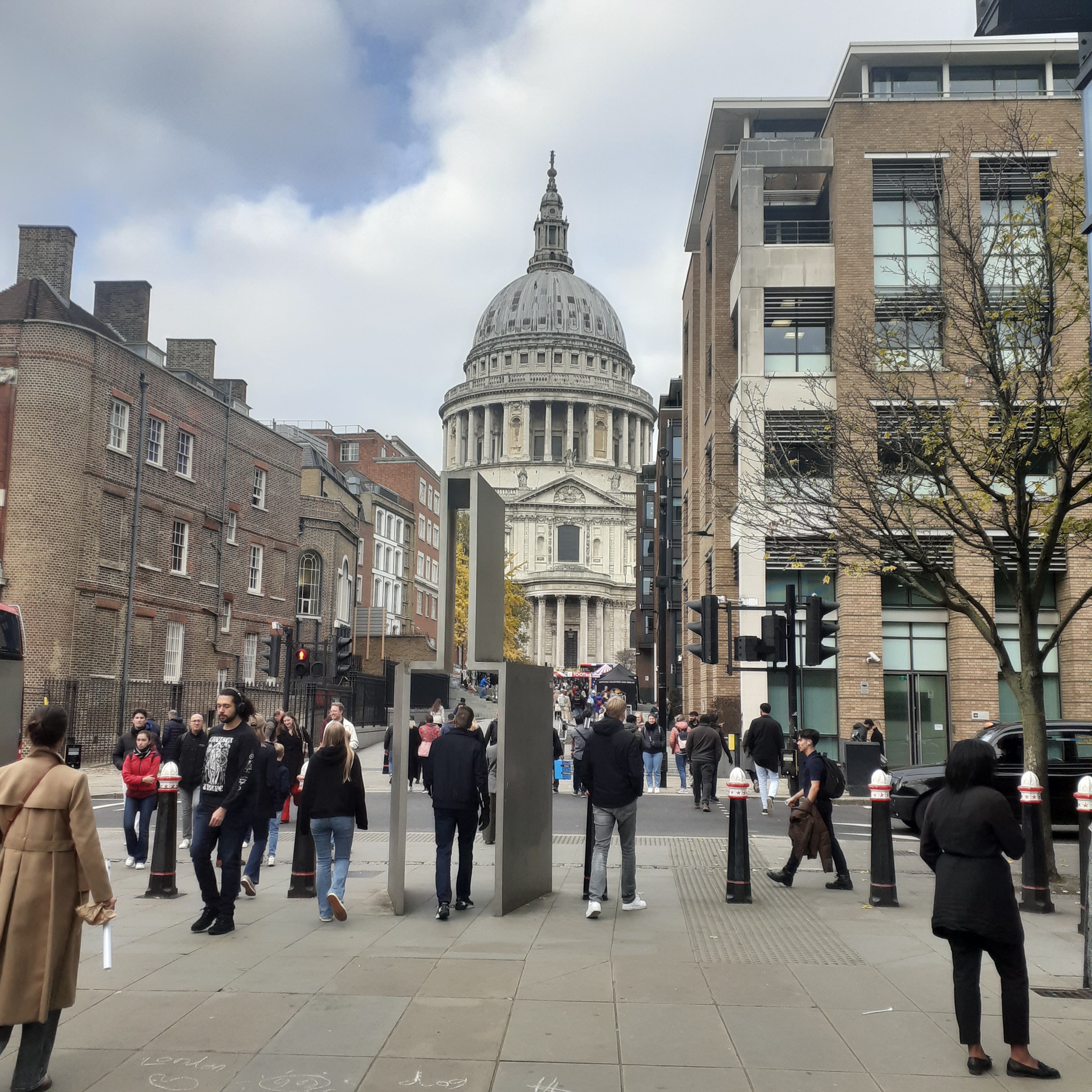
The true signature of the London skyline is best appreciated from the pedestrian bridge connecting the City with the Globe theatre on the South Bank. St Paul’s Cathedral boasts a heritage stretching back almost a thousand years. The medieval cathedral stood here for six centuries from 1066 until the Great Fire when it was destroyed. It was rebuilt by Sir Christopher Wren, completed fifty years later in an exuberant Baroque style. Loved by most, some stern Protestants have decried a whiff of Popery about its ornament and grandeur, noting its similarity to St Peter’s Basilica in Rome.
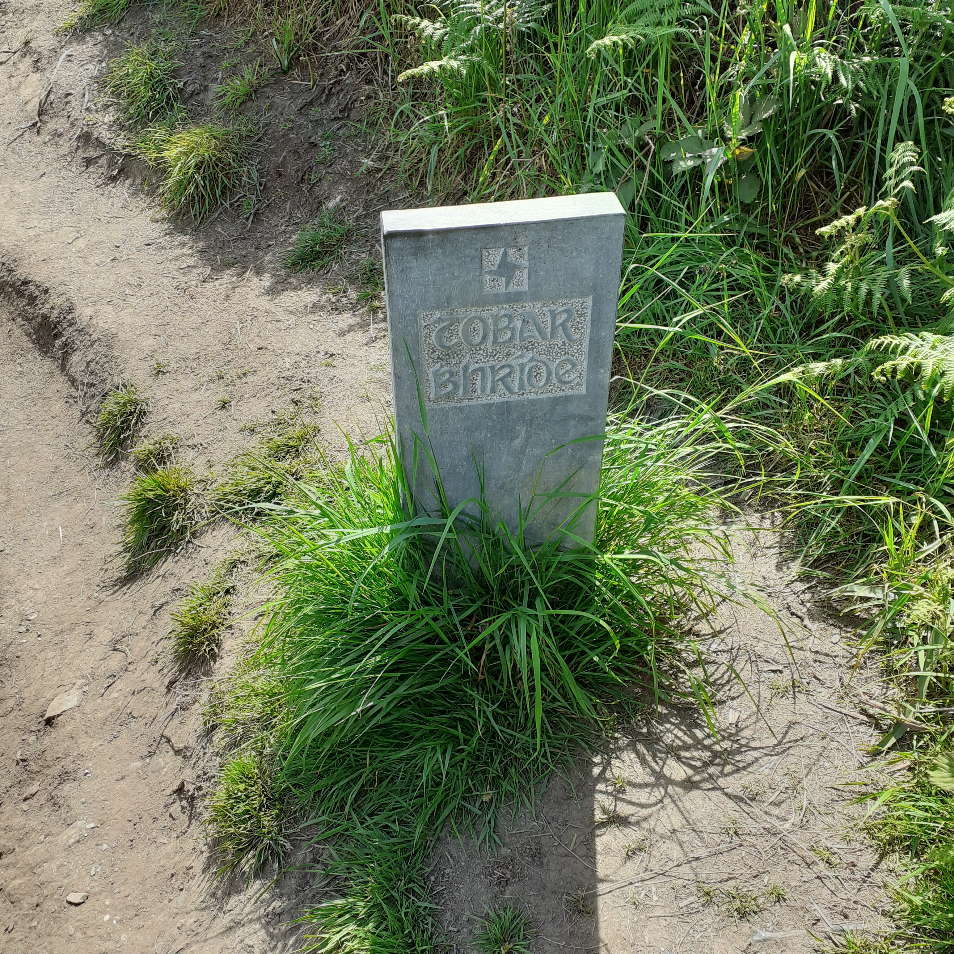
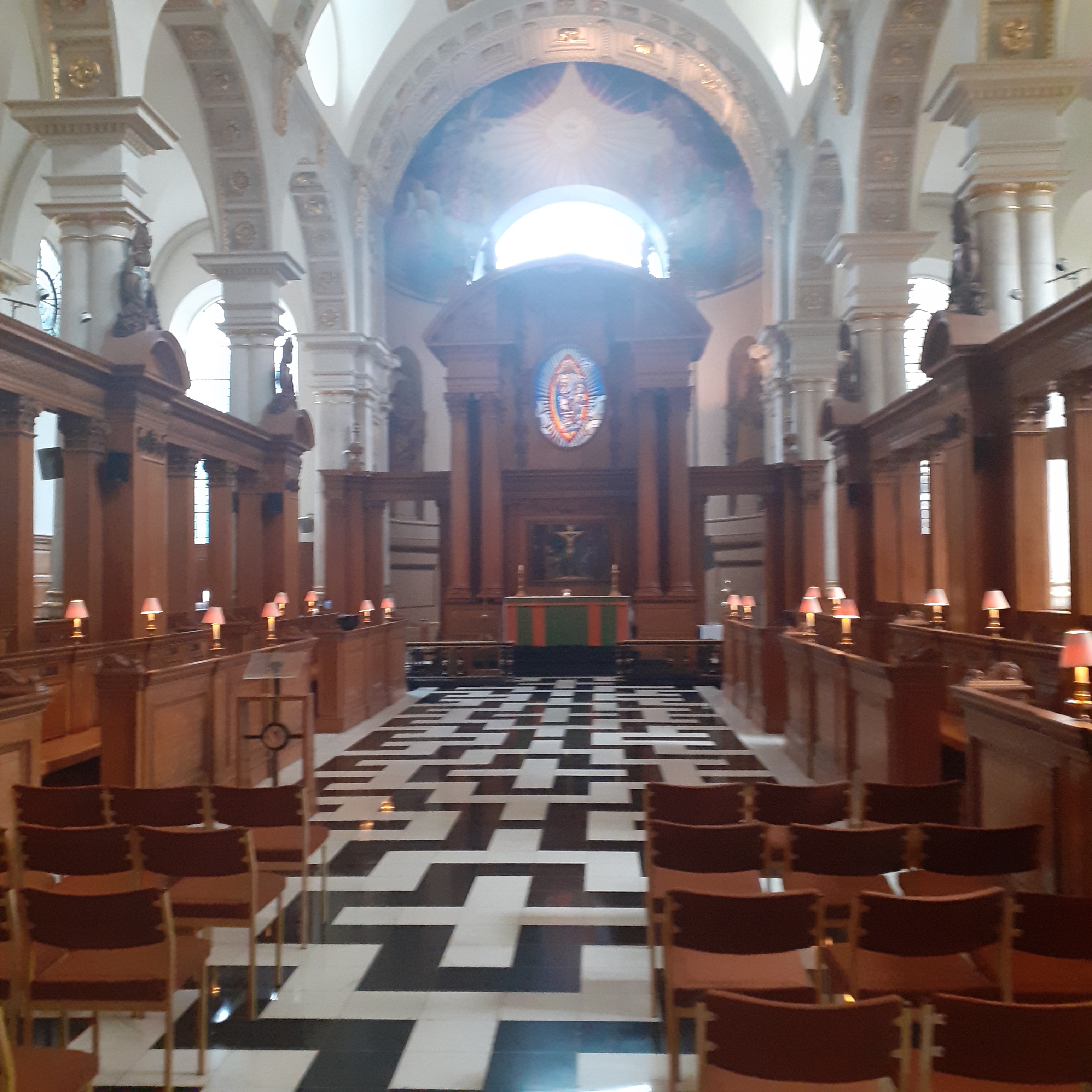
Some vestiges of the Roman Walls persist nearby, their perimeter topping Ludgate Hill. Walking down Ludgate Hill takes us to Fleet Street, once the centre of the newspaper trade. Hidden up a nearby lane, you might find St Bride’s Church. Another Christopher Wren building, St Bride’s is also known as the Printers Church. It was originally founded by Irish monks converting the West Saxons in the seventh century, and named to honour St Bridget of Kildare.
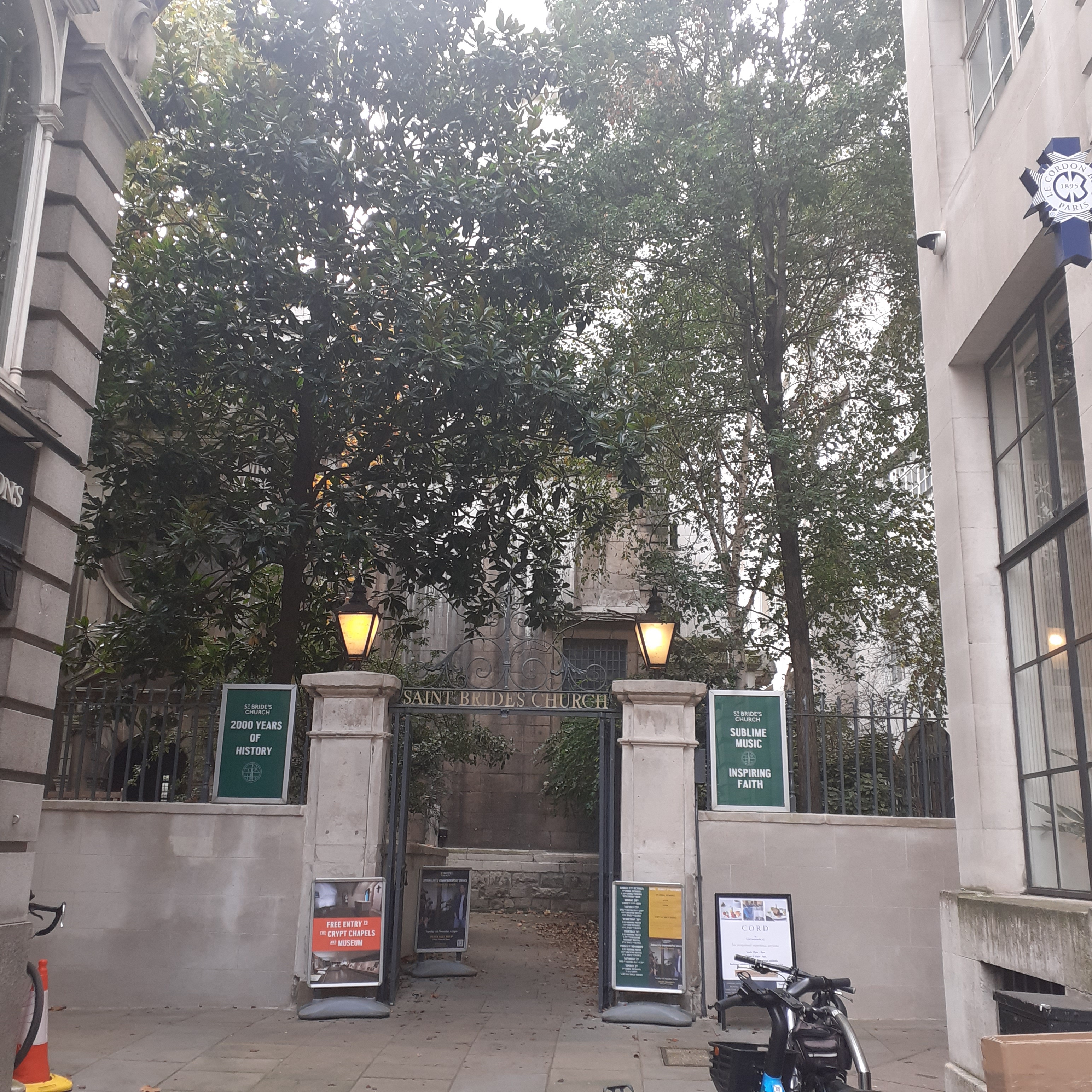
Bridget lived between 450 – 525 AD. The name Brigid, original Gaelic form of Bridget, is associated with a Celtic Goddess, a name we recognise from the Brigantes of Boadicea fame in Roman Britannia. Little is known of Saint Bridget’s early life but she established a community of nuns and came to be an important Abbess in the early Gaelic church, taking precedence over the Bishop of the Diocese of Kildare. Kildare, Gaelic for the church of the oak, has a cathedral dedicated to her.
Saint Brigid’s feast day falls on the first of February, and is associated with early spring rites. A ritual associated with her is the fashioning of a small cross from rushes. The distinctive cross, its prongs radiating from a central square swirl, has also been adopted as the logo for the Irish national broadcasting service, RTE. Brigid was patron of poetry and the arts, livestock and dairying, and was symbolically associated with fire. Amongst her more regular miracles was the ability to turn water into beer. She was exceptionally popular amongst both Irish and Danes for some reason
St Bride’s has an even more global association. Here, in 1587, Elenora White married Ananias Dare. The couple promptly set sail for America with a group that founded the first English speaking colony there, at Roanoke, Virginia. Their daughter Virginia, born later in 1587, was the first child born in America to the colonists but disappeared along with her parents and other colonists. Desperate attempts by Elenora’s father John White, the colony’s governor, from 1580 failed to resolve the mystery of the disappearance. The Lost Colony may have been wiped out by natives, or perhaps some, maybe Virginia, were sheltered by a local tribe, and intermarried with them.
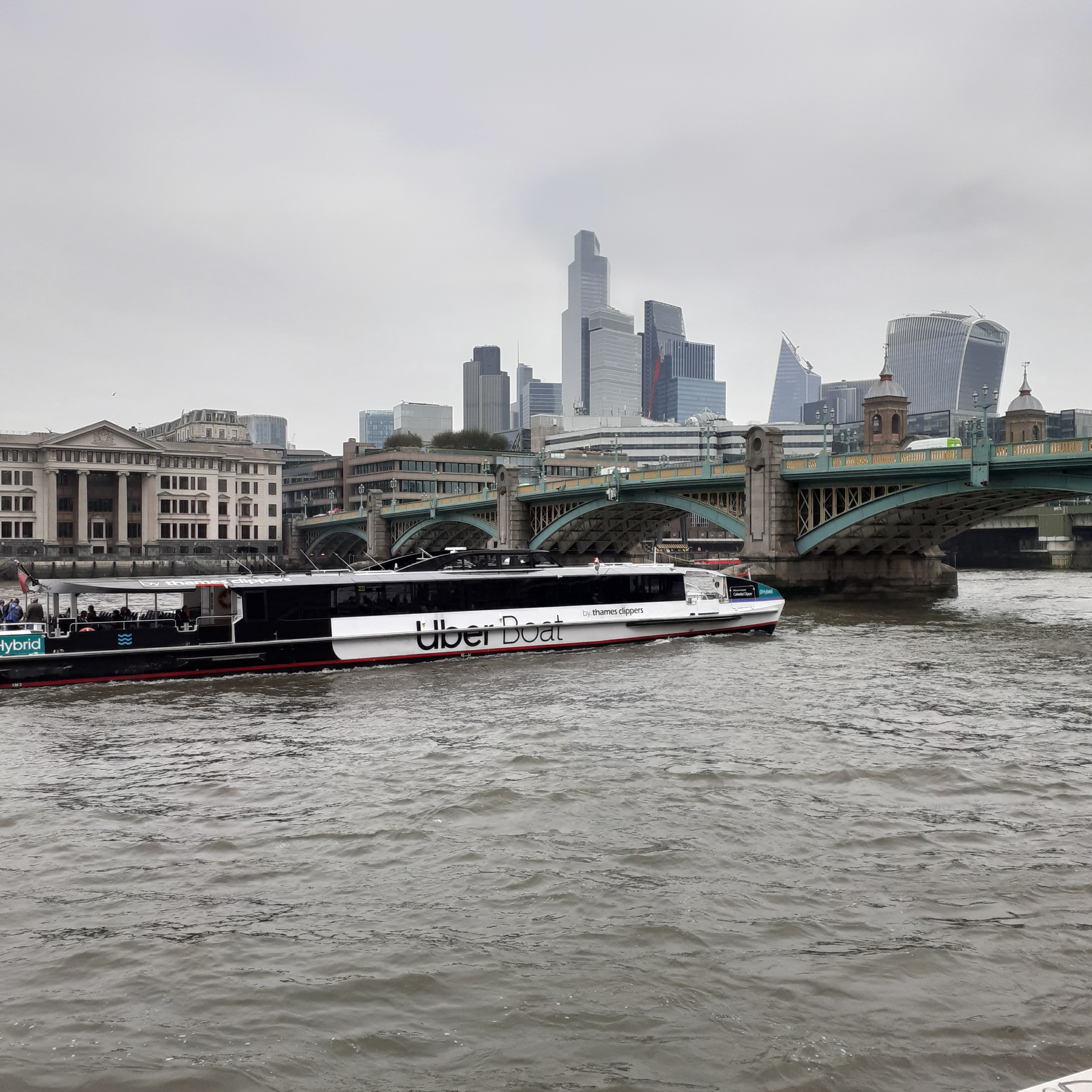
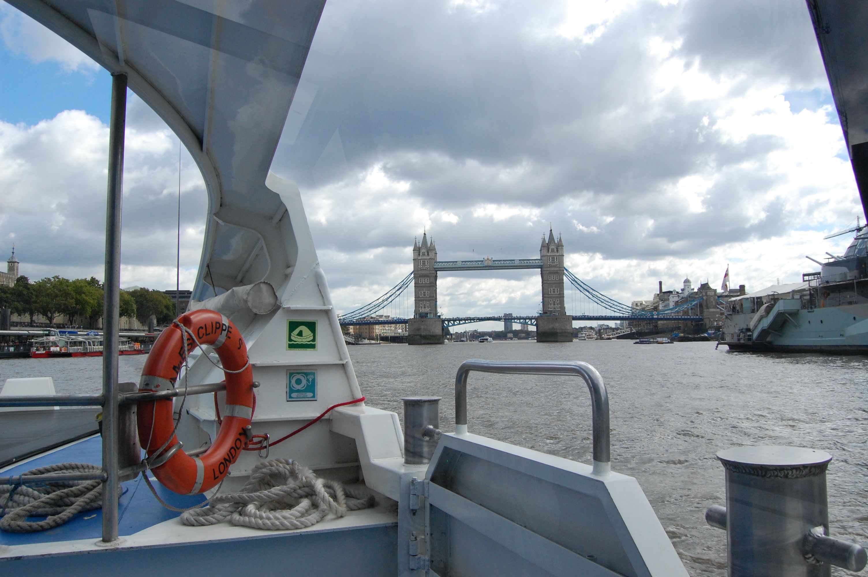
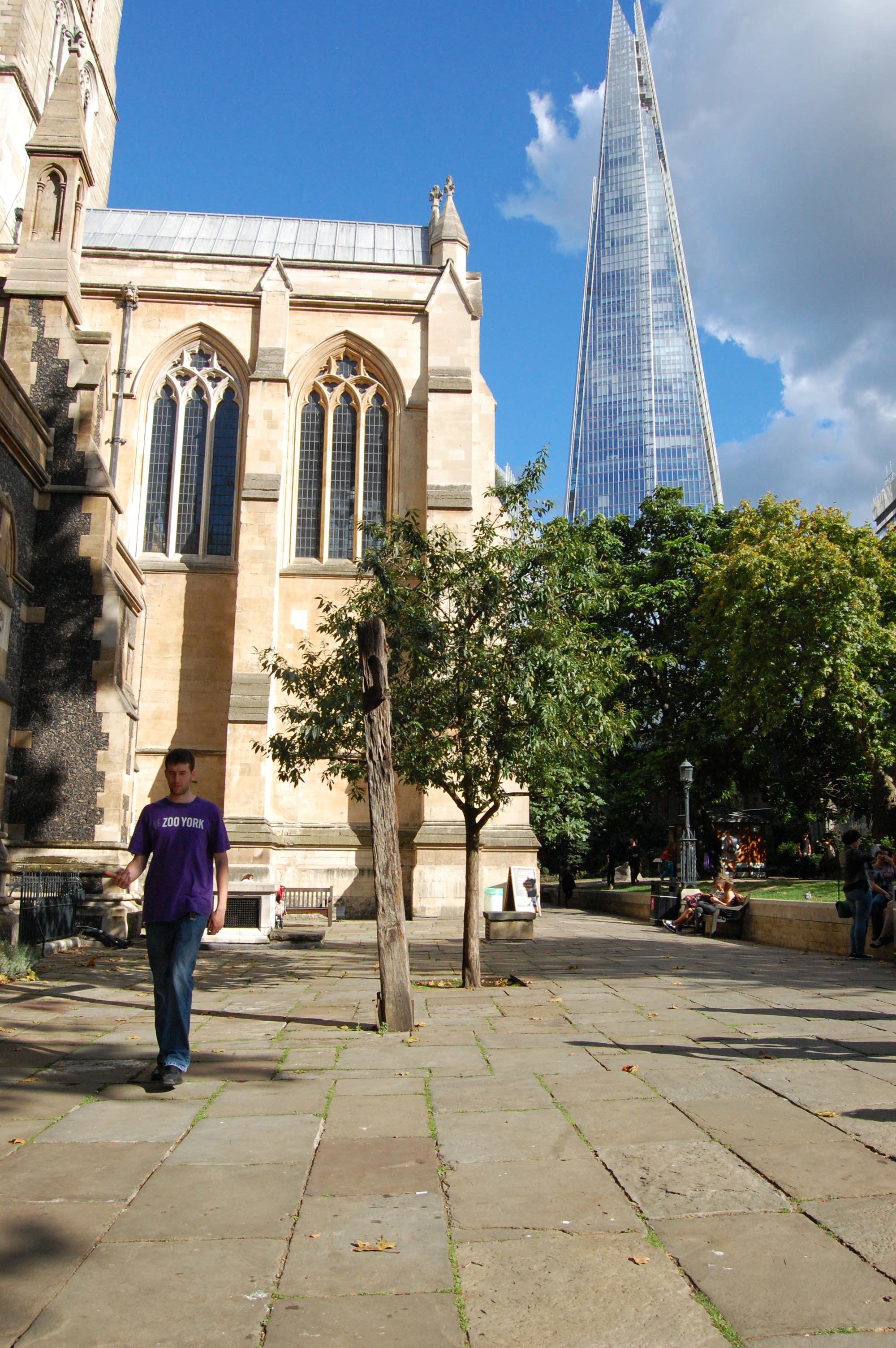
There are plenty other churches of interest in the immense shadow of St Paul’s. Continue down the Strand, which flows either side of two landmark churches, St Clement Danes and St Mary le Strand. There’s also Temple Church made famous by Dan Brown. The Strand, as the name implies, is not far from the river. The Thames bustles with pleasure boats, service and commercial craft. M and I once took a trip from Embankment to Greenwich by boat. Operated by Thames Clippers, the service runs from Putney way out west, passing Chelsea, Battersea Power Station and the Houses of Parliament to the Embankment where we got aboard. Heading east the City rises to our left, with Shakespeare’s Globe on our right. We pass through Tower Bridge, another emblem of London with its fortress-like architecture and bascule. Horace Jones was the architect and John Barry the engineer. The project completed in 1894
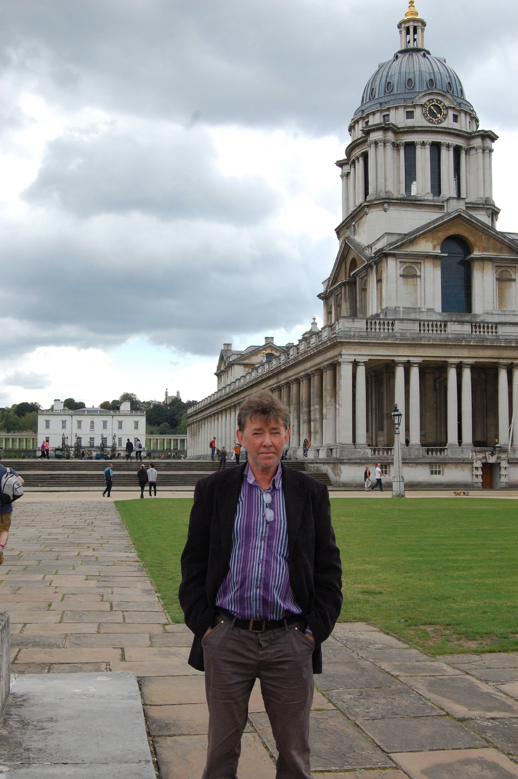
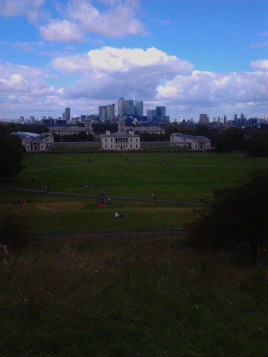
Into the exotic east, Canary Wharf is a couple of stops before Greenwich, while Woolwich Arsenal lies further to the east. Greenwich awaits on the south bank. The Royal Navy College is a neo-classical masterpiece of Christopher Wren. Begun in the late 16th century, it was originally the Royal Hospital for Seamen. Beyond the splendour of its colonnades and domes, Greenwich Park slopes up to the Royal Observatory. Highrise London stretches along the western horizon. From 1884 Greenwich was recognised as the line 0 of longitude. The accurate measurement of longitude had been a problem in previous centuries. With the Longitude act of 1714, the British Parliament offered £20,000, almost four million quid in today’s money, to anyone who could devise a reliable system for the reckoning of longitude.
At that time, John Harrison, a carpenter from Lincoln in his early twenties, was making almost frictionless clocks..He took on the challenge and In 1759 Harrison’s H4, similar to a pocket watch, seemed to fulfil the criteria. However, the board demurred, putting Harrison’s success down to beginner’s luck. His H5 passed the test, though Harrison still had difficulty extricating the prize. Only the support of George III gained him some compensation, to the tune of £8,500. Harrison was eighty years old and died shortly afterwards in 1776. His timepiece was used by Cook on his second and third voyages. William Blythe also carried one, although it was nicked by Fletcher Christian, to be returned to the Maritime Museum much later. The Museum has an exhibition devoted to the Harrison clocks. On our visit a museum guide gave a detailed and entertaining account of Harrison’s travails. Spellbound, I lost all track of time. We nearly missed our boat.
Beyond Greenwich and you are flowing onto the world’s highway, with all the oceans and seas connecting with all the freeflowing rivers and placid canals. Our return trip took us to Southwark Cathedral. The bells were ringing out as we found an outdoor table at a local hostelry. Glorious sound, no doubt, unless you are tying to enjoy a quiet pint in a beer garden. London certainly swings like a pendulum do. And London is always calling the curious traveller.
London calling to the faraway towns …
The ice age is coming, the sun is zooming in
Meltdown expected, the wheat is growing thin
Engines stopped running, but I have no fear
London is drowning-and I live by the river
London Calling is by The Clash, written by Joe Strummer and Mick Jones. It is the title track of their 1979 album, and echoes the opening call of BBC World Service during WWII. The febrile apocalyptic tone is very seventyish, or maybe still persistent. I somehow heard the song’s hookline as “London’s burning, and I live by the river.” Which might be more consoling. Not to worry, though; the Thames Barrier was completed in 1982 near Woolwich protecting London’s flood plain.