The Liberties of Dublin

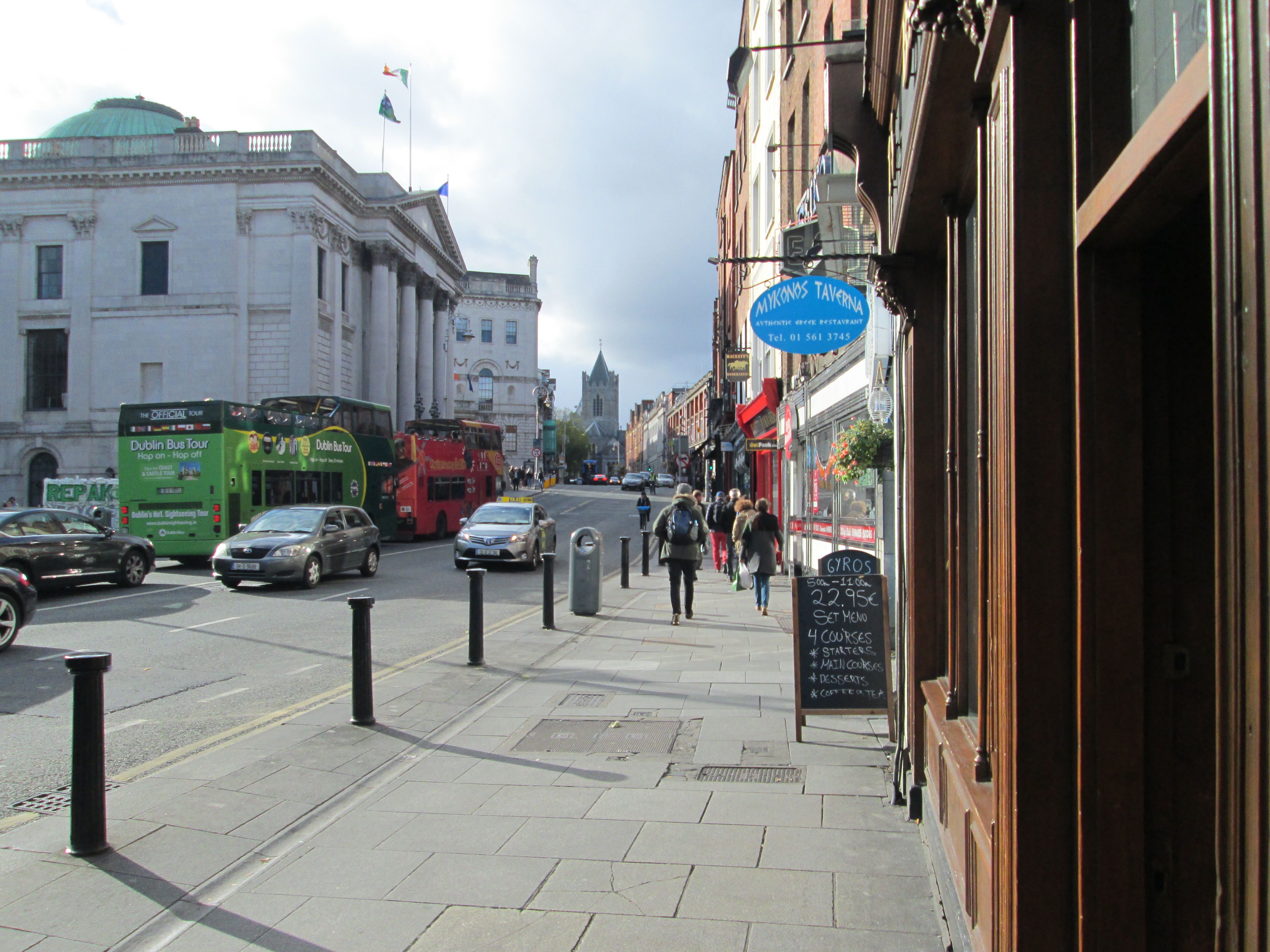
As a child on early forays into Dublin, I’d sit upstairs on the bus looking over the jumbled roofs of the Liberties. Church spires punctured the sky, shifting landmarks against the sea of slate as the bus crawled down The Coombe, toiling up past St Patrick’s and Christchurch cathedrals on its way into the city centre. I recall a friend of my mother’s laughing as I blessed myself passing Saint Patrick’s. It was a Protestant church! In fact both cathedrals, though almost adjacent, are Church of Ireland. However, the persistent Catholic claim on Christchurch means the Diocese only maintains a Pro-Cathedral for Dublin.

It was down by Christchurch that I first met with Annie,

A neat little girl and not a bit shy.

She told me her father, who came from Dungannon,

Would take her back home in the sweet bye and bye.

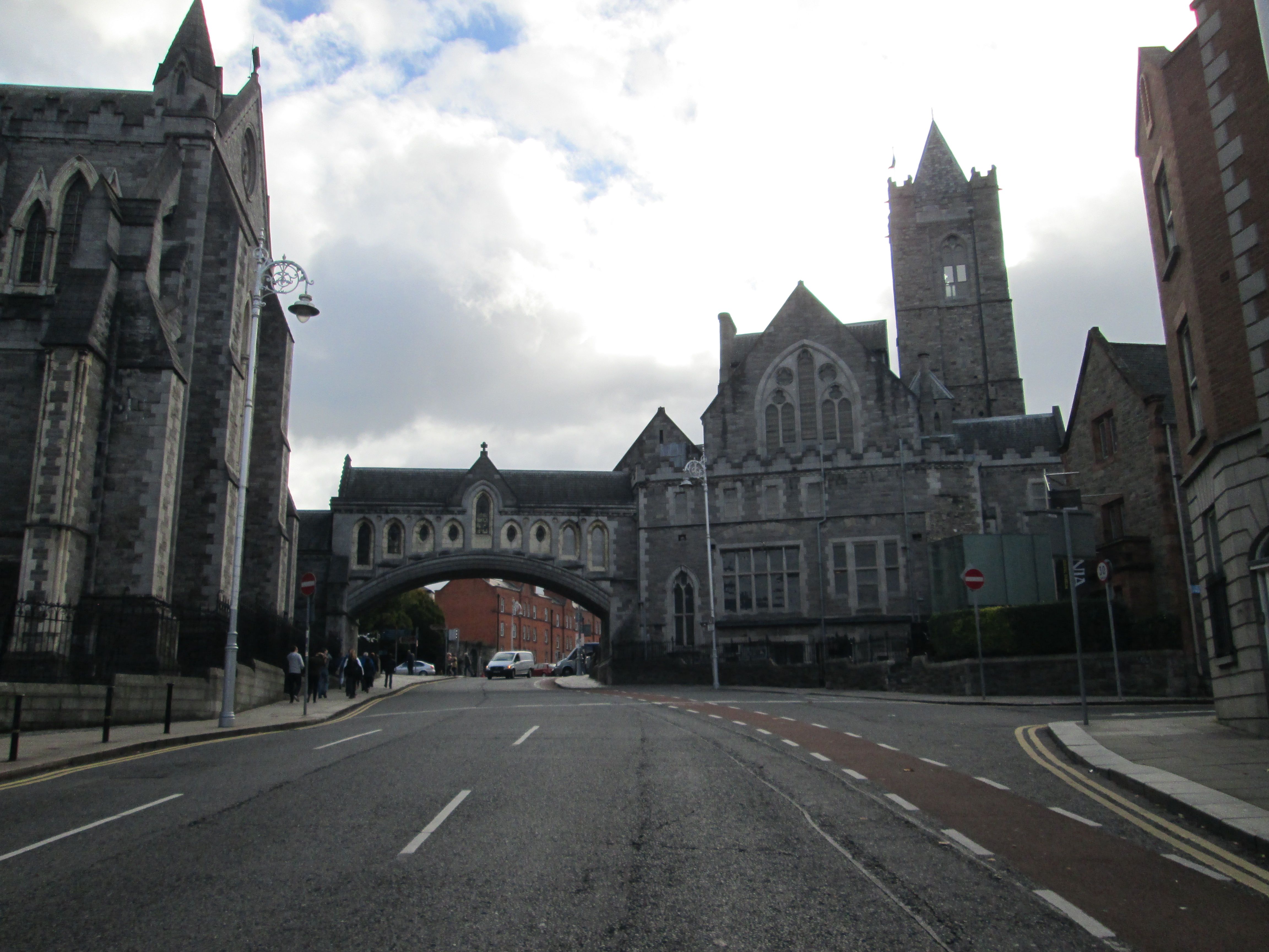
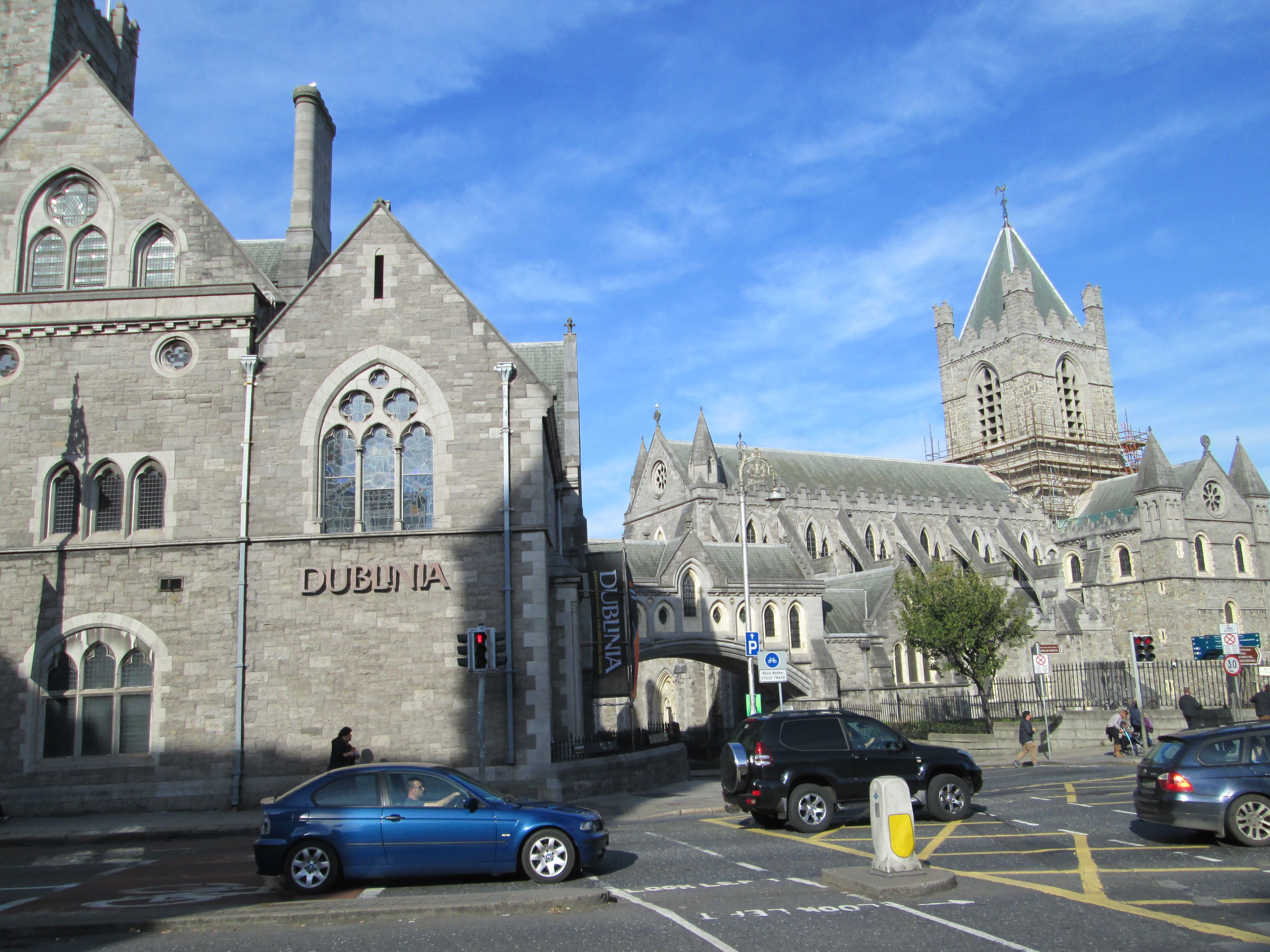
Christchurch Cathedral

Christchurch Cathedral

Christchurch Cathedral marks the ancient centre of Dublin. It was founded in 1028 by King Sitric Silkenbeard. Dublin, more than a decade after the Battle of Clontarf, was still Danish. Sitric, one of the few survivors of the battle, became determinedly devout in his later years, the cathedral his enduring legacy. The king didn’t stay in his city to die. His throne was usurped and he decamped to York on the eve of the Norman invasion of England. A century later, the Normans came to Ireland’s green shore. Strongbow (Richard De Clare) took the spoils, including King Diarmuid’s daughter Aoife. Having defeated the Danes, in Dublin, Wexford, Waterford, and ultimately at Bloodybank in Bray, he funded the restoration of Christchurch for Archbishop Laurence O’Toole. Strongbow’s remains were interred there, while his effigy reclined peacefully on the tomb. The original stone knight has not survived, however, destroyed in one of the cathedral’s several collapses; the current figure being a substitute.

St Patrick’s, Ireland’s largest church, is close by at the foot of Patrick’s Street. Another ancient institution, it was, up to Tudor times, the equivalent of the city’s university. It’s most starred connection is with Jonathon Swift, Dean of the cathedral and creator of the permanently resonating world of Gulliver’s Travels. Next door is Marsh’s Library, a precursor of the public library. Neither borrowing nor lending were the thing then and readers were locked in cages with their chosen book to stem pilferage. Librarians these days are too soft by far.

While no visible barrier currently exists to explain the existence of two cathedrals in such proximity, that was not always the case. All those centuries ago, Christchurch was within the city walls, St. Patrick’s, without. Those ancient walls have well and truly crumbled. A portion remains to the north of St Audeon’s Church, encompassing the only remaining city gate. A couple of fragments of the wall have been unearthed nearby. At the corner of Cornmarket and Lamb Alley, a good chunk of wall gives you some idea of where the western extent of the city was.

A portion of the city wall at Lamb Alley

A portion of the city wall at Lamb Alley

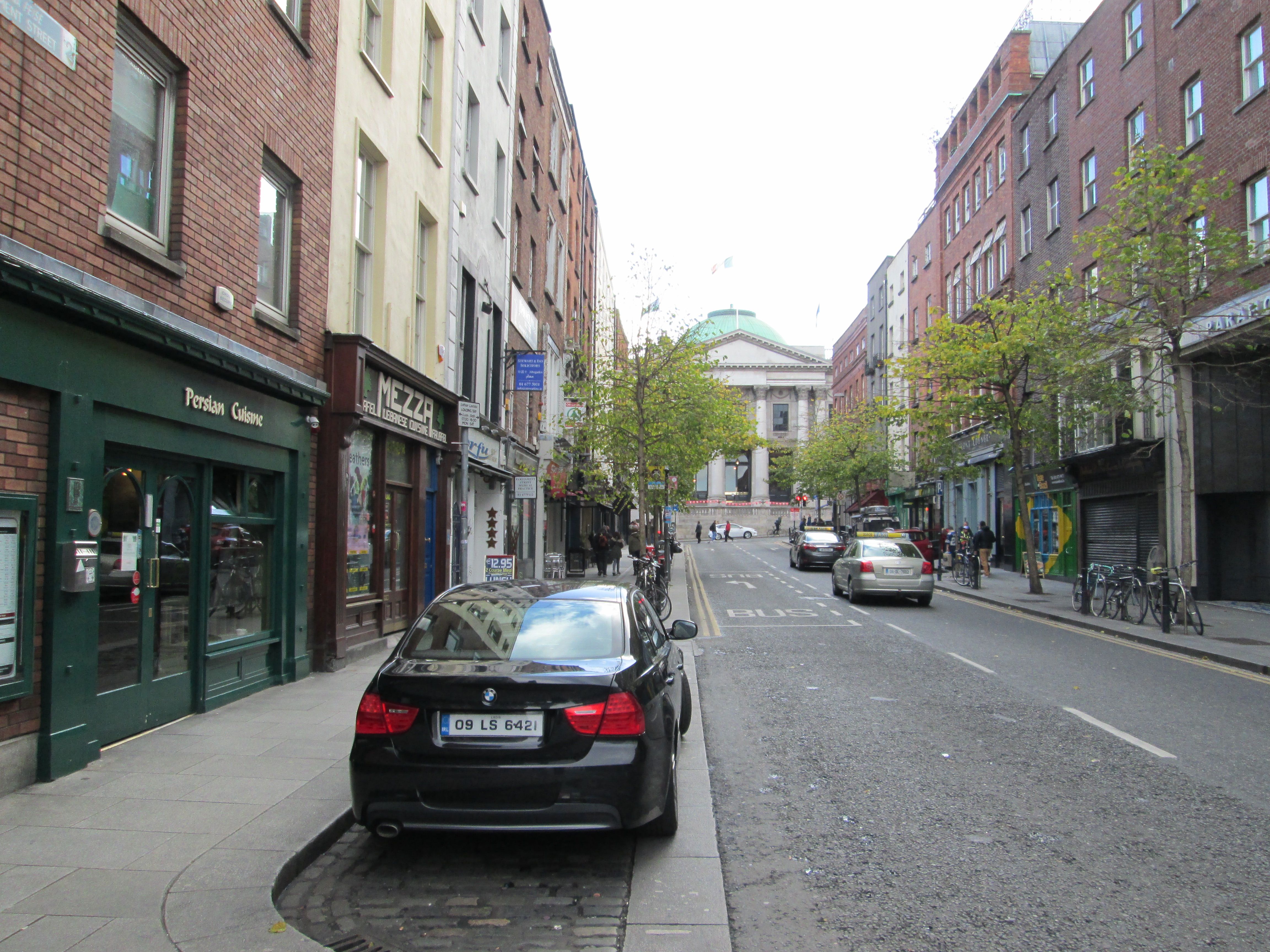
Beyond here lies an area known as The Liberties. Liberties were manorial possessions, usually attached to a monastery that enjoyed benefits and independence from the walled city. Today the term applies to two ancient liberties, The Liberty of Saint Thomas and Donore, and the Liberty of Saint Sepulchre. Saint Thomas’s is delineated by its two main axes, The Coombe to the south and here, all along Thomas Street as far as James’s Street to the west. St Sepulchre’s ranges east from Patrick’s Street and Clanbrasil Street, to Whitefriar’s Street Church off Aungier Street.

All along Thomas Street and down to the Liffey,

The sunlight was fading and the evening grew dark.

Over King’s Bridge and beyond in a jiffy,

My arms were around her up there in the park.

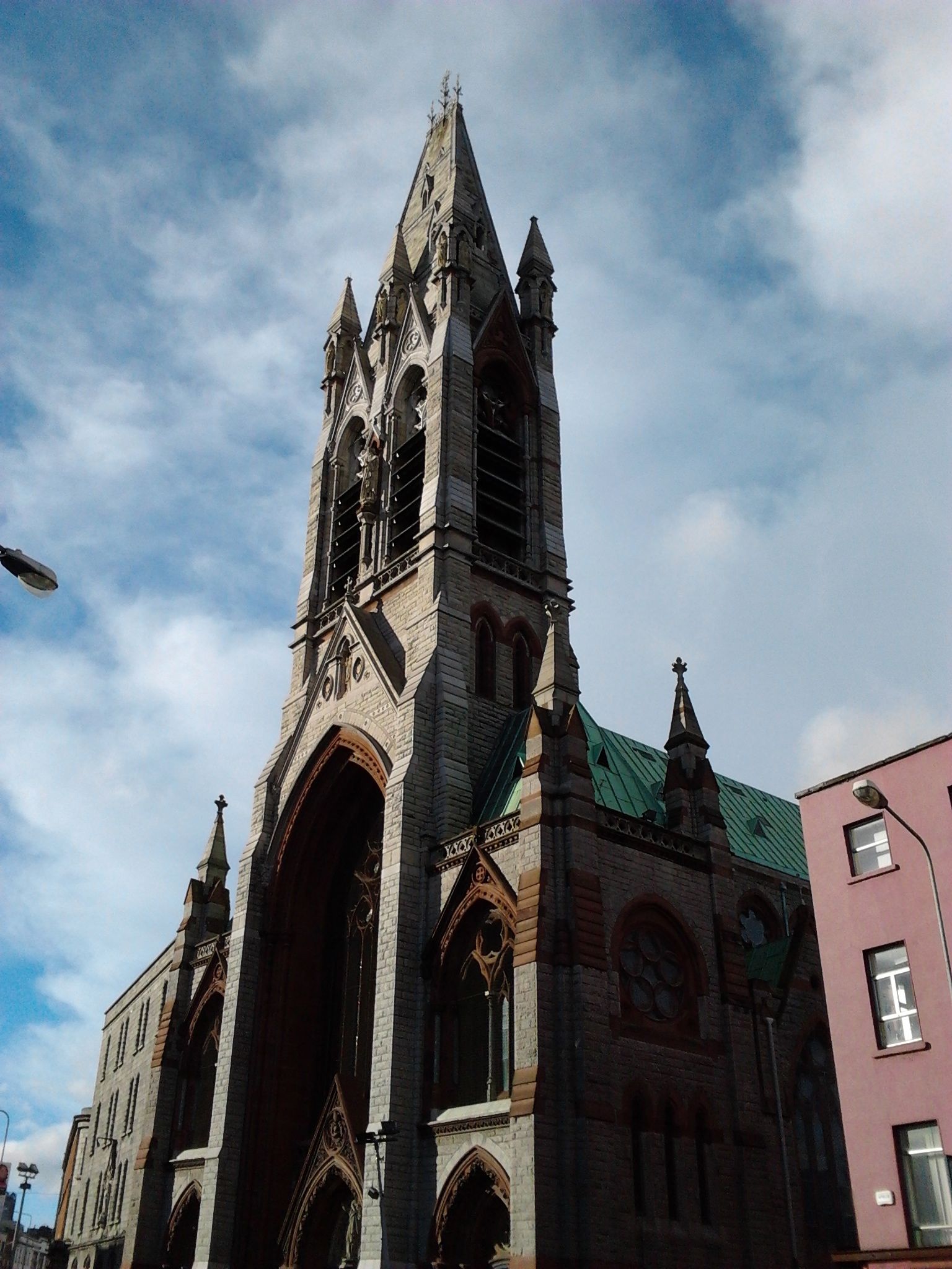
A striking landmark nails the start of Thomas Street. From afar it always seemed to me a castle in the sky, floating tantalisingly out of reach on those distant bus journeys. It is the fabulous, metred spire of the Church of St John the Baptist and St Augustine, the highest in Dublin, rising to more than two hundred feet. The church was built in the late nineteenth century where a monastery and hospice had stood in Norman times. It was designed by Edward Pugin. He was of French Hugenot stock and the building does indeed have something of the air of a French chateau about it. Described as a poem in stone by John Ruskin, it is that, it also it sings with gothic romance. The twelve statues set into niches on the tower were rendered by James Pearse, father of Patrick Pearse. Harry Clarke, that most gifted Irish exponent of Art Nouveau, is responsible for the stained glass windows near St. Rita’s side-altar. It is an interior for prayer and contemplation, a welcome respite from the antic city outside.

John's Lane Church, Pugin's 'Poem in stone'.

John’s Lane Church, Pugin’s ‘Poem in stone’.

Thomas Street evolved as a market street without the walls. Cornmarket would have been at the old western gate of Dublin. Brewing, distilling and weaving, especially silk weaving, became the main industries of the area. The busy thoroughfare was often the focus for more than industry and commerce. Thomas Fitzgerald (Silken Thomas), Earl of Kildare, made this the site for his rash assault on Dublin Castle in 1535. His forces used the upper stories as a causeway of sorts in their attempt to breach the city walls. The citizenry remained firm however, and Thomas was ultimately captured and executed.

The original monastery, the manorial centre of the Liberty, was at Thomas Court, at the top of Marrowbone Lane. It had extensive land holdings well beyond the immediate area, including lands at Ardee in County Louth and Kilruddery in Bray. At Henry VIII’s Dissolution of the Monasteries, these lands were given to William Brabazon with the title Earl of Meath. Hence, some of the names you will notice in streets throughout the liberty.

Robert Emmett had no more luck than Silken Thomas with his rebellion in 1803. Despite careful planning, his assault on Dublin Castle degenerated into a grim fiasco, with mob violence along Thomas Street. Emmett was executed for his trouble, at a gallows close to St Catherine’s Church.

Music and art have become a more notable feature of the area than riot and rebellion. Or perhaps they’re simply different facets of it. The National College of Art and Design located to the old Power’s Distillery in the nineteen eighties. Myself, amongst others, has tramped its hallowed halls. Some never escaped at all. BIMM, originally the Brighton Institute of Modern Music sends stray notes and students into the air around Francis Street. Vicar Street has become Dublin’s most comely music venue.Here, I’ve seen Patti Smith gather a group of local musicians together for a Celtic take on Smells Like Teen Spirit. Imelda May radiate love and rockabilly as the local girl made good. I’ve seen Jack L hold the audience in his hand, with the lights down and the electricity off, with nothing but a concertina and a voice to evoke the troubadour of another century. The Waterboys are coming soon, and there’s always something there.

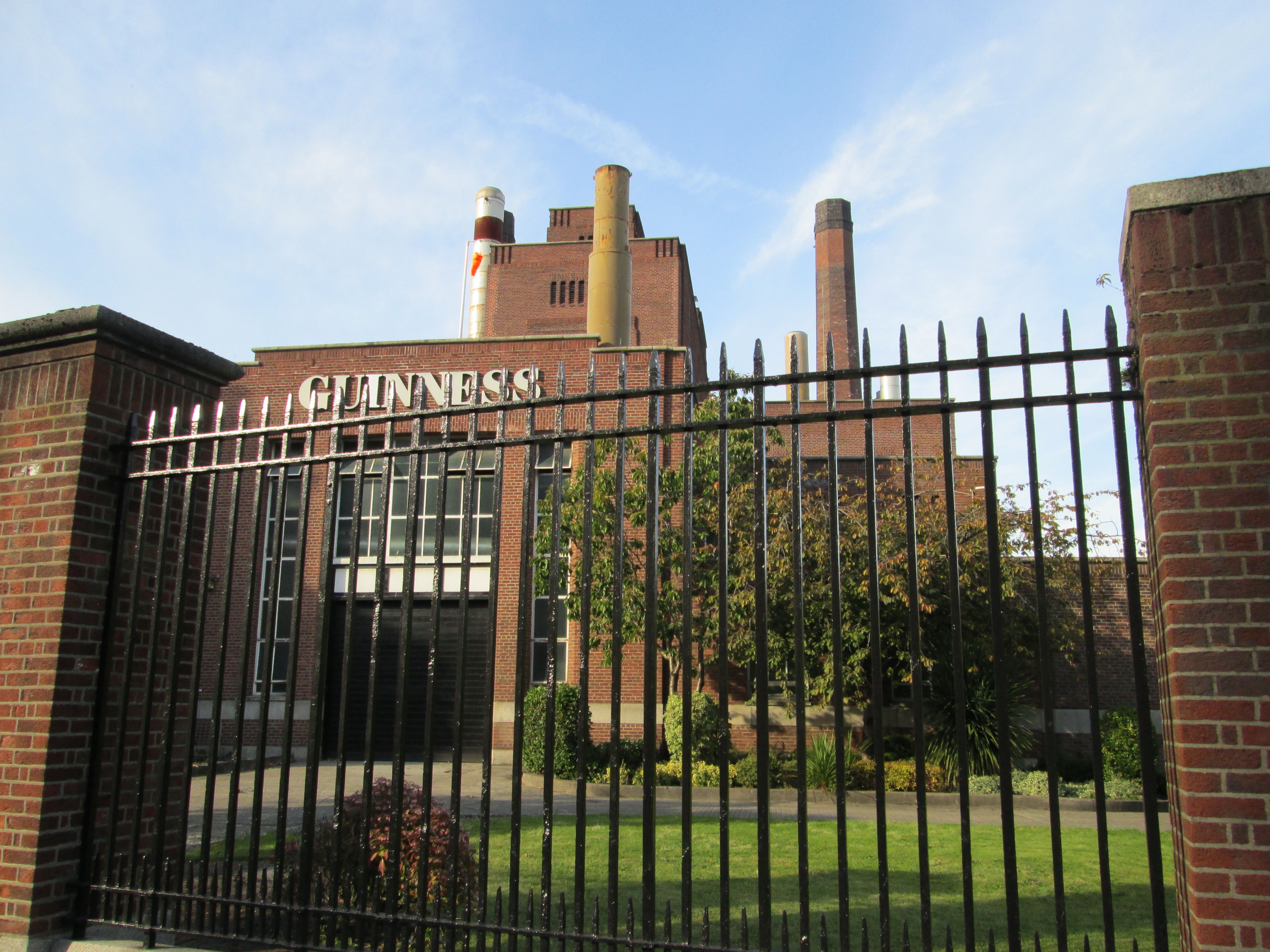
Saint James's Gate Brewery

Saint James’s Gate Brewery

These days, Thomas Street remains one of only a couple of places in Dublin where street trading is permitted. It is, always has been, a rambunctious street. The heavy aroma of hops seeps through the air from Guinness’s brewery to the west. Arthur Guinness, from Celbridge in Kildare, founded his brewery in 1759 at Saint James’s Gate. The distinctive Stout has become something of a national emblem. As the country lurched from boom to bust, the brewery celebrated two hundred and fifty years with the inauguration of Arthur’s Day, raising a pint to the man at one minute to six on the chosen day. The great and the good, as usual, getting a whiff of people having fun, sucked in their cheeks, waved a boney finger of prohibition. But they can’t stop you doing it if you so desire. A visit to the Guinness Hop Store nearby, can be topped off with a pint and a panaromic view at the Gravity Bar. Or you can simply walk into any bar.

And what’s it to any man whether or no,

Whether I’m easy or whether I’m true.

As I lifted her petticoat easy and slow

And rolled up my sleeve for to buckle her shoe

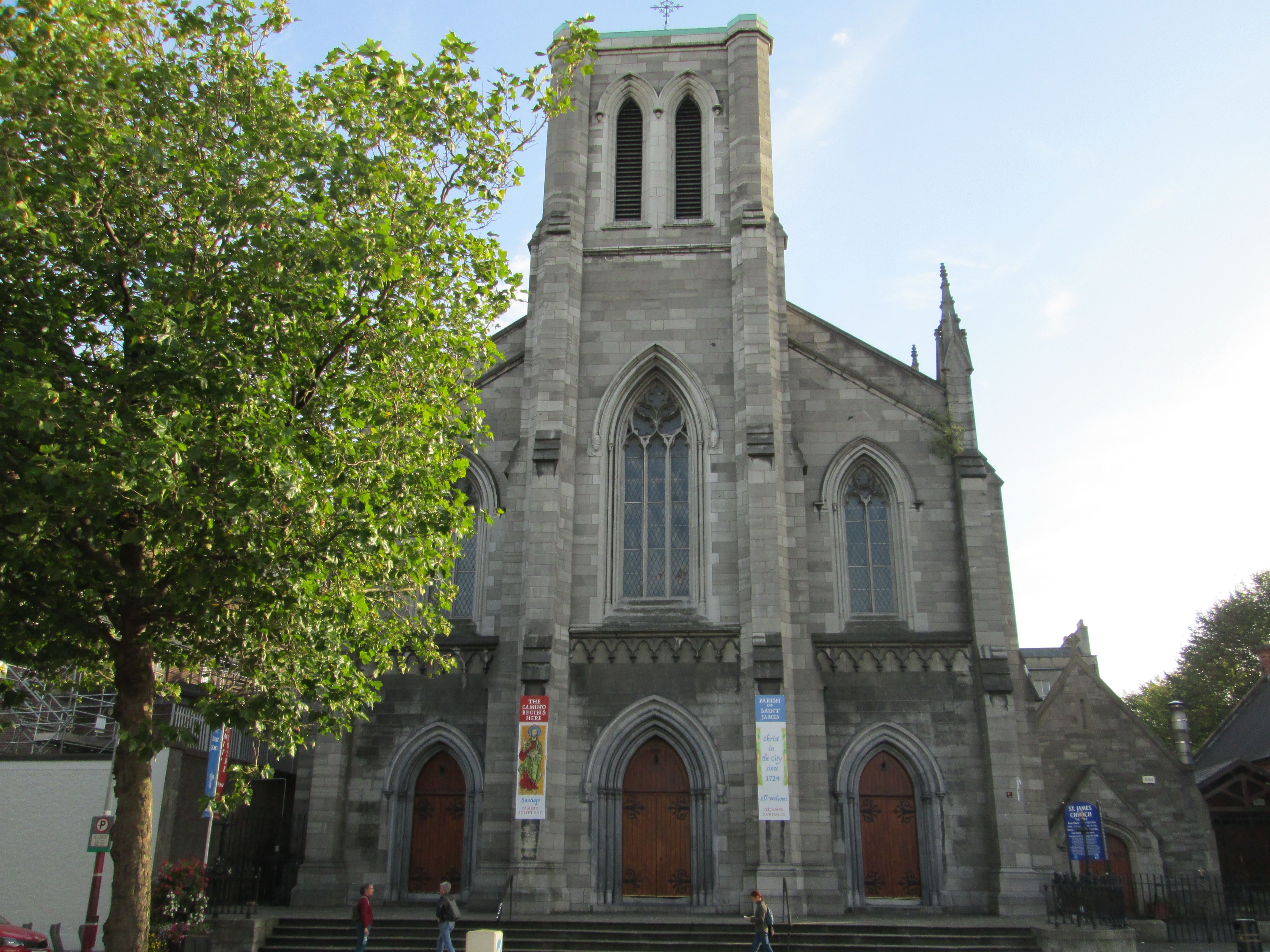
St. James's Church

St. James’s Church

Where Thomas Street ends, St James Catholic Church marks the beginning of the street of that name. It can also be the beginning of a more ambitious walk. Passports for the Camino de Santiago are available here, a first step on the pilgrimage across northern Spain to Finistere, the very end of the earth.

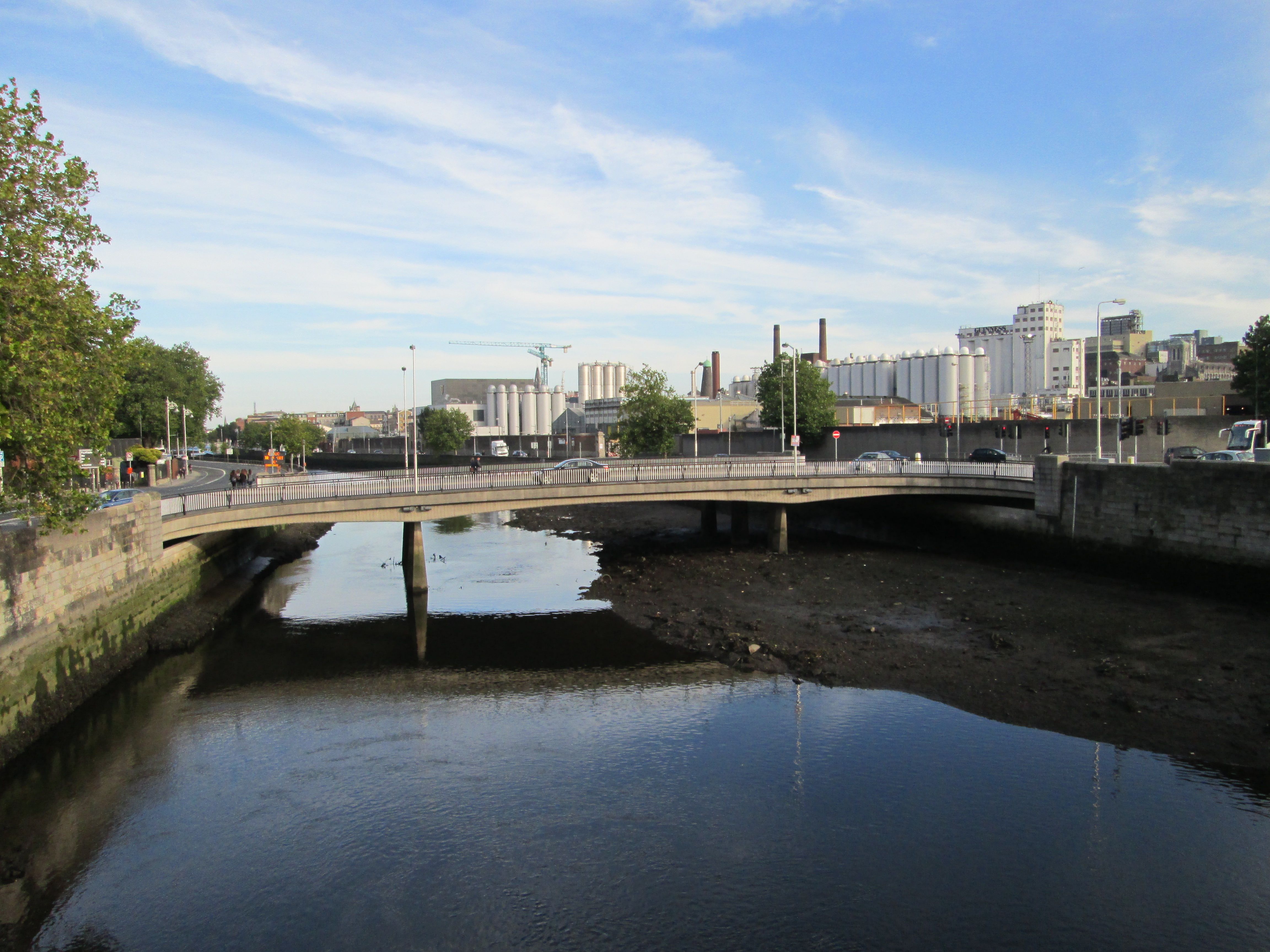
The Liffey at Kingsbridge

The Liffey at Kingsbridge

For me, I take a right turn down Steven’s Lane to Houston, formerly Kingsbridge Station. A fine piece of Victoriana from 1846, it’s the principal western rail terminal for Dublin. also serving the southwest. There’s a good bar to the side, and seating outside not far from the Liffey. To the west lies the Phoenix Park, to the east lies the city. The Luas line carries trams regularly to and fro. I will catch one, when I’m ready, leaving me conveniently near Connolly Station for my Dart home.

Manchester

Just west of the Pennines, South Lancashire seethes with cities. We’re Manchester bound, although the route I take via the circling motorways is a bit, well, circuitous. Eventually I trust to luck, or instinct, following a long straight road that falls ever so slightly downhill. Despite a brief detour through a dodgy flats complex, courtesy of ubiquitous roadworks, I stumble upon Piccadilly Station, close to where we’re staying. Mind you, the rental company has changed its address without telling anyone, but we hunt it down eventually on the roof of a multi-story.

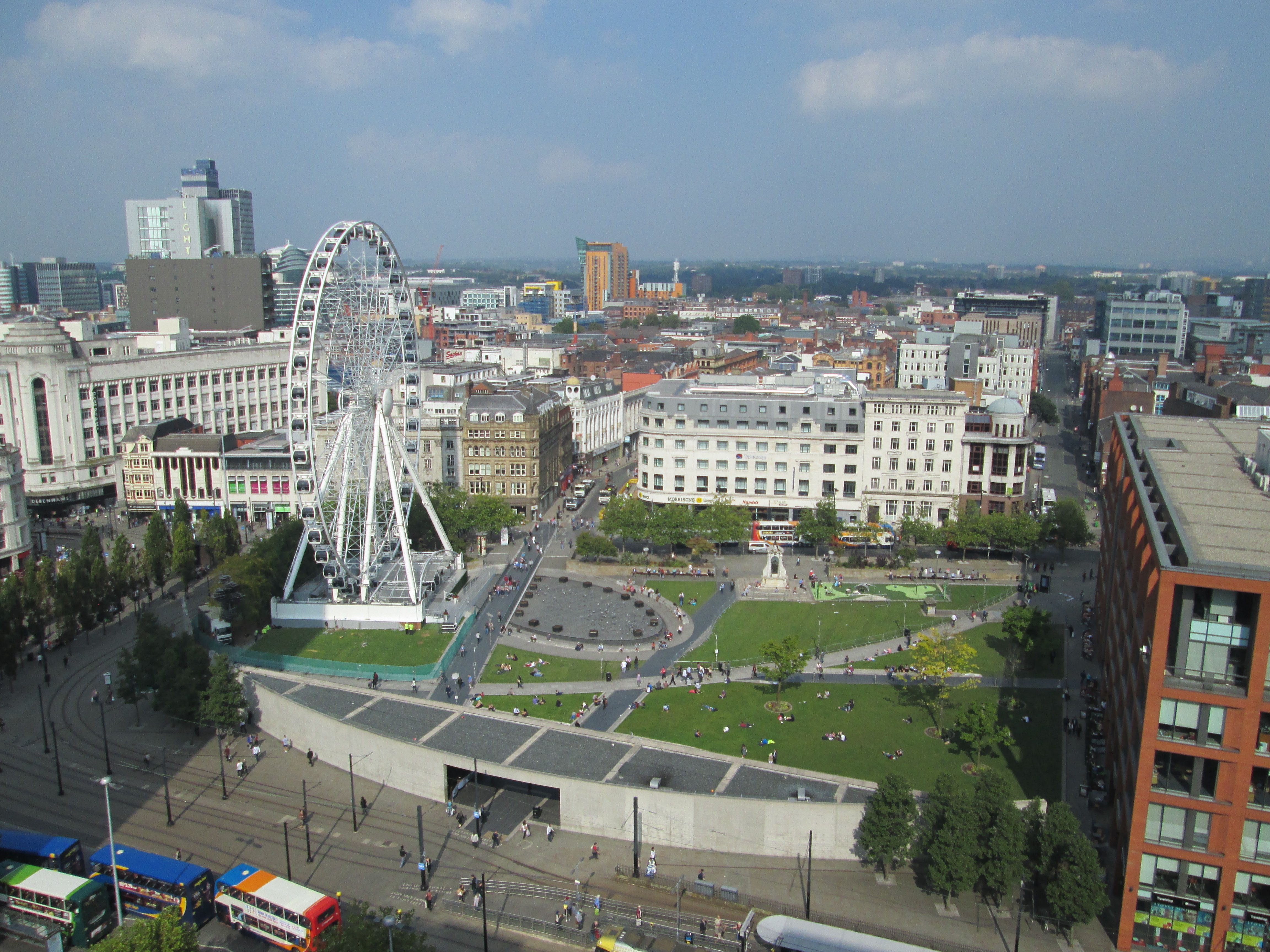
View from the Mercur over Piccadilly Gardens

View from the Mercur over Piccadilly Gardens

Manchester has been compared to an incredibly vast shopping centre, where you never feel more than halfway towards the centre, ever. It does have its fair share of malls, not necessarily a bad thing. The point is that Manchester, like many new cities, is an urban conurbation – you can go city to city without leaving town. I figure we stayed in the centre, or high above it anyway. The hotel overlooks Piccadilly Gardens which pass for the town square. Here is the hub of the clanking tram system, Britain’s most extensive and a boon for the visitor or commuter. The Gardens itself is as ugly a slice of modernity as you are likely to see, its designer presumably antagonistic to the concept of parks, or people, or possibly both. Enter, if you dare, through the facsimile of an underpass; works wonders for the confidence that. What better place to lie in wait, slither out and importune strangers for money or drugs. We decide to give it a go. One step in, someone steps out of the shadows and importunes me for money. Disengaging from that, another approaches stage right. We give it a miss, retiring instead to the relative safety of the surrounds, a rather sleazy strip of downmarket dens.

The name Piccadilly also denotes London’s centre, so what does it mean? The word supposedly derives from a collar of Spanish lace, a high fashion item in the sixteenth century. Perhaps an allusion to the parade of fashion common to a city centre. Manchester bustles more than it poses. There is a regular beat of footfall along with the throb of commerce. Plenty of shopping here, along straight, severe canyons and in extensive modern malls. Manchester has been referred to as being about as beautiful as the back of a fridge. That’s a bit harsh. While there’s something functional, determinedly commercial, about the city, there are shards of beauty in its Victorian civic and industrial architecture.

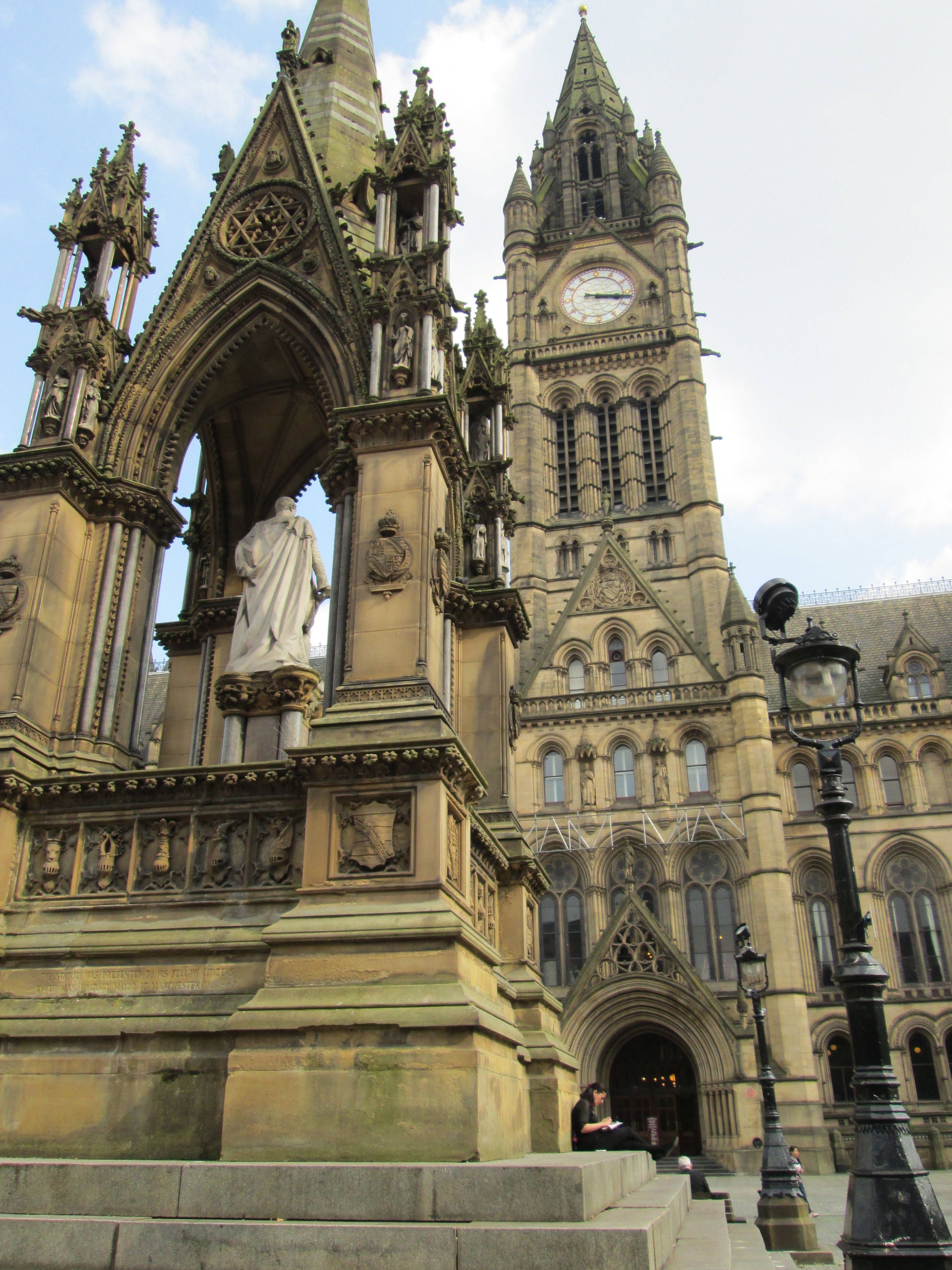
City Hall and Albert Square

City Hall and Albert Square

None finer than the Gothic extravagance of the City Hall. Palatial but, with an eye to the democracy it represents, accessible. You are free to enter, more detailed exploration by guided tour. An atmospheric restaurant peeps out of the cloistered entrance hall. Function rooms are available for those with a taste for the gothic. Both interior and exterior aspects are full of the beauties of fine craftsmanship, allied with the notion that buildings can be expressions of a higher ideal, that they can occupy the imagination as well as physical space. It dominates Albert Square, a surprisingly calm space boasting almost as many statues as people. While herself plunges into the sea of shopping, I linger in the square, The Chop House on the corner providing the oasis, a quiet pavement table with a view.

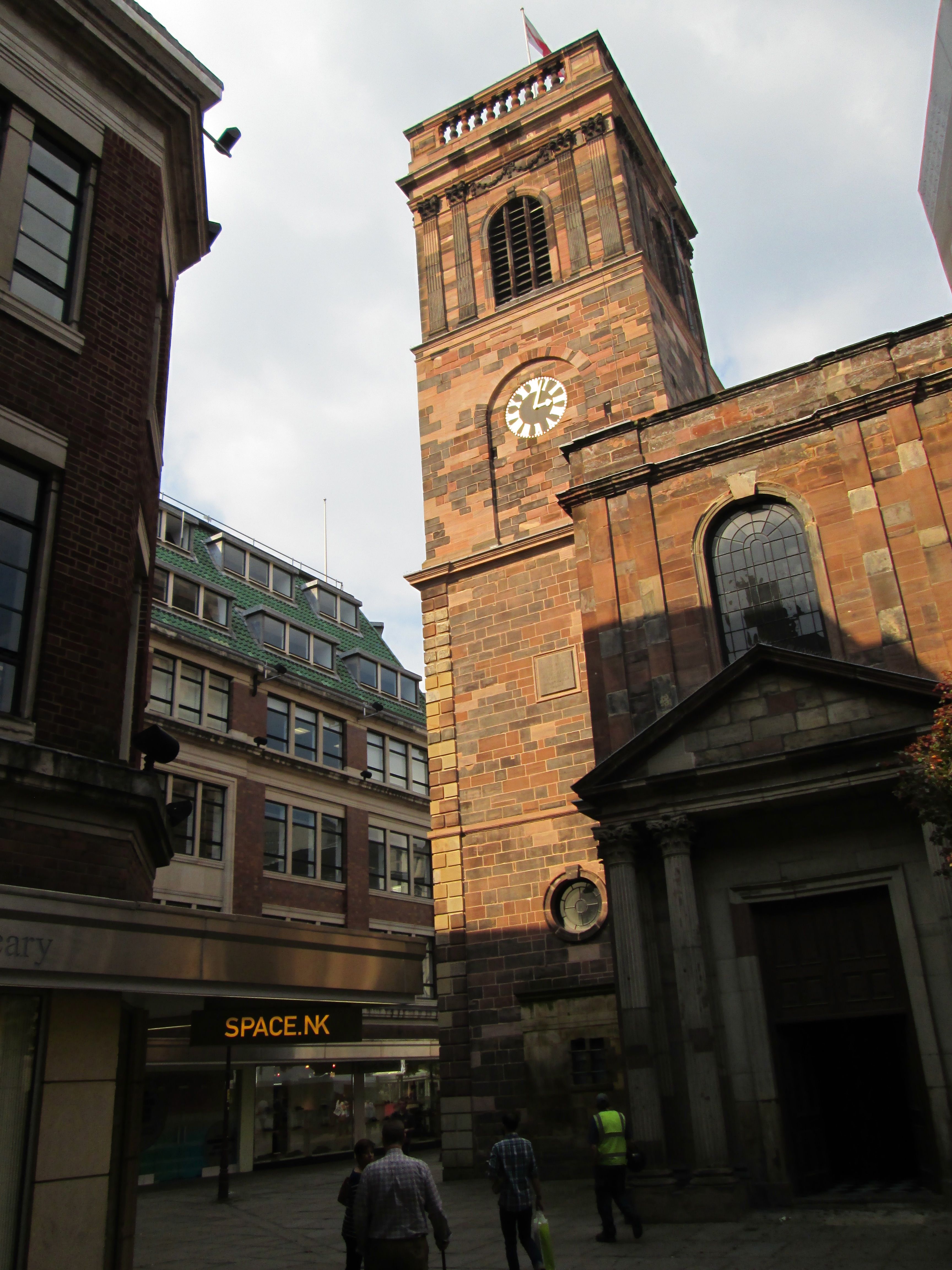
St. Anne's Church

St. Anne’s Church

We’ve arranged to meet at St Anne’s Square, a smaller, intimate space which also offers respite from the commuting and shopping throng. The old church that gives the square its name has been here since the eighteenth century when Manchester was still a small town. A feeling of more olden days pervades. There are market stalls, pub and restaurant marquees, and the right ambience to relax and watch the world go by.

Manchester is really a modern city. It only received that designation in 1853, by which stage it was on the crest of the tidal wave wrought by the Industrial Revolution. Cotton was king, the city even nicknamed Cottonopolis. Warehouse City was another monicker, as the city flexed its industrial muscles to conjure up a Lowryesque landscape. The artist was a local, lived, studied and is buried here. The major museum in his honour, The Lowry, is housed nearby on the Salford Quays. Manchester, lest we forget, became a major port in the late nineteenth century. Over sixty miles from the sea, it was connected by the Ship Canal in 1894.

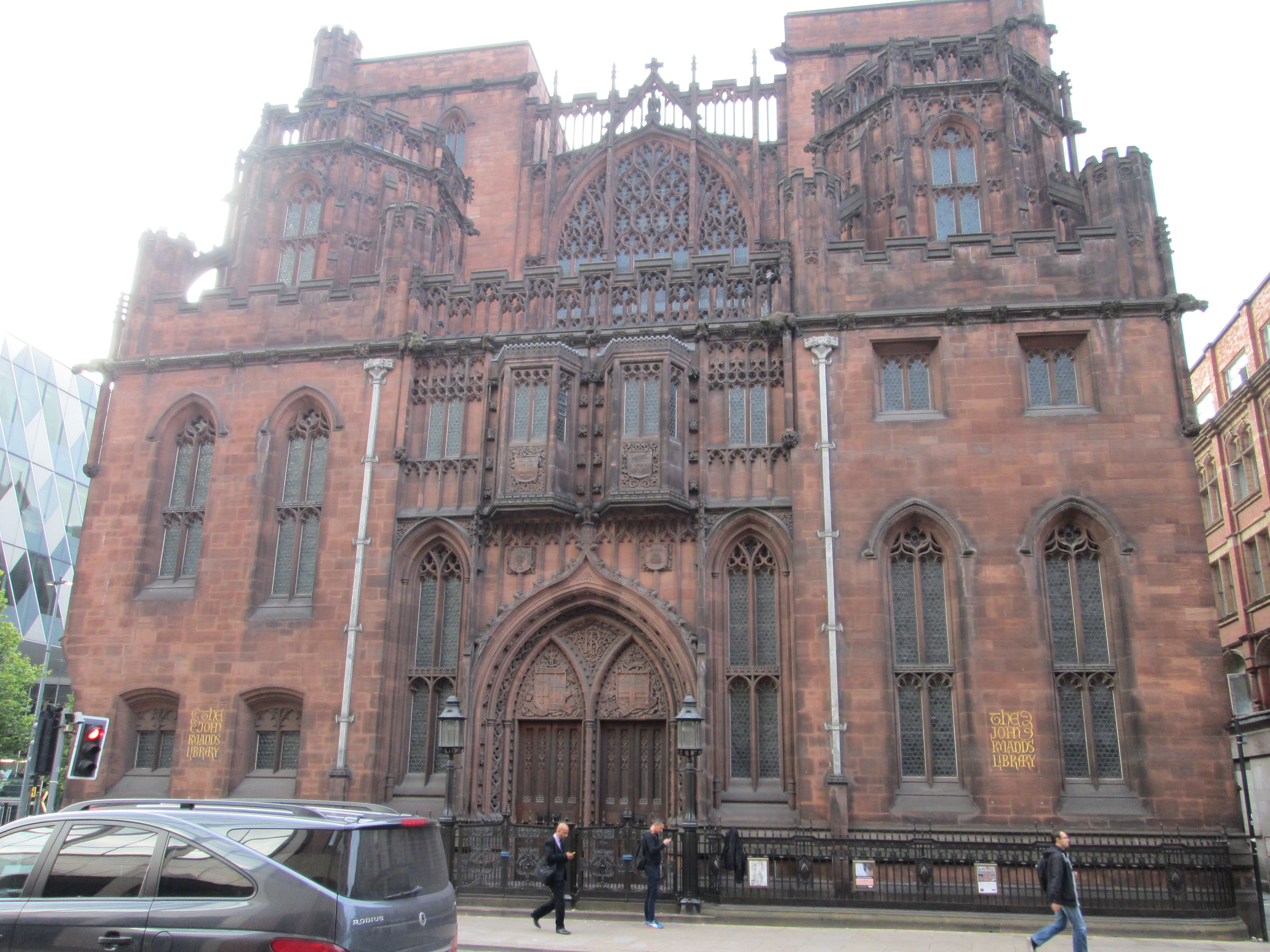
Ryland's Library

Ryland’s Library

Along Deansgate, you can catch the flavour of power that propelled this city into the twentieth century. Handsome proportions of streets and buildings, the Victorian and Edwardian palaces an impressive statement of wealth and craft. Not only God and Mammon, Manchester nurtured culture too. The John Rylands Library is a supreme Gothic confection from the early nineteen hundreds. It houses ancient papyrus and illuminated manuscripts, a Gutenberg bible and an extensive collection of the printing of Caxton. Beyond Deansgate lies the river and the great canal system. A city for exploration in itself.

Cathedral Gate

Cathedral Gate

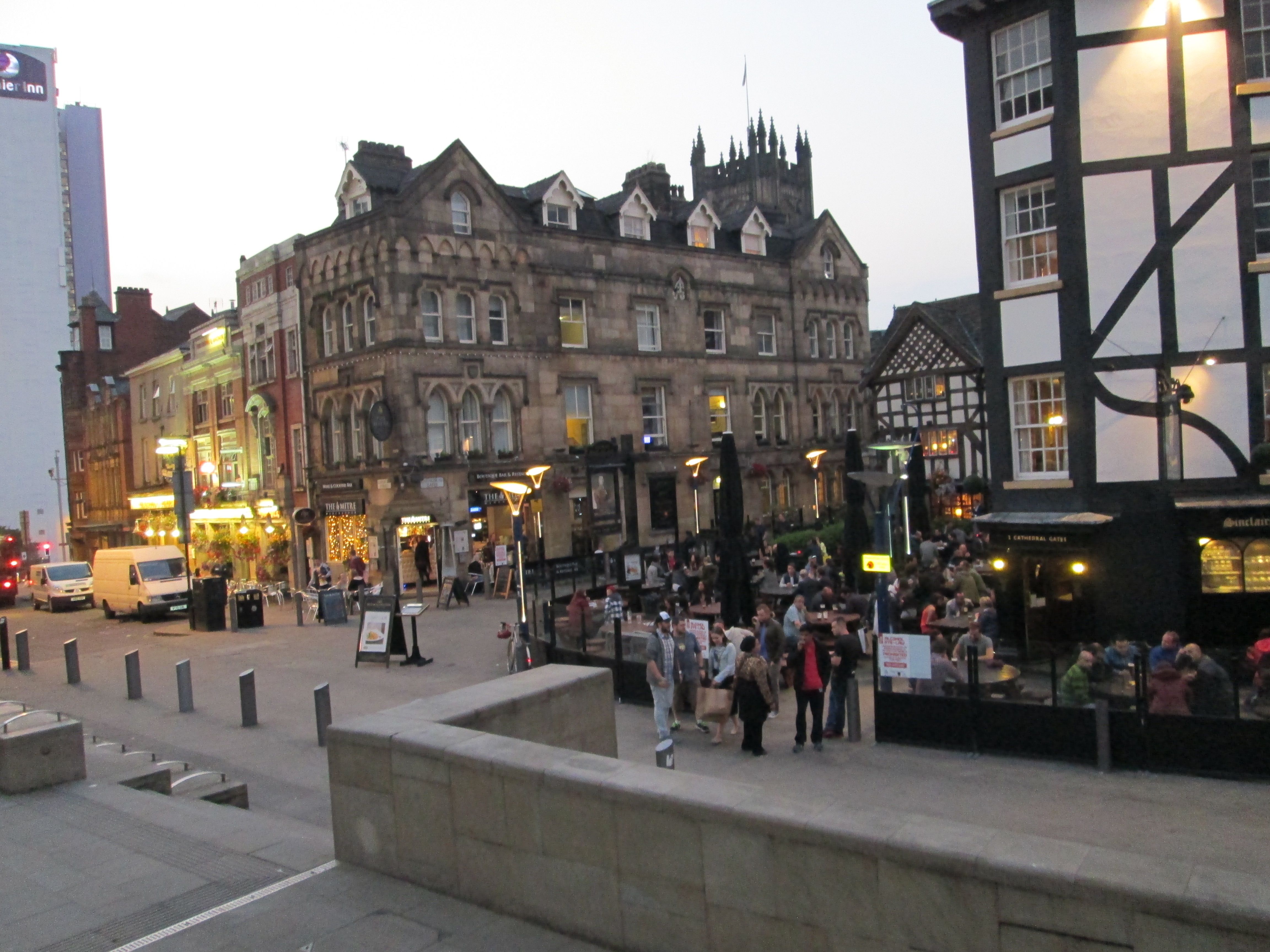
Hunger, for now, draws us back to the commercial hub. We dine at a high end pizzeria, and very nice it is too. This precinct has grown quieter at night but the atmosphere is good. Through a vast mall we find ourselves on a raised terrace with a view of Manchester Cathedral beyond. The Cathedral dates back to the fifteenth century though, like the city that now surrounds it, has undergone much change since. Below us is a lively spot, all mock tudor beams, called the Cathedral Gates. This is the place to be, with extensive outdoor seating and a great buzz. The medieval quarter, as such, straggles around here. There are guided walks to get you in touch with the original essence of the city. Every city comes from somewhere, you do want to keep that spirit alive.

The Mancunian with the golden car

The Mancunian with the golden car

We wake to the incessant tinkle of trams. It’s all abuzz again. We take a tram to Piccadilly Station, heading for home via England’s extensive, if weirdly connected, rail system. We require three trains to get to Holyhead; a pity the ferry cannot sail from Manchester.

Dublin – National War Memorial Gardens

I first discovered these gardens in the 70s, heading for Phoenix Park from Drimnagh, just past the Grand Canal and Kilmainham. Discovery is the appropriate term, back then these gardens were forgotten and in a ruinous state. Hardly a soul would venture in there, other than those wanting to step outside of society. Burnt out cars and burnt out people came to be the companions of the marooned masonry and overgrown parkland.

100_1463

You could just about discern within the remnants the outline of something which once must have been impressive, perhaps the whisper of faded empire. It was a place to give free rein to ghostly imaginings, conjuring a Classical past from Gothic decay. There were mood altering substances at work too. Like I said, it was a place where we could step outside of society for a while.

The decay was at last reversed. In the 1980s, the Office of Public Works (OPW) began the restoration work. Completed towards the end of the decade, The Irish National War Memorial Gardens were restored to their original state. The memory of our true past was once more cherished. It is sometimes thought that the Gardens were allowed to go to ruin as they were essentially a British Army memorial to those who fell under that command in the Great War of 1914 to 1918. This does not stand up to scrutiny. The 1970s saw widespread degradation of our urban fabric, including parks. In large part this was caused by the economic recession of that period, but there was also a disregard for our architectural heritage, a craven desire to prefer the modern over the old. It is the reversal of the latter trend that has allowed us to reclaim the treasures of our built heritage.

100_1462

Mind you, the Gardens at Islandbridge are not particularly ancient. In their decade of ruin they were barely forty years old. The concept of a memorial garden came shortly after the end of the Great War, at a time when Ireland was entering the throes of its own War of Independence. The object was to commemorate the fifty thousand Irishmen who had died in the European conflict. This project was initiated in the fraught first decade of Irish independence, in a country riven by the bitterness of the Civil War. 1931 saw the development of the parkland between Islandbridge and Chapelizod on the banks of the Liffey. If the accession to power of Eamon De Valera did not seem auspicious, the project didn’t founder. Work commenced on the Memorial Gardens themselves in 1933. The project was completed in 1939, as another global conflict broke out. It’s notable that, in a spirit of shared memory, with the wars of independence so fresh in the mind, the workforce consisted in equal halves of ex-servicemen from the British and Irish armies.

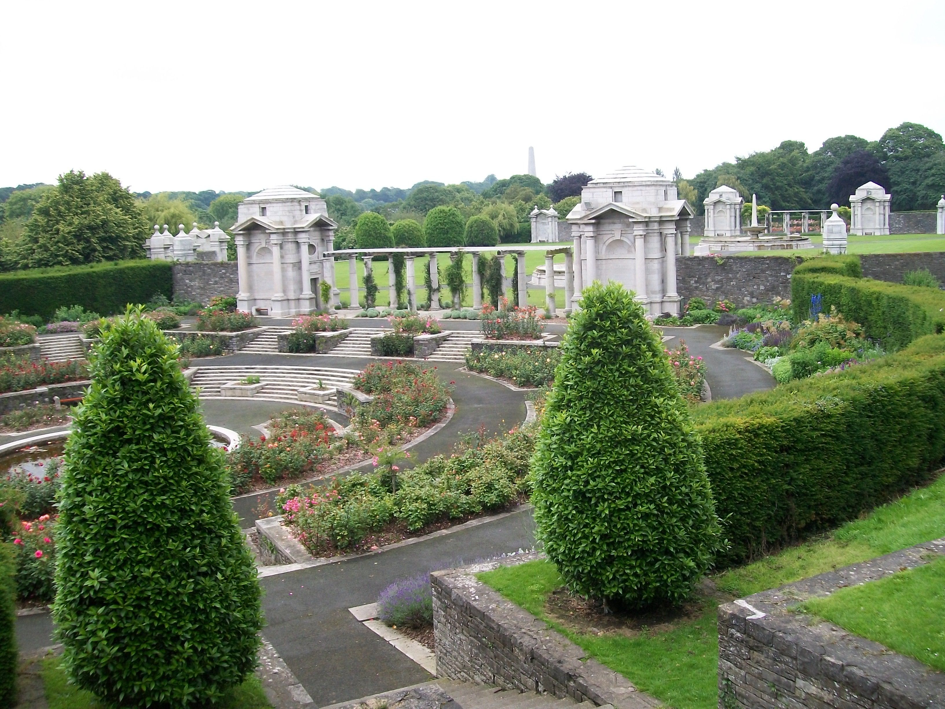
Sir Edwin Lutyens, one of the finest British architects of the Modernist era, designed the Memorial Gardens. World renowned, Lutyens had worked extensively in Ireland, including Heywood Gardens in County Laois, and at Howth Castle and Lambay Island in Dublin. His work is characterised by its harmonising of Classical and Modernist styles. At Islandbridge, he set out a symmetrical plan, rich in imagery yet restrained in effect. The main lawn is centred on a War Stone, symbolising an altar, while the flanking fountains are marked by obelisks representing candles. At each end are a pair of granite Bookrooms linked by pergolas. The Bookrooms are a repository for the eight volumes of books recording the names of all those Irish who perished during the war. These were designed and illustrated by Irish artist Harry Clarke, most renowned for his stained glass.

The Bookrooms and books can be viewed by appointment. We had contacted the Gardens in advance, and received an informal, personal tour of the monument from one of the OPW onsite team. It is an informative and moving experience, to see entries for such young men, mere boys really, who drew their last breath on a foreign field, preserved here by name, forever young.

100_1461

Passing through the linking pergolas of granite columns and oak beams, we enter the sunken rose gardens. Each are centred on lily ponds and surrounded by yew hedging. These are points of tranquil reflection, allowing the monument to recede into a serene mixture of flora and elements. To the south is the most imposing statement. The Great Cross presides over all, inscribed to ‘the 49,400 Irishmen who gave their lives in the Great War.’

The restoration of the park restores the dignity of those who fought in the war, but it is not, nor was it ever, a triumphal memorial. The classical elegance underpinning Lutyens design is a quiet reflection on the sacrifice of these men. It is, in effect, a monument to peace. The first visit of an English monarch to an independent Ireland, in May 2011, was marked with the laying of a wreath by Queen Elizabeth II at the Great Cross. Almost a century after that great fallout, a note of reconciliation was sounded.

That war, which we now call the First World War, did not end all wars. Sadly, such dreams are just that. We can wallow in wishful thinking, seek solace in forgetfulness, but it is, perhaps, better to remember our history and hopefully to learn by it. Ireland did gain its independence through bullets and blood, our National Anthem notes this fact. But it was the force of civil solidarity, allied with vision and idealism, that won the day and, to an extent, won the peace. Don’t forget that.

York

York was once the dominant city of the north of England. Founded by the Romans as Eboracum and becoming, about a thousand years ago, seat of the Danish kings. They lorded it over the natives, if we could apply that term to the Anglo-Saxons of the age. Its influence extended as far as Ireland. The Dublin Danes were inextricably linked with York, Jorvik as it was then known. The great Sitric Silkenbeard retired here to die in the middle of the eleventh century, leaving Dublin with the legacy of Christchurch cathedral. York’s own cathedral, York Minster, would have been in an earlier, smaller incarnation then. Both Dane and Norman would conspire to destroy, and rebuild it, before the present Gothic masterpiece arose in the thirteenth century. One of the largest cathedrals in northern Europe, its majesty underlines the importance York enjoyed into the late middle ages. York

York’s influence on contemporary Britain may have waned somewhat, but the city has nurtured its original grandeur. Few places that I have seen have attained such a harmony between ancient and modern. The great cathedral still crowns the hill, a hymn to the power and endurance of medieval church architecture. Meanwhile the ancient walls are virtually unbreached, enclosing a sizeable city and straddling the mighty River Ouze. Having walked the walls of the early-modern city of Derry, and very impressive they are too, it’s another treat to walk these older, more extensive walls, two and a half miles in circumference. We reach York in bright sunshine, the bricks and trees of the suburbs alive in the charged northern air. We circle about the walls to find our hotel hard by the railway station. It’s a grand, nineteenth century pile, from the halcyon days of Victorian industry, when railway hotels were the acme of wealth and elegance; this was the place to be! There are extensive formal gardens to the front, with the picture-perfect city hung above us, tantalisingly close. To complete the harmonic transition of the ages, the hotel is thronged by a science fiction convention. There’s a great buzz with eager groups huddling in frantic, and often hilarious, discussion. There is a higher than usual percentage of hirsute geeks, aging goths and, unexpectedly, lesbians. After the mayhem of reception, it’s time for a grander entrance at the most impressive of hotel staircases.

Walking along the city walls

Walking along the city walls

The city walls are there to be walked, taking us an hour into the slow sunset. They encircle a large urban area of about two hundred and sixty acres. Although earlier defensive ramparts have been unearthed, it was the Normans who established the extensive fortifications. York Castle was the centre of the defenses, this complex surveying the only unwalled section, where the River Fosse forms a natural defensive moat. The walls also helped generated wealth through establishing a secure customs point on the major river, The Ouze. Everyone who was anyone passed through here. The Romans, the Danes and the Normans all left their mark. Richard III looms large; the last king of the House of York he is held in higher regard here than elsewhere. Richard, still stooped under Shakespeare’s caricature, is receiving some rehabilitation since the recent discovery of his remains in a Leicester carpark. York has a museum dedicated to him, housed in the largest of the four city gates, Monk Gate, with a functioning portcullis to boot.

York Monster from the city walls

York Monster from the city walls

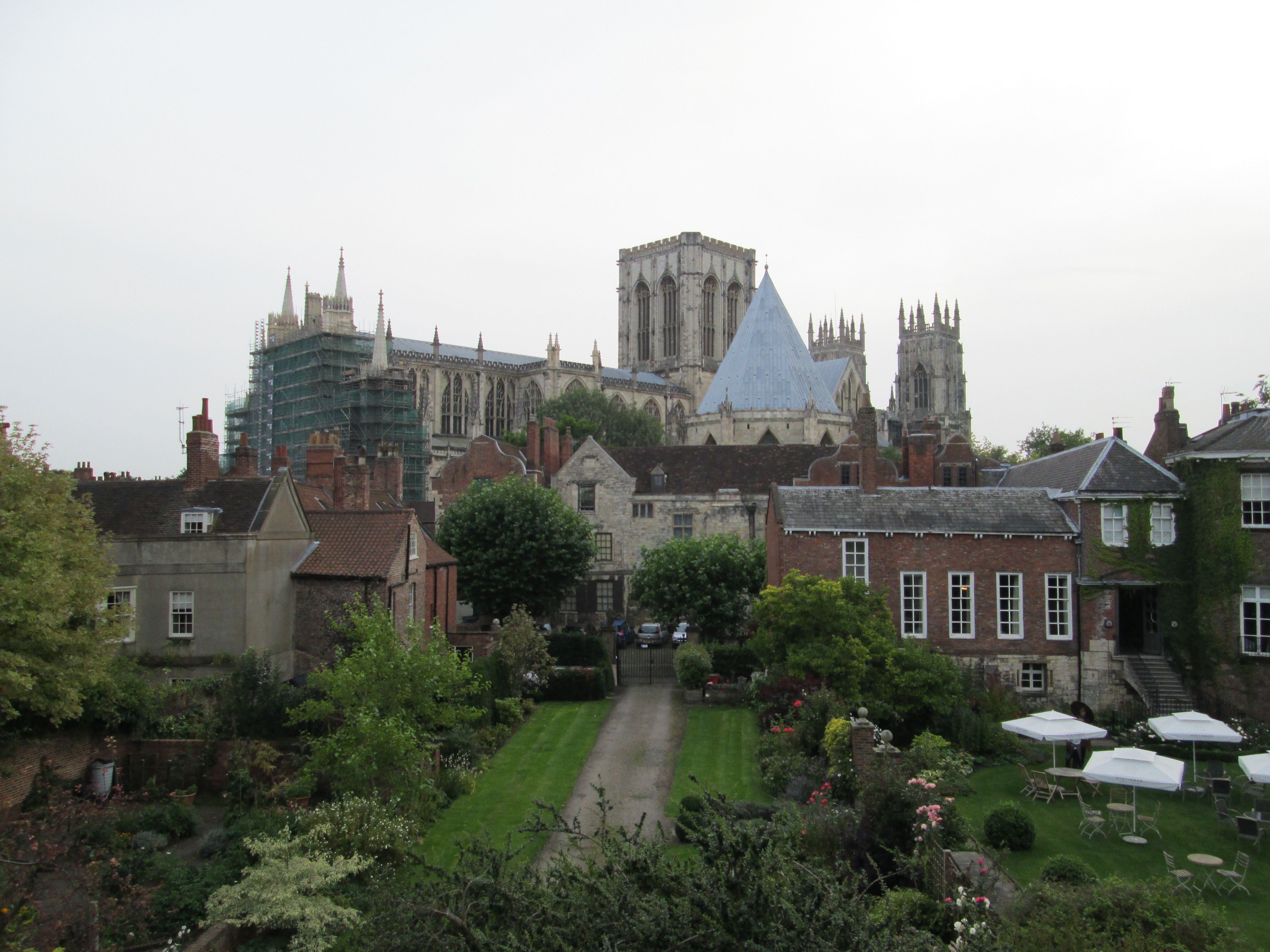
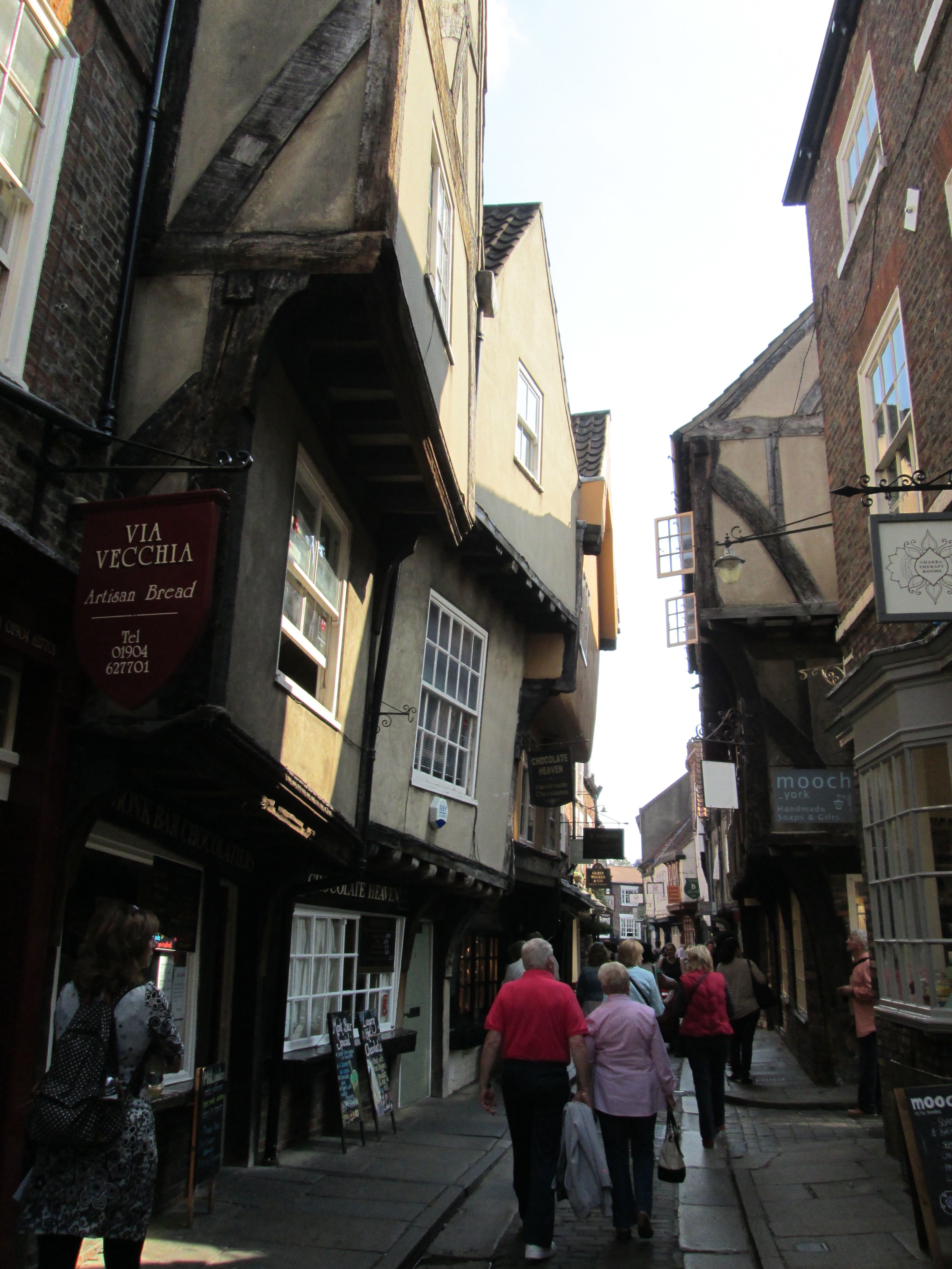
We step off at the cathedral. The illusion of passing through a gate in time is strong here. York Minster dwarfs the surrounding medieval city. The old town tunnels further into history.The Shambles, its most famous and ancient street, becomes literally a tunnel of wood-framed leaning buildings, stooping across the narrow passageway to hinder the sky. The shambles were the shopfront counters of butchers, primarily, and other selling their wares. Back then, you stayed on the street to do your shopping, the vendor displaying their goods on the shambles, conducting transactions through the ground floor window of the shopfront. Medieval wood and stone still survives, worn smooth through centuries of use.

The Shambles

The Shambles

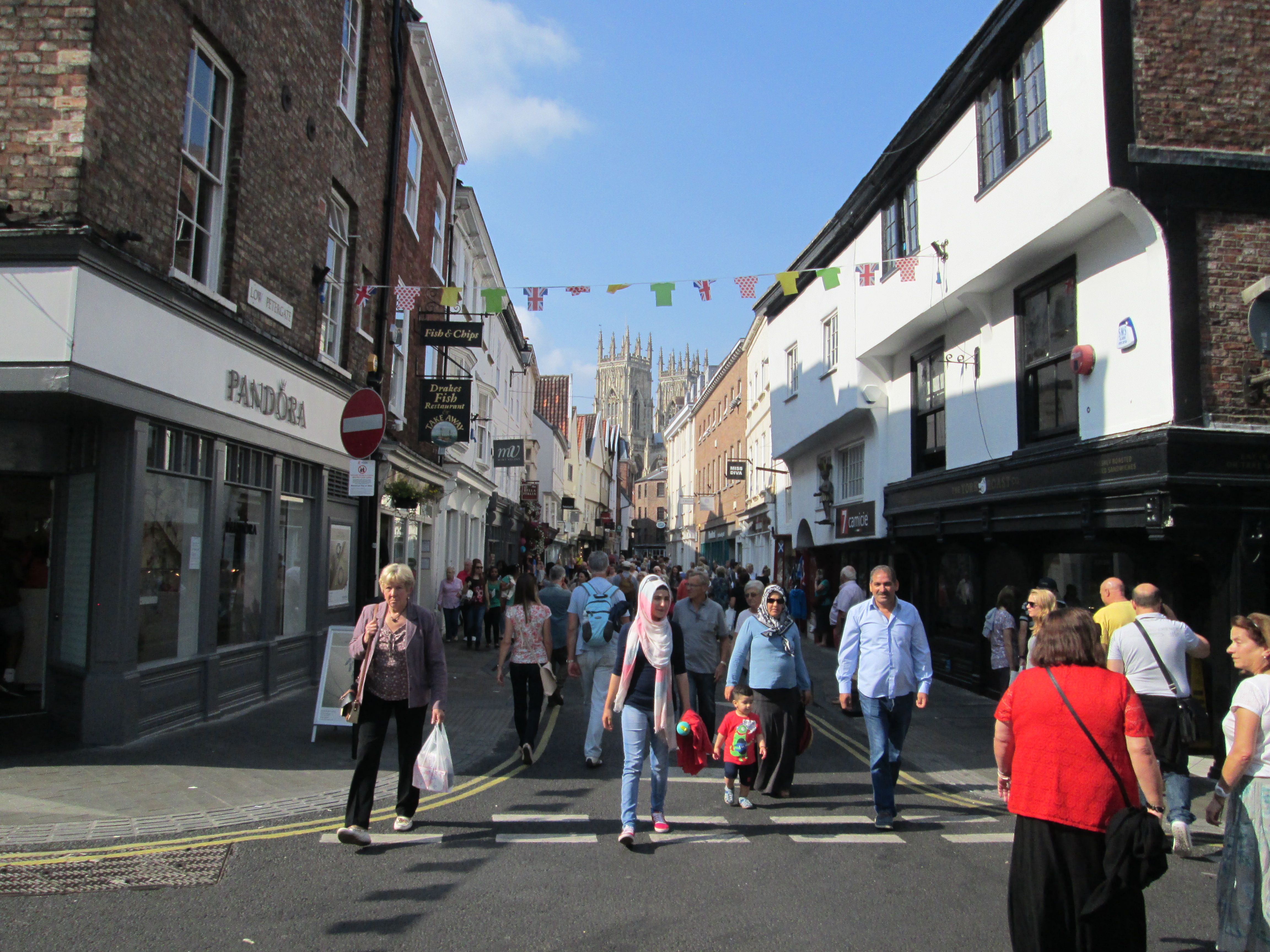
The tiny streets weave and flow, thronged with shoppers, tourists and the blooming party scene of early evening. There are plenty of old traditional bars. The Olde Starre Inn, is York’s oldest. Dating from 1664, its foundation coincided with the birth of Kronenberg, a happy coincidence indeed which must be honoured. The Judge’s Lodgings has a pleasant raised patio where we soak up the evening sun, sampling the ale while the ‘girls’ gather for the night. Wilde’s of Grape Lane is, for some reason, dedicated to our own great Oscar. An eclectic mix of Edwardian frippery, contemporary music and brown cafe ambience, it’s just right for drinking and dining pleasure. Burritos and Kronenberg, if you must ask, and very good too. On another day, more basic delights are catered for with a stop at a vernacular cafe near the markets for pie and chips washed down with a bottle of local ale. Ah yes, Black Sheep Ale, how wonderfully named. With the weekend on top of us, hens, clad in minis and sashes, teeter on stilettos over centuries old cobbles. Meanwhile, stags in their civvies are starting to rut, so we must weave our way home, as you can imagine. Betty’s Tea Shop is another Yorkshire institution. Founded in 1919 by a Swiss baker, Francis Belmont, it strives for a traditional ambience,elegant and deferential. On the last morning, as the Boss seeks out the White Stuff (it’s a shop, honestly!), I take coffee at Betty’s on Stonegate. Its upstairs tea room forms an oasis of sorts, bustling but somehow calm in its certainty of caffeine and spices. It’s a perfect pick-me-up for our morning departure. Back at the hotel the SF gig is winding down. People are getting ready to rejoin the real world. The throng meanders along the swirling corridor from some classic movie, then winds down the massive staircase to reception. A couple of starry trekkers prepares to check out, or as one says knowingly, to no-one in particular: “to boldly go.” I suppose we must. But look forward to going back, when time and space allows.

Bray – a Short History.

Bray – History.

Bray is a direct translation from the Irish ‘Bré’, meaning a hill. For some time, however, the Irish version was given as Brí Chualainn whose meaning is disputed. In general it is taken to derive from Ui Bhriain Chualainn, the land of the O’Byrne’s of Cuala. The O’Byrnes, usually styled Byrne, are a significant Wicklow name, along with Cullen, O’Toole and Kavanagh. These clans disputed coastal Wicklow with the Danes and subsequently the Normans.
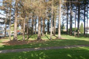
St Sarain's Cross at Fairyhill

St Sarain’s Cross at Fairyhill

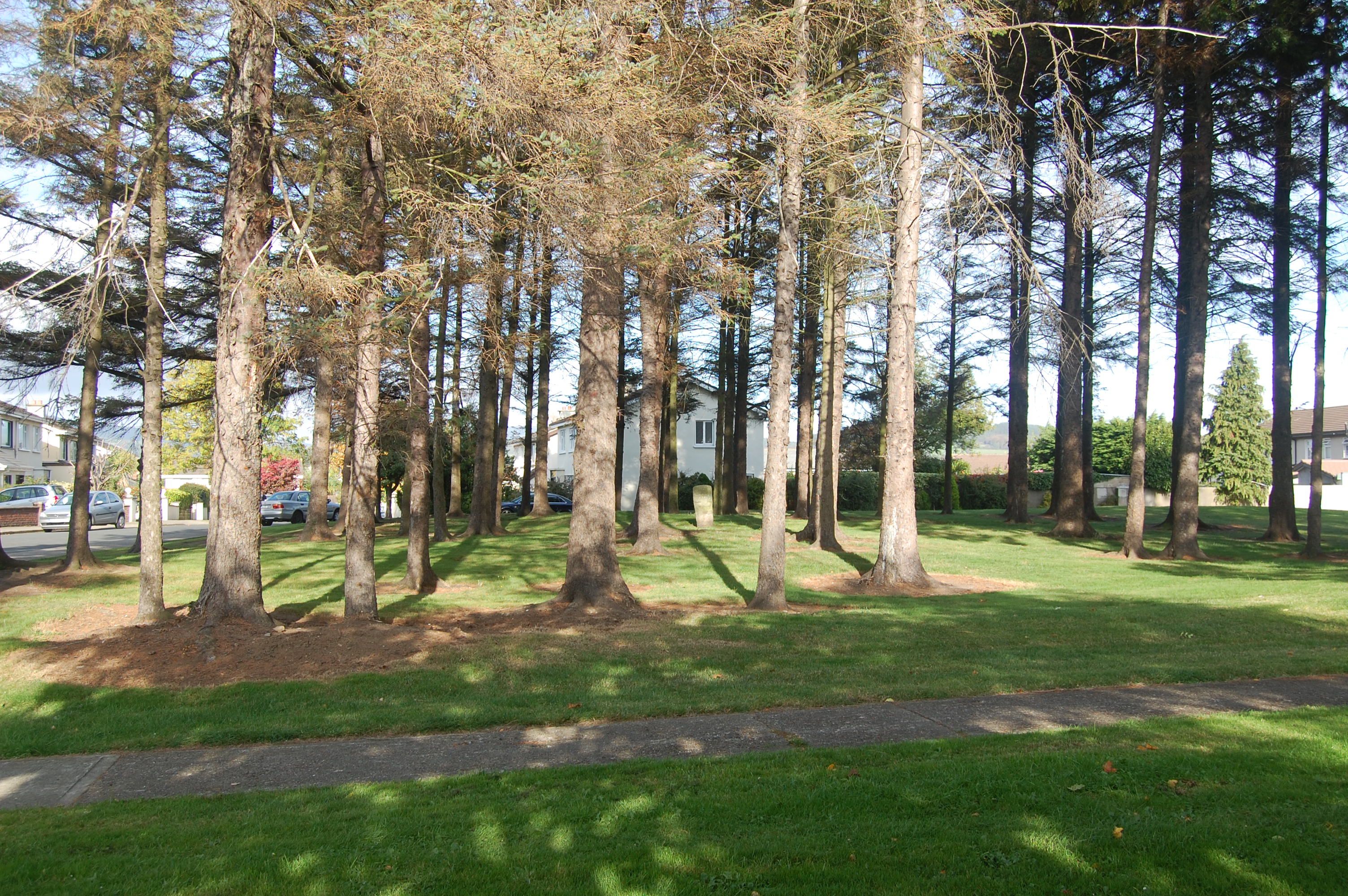
There are some remnants from the early Christian era, dating from the fifth century onwards. The ruins of Raheen a Chluig, the Little Church of the Bell, are on the lower, northern slopes of Bray Head. Two well-weathered early Christian crosses survive, at Fassaroe to the north, and Fairyhill to the south. This latter cross, situated in a hilltop stand of fir trees at the entrance to a modern estate, is attributed to Saint Saran. The saint is further commemorated in the name of nearby Killarney Road, the southwestern approach road to the town.

Bray, as a definite location was established by the Normans under Richard de Clare (Strongbow), at the fording point of the River Dargle near where the town bridge now stands. The location was of importance since it marked the southern extent of the Pale, the area of Norman influence around Dublin. As such, Bray was a frontier fortress, sporadically attacked by native clans from the south. The castle was built just west of where St Peter’s church stands. Other castles, or tower houses, were established at Castle Street north of the Dargle, and Oldcourt further south. Only the ruins of Oldcourt Castle remain.

The lands south of Bray were granted to Walter de Riddlesford, one of Strongbow’s loyal adventurers in the invasion of 1169. This led to the establishment a large demesne centred on Kilruddery, the Church of the Knight. The route between this estate and Bray Castle established the line of Main Street. Thus, Bray grew as a typical manor town of the era. Agricultural produce, milling, brewing and a freshwater fisheries maintained the economy of the town over the next few centuries.
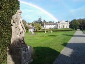
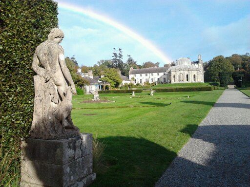
Kilruddery

Kilruddery House and Gardens

The Brabazon family had come into ownership of the estate in the early 16th century through William Brabazon, Lord Justice of Ireland. Brabazon gained favour through his zealous support for Henry VIII as King and head of the Irish church. The title Earl of Meath was granted to his great-grandson William in 1623. Kilruddery House had to be rebuilt following destruction in the Cromwellian wars of the mid century. The current building is largely an 1820s reconstruction in the gothic Tudor revival style. The original gardens remain, designed by the French gardener Bonet, they are a unique example in Ireland of eighteenth century design. An eerie, placid beauty attaches to them, the most notable vista is presented by the parallel canals running south of the house. Adjacent to this gothic realm, classically inspired additions were added in the eighteenth and nineteenth centuries.

By the end of the eighteenth century, Bray’s development as a resort had begun. The Romantic movement inspired people to regard the sea as beneficial to health, of body and of spirit. Contemplation of beautiful scenery and engagement with nature was also encouraged. Bray was ideally situated, close to these benefits and also convenient to Dublin. Novara House, an early beach lodge, lying at the southern end of Novara Avenue, dates from this time, though it has been extensively modernised. Originally known as Bay View, it is sited a half mile inland from the seafront itself. The early nineteenth century saw the building of three Martello Towers to guard against the Napoleonic threat. One of these survives on the crag overlooking the harbour at the north end of the seafront. In the 1980s this became, for a time, the residence of that other wee general, Bono of U2. The harbour itself would not be constructed until the second half of the century, such sea traffic as there was unloading at a small dock at the mouth of the Dargle opposite the Harbour Bar. This popular, atmospheric pub from the 1840s is one of the few buildings on the seafront to predate the coming of the railway.

The railway transformed Bray. The Dublin-Kingstown (now Dun Laoghaire) was opened in 1834, however, twenty years passed before it was extended to Bray. Railway engineer and developer William Dargan, was instrumental both in bringing the railway to Bray and in developing the town into a major attraction for visitors and new residents. The area between Main Street and the seafront was developed with straight, tree-lined avenues lined with elegant Victorian terraces. Dargan had an exotic Turkish Baths constructed in the Moorish style on Quinsboro Road. It was a startling addition to Bray’s streetscape for over a century before its sad demise in the 1970s. Another of Dargan’s initiatives was the National Gallery of Ireland facing Merrion Square in Dublin. A statue of the indefatigable entrepreneur and patron stands in its forecourt. In Bray, he is commemorated in the name of a terrace on Quinsborro Road, and in a mural at Bray Dart station.
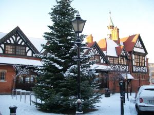
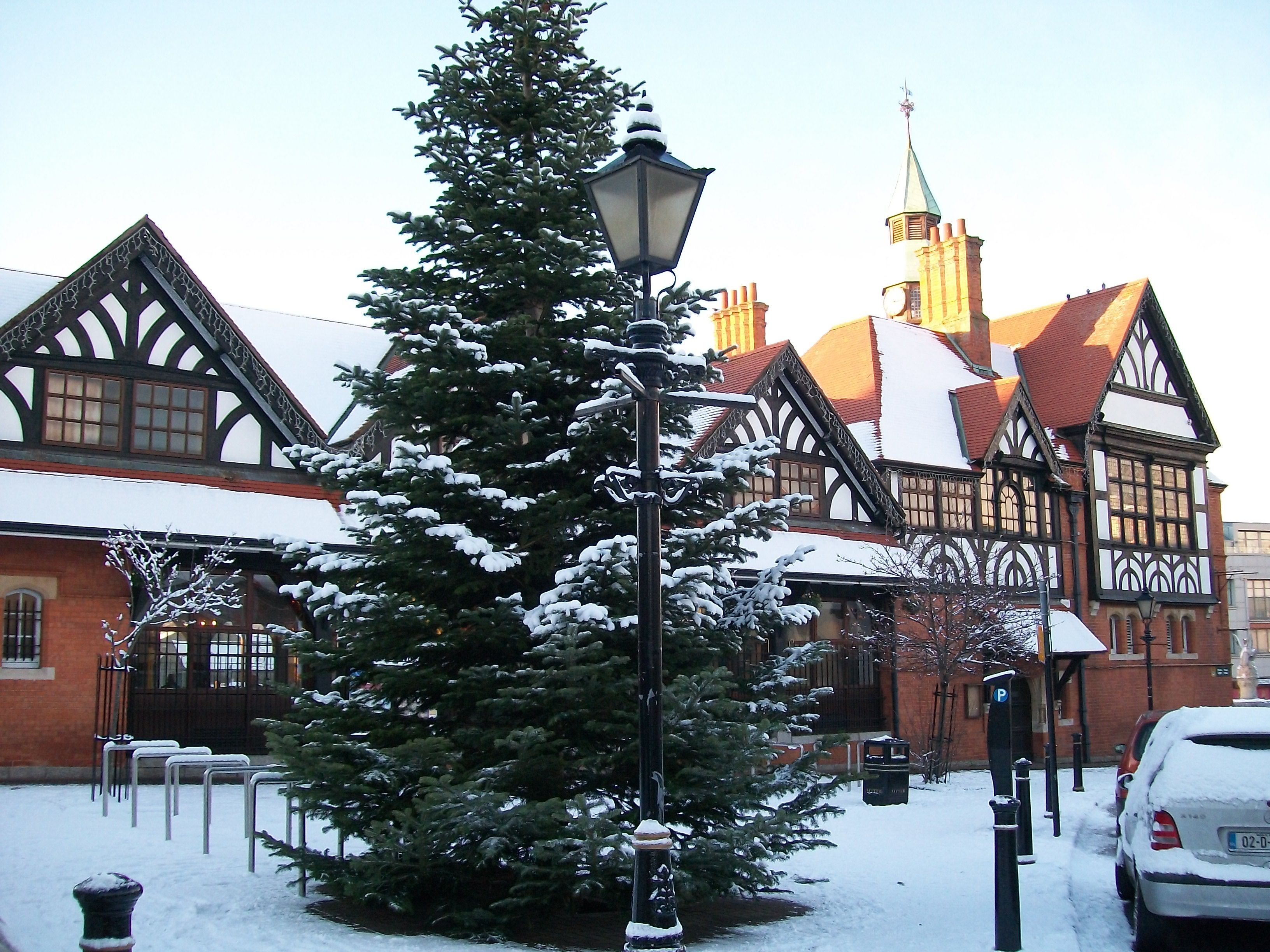
Bray Town Hall, completed in 1881

Bray Town Hall, completed in 1881

Major hotels were established to cater for the influx of tourists and day-trippers. Quin’s Hotel, overlooking the Dargle at the north end of Main Street was transformed from a small town inn. It is now the Royal Hotel and Leisure Centre. Other hotels sprang up on the seafront and adjacent to the railway station. The International Hotel, facing the station’s west frontage, was the largest hotel in Ireland on its completion in the 1860s. The development of the Esplanade with its seawall Promenade, and the Harbour came soon after. Bray, once the small manorial village, was transformed into a thriving resort for the quality, and dubbed the Brighton of Ireland. By the end of the century, the town’s population approached the ten thousand mark, whereas most Irish towns, in the aftermath of the Famine, showed declining populations. During the Edwardian era, Bray continued to epitomise the stylish resort.
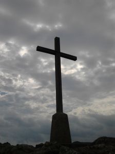
The Cross on Bray Head

The Cross on Bray Head

After Irish independence, it began to drift downmarket. Fashions change, and holiday resorts now catered for a more egalatarian population. Amusement arcades mushroomed, an increasingly raucous brand of fun was demanded. Big band music, cinema, donkey rides were all part of summer at the seaside. Blackpool of Ireland, might have been more appropriate as a nickname. After the hiatus of World War Two, British holidaymakers returned in the fifties. Bray Head acquired its crowning stone cross in the Holy Year of 1950. This has become an iconic image of the east coast. A chair lift brought people to the summit. It’s long gone, though the cross remains. Top Irish showbands such as the Royal and Miami played the Arcadia ballroom on Adelaide Road in the late fifties and throughout the sixties.

Ardmore Studios were opened in the early sixties, bringing a touch of silver screen glamour to Bray. The studios, on Herbert Road, hosted major American and British productions, the industry grew to provide television and advertising facilities. While Wicklow’s lovely scenery was a big draw for producers, Bray’s versatility also came into play. Over the years, the town has stood in for smalltown Vermont, a typical Irish western town or the heart of the English Home Counties on the large and small screens. Neil Jordan painted the seafront pink for The Miracle, he also used it for Dublin in the film Michael Collins, the Carlisle Grounds standing in for Croke Park during the War of Independence.

Changing fashions saw the postwar tourist boom fade too. Foreign destinations became a bigger attraction for summer holidays. Tourism was further eroded by the oil crisis and recession of the seventies. Bray experienced an unfortunate depredation of many of its attractions and landmarks. The Internatinal Hotel was destroyed by fire in 1974. The vacant lot festered for a decade or more, eventually taken by a bowling alley. The Arcadia became a cash and carry. In 1980, the Turkish Baths were demolished in the crass, shortsighted civic vandalism that prevailed.

There was light at the end of the tunnel, and it was an oncoming train. The electrification of the suburban rail system initiated the Dartline in 1982. Bray Daly station was once more a key focus of the town. In the 1990s, a project sponsored by Bray Community Arts Group, commissioned a painted mural on the eastern platform. The mural depicted the history of the town and the railway decade by decade from the 1950s to the present day. Brunel, Dargan, Oscar Wilde and James Joyce are all featured. Wilde’s father had property in Bray and the writer was to suffer an early, unfortunate trial at the Courthouse. James Joyce has a stronger association. He lived at Martello Terrace, hard by the waves pounding the Promenade. The house features in Portrait of the Artist, while the phrase, “snot-green, scrotum-tightening sea” may owe something to the location. The mural has been badly weathered by the briny air,  so original artists, Triskill Design, have undertaken a replacement project using tile mosaics.

The rejuvenation of the railway brought a population boom to Bray. By the end of the century the population had doubled to over thirty thousand people. The new residents were housed, for the most part, in suburban estates south of the town. New schools and industry followed. The protection of the sylvan setting has helped soften the impact of such an extensive building development. Still it grows, and new estates and roads now crowd to the edge of the lands of the Kilruddery estate.

Hail, rain or snow, crowds gather for the annual New Year Swim

Hail, rain or snow, crowds gather for the annual New Year Swim

If the amusement arcades have waned, the seafront remains a magnet for all those seeking rest and recreation. Bars and restaurants now cater to the fashion of al fresco drinking and dining throughout the summer. The annual festival has hugely expanded its carnival attractions, drawing thousands over the St Patrick’s day festival and the Summer Festival throughout July and August. The Fireworks display and the Air-show have seen crowds approaching a hundred thousand throng the length of the Esplanade. Returning Olympic hero, boxing gold medallist Katie Taylor, drew a massive crowd of wellwishers to the Esplanade in 2012. For fitness fiends and boulevardiers, the amenity of the seafront Promenade and Bray Head is popular year round. The National Sealife Centre, north of the Bandstand, is one of Ireland’s most popular visitor attractions. An unimpressive pile at its inception, it has developed into a sleek modernist building, with restaurant, ice-cream parlours and cafes, augmenting the wet zoo at its core.

The Civic Centre at St Cronin’s, off Main Street, was a major project of the late century. This included the Civic Offices and the Mermaid Arts Centre, incorporating a gallery, theatre and workshop space for several arts disciplines. The Mermaid brought to fruition a long campaign to establish a designated arts centre from artists and groups including Signal Arts and the Bray Arts Group. The Centre is an important focus for the arts in Bray, however the arts scene thrives at several venues around the town, with music, theatre and literature particularly strong. The Bray Jazz Festival in early May is in its fourteenth year, bringing top national and international musicians to a dozen or so stages from Main Street to the Seafront.

Storm clouds gather over the Prom

Storm clouds gather over the Prom

The financial collapse of 2008 stymied commercial growth in the town centre. Proposed shopping centres, north and south of the bridge, failed to materialise. Town centre businesses in Bray, as elsewhere throughout Ireland, are on the retreat as out of town retail parks and on-line shopping erode their customer base. Bray also lost its town council, it being subsumed into Wicklow County Council. Whether this will prove unsympathetic to Bray’s future needs remains to be seen.