Wicklow’s Wonderful Coast – 13

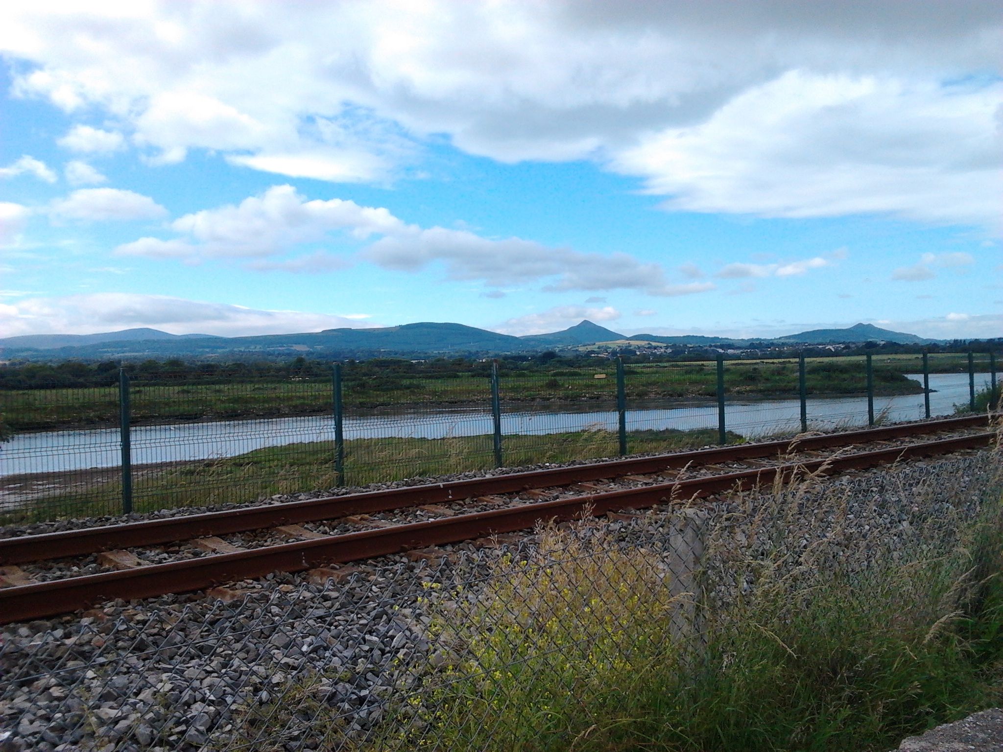
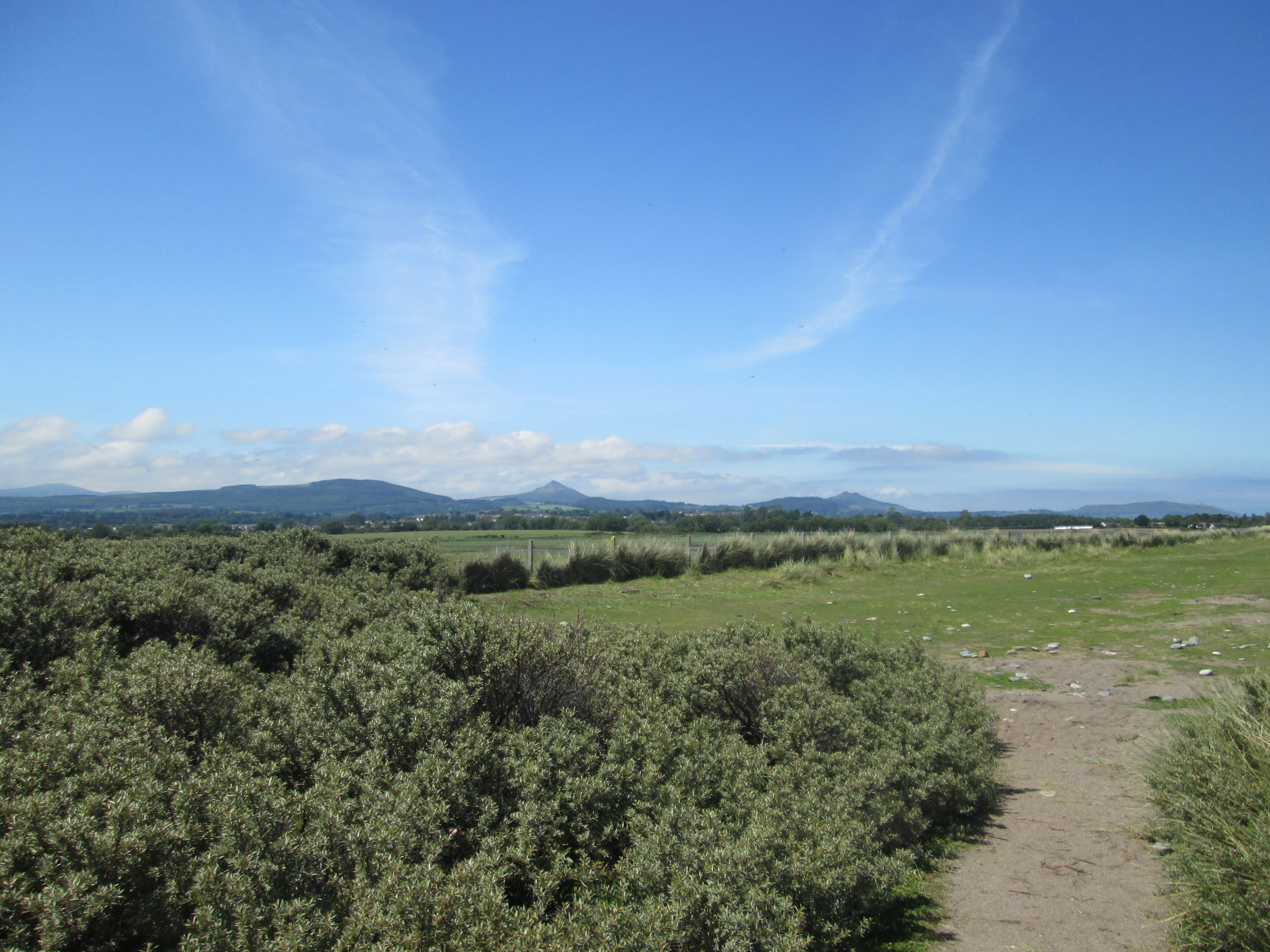
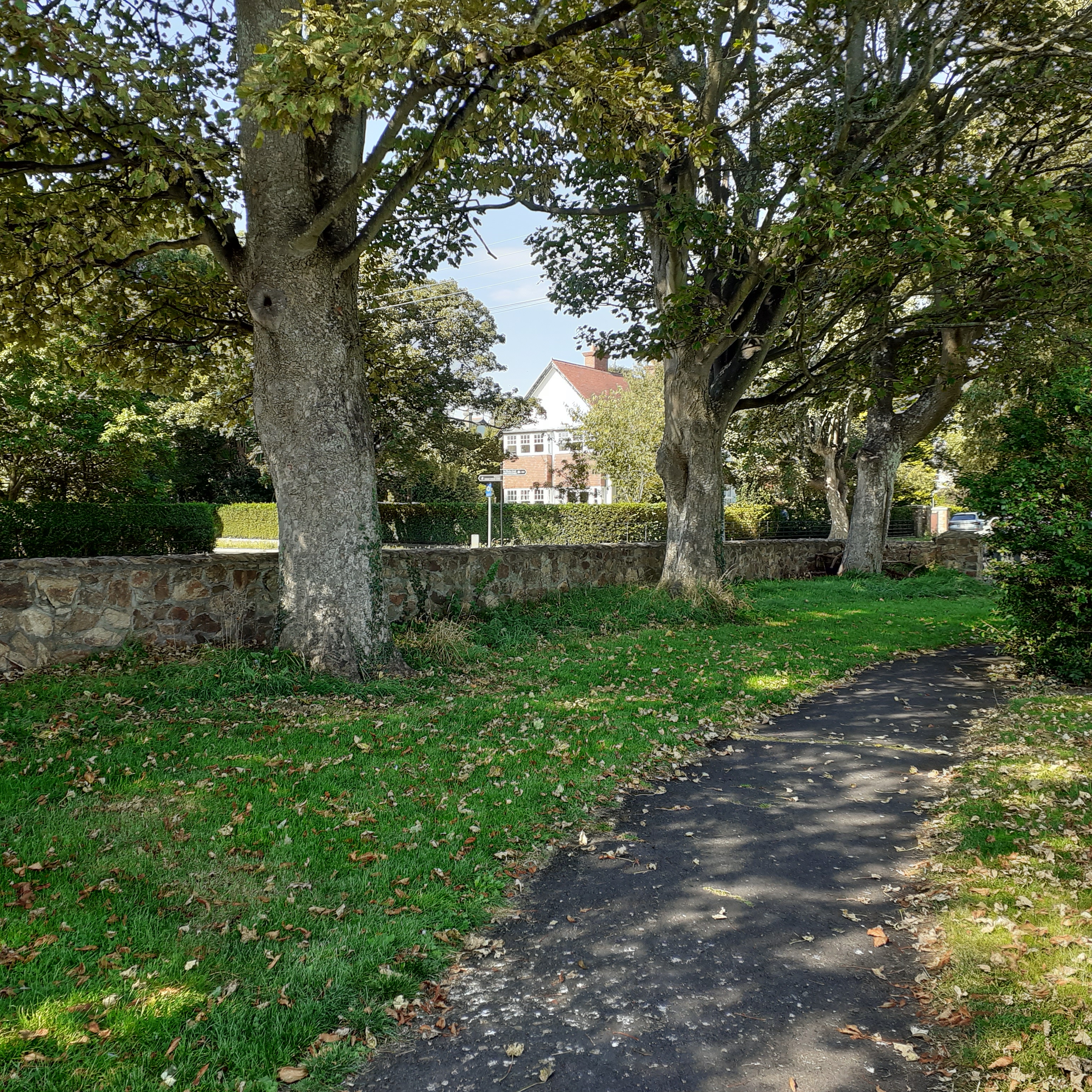
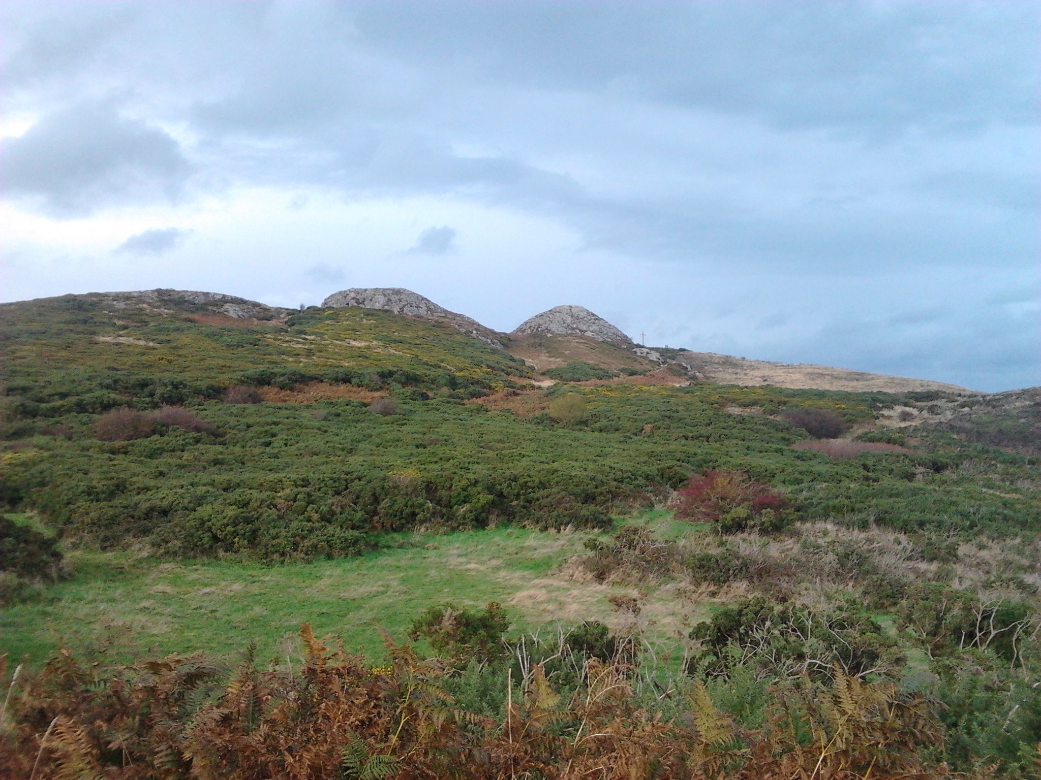
Leaving Newcastle village behind, we can return to our coastal trail via Sea Road. South of Sea Road and not far from the beach, there’s public access to the East Coast Nature Reserve at Blackditch Wood operated by Birdwatch Ireland. The approach walk heads towards the beach then turns south along the landward side of the coastal ridge carrying the railway. The path heads back inland onto a boardwalk crossing a stretch of fenland through high reeds. There are eighty acres of preserved wetland to be explored and enjoyed.

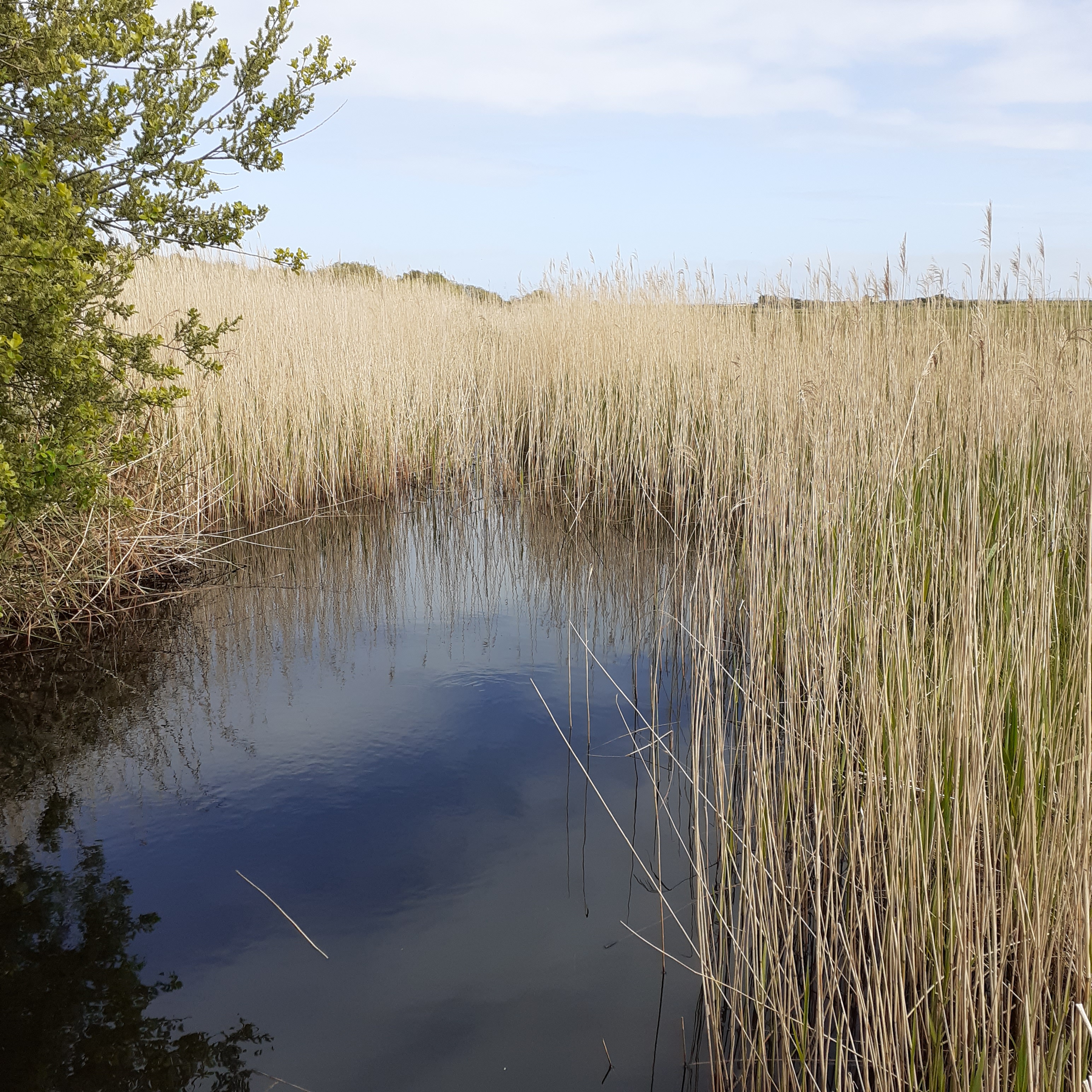
The feral fen had all but vanished from this coast through drainage and modern development. It was nurtured back to health by the Birdwatch project about fifteen years ago, stemming from a European wide initiative at the start of the Millennium. Water levels were raised and encroaching woodland removed to restore the natural environment. Another aspect has been the introduction of diminutive Kerry Bog ponies whose grazing controls the vegetation. The fens, intertwined with wetland, willow scrub, and indigenous birch woodland forms a rare and precious environment.

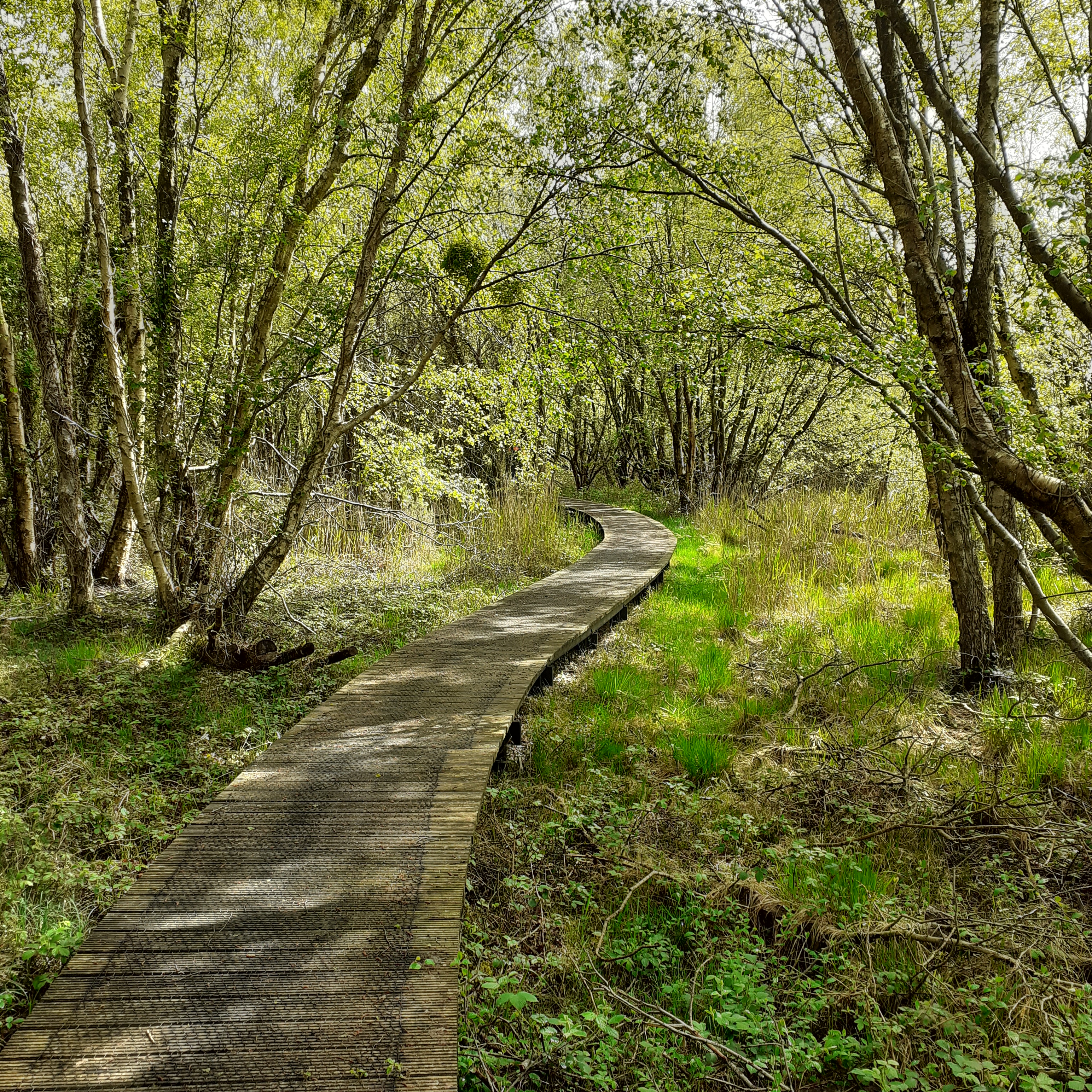
There’s a treasure of birdlife here. Whooper swans and Greenland geese come south from the Arctic as do such predators as Peregrine falcons and harriers. The little egret’s a resident and you may spot kingfishers, curlews, herons and more. Birdwatch Ireland help the dedicated ornithologist with three observation hides in place. Boardwalks curve through the wetland making access easy for the wanderer without intruding on the visual integrity of the landscape. It’s like walking on water.

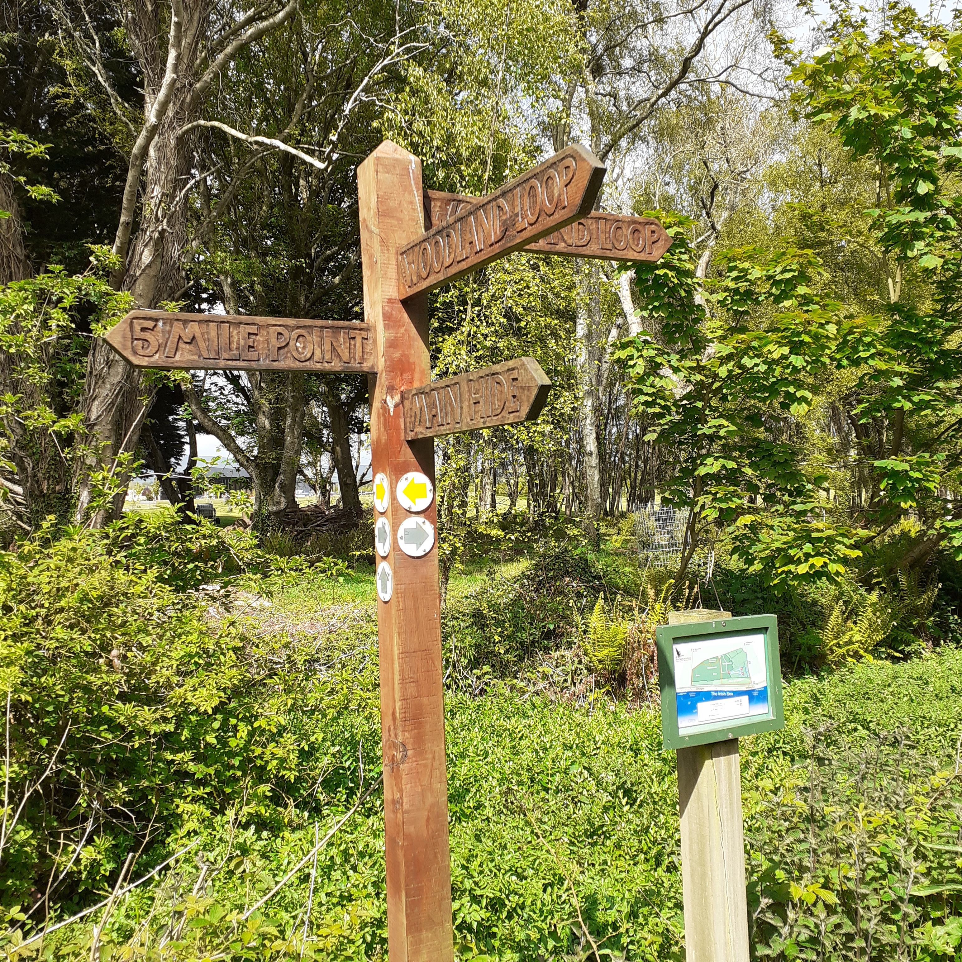
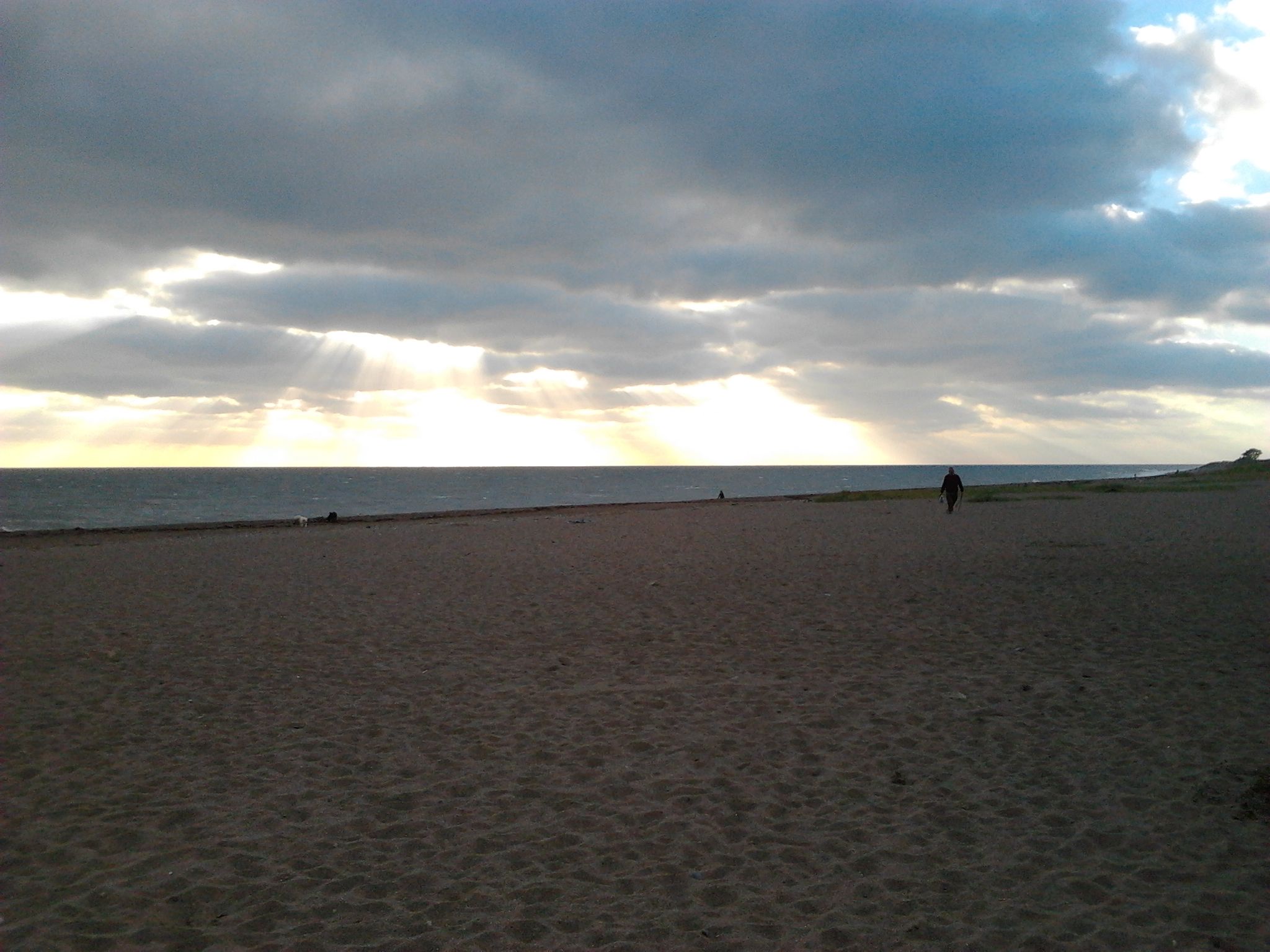
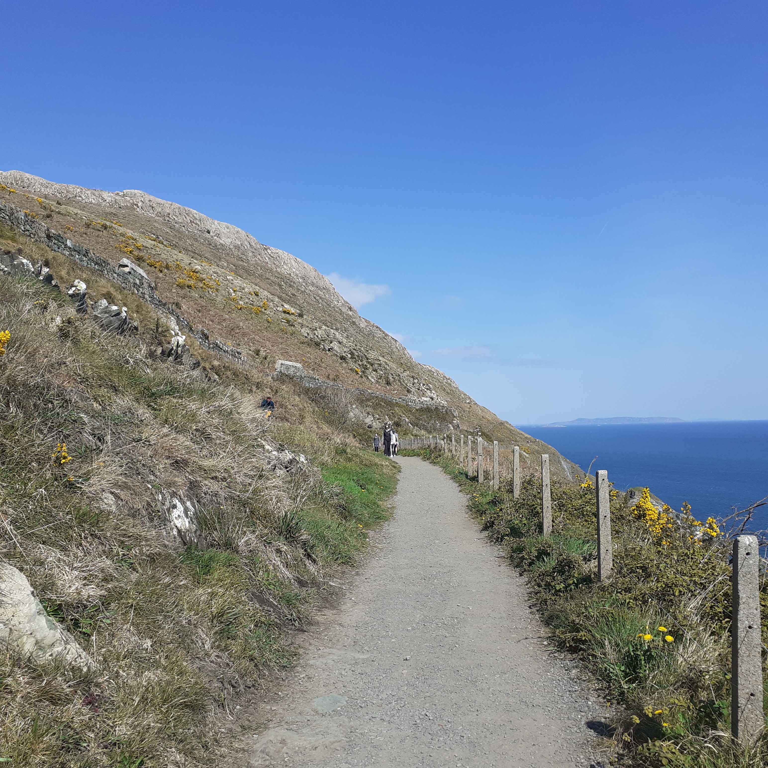
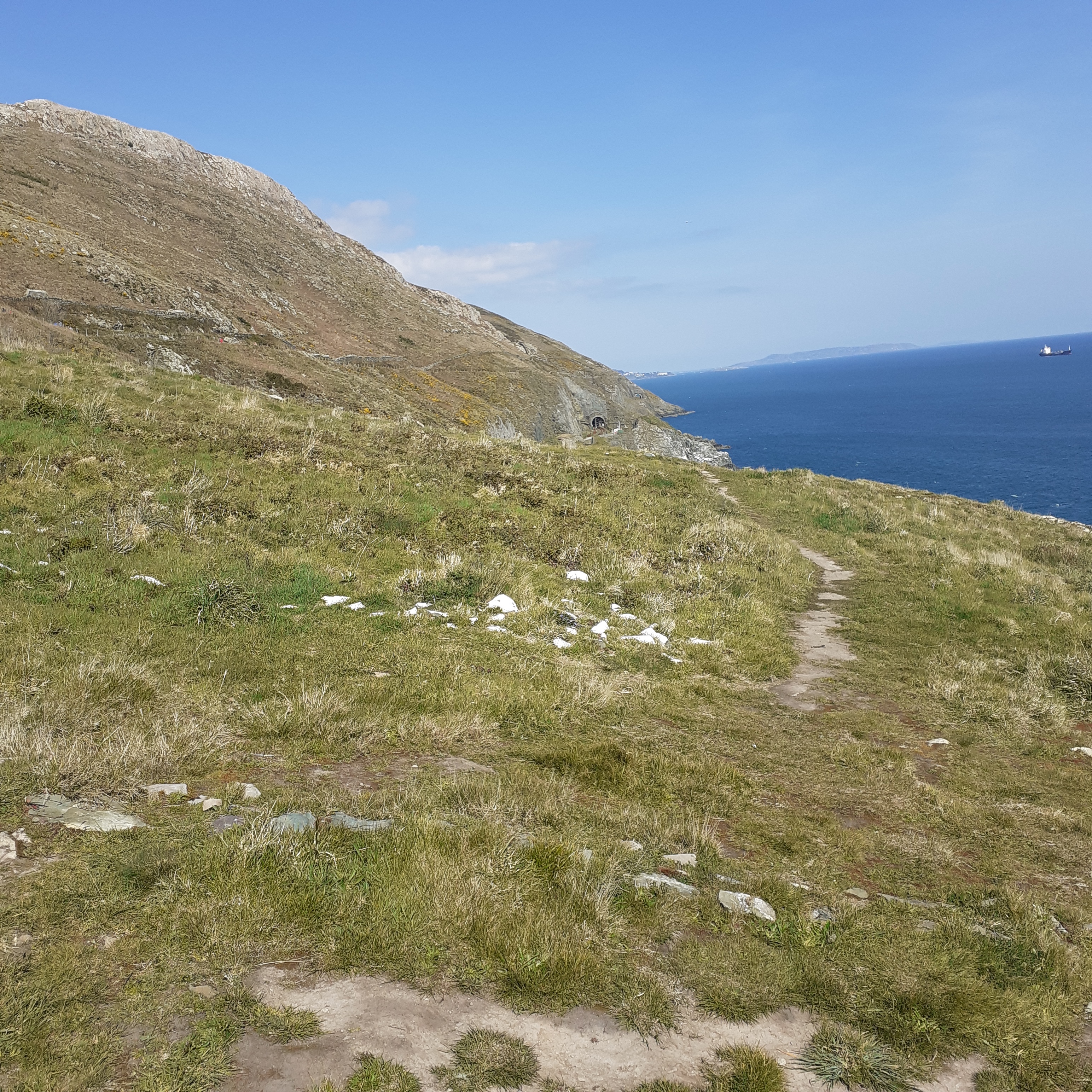
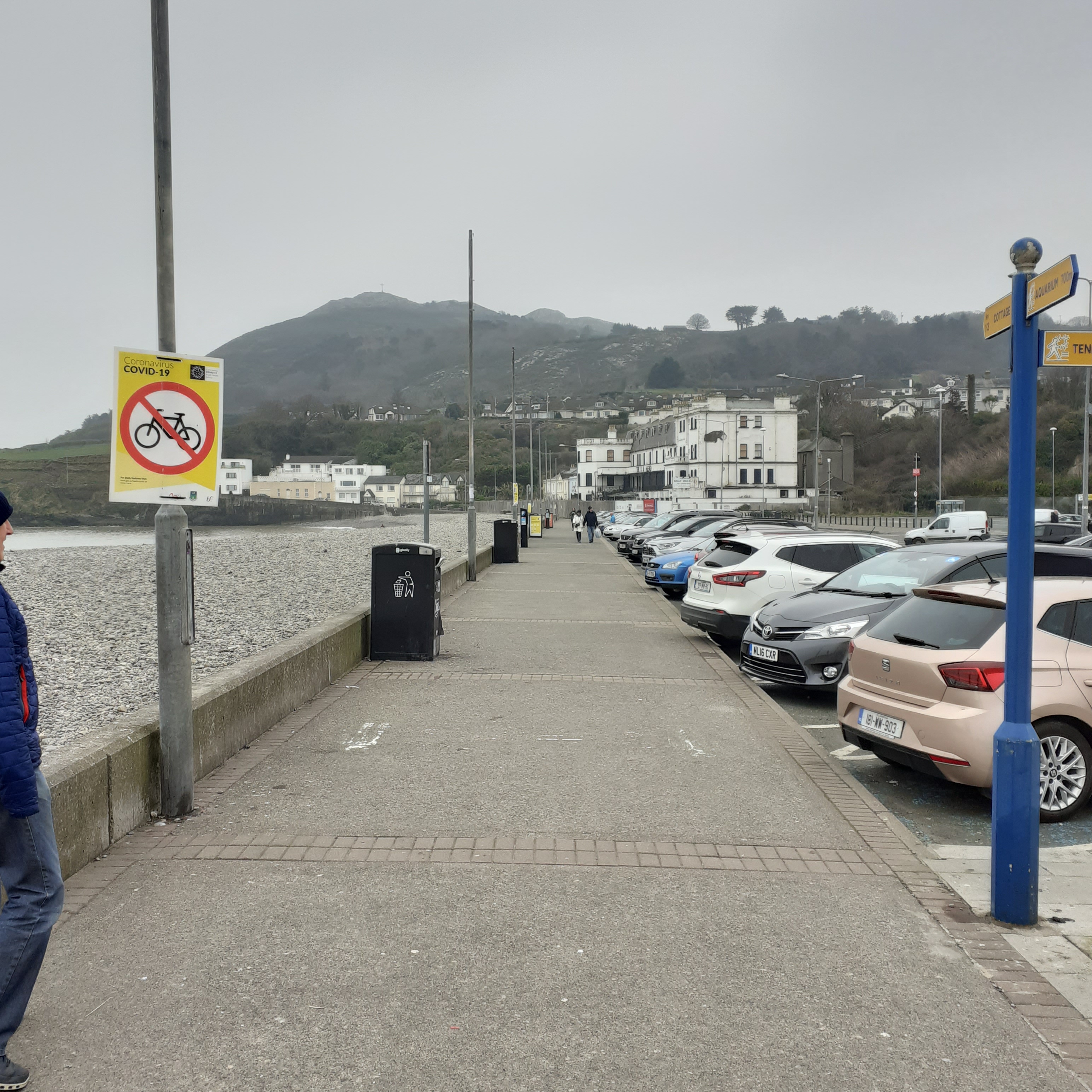
Following these paths is to step into another time and place. In summer heat I might wear a check shirt and hum a few Creedence numbers. In the shoulder season a spooky gothic feeling pervades. In winter it’s mostly out of bounds, and prone to flooding, which is its natural state. Making our instinctive way southwards, and there are signs, we make egress to the beach at Five Mile Point. We usually complete a loop walk returning north along the beach. It’s about a 7 kilometre round trip. 

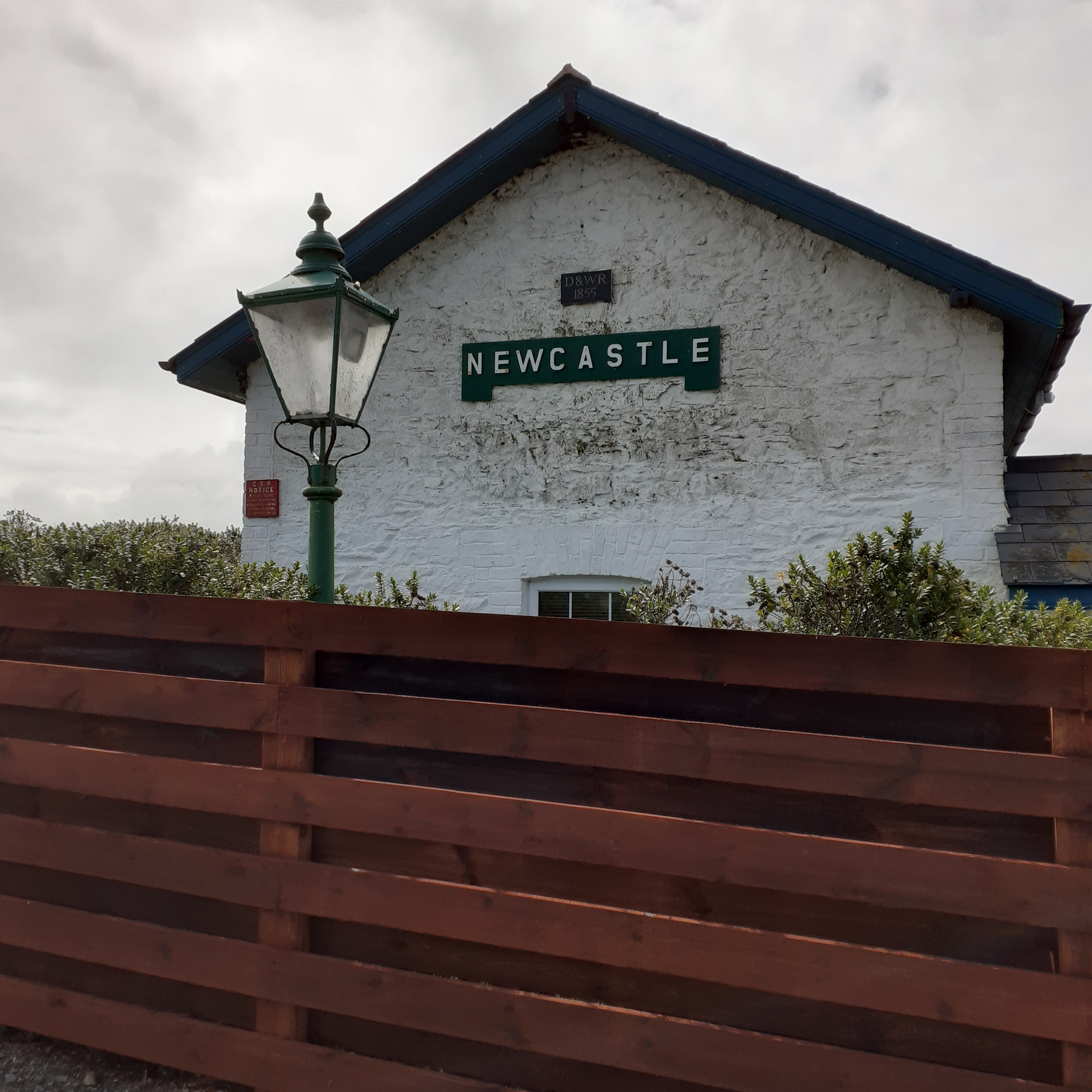
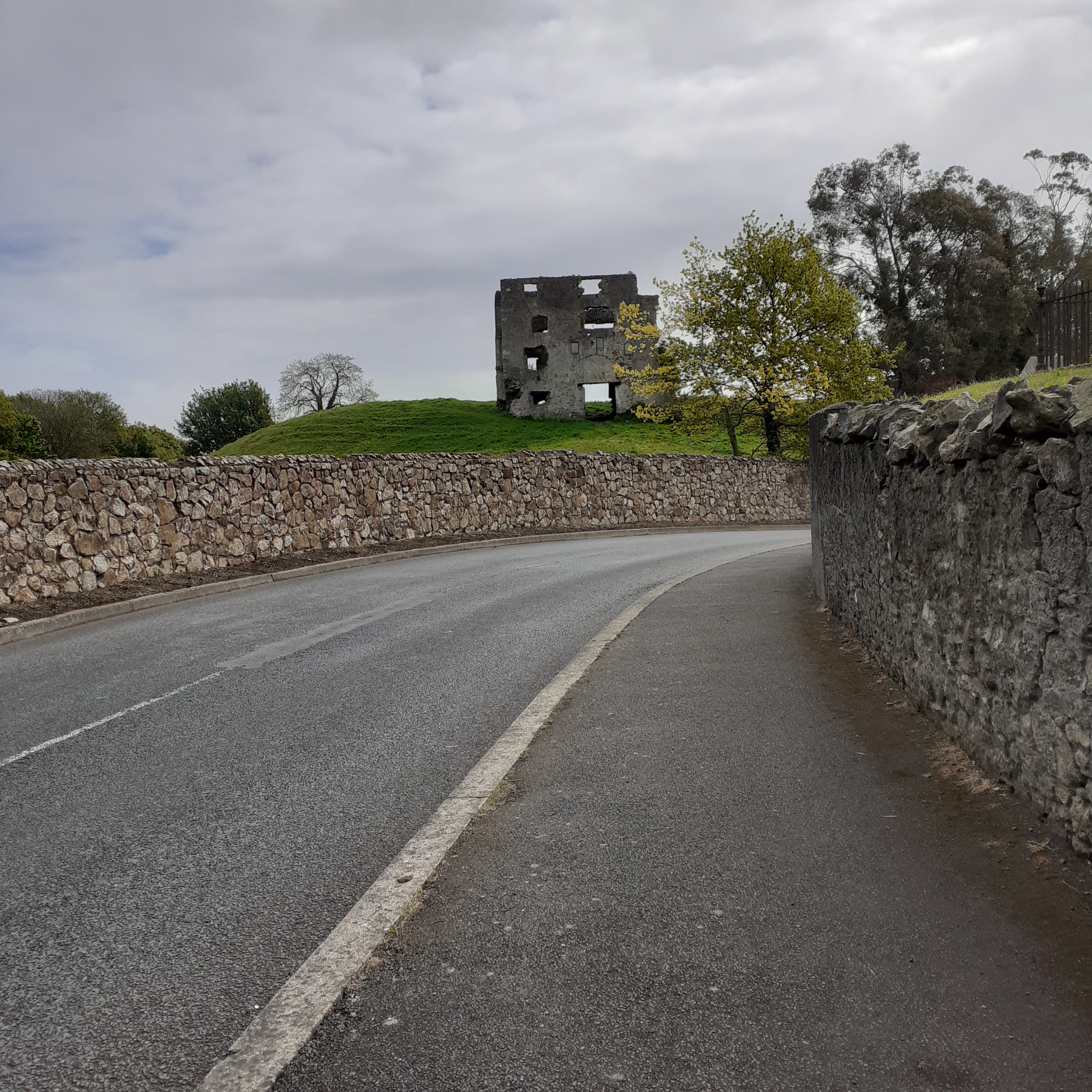
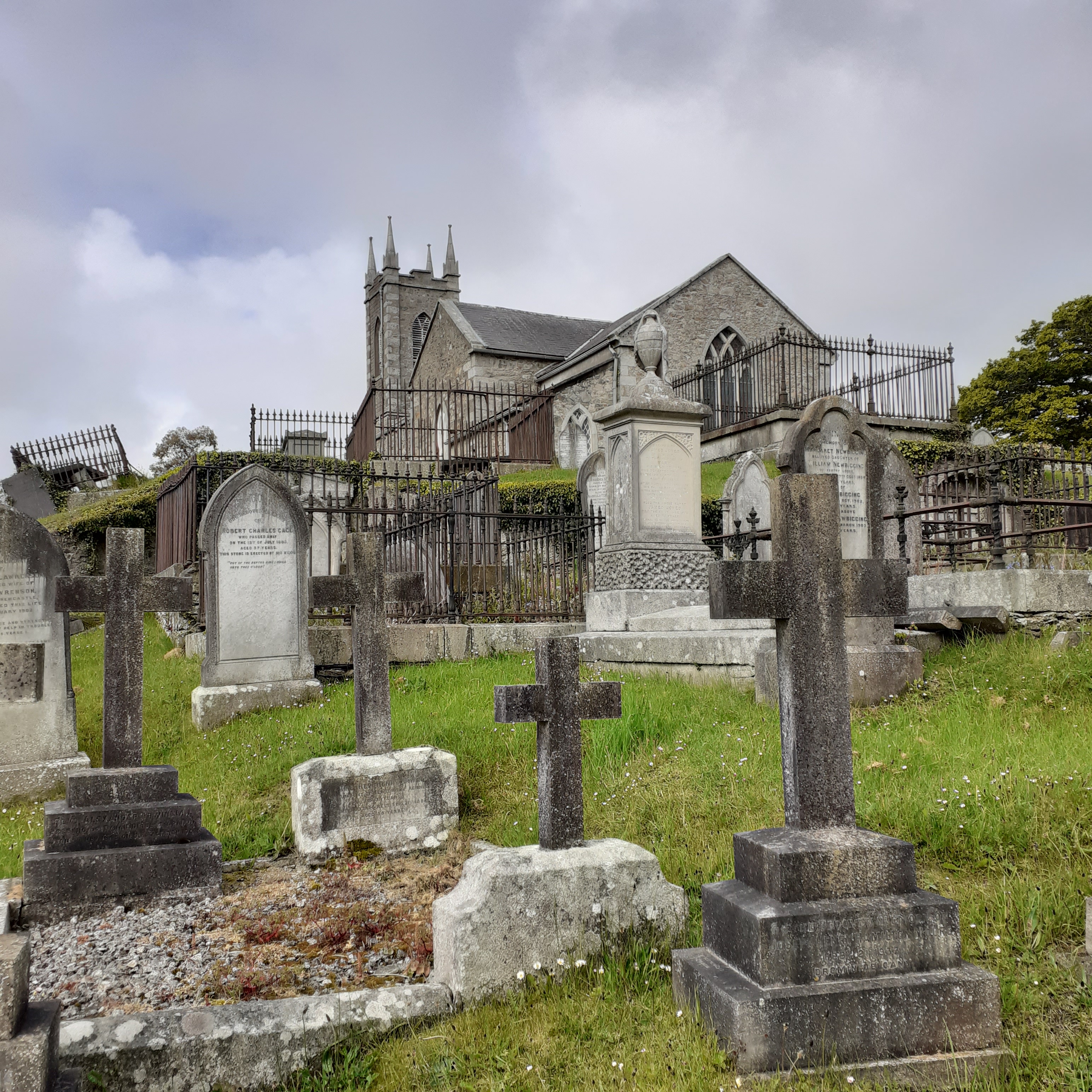
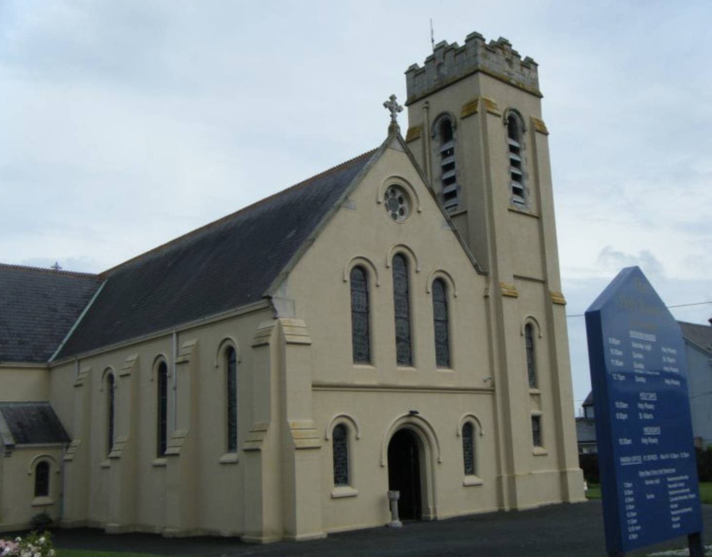
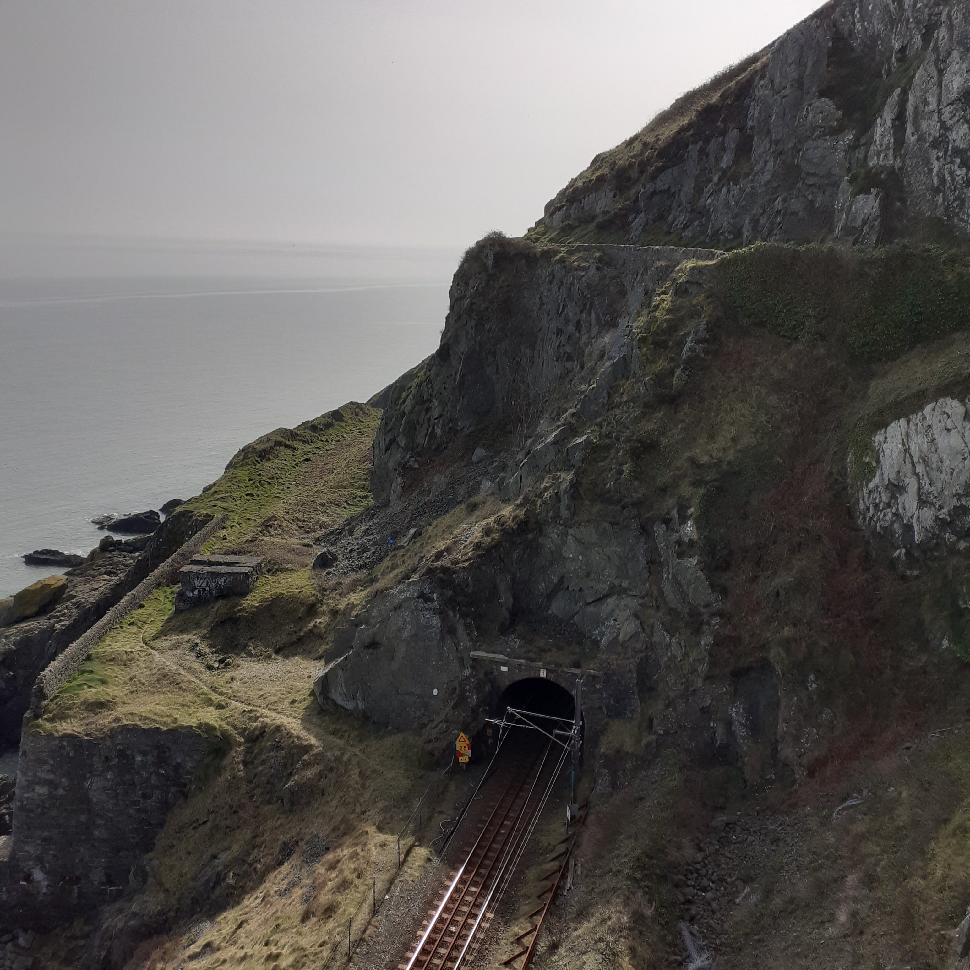
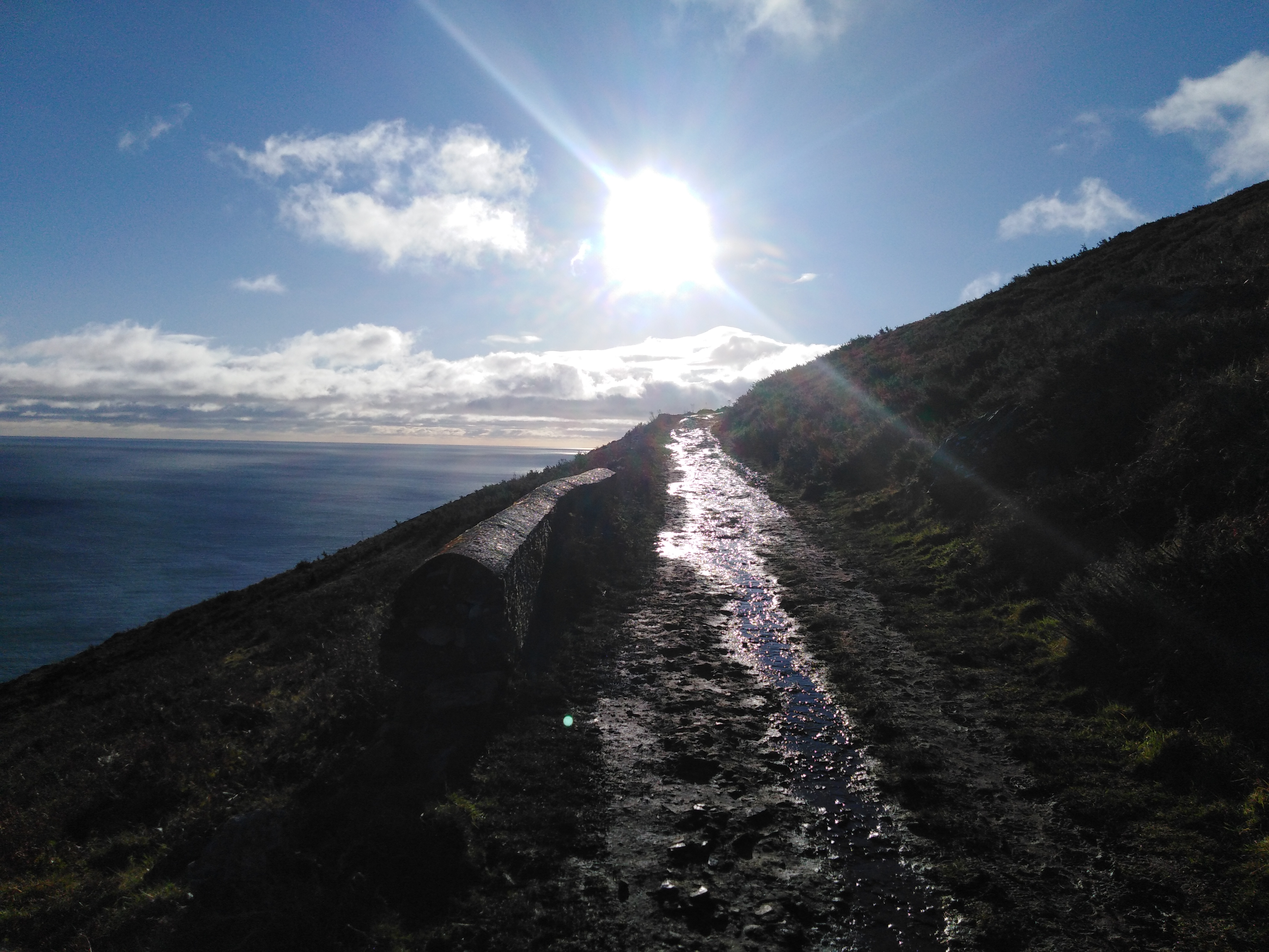
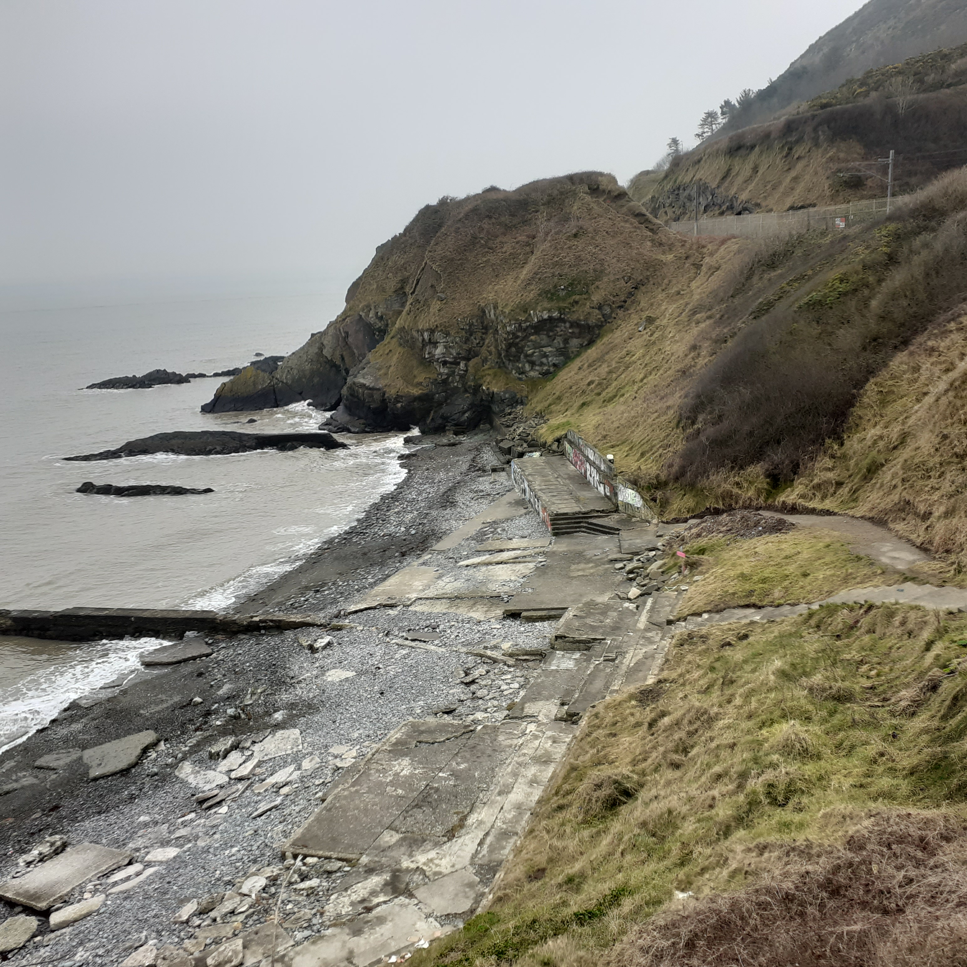
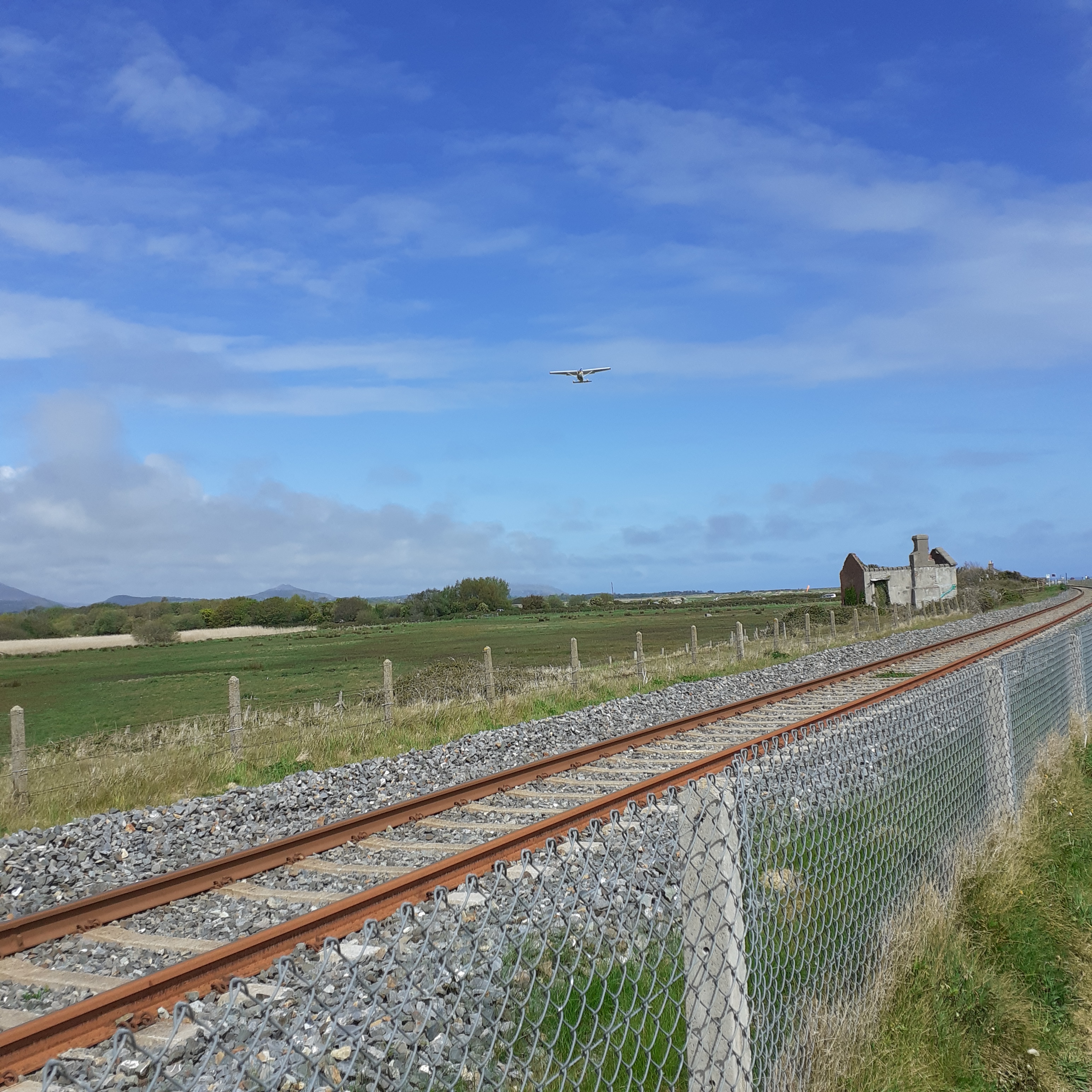
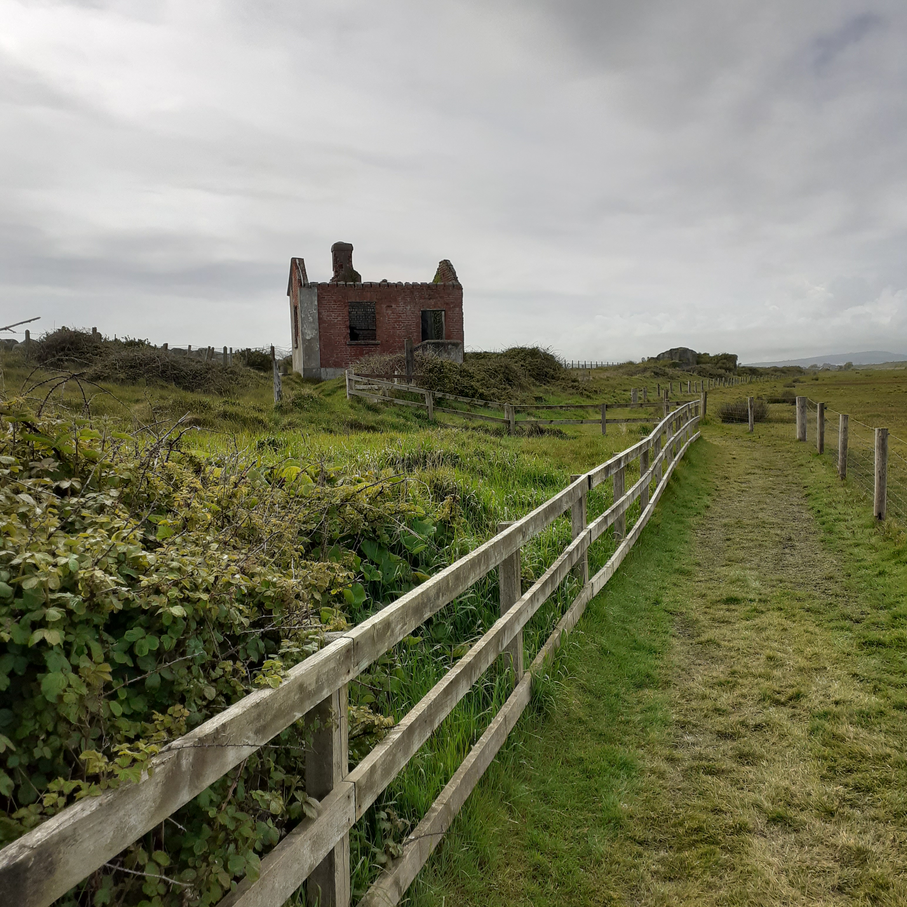
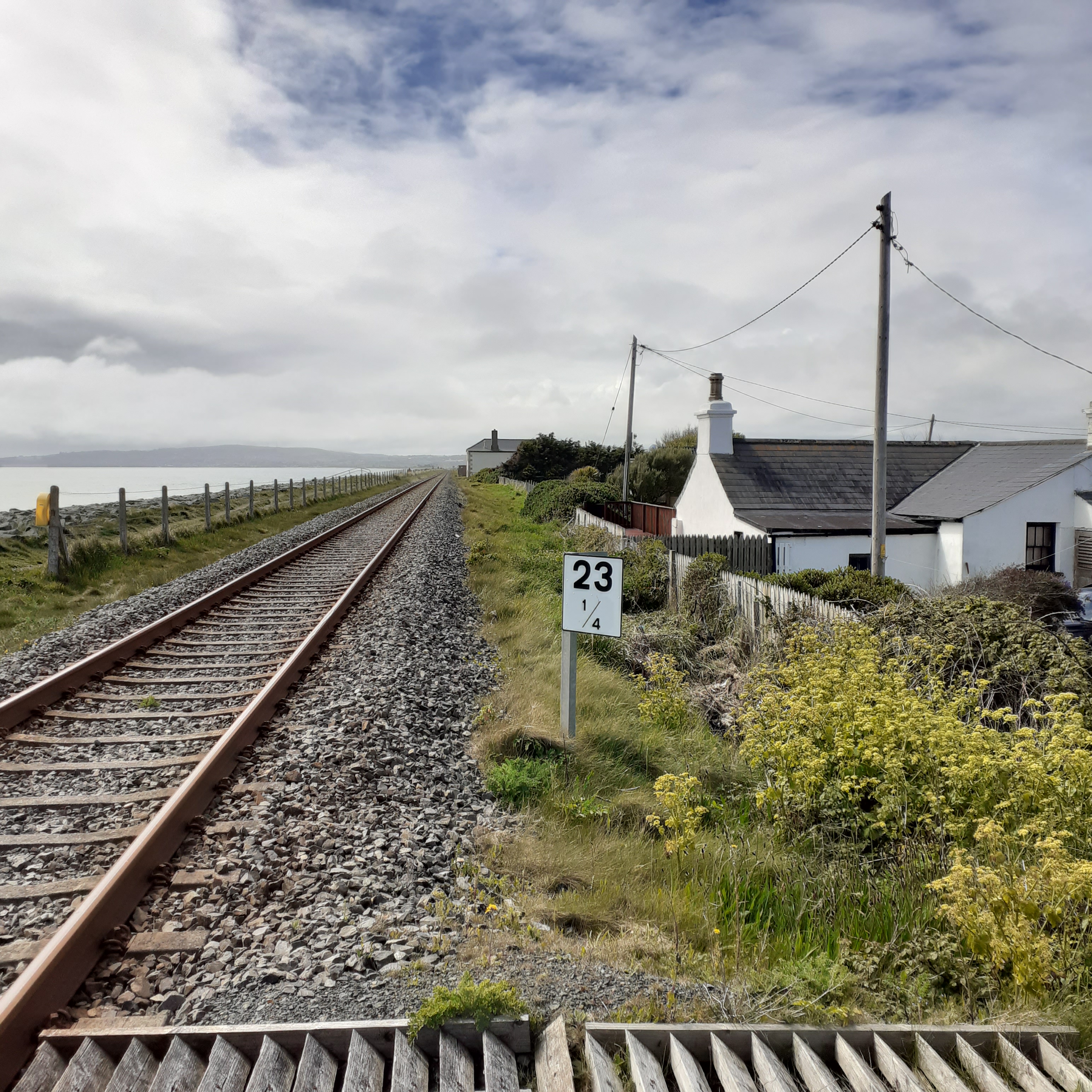
From 1856 you could hear the lonesome whistle blowing down the tracks. The line now ran all the way to Wexford extending from the Dublin – Bray connection two years earlier. Newcastle’s pleasant little railway station was built, a lonesome outpost for ninety years. Newcastle Station remained in operation until 1964, but unlike Kilcoole it was never reopened and is now a private residence. There are a couple of ruins along the line a few hundred yards south of the station. Here, where Ireland’s belly bulges toward Wales, this part of our coast, so isolated now, has been for millennia a bridge to the wider world. Adventurers put ashore and new connections were made. The Cable Hut, a neat redbrick ruin was  the terminal for the first submarine telegraph cable laid from Nevin in Wales by Capt Robert Halpin in 1886.

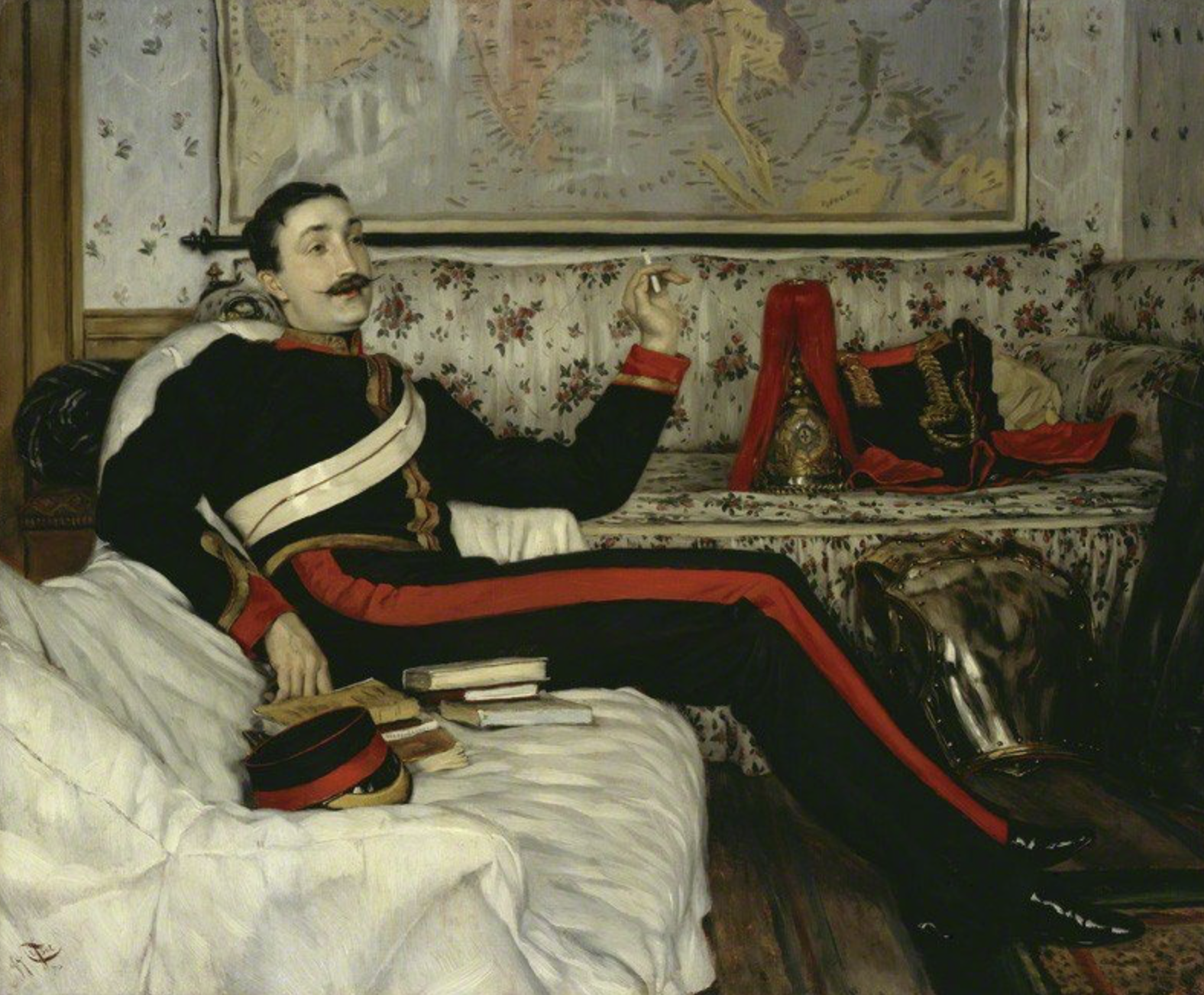
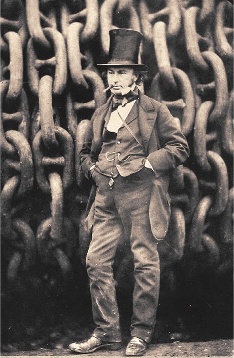
Halpin was born at the Bridge Tavern in Wicklow Town in 1836. Hearing mariners’s tales in his father’s tavern made him determined for a seafaring life and he left home at ten to follow his star. By the age of twenty he’d sailed around the world and soon gained his first command. Aged twenty four his ship the Argo struck an iceberg off Newfoundland and sank. It was a setback for the young captain, but he recovered. A swashbuckling spell saw him running blockades in the American Civil War but it was the Great Eastern which made his name. 

Launched in 1858 the great iron ship was five times larger than any other ship then built and was the brainchild of Isambard Kingdom Brunel. Jules Verne dubbed it the floating city, but it was something of a white elephant as a passenger liner. Passed from Billy to Jack, the ship was redeemed when pressed into service laying submarine telegraph cable. In 1866, the Great Eastern, with Halpin as first engineer, laid the first successful transatlantic cable to work uninterrupted, from Valentia in County Kerry to Hearts Content in Newfoundland (now Canada). As captain of the ship, Halpin was responsible for laying twenty six thousand miles of cable, enough to circle the globe, and earning him the nickname, Mister Cable.

Hey ‘chelle it’s about time you wrote

it’s been over two years y’know, my old friend

take me back to the days of the foreign telegram

and the all night rock and rolling

hey ‘chelle we wuz wild then

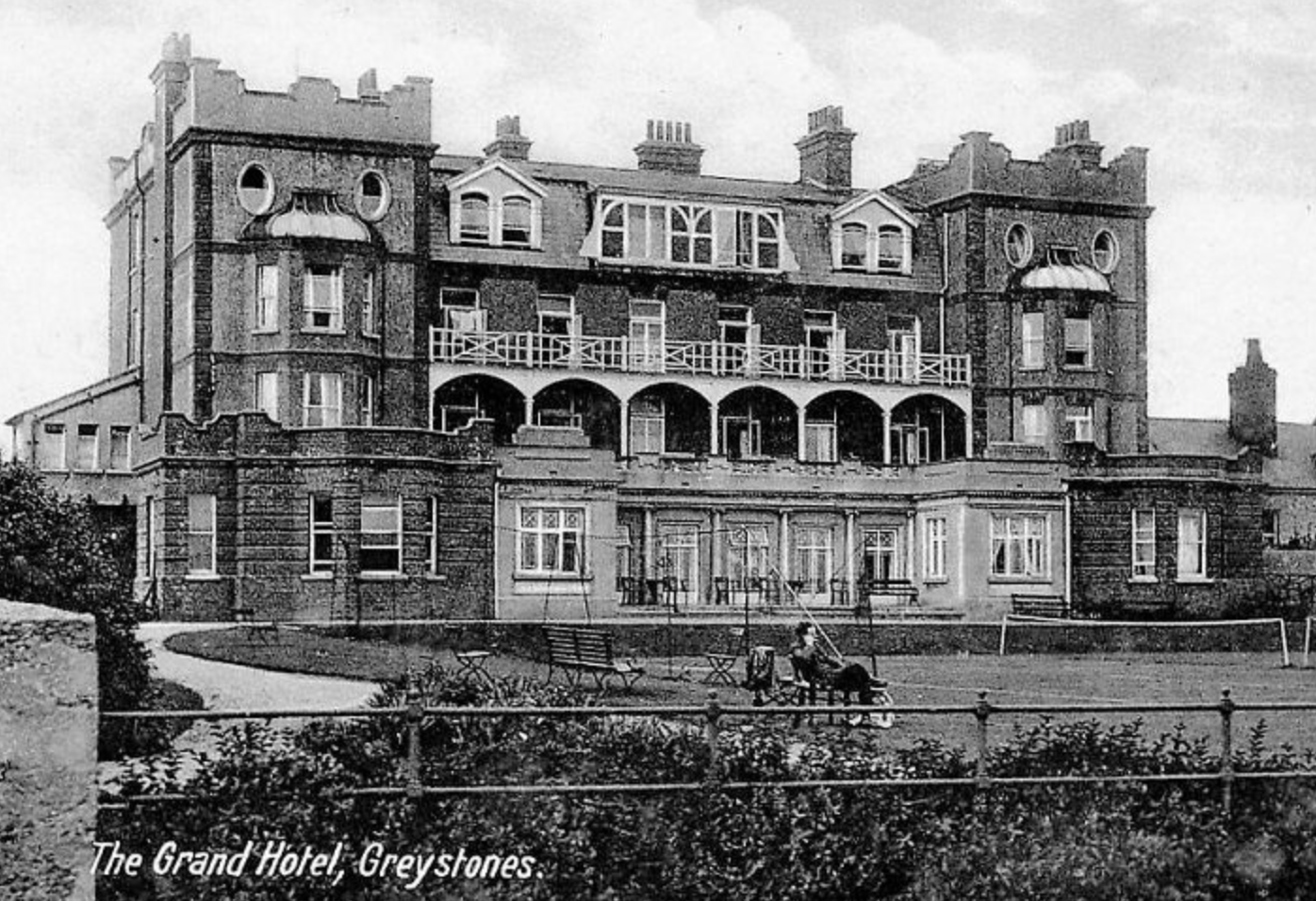
Halpin returned to live in Wicklow in 1875 and built Tinakilly House at Rathnew, two miles north of Wicklow Town on the other side of the Murrough. The house was designed by James Franklin Fuller, the Kerry architect responsible for such gothic masterpieces as Kylemore Abbey and Ashford Castle, as well as Dublin’s Farmleigh House and St Catherine’s church in Thomas Street.

Halpin died in 1894 aged just fifty eight. After such an adventurous life, his death was caused by a minor cut inflicted while trimming his toenails. He contracted gangrene and died. Tinakilly House now operates as a hotel with a renowned restaurant. The government likes to meet there, as do I. But not with them.

Hey ‘chelle you know it’s kind of funny

Texas always seemed so big

but you know you’re in the largest state in the union

when you’re anchored down in Anchorage

Karen Michelle Johnson, professionally known as Michelle Shocked, penned her signature song, Anchorage for her 1988 album Short, Sharp, Shocked. It wonderfully conveys distance and distant friendship, two contrasting spices of life. As birds migrate so we too travel and seek. The song namechecks two friends of Shocked, Jo Ann and Leroy Bingham, a Comanche and a Blackfeet Indian who moved to Alaska after their wedding. One of my favourite songs, it induced an urge to see the place. Eight years ago I did, and on the taxi in from the airport I was pleased to find the driver, a blow-in from the Lower 48, was called Leroy. And he said ‘hello’.

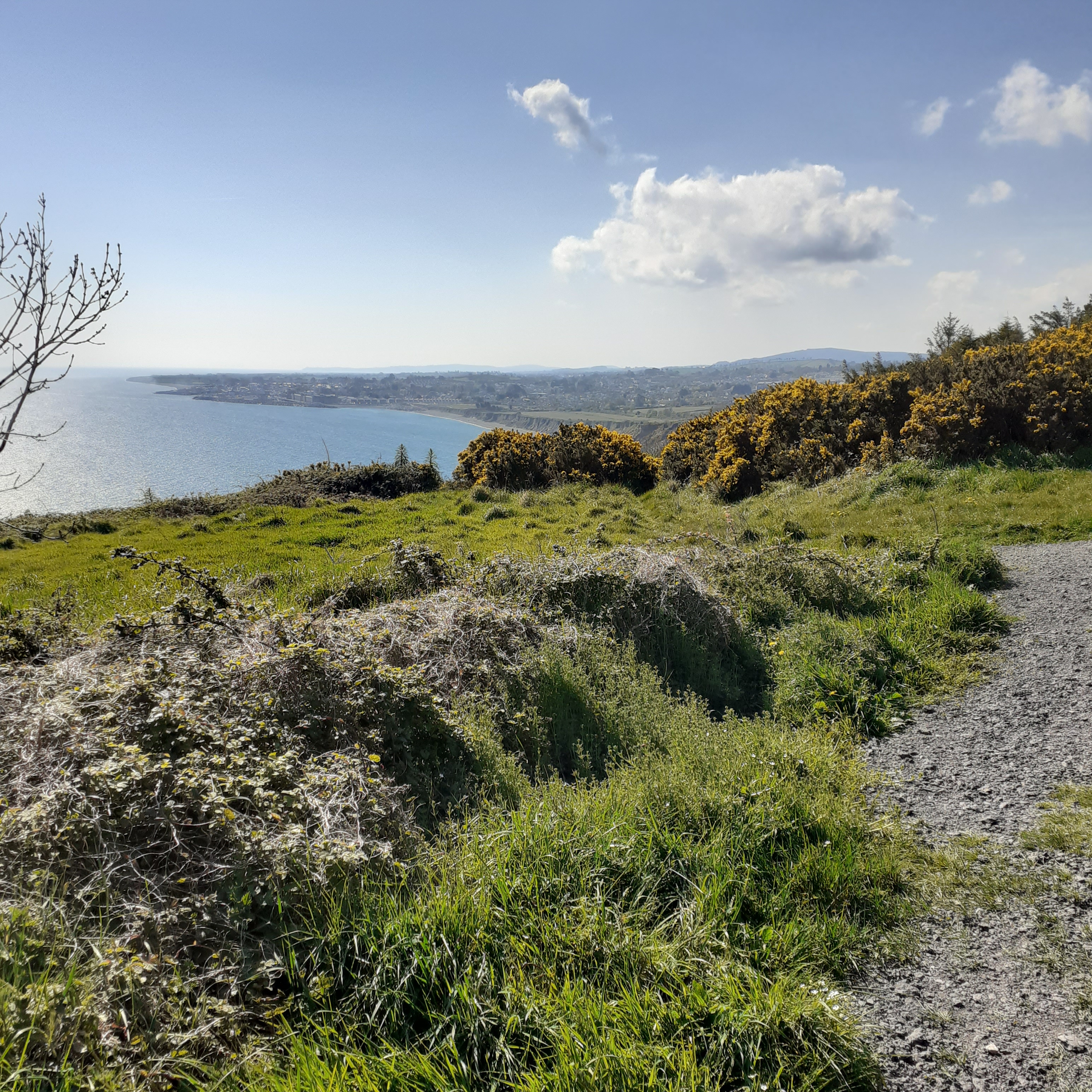
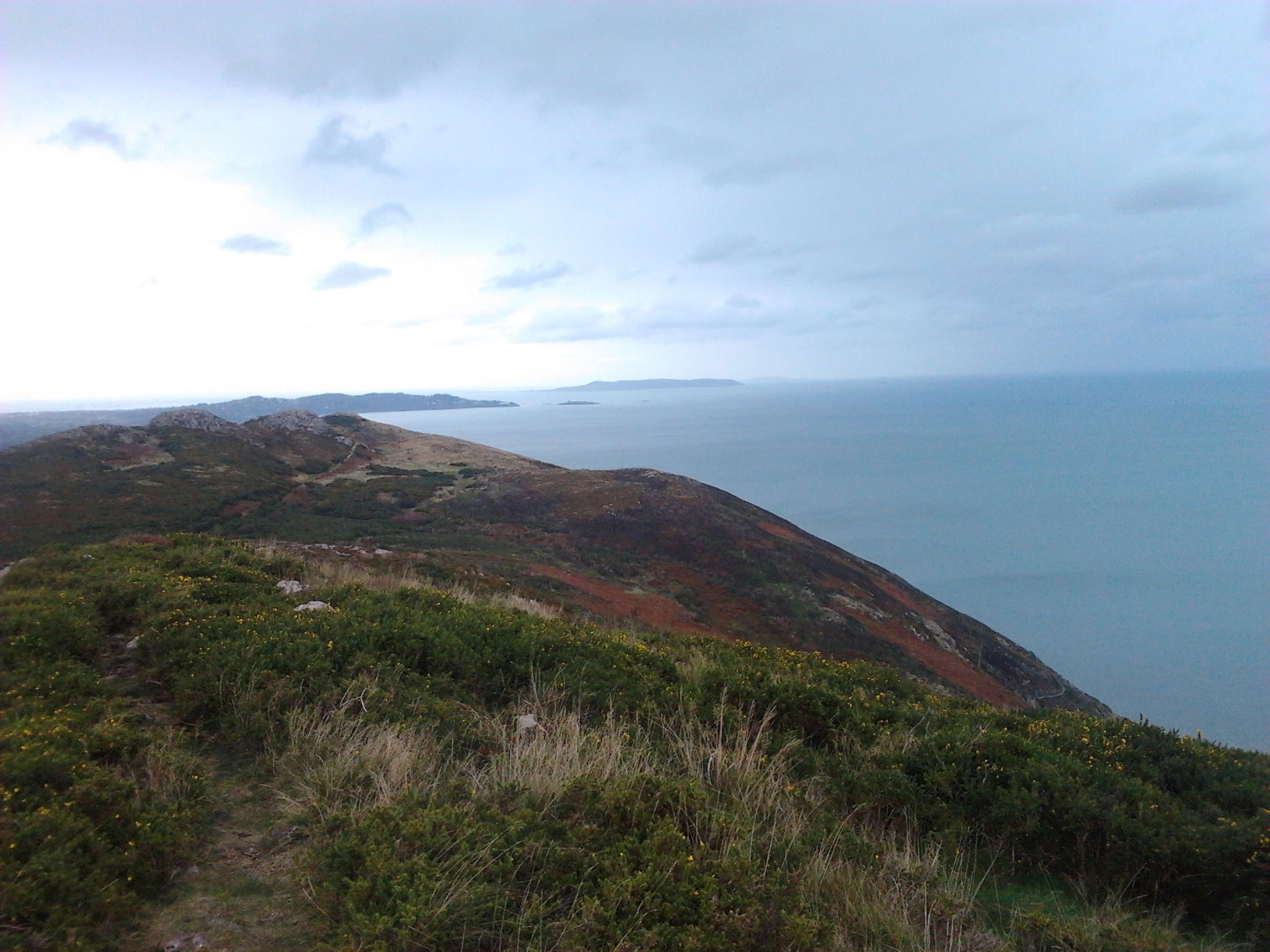
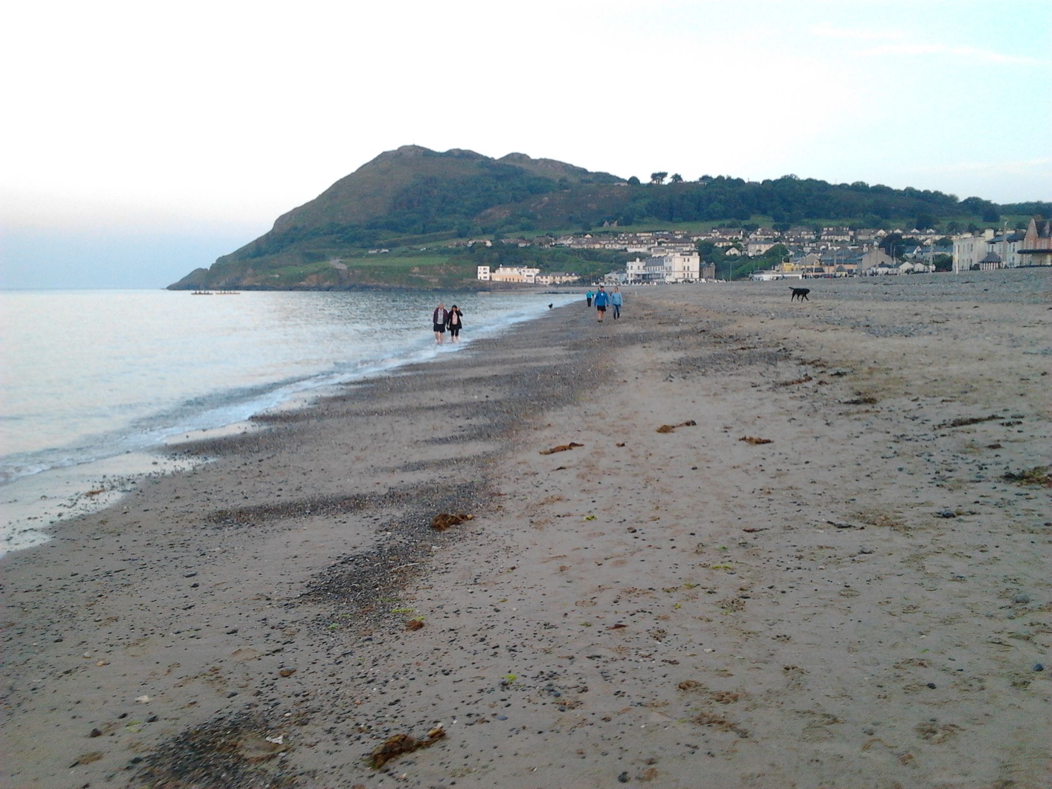
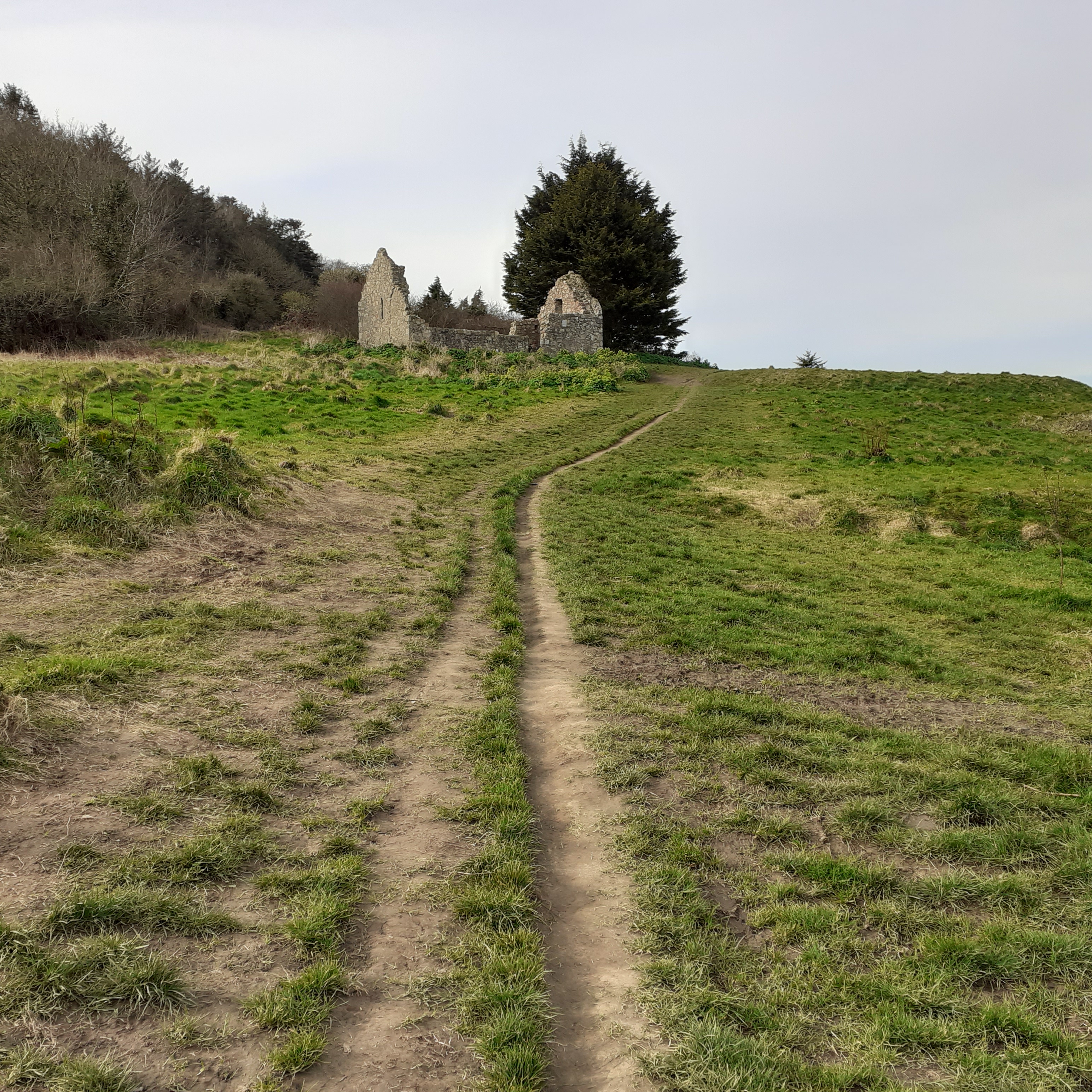
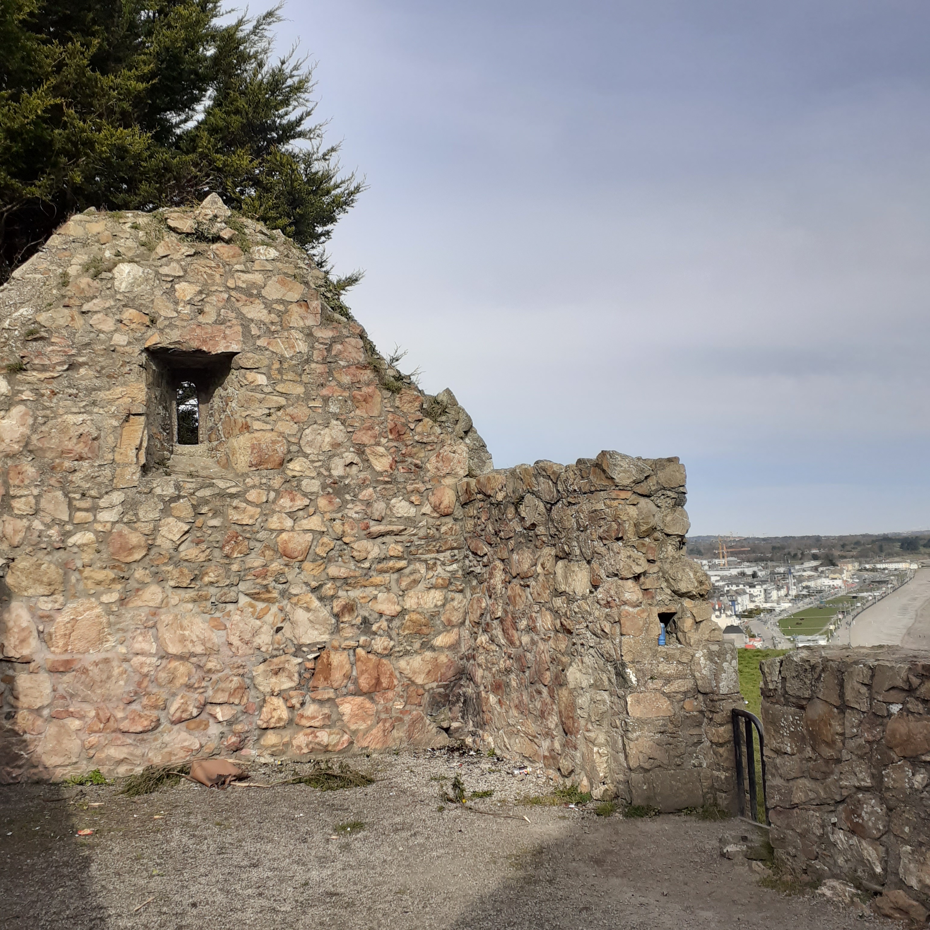
From Five Mile Point, you’ll notice the strand curving slightly to the right and the low bulk of Wicklow Head inserts itself across the southern horizon. We’re headed into port. Amongst other adventurers on this stretch of the Wicklow coast were Saint Patrick, patron saint of our isle. According to John Bagnell Bury, 1861 – 1925, Professor of Modern History at Trinity, Saint Patrick arrived on his mission to Ireland in the port of Wicklow at the mouth of the river Vartry. Bury figures Patrick had escaped his spell as a slave from here also. In ancient texts there is some confusion as to whether the river is the Vartry or the Dargle, which would see Patrick landing at Bray. Either way, he was not well received by whichever set of inhabitants first set eyes on him. Amongst his acolytes was a young priest who had his teeth knocked out by stone throwing locals. Since styled a saint, he bestows his name on the county; Cill Mantain in Irish. Mantan is a nickname meaning toothless or gummy. While Patrick got out of Dodge and took off for Skerries in North Dublin, Mantan stuck around to preach the gospel to the locals. Though with what clarity we can only wonder.

Wicklow’s Wonderful Coast – 12

There’s a small free carpark adjacent to Kilcoole Station. Through the gate and over the level crossing and you’re on the beach. Usually we walk south along the shingle beach to Newcastle and back again, about a nine kilometre round trip. The gentle oblique curve of Wicklow’s coast gifts an unusually wide horizon to the wanderer. The bleak beauty is accentuated by the lonesome railway line. We’re on the edge of nowhere.

Just past a large intrusion of wild shrub and to our right, across the tracks, a slim finger of placid water intervenes. This is the northern tip of an extensive coastal wetlands stretching along the coastal plain to Broad Lough near Wicklow Town. This is known as the Murrough and is a haven for wildlife and a subtle joy to the eye. The Murrough is 15km long and comprises the largest coastal wetland on Ireland’s east coast.

Kilcoole Wash is a picturesque lagoon that acts as a magnet for migratory birds. It is particularly noted as a major breeding ground for the Little Tern. They come all the way from the western mediterranean and North Africa to their breeding colony here. In season, dedicated amateurs keep watch on them ensuring the little darlings go unmolested. Make sure you keep to the designated pathway to continue through. 

The Breaches is a little further on. This is an outlet for the wetlands into the sea. It runs swift and wide and deep so you’ll need to cross by the railway bridge. This is safe but do take care and don’t loiter. 

We’re about halfway along towards Newcastle. After the Breaches we walk along Leamore Strand. Large concrete cubes form a line of protection for the railway line and also function as a raised pathway. The blocks are dated, with some going back almost a century.The lonesomeness here is interspersed with the occasional buzzing of small aircraft. Newcastle Aerodrome appears to the right, its 690 metre grass runway in use year round. The place evokes a more halcyon image of aircraft travel.

If you can use some exotic booze, there’s a bar in far Bombay

Come fly with me, let’s fly, let’s fly away

Come Fly With Me is the title track of Frank Sinatra’s 1958 album. The song was commissioned by Sinatra from Sammy Cahn and Jimmy Van Heusen. The album’s songs are based on the theme of a musical trip around the world. Sinatra’s sequence of concept albums began in 1955 with In the Wee Small Hours. The notion of a unifying musical theme was novel then, most albums being a random compendium of songs. Sinatra was instrumental in establishing the studio album as a unified concept in artistic terms.

So, trains and boats, and even planes will take you the East Coast’s remotest point. Or thereabouts. The trains don’t stop here anymore and since, unlike Bono, I don’t have my own aeroplane, it’s car or bus for me. Newcastle is about a mile inland. The village runs along a short main street of mixed housing, some echoing olden days. The local pub is bounded by a brook which swings seawards under the bridge, giving the pub its longterm name: the Bridge. It’s the Castle Inn now. The garage and general store is across the road There are a few small estates scattered in the neat farmland surrounding. 

The castle in question was not particularly new, being originally constructed circa 1180 by Hugh De Lacy, the first Anglo-Norman governor of Ireland under Henry II. It was located a half mile further inland, on the road to Newtownmountkenedy. Newcastle was the administrative centre of old Wicklow until the county was shired in 1606 and power moved to Wicklow Town. The castle had been destroyed late in the sixteenth century. The impressive ruins now visible are of a large fortified residence built on the old castle’s footprint. They do resemble a castle bastion and you may be familiar with them from Hozier’s video To Be Alone. 

Across the road the church crowns a smaller hill. The first church was built in 1189. Subsequently destroyed in 1640 it was rebuilt in 1780 and a tower added in 1821. It serves the Church of Ireland community. It is the perfect manifestation of the traditional country churchyard. A wonderful ornate metal doorway guards the entrance. For the Catholics, the Holy Spirit oratory was built in the village in 2009. The picturesque Saint Patrick’s Church in Kilquade, a couple of miles north, is the parish church. That was rebuilt in 1802 having been burnt down in 1798. Newcastle Down the Years by Canon Robert Jennings, published in 2008, gives an in depth and very readable history of the area.

David Hozier Byrne lives across the road from Newcastle Church, which seems appropriate somehow. Originally from Bray, his father, John, a musician and his mother, Raine Hozier, a visual artist. Hozier’s eponymous debut album was released in 2014 and was a hit worldwide. His second album, Wasteland, Baby was released in 2019, echoing this success.

See him there, holding up the bar at the Bridge, scribbling snatches of songs while he calls another pint. In truth, he’s probably working hard up in his home studio on a third album. Well liked, he’s personable and generous with his time for local and national fundraisers. He appeared recently on the Late Late Show with a rendition of the Parting Glass in tribute to those who had died of Covid. It’s a Scottish traditional song which dates back at least four hundred years. Robbie Burns’s trad based poem Auld Lang Syne has overtaken it in popularity in Scotland, but in Ireland devotion to the Parting Glass has waxed. The Clancy Bros and Tommy Makem set the ball rolling on their 1959 album, Come Fill Your Glass With Us. The Dubliners, the Voice Squad and Liam O Maonlaoi all have versions. Hozier’s is now released as a single, the proceeds going to the ISPCC.

Of all the money that e’er I spent

I’ve spent it in good company

And all the harm that e’er I done

Alas it was to none but me

Newcastle is the last stop on the Dublin suburban bus service with the number 84. So it’s possible to take a bus to here, hike up the coastal trail and hook up with regular DART services at Greystones or Bray. There were times when the 84 was a bit approximate in timetable terms. Planned expeditions to the Bridge have extended into overnighters. There I’d be, regaling customers with my rendition of the Parting Glass, only to sway into the carpark and find the bus gone. Nothing for it then but to return to the bar for another parting glass before closing time.

For all I’ve done for want of wit

To memory now I can’t recall

So fill to me the parting glass

Good night and joy be with you all

Wicklow’s Wonderful Coast – 11

From Greystones Railway Station, heading south, the thoroughfare becomes Mill Road. The Burnaby, fronted by a rectangular green park, lies off to the right. A few yards further on is the library. Greystones Library has been my base for more than a decade. I recently retired seeking even greater idleness and literary and artistic expression.The Library was built in 1910 on a site donated by Lizzie Le Blond. Originally it was a symmetrical building so that its entrance porch, with the small spire and weathervane on the roof was literally a central feature. It has been enlarged a couple of times, first the northern wing being doubled in size but keeping the original architectural style. and more recently, a large, modern, but visually unobtrusive, upstairs extension overlooking the sea to the rear.  

This is a Carnegie Library. Andrew Carnegie was born in Dunfermline in 1835. His riches derived mostly from the American steel industry. From the start of the twentieth century he gave away almost ninety per cent of his fortune to charities, foundations and universities. In 1889, he wrote the Gospel of Wealth, calling on the rich to use their wealth for the improvement of society. One of his early projects was Carnegie Hall, built in New York in 1891.

He is credited with funding the development of three thousand public libraries in English speaking countries. His first was, appropriately, in his birthplace of Dunfermline. The deal was that he would provide the buildings and equipment on condition that local authorities matched these funds with the provision of land as well as operational and maintenance costs. Carnegie did not believe in one way charity. If people wouldn’t help themselves, he didn’t want to help them.

Carnegie’s bequest funded sixty six libraries in Ireland, sixty of which are still in use. Ultimately, Wicklow would get three libraries from the scheme, at Bray, Greystones, and Enniskerry. Overall, eleven counties would benefit, leaving twenty one counties with no Carnegie Library at all. In 2019 An Post issued a series of stamps commemorating the establishment of the Carnegie Libraries in Ireland. With line drawings by contemporary artist Dorothy Smith, the featured libraries are in Dublin, Limerick, Kilkenny and Enniskerry.

Librarians on Bloomsday

Greystones Library has amongst its events the odd literary evening. My first night as a guest writer was there. Launching nervously into my introduction, I was surprised by an arm raised in question almost immediately. Lively bunch, I thought. I will be taking questions later, I said. Undeterred, the old gent asked: “Is this not the talk on diabetes?” It wasn’t, at which the gentleman and the entire two front rows rose and departed. This, thankfully, was more an ice-breaker than a Titanic. A night to remember, all the same.

More recently, I was support act to poet David Wheatley. Born in Bray, Wheatley had crossed the pond to teach at Hull and Aberdeen University. In 1998 he was Writer in Residence for Wicklow and I was one of a number of local writers included in his anthology, Stream and Gliding Sun. That title is culled from Yeats, his 2010 collection A Nest on the Waves, draws on the mythology that the storm petrel lays its eggs on the sea. It makes an analogy with the life of the traveller, nomadic tribes, emigrants, migratory birds and, I suppose, those impelled by wanderlust. 

The poem Naiad takes its title from an aquatic nymph, or a female swimmer.

first find your wave

and breast it, break it

enter the weave 

of the Sea’s pocket

A couple of modern terraces occupy a triangular plot formed between Mill Road and the railway. The town effectively peters out where they meet, though housing estates and sports facilities occupy the large suburban area to the south. We can duck under the railway bridge here onto Greystones’s South Beach. Beach and rail run parallel for the next twenty kilometres until Wicklow Town. 

Wicklow’s coastline arches away from the horizon holding a narrow coastal plane with the Wicklow Mountains beyond to the west. This all makes for a big blue horizon, a vast expanse of sea and sky. The disturbance made by trains to our immediate right is not so severe as we are now outside the regular commuter zone, but be careful near the tracks, they are active with inter city rail, the Rosslare Ferry service and some freight. Meanwhile, it’s an easy, flat walk, usually quiet and lonely with nothing to do but fill your head with sea and sky.

After about five kilometres we draw level with the next town. Kilcoole’s tiny rail station faces the sea though the town itself is a mile inland. The station first opened in 1855 but closed in 1964 through lack of interest. It reopened in 1980 as the local population grew but it’s still Ireland’s quietest station, unmanned, no ticket machine, with five daily trains on weekdays serving Dublin and Rosslare and two on weekends to Rosslare and Dundalk. 

Next to the station the famous gun-running of July 1914 is commemorated. On board Sir Thomas Myles’s yacht Chotah, six hundred Mauser rifles and twenty thousand rounds of ammunition were landed. This was a part of a larger consignment already landed in the Howth gunrunning aboard Erskine Childers’s Asgard. The intent was to arm the Irish Volunteers against the UVFs open sedition. The UVF were aided by the army’s refusal to interfere when they ran guns ashore at Larne some months earlier. Both sets of arms were purchased from the Germans. The Howth gunrunning was done in a full blaze of sunshine and publicity. Army and police were dispatched to intervene but with paltry results. But a subsequent confrontation on Bachelor’s Walk led to the death of four civilians when the army opened fire on a jeering crowd. The Kilcoole guns were brought in at night and squirelled away by bicycle, car and charabanc to Pearse’s school St Enda’s in Rathfarnham.

The road to Kilcoole is along a narrow and unremarkable rural lane. Kilcoole is Ireland’s hundredth largest town, with a population of three thousand people. In the modern mythology of televisionland, Kilcoole becomes Glenroe, the setting for a long-running rural soap. Written by Wesley Burrows, who had earlier penned the Riordans, which ruled the airwaves in the seventies. A spin off, Bracken, brought Gabriel Byrne’s first role in 1981, before the Walkinstown schoolteacher, who taught in St Enda’s Crumlin branch, morphed into Uther Pendragon in John Boorman’s Excalubur. Glenroe, a spinoff from Bracken, focussed on the fictional village where affable bachelor Miley Byrne and his father, Dinny, ran a local farm. There was love interest too with local girl Biddy McDermott giving him the eye. Courtship and kitchen sink, village pub and chapel – both Protestant and Catholic – were the backdrop for all the fevered plots and passions of Ireland’s favourite village, enthralling the population at large for almost twenty years. It ended in 2001. Glenroe Farm functions as a visitor centre with domestic and farmyard fauna set within a picturesquely archaic farm. Kilcoole’s three pubs provide a healthy social hub, Byrne’s by the Sea Road, Lee’s long bar and the Molly Malone, a magnet for Dubs, no doubt, and the local in Glenroe.

Away from the temptations of Kilcoole, we set our faces to the south and head off into splendid isolation along one of my favourite stretches of coast.

Fly away on my zephyr

I feel it more than ever

And in this perfect weather

We’ll find a place together

The Zephyr Song is from the Red Hot Chilli Peppers’s 2002 album, By the Way. Guitarist John Frusciante has said that By the Way was the happiest time of his life. Such feelings are infectious. Happy days!

Drinking at the Harbour Bar

Bejabbers, I’ve had my first vaccine. Suddenly, things are looking up. The world, long empty, is again filling up with possibilities. Restrictions are being eased and in about a month al fresco drinking and dining will return. So, in case any of yiz have forgotten what that’s like, I’ve painted this scene outside the Harbour Bar from about two years back. It is after the Bray Air Show on a blazing summer’s day and tens of thousands of thirsty folk go looking for a pint. And what better place than Bray? 

I am alone in a crowd and it is a very pleasant place to be. I hope I’ve conveyed the feeling of being inside the scene, as distinct from the remote artist observing from the outside. I’m thinking of those great group paintings of Auguste Renoir: the Luncheon of the Boating Party and the Moulin de la Galette. That was late nineteenth century Paris and Renoir and his mates were changing the way we look on life, love and art, and the whole damned thing. But people are the same all over, throughout space and time. After the plague year, the world will open again. I’m celebrating.

Simply, this is what people do and always have. This is what makes life fun. The painting is quite different from the more isolated feel I usually go for, and I’ve needed to adjust my technique to accommodate that. It’s in acrylics, as usual, but has more of a watercolour feel to it. I laid out the composition precisely, but went for a freer brushstroke to capture that atmosphere of movement and joy. I hope this works. Of course, nothing beats the real thing. Bring it on!

Wicklow’s Wonderful Coast – 10

From Greystones Harbour, the direct route to the town centre is via Trafalgar Road heading uphill. Off to the left, Cliff Road follows the rocky seafront around the promontory. This continues on via Marine Road heading for the South Beach. You can make a loop back inland via La Touche Road which joins Trafalgar near the railway bridge.

About halfway along Trafalgar Road is the large husk of the La Touche Hotel. This was the town’s only hotel, and much the largest building. It vaguely suggests the outline of a castle. Four storeys with a tower at each corner and mansard roofs connecting along front and rear facades. The La Touche opened as the Grand Hotel in 1894. It was the height of elegance in its day and a setting for one of history’s subplots too. Michael Collins, en route to London for the Treaty negotiations, proposed to Kitty Kiernan there in October 1921. The wedding was set for November the following year, but in August Collins was killed in an ambush by Irregulars in County Cork. Kiernan had been educated at Loreto Convent in Bray, before a brief period at Saint Ita’s, Padraig Pearse’s experimental attempt to launch a St. Enda’s for girls.

After Independence, the hotel remained old world, and came somewhat stuck in time as the town grew. Extensive development in the late century included a conference centre and a large performance venue and night club. The venue hosted Mary Coughlan and other top local acts, while  Bennigans Bar gave onto a large terrace and gardens and was a boon in summer.

In 2004 the La Touche closed for redevelopment as apartments. The development has only recently been completed. Meanwhile, with the Beach House and the Burnaby the only other bars, Greystones suffered the reputation of being the driest town in Ireland, a dubious distinction that was made even worse by the closure.

David Digues La Touche was amongst the Huguenot exodus from France following the revocation of the Edict of Nantes. He fought at the Battle of the Boyne came to Dublin where he established his silk business, later moving into banking and property. His son David built the Bellevue estate near the Glen of the Downes, while grandson Peter expanded the holdings to include Luggala, a famous haunt of the rich and famous in the sixties at the hectic salon presided over by Guinness heir, Gareth De Brun.

La Touche acquired the lands of upper and lower Rathdown, where modern Greystones now lies. The Barony of Rathdown stretched from south Dublin to Delgany, but in modern times is confined to the Dublin side in the county of Dun Laoghaire-Rathdown. Greystones first appeared on the map at the end of the eighteenth century. It was noted as a fishing village but the population remained under three hundred people until the coming of the railway. La Touche granted land and money for the building of St Patrick’s Church in 1857 and the roads of the new town were laid out by the La Touches in the 1860s. The population neared the thousand mark by Independence with two thirds of the population were Protestant. Even today, Greystones has proportionally the largest protestant population in the state at over ten per cent of the eighteen thousand residents.

The town’s Catholic Church lies east of the tracks. the Holy Rosary church was designed by WH Byrne in 1909. It is a Romanesque Revival building, attractive in design but rendered somewhat grim by the plastered exterior. Crossing the bridge La Touche Place leads to a t-junction with the main street, Church Road. This is named for St Patrick’s off to the north, serving the Church of Ireland community. Heading out of town it is tree lined and residential. Turning left, we slope downhill through the town.centre

In fact, Greystones is very much the modern urban village. Church Road, is low level sloping down to the station and the sea, its many eateries and coffee shops colonising the pavement, particularly pleasant when you can bask in the summer sunshine. Mind, if you topped up on caffeine at every opportunity, you’d be wired to the moon by the time you reached the station.

Temptations include the vegetarian Happy Pear, eccentric Italian Cafe Delle Stelle and that much sought after condition, Insomnia. Across the road the Hungry Monk is a famous evening eatery. Bochelli’s is a fully licensed restaurant with a streetfront terrace and a fine seafaring mural featuring Samuel Beckett, of all people. But I must go on

My impression of Greystones Railway Station, acrylic on canvas.

At the bottom of the hill is the rail station. Initially, the station was referred to as Delgany, a larger settlement a mile or so inland. Then Delgany and Greystones until finally Greystones was large enough to claim sole billing on the railway sign by the turn of the century. The Station was designed by George Wilkinson, who was also responsible for Bray Station and the Harcourt Street Terminus. It is a two storey building and is larger than most rural stations. The entrance porch with three high glass fronted bays, is attractive and opens onto a small plaza. Connection to the DART service was completed in 2000.

Across the road the Burnaby Pub, established in 1881, is a regular port of call. Inside it has large screen sports and is particularly thronged with worshippers for Ireland and Leinster rugby games. There’s a good food menu too for lunch and early evening. In the summer, the paved back garden is a favourite spot to cool down from a hot day at the bookface. The name derives from the nearby estate, and thereby hangs a tale or two.

The railway station stands on the dividing line between the estates of La Touche to the north and Whitshed to the south. The Whitshed estate became known as the Burnaby when a housing. development was laid out by Alfred Wynne in the 1890s. It has become a byword for the fabulously well to do, the epitome of posh. Local author Paul Howard no doubt mines his inspiration for such Dartline heroes as Ross O’Carroll Kelly from this rich vein. It is an estate of handsome detached period houses and quiet sylvan avenues. The Whitshed estate was the inheritance of Elizabeth Hawkins Whitshed, also known as Lizzie Le Blond, famous mountaineer and explorer, writer and film maker. The dashing name suited her larger than life image, though she wasn’t blond. Her third husband was Aubrey Le Blond. The Burnaby name comes from her first husband  the famous advenurer and soldier Frederick Burnaby

Born in 1860, Lizzie had been quite the belle in London of the Belle Epoch. She married Burnaby at nineteen and they had one child, but herself and Frederic were soon living seperate lives. She moved to Switzerland and set out to conquer the Alps founding the Ladies Alpine Club. She was a talented photographer, and an early  film maker, recording the sporting events of St Moritz. She died in 1934 and is buried at Brompton cemetary in London.

Some boys take a beautiful girl

And hide her away from the rest o’ the world

I wanna be the one to walk in the sun

Oh girls, they wanna have fun

Frederick was a swashbuckling hero of his day. He was a soldier and intelligence officer with the elite Royal Horse Guards. At six four and broad shouldered he cut an impressive figure, captured in a portrait by James Tissot which hangs in the National Portrait Gallery in London. (There’s a print displayed in Greystones Library.) He fell into adventures which scandalised his superiors and thrilled the Victorian world. Most famously, in the winter of 1875 he set out from St Petersburg on a thousand mile journey through steppe and desert to the fabled city of Khiva in Uzbekistan. His account, Ride to Khiva, Travels and Adventures in Central Asia, was a bestseller, followed the next year by On Horseback through Asia Minor. His travels weren’t confined to horseback, in 1882 he crossed the English Channel to France in a gas balloon, prompting another book. Perhaps he would ultimately have circled the globe if given the time. Frustrated at not being selected for the force sent to relieve Gordon of Khartoum, he joined the campaign anyway while on leave. But it was to be his last stand. He died at the Battle of Abu Klea, in Sudan, in 1885.

Girls Just Wanna Have Fun appears on Cyndi Lauper’s debut album She’s So Unusual in 1983. I’m sure Lizzie would have approved, though far removed from the more working class backdrop of the lyrics. Interestingly, the original was written by Robert Hazzard with a male POV. Perhaps both versions are tailored to suit this dynamic duo.

Wicklow’s Wonderful Coast – 9

After the Brandy Hole, the Cliff Walk takes on a more isolated air. The summit towers above us to the right, steep and rugged, thinly coated in green, while the deep blue sea sparkles below us all the way to the horizon. Dublin and Bray lie hidden behind us, and Greystones is yet to emerge. 

As the high headland recedes, the vista southwards broadens before us. We are around halfway  between Bray and Greystones. To the right the grass verge extends into a natural cutting backed by an exposed section of cliff face, a giddy boundary wall clinging precariously to its top. This makes for a good rest stop to take in the view and relax with picnic or flask. 

Some yards on to the right a steep narrow track leads to Windgates. The Wind is pronounced poetically, as you would do to a watch. There’s a gate at the top of the incline, and we emerge onto tarmac and a pleasing terrace of modern housing. There was once a hotel here, the Cliff House, with a picture window bar to take in the view, but that’s more than a quarter century gone. A pity, on a warm, sunny day it would be the perfect place to sink a few and watch the sun’s lazy arc. Current residents at least have that pleasure, and they were friendly as I passed. Don’t think of parking here, however, it’s a private car park. There’s not much opportunity on the access road either, though there was a decent pull-in further back towards the main road, which lies a mile west. At the t-junction, turn right for Bray. There’s a footpath all the way back if you’re doing a loop walk. 

Continuing along the Cliff Walk, it’s now downhill all the way to Greystones Harbour. A birdwatcher notice calls attention to rock doves and peregrine falcons, and sand martins who nest  in softer terrain further down. First, there’s a gap in the fence leading to a wide sloping green with views across to Greystones. Near the edge there’s an old World War 2 sign spelling Eire along with the number 8. The sign lay forgotten for seventy five years until recently uncovered by a gorse fire and restored by locals.

These signs originated with the establishment of the Coastal Watch in 1939, at the beginning of World War Two, or as we quaintly called it: The Emergency. The Watchers were housed in concrete pillboxes looking seawards, with a small hearth and barely room to swing a cat. From 1942 they were tasked with making the signs saying Eire. These signs were placed along the coast to warn bomber aircraft that they were over neutral territory. Reviewing the work on a flying tour, the Army Chief was horrified to see a huge disparity in style and competence, with many signs illegible. A uniform template was circulated, and the job was completed with Roman capitals formed from stones embedded and whitewashed. Each site was clearly numbered 1 to 82 which also provided a good navigational aid. Number 1 was in County Louth and 82 in Inishowen, Donegal. Bray is No 8 and the next sign on at Wicklow Head is number 9.

Éire is the Gaelic version of Ireland and used as the name for the independent Irish Free State after the Constitution of 1937. With the declaration of a republic in 1947, the Republic of Ireland was used as a description, but not as a name, usually in the context of differentiation from Northern Ireland as with, for instance, the Republic of Ireland soccer team. Ireland should be used when speaking English, Éire if speaking Gaelic. If you must use the Gaelic term, remember that Éire is the nominative, but in dative and genetive cases it changes. Erin, an Anglified somewhat poetic term which phonetically captures the Gaelic forms, is used in such phrases as Erin’s green isle or Erin go bragh!

The name Eire derives from an early Gaelic mother goddess, Eriu. It passed into wider usage with the voyage of Pytheas of Massalia. From the ancient Greek province at Marseilles, he sailed past the pillars of Hercules and on into the Northern Atlantic in around 325BC. He witnessed the midnight sun and described lands of ice and snow in the fabulous kingdom of Thule. Since seen as Iceland or Greenland, it was more likely Norway. He also navigated the Celtic Isles, and his name for Ireland, Ierne, refers to Éire.  

Pytheas’s works were lost over the centuries, but are woven into the works of subsequent writers and mapmakers. Claudius Ptolemy, of Alexandria, was a geographer and astronomer who mapped the classical world and its peripheries the first century AD. His map outlines the westernmost island with the city of Eblana at the head of a wide bay midway along the East Coast. Eblana was ancient Dublin. Ptolemy dubbed the island Ivernia which subsequently the Romans changed to Hibernia; the cosseted Mediterraneans seeing this as the Land of Winter. A notion proposing that Eire derives from old Celtic for Western Island is dubious. Nevertheless there’s a whiff of logic to it. After Ireland there was an ocean of nothingness, a ceaseless storm of salt water and sea monsters all the way to India.

Returning to the path, it now falls steeply and the vista of Greystones at the head of Wicklow’s coastal plain is swallowed up. The hard rock of the headland is behind us and the clay hereabouts is more easily eroded. The railway leaves the foreshore to pass beneath us. The Cliff Walk has been sporadically extinguished around here, though walkers will always find a way. However, it is being put on firmer footing as the Council convert the surrounding fields into parkland. We become immersed in the discreet charm of suburbia as the way into Greystones Harbour is through a modern housing development.

Greystones Harbour was once a partial structure with one stout pier to the east and a rubble groyne to the west. The modern harbour with a large marina was completed in 2013. It is impressive if unlovely, a stark, rather militaristic enclosure. The concrete wall surrounding doesn’t help much either. Where once was a stony beach, there’s now a hard paved esplanade well thronged with weekend strollers. Set disconcertingly against the steel and glass of modernity, a small cottage proclaims Fish and Chips in old english font. Sweeney’s is one of those Tardis type structures, with far more inside than you would think from the exterior There’s seating inside and out and also take away, a small amusement arcade is concealed somewhere within.

It’s a favourite of mine for breakfast and I like to go the full nine yards, with sausages, bacon, pudding, eggs and ‘shrooms. Best breakfast on the East coast if you ask me. You can even indulge in chips, though I prefer those later in the day and in the company of Sweeney’s most excellent and enormous battered cod. A sea monster in the best sense.

Across the road, the Beach House might be more accurately named as it’s a bit further from the beach than of yore. It’s a large bar with a good menu and outdoor terraces front and back. To the side, Dann’s Bar is a convincing facsimile of an old style pub. With music sessions, dark wood and darker pints, this is is the place to fully enjoy a drink free of such time wasting fripperies as television and food. A song hangs in the air, a sea shanty telling tales of monsters and men. It’s a common condition for those spending time in Sweeney’s and Dann’s.

There was a poor thing that flowed in with the tide

It was forty feet long, boys, and forty feet wide

And we called it the herring that came it with the tide

Take him away and don’t delay

One your leg, two your leg, three your leg

Throw your leg, over me Johnny sez she

From the Dubliners album, Drinkin and Courtin’ of 1968.

Hear the voice of Ronnie Drew, his black hair and beard framing those pale blue eyes. In many ways the epitome of the working class Dub, the hard chaw with the heart of coal, Ronnie was born in Dun Laoghaire in 1934 and moved to Greystones having married a local  girl. Both places are seen as heartlands of the upper middle class. Dartland personified. Things are always a little more complicated than they seem.

Wicklow’s Wonderful Coast – 8

After the joy of the summit, we magic ourselves back to where we began, beside the Scenic Car Park at the junction of the Cliff Walk and the steep path up Bray Head. A good walker can combine both paths in a loop, or take either route between Bray and Greystones. But with time on our side, we have taken both separately.

The cliff walk curves away to the left and from now on is a relatively level, well beaten path all the way to Greystones. It’s just over 6K and takes about an hour and a quarter to walk. It’s a path well travelled and particularly busy on a summer’s weekend. In the morning you’ll have the sun on your side and a glimmering coastal panorama. Shade falls after noon but the views remain captivating. There’s a surprising remoteness for such proximity to town and city, and a welcome seasoning of wild fauna. There are goats on the high headland, seals and sometimes dolphins in the sea, and the air alive with birdlife. Gannets, kittiwakes, guillemots, razorbills, shags and cormorants ply their trade along the cliffs. Herring gulls and great black-backed gulls circle ominously, and you might spot such elegant predators as peregrine falcons and kestrels. 

The Cliff Walk originated with the extension of the railway southbound in 1856. The Earl of Meath, whose Kilruddery estate stretched from Giltspur to the sea, did not want the railway line to bisect his demesne, but was willing to donate the land along the foreshore free of charge. The problem was this consisted of sheer cliffs and was going to require major engineering skill to construct a railway along it.

Isambard Kingdom Brunel was given the task. Brunel was the star engineer of the time, born in 1806 in Portsmouth, England to a French father and English mother. Having completed his education in France, he returned to England in the late twenties to work with his father Marc on the construction of the Thames Tunnel. His subsequent career showed extraordinary invention and versatility over a wide range of projects. The famous Clifton Suspension Bridge near Bristol was an early triumph of design and aesthetics. Various difficulties prevented it being built during his lifetime, but, though altered in its final details, it is considered a fitting tribute to his genius. He became a central figure in the development of railways in these islands and pioneered modern oceanic travel with the design of large scale, propeller driven, all metal steamships. 

The Great Western, a paddle steamship, made the Atlantic crossing in 1838 in just fifteen days with fuel in reserve. Great Britain, the first truly modern ship, was made of metal rather than wood and driven by propellers instead of paddle. In 1852 he began work on the Great Eastern, the largest ship of its time. 700 foot long and holding four thousand passengers, it carried enough fuel to make the round trip to Australia. Finally launched in 1860, Brunel wouldn’t live to see the day; he died, aged fifty three, in 1859. As often happened with Brunel’s projects, it was not quite the success intended. Brunel was ahead of his time but world trade had not attained the economies of scale required to see his plans blossom. But, while it failed as a passenger liner, the Great Eastern found success as a cable lying ship, laying down the first successful transatlantic telegraph cable in 1866

Brunel first appeared in Ireland and encountered Dargan at the opening of the Dalkey Atmospheric Railway in 1844. Dargan enlisted Brunel as engineer for the development of Bray seafront, with the building of the sea wall and Promenade. He was the obvious candidate for the job of extending the railway line to Greystones, and he surveyed and engineered the route in1855/6. 

The coastal route may seem the most logical route south from Bray, but it brought practical difficulties. Brunel was faced with the prospect of forcing the railway through high coastal cliffs. He opted for timber trestle built viaducts where possible. The original line had only two tunnels but since completion there have been four realignments. Erosion and rockfalls saw the route moved closer to the cliffs and the modern line passes through four tunnels, the longest and most recent built in 1917, almost a kilometre long. Such changes and high maintenance costs lead some to call the development Brunel’s Folly. But given the lucrative passenger trade, especially since electrification, this seems a misnomer. Whatever the cost, the benefit of this glorious route in terms of both engineering and aesthetics is well worth it.

The ten minute spin is the most spectacular of Ireland’s railway journeys. The hour long trip from central Dublin is a joy: exiting via the starred coast of the teeming city, past Dun Laoghaire, Ireland’s first train route, and then bursting upon the glorious scenery of Killiney Bay. Bray follows, and then to cap it all there’s this thrilling ten minute leg to Greystones. The route features on series three of Michael Portillo’s tv series of great railway journeys. These days the rail is electrified and trains travel every half hour. 

Bray Station has a mural of Brunel. He cuts a distinctive dash with his high beaver hat and bristling sideburns. He is said to have always carried a leather pocket case lined with fifty cigars. Now there’s a man who liked to plan ahead. Nothing more frustrating than finding yourself halfway along a railway line in exotic terrain and running out of your preferred cheroot. I reckon fifty should do between Bray and Greystones, maybe both ways if you fancy cutting down.

After construction, the walk was opened to the public, but with conditions. Lord Meath built a lodge to levy a toll of one penny, every day except Friday, when the Lord had it to himself. Lord Meath’s Lodge today lies in ruins, almost a scenic embellishment in itself. There’s a set of steps leading up the cliff just past the southern standing gable. This was for Lord Meath’s own guests, leading up to a scenic headland route, today overgrown. The view from the top of the steps is magnificent. I seem to remember that the lodge was converted for use as a tea rooms in the fifties and sixties, at the time of a major tourism upsurge. Such enterprise died off in the depressed seventies and eighties. It might fly again though. I’ve seen it work on many continental cliff paths. 

After a short uphill section, we come to a deep slice in the headland: the Brandy Hole . There’s a spectacular view into the ravine, illustrating the wonders of building a railway in such a hostile environment. You can still see where the old route lay seaward of the modern tunnels. This was the scene of a serious accident a decade after the line was opened. A northbound train derailed at Brabazon Corner on an August morning in 1867 and plunged off the trestle viaduct to fall ten metres into the landward side of the ravine. Two were killed and dozens injured. An investigation found no fault with the structure itself, though the railway was realigned. Ten years later the viaduct was removed and the route pushed further inland. 

The Brandy Hole was a smugglers’s cove up to the mid nineteenth century. It was used to smuggle brandy, wine and silk from France. The cut of the ravine kept activities out of sight of the coastguard in Bray and Greystones. There was entry to a vast cave at sea level and, it is said, a tunnel connecting to the landward side of Bray Head. Such traces were obliterated with the construction of the railway.

This aspect of the cliffs, to be hidden in plain view, lends an aura of mystique. The shimmering shifts of the atmosphere, birds and clouds and sparkling sea, can make the wayfarer feel unmoored in time. You expect to turn and see the promenaders of Bray in Victorian attire, twirling parasols or moustachios, politely perplexed at your modernity. Or rounding a sudden bend, a ruffian might lounge with dubious beard and earring. Tipping their tricorn hat for a lucifer, in that pleasant sulphurous flare you’ll catch a glimpse in their one green eye of the hidden cave and its glittering treasure.

I fled to the island where the animals roam

found a darkened cave and called it my home

at night I could hear the birds and insects

and lay my body down on a bed of regrets

Holy Moses, the devil’s after me

between the sea and the sky chasing me down

Holy Moses by the  Cujo Family, from their eponymous debut album of 2010.

Crossing O’Connell Bridge

Modern Dublin radiates from O’Connell Bridge. The River Liffey divides the city between North and South, flowing swiftly East to the port and the wider world beyond. The bridge marks the end of O’Connell Street, the city’s principal thoroughfare running due North behind us. We’re heading South of the river where the thoroughfare divides into d’Olier Street and Westmoreland Street. Four named quays meet, Burgh Quay and Aston Quay on the Southside, with Bachelor’s Walk and Eden Quay on the Northside. So, seven roadways and a river, and by the river the sea, and on to the whole world.

This acrylic catches us entering the nexus of the bridge. It’s a sunny winter morning and the sun pours down like honey from a vertiginous sky. Ahead, the centrepiece is a six storey Gothic Revival Chateau which seems to be the fulcrum of the spectacular weather patterns above. People and cars pass by, overhead a seagull circles, perhaps singing away to himself.

The feeling of space is emphasised by the unusually wide proportions of the bridge and connecting streets. The original Carlisle Bridge from the end of the eighteenth century was hump backed and narrow, but redevelopment in 1880 created a structure which was said to be as broad as it was long: fifty metres wide and forty five long.

D’Olier Street branches left, Westmoreland Street right. D’Olier Street is named for Jeremiah D’Olier, a Huguenot goldsmith who became Dublin City Sherriff in 1788 and a Wide Streets Commissioner. The Commission was established in 1758 and over the next ninety years transformed Dublin from a medieval maze of alleyways into a modern city of wide thoroughfares. D’Olier Street and Westmoreland Street are each ninety feet wide.

The modern building to the left is O’Connell Bridge House. Built in 1964, the twelve story concrete and glass tower effectively marks Dublin City centre. It has pleasing clean lines and a strong vertical at its leading edge which functions as a clock tower. Coherently topped out, the ‘penthouse’ was originally a rooftop restaurant with fine views of the city centre, but it was quickly commandeered for office space. One of the few attractive buildings of that decade it was designed by Desmond Fitzgerald, also architect for the Dublin Airport terminal building of 1940.

If there’s a song in my heart, or I hear the seagull singing, perhaps this is it. Four Strong Winds is a Canadian folk anthem, written in New York by Ian Tyson in 1961 and recorded with his partner Sylvia Fricker. Neil Young’s version with backing vocals by Nicolette Larson is taken from his 1978 album, Comes a Time. That plaintive vocal takes you into the vast wilderness of Alberta, or anywhere at all, into a glass filled with the aching loss of loneliness, but bubbling with the permanence of hope.

Four strong winds that blow lonely

Seven seas that run high

All those things that don’t change, come what may

But our good times are all gone

And I’m bound for moving on

I’ll look for you if I’m ever back this way

Wicklow’s Wonderful Coast – 7

Beside the Scenic Car Park, the path forks. To the right, the steep walk up Bray Head. To the left, the Cliff Walk towards Greystones. The Cliff Walk is the main route along Wicklow’s Wonderful Coast. The path over the top of Bray Head is the high road. 

We’ll take both. It’s a must. After all, no trip to Bray would be complete without a climb to the top of Bray Head. The direct route is a steep but manageable climb through deciduous woodland. 

A flight of almost one hundred and fifty steps eases the burden early on. We rise through deciduous woodland towards Eagle’s Nest. In the fifties and sixties there was a chairlift along this ascent. This was the brainchild of Eamon Quinn who ran the Red Island Holiday Camp at Skerries, beyond Dublin Bay. Camp inmates had the free offer of a day trip to Bray, with a chairlift up the head to crown it. Clearly a favourite with the Escape Committee. Quinn’s son, Fergal, would launch Quinn’s Supermarkets in 1960, later Superquinn, Ireland’s first supermarket chain.

You can still see the chairlift ruins form a twisted sculpture on Eagle’s Nest. Up until the early seventies, this was a hub of activity, with Eagle’s Nest Ballroom, tea room and snack bar thronged from morning till night. Maybe the fabled eagle can return in the quiet that prevails. These days it’s shanks mare all the way up, but a fit walker should do it in about thirty minutes, and be rewarded with majestic views at the top.

It’s the sort of panorama that puts you on top of the world. The coast of Wales is sometimes visible on the eastern horizon, a chimera occurring only when conditions are just right. The view to the north includes Dublin in the mid distance, and you can clearly pick out the twin chimneys of the Pigeon House. The Mourne Mountains sometimes form a faint serration on the horizon. Around the western arc are the beautiful domed granite mountains of Wicklow. 

There is also a longer, but more gradual ascent from the Southern Cross, along the boundary of the Bray Golf Course. This route offers superb views to the west with the Sugarloaf mountains particularly prominent. This distinctive low range which includes Bray Head, is formed of metamorphic rock, quartzite, of the Cambrian period, unlike the granite Wicklow range formed in more recent Devonian times

For mountain anoraks, the Great Sugar Loaf is a Marilyn, as distinct from a Munro. A Munro, denotes a Scottish mountain over three thousand feet. Wicklow’s only Munro would be Lugnaquilla at the southern end of the range. The Great Sugar Loaf is only sixteen hundred feet in elevation, but relative to the surrounding lowlands is very dominant. Its distinctive conical peak is white streaked, and often mistaken for a distinct volcano. It is actually a raised beach.

The Marilyn designation was a humourous response to the Munro. Marilyn Monroe is the inspiration here. I won’t labour the point, or points. Norma Jeane Mortenson was born in Los Angeles and raised in an orphanage and foster home. She became the icon of the sexual revolution of the fifties and sixties. Originally a pin up model, she used the exposure to break into film. Although she patented the dumb blond roll, she was neither dumb, nor blond. She founded her own production studio company as leverage against studios who were typecasting and shortchanging her. She was in fact a fine comedic actress, so good that people assumed she was what they saw, when she was something else entirely.

Bernie Taupin’s lyric captures the duality of a shining myth and a lonesome soul.

And it seems to me you lived your life

Like a candle in the wind

Never knowing who to cling to

When the rain set in

Billy Wilder’s 1959 comedy, Some Like it Hot, won Marilyn a Golden Globe. One of the best movies ever, it bears repeated viewing. It is iconic itself, as the best films are, particularly that era of black and white, creating a monochrome memory that colours our formation.

And I would have liked to have known you 

But I was just a kid

Your candle burned out long before

Your legend ever did

Of course, when you get to the top there is that unmistakeable Bray icon. At eight hundred feet the headland is the most significant on Ireland’s East coast, it would be notable even if unadorned. It wears a distinctive concrete cross atop, installed in 1950, the Holy Year. The cross, thirty feet high, enhances the unique profile of the head, making it perhaps Ireland’s most recognisable peak. Some fume at the religiosity of it, but are missing the point. Landmarks are essentially social and historical artefacts, nobody is concerned with their original purpose.

It may be a place of pilgrimage, but it’s not a compulsory factor for all. Most go to be there, to take in the moment and all the history it has witnessed. Some poke fun at it. For a while the monument was fitted with a basketball net. Of course, many graffiti on it, pledges of love, or. hate, or simply marking that moment in time. There’s plenty of room to twirl through three hundred and sixty degrees. You can clearly discern our route to the south, at least as far as Wicklow Head.

From the Cross, a path leads over a stile and you step into a wild uplands. Bray Head forms a surprisingly extensive upland area. You can be lost in a world of your own up there. Two distinct ridges become apparent, each defined by rows of rocky outcrops. The first falls behind us, marked by the cross on the easternmost dome. The other is before us, slightly higher and including the summit. A lazy hammock of furze and grass is swung between them, roamed by random groups of goats and ponies. 

This high walk is balanced precariously above the cliffs. Up here, our eyes are drawn to the gleaming, blue sea. The headland slips with us into splendid isolation. The path is less well travelled than the lower one, though busy enough of a summer weekend. As we rise toward the second range the route is precariously poised above a steep drop to the left, and the old stone wall much eaten away. The last range of knuckled outcrops reappears and an ugly wire fence marks off the fall to the cliffs. There is a stile a bit further along allowing access to the lower walk. 

First I must seek the summit. This is marked by a triangulation point and is reached by a quick clamber, no more than a couple of minutes off the path. The triangulation point is graffitied as you would expect. I seldom paid much attention to the detail of it until one day an addition caught my eye. As I filled my eyes with blue, a sunburst graphic distracted me, illuminating a familiar name. I read my youngster had immortalised himself on the stone. Helpfully timed and dated too, for a particular time and date when he should have been in school. With evidence displayed like that, why hire private detectives. Written on stone, on the highest point in town, the truth was there for everyone to see. Well, I just had to laugh.

Spend a few minutes on the roof of the world, no place more appropriate to lig do scith. A bit of r’n’r if you like. So, I’ll sometimes climb to sit beside it and consider this and other graffiti I have known. There are all sorts of ways we convey messages and meaning. Sit for instance and think of that most generic, but sometimes heartfelt of greetings: wish you were here. It’s a message in a bottle, a plea for company. Through it we include absent friends, memories of times past and good times to come. Usually a postcard, but it can be written on air. Greetings from Bray – Wish You Were Here.

How I wish, how I wish you were here

We’re just two lost souls

Swimming in a fish bowl

Year after year

Written by David Gilmour and Roger Waters, the song is a fine evocation of isolation and yearning. It was the title track of their 1975 album

Wicklow’s Wonderful Coast -6

The Boathouse marks the southern end of the Esplanade; now a cafe where you can sip your coffee with close up views of Bray Head. The Promenade extends three hundred metres farther to the foot of the Head. This cul de sac was home to Dawson’s Amusements and other arcades. Dawson’s arrived as a travelling show in the 1920s. They launched Bray’s first amusement arcade in 1941 from a rickety timber pavilion. As the amusement scene caught on, this developed into a swish art deco concrete building in the fifties. In the eighties, a huge aircraft hanger type structure took its place. Towards the end of the century the amusement business waned and Dawsons departed leaving a sizeable crater now used as a car park. Star Amusements next door remains. 

Seafront paraphernalia abounds in a huddle of small premises. There’s ice creams, candyfloss and a few good chippers, including Cassoni’s, my favourite, established here in 1949. The family had left their Italian homeland in 1910, bound for America. Ireland intervened, and they opened business in Derry, moving to Athlone, Dublin’s Thomas Street and finally Bray. One of my first painting commissions was from Victor who ran the seafront premises. Victor, keen soccer fan, wanted an action portrait of the two star players of his motherlands, Ireland and Italy: George Best and Roberto Baggio. Liam Brady could have been a candidate, but Best was a sexier prospect, being fifth Beatle and all that. Baggio was at his peak then, playing in three world cups in the nineties, scoring in every one, nine goals in all. 

Past the amusements, a large white building nestles into the headland. The Bray Head Hotel dates to 1862 but has been in decay for many years. Weirdly, it tends to be used by the film business and frequently features as a seafront hotel in Irish movies. Many viewers must regard it as the place to stay. But for decades its hotel operations have been very discreet. Hotel and bar continued to operate, but within a time warp that seemed indifferent to the outside world. 

Seven years ago, RTE sent writer Deirdre Purcell to stay for a month and write a tv play inspired by the experience. She had never written drama before, but the noirish decadence of the Bray location resulted in Shine On. Yet the light continues to dim.

The hotel was one of a chain owned by the Regan family. This haunted heritage is part of the baggage of modern troubadour Fionn Regan. He has been compared to Bob Dylan and Nick Drake, with a touch of the Mike Scott too, methinks. Such labels are only useful as introductions. Regan’s vision is unique, and very much born of the environment where he was formed. All the quirks of a Fawlty Towers hotel, the relentless pursuit of fun in a seaside town, and the wonderful contrast of natures vulcanism and urban verve.

‘I have become an aerial view of a coastal town you once knew,’ he sings on his debut album the End of History, in 2006. He recently released his fifth album, Meetings of the Waters. It’s not that Meeting of the Waters, which we’ll come to later, I promise. Moore has permanent rights to the No 10 jersey, as it were, but Regan’s a worthy folky successor.

The meetings of the waters

Just below the ribs

To the higher reach

From the roots of love

The road becomes a path and reaching the end of the seashore veers left to launch us onto Bray Head. This is where the road really rises. The Irish for bon voyage, ‘go n-eiri an bothar leat,’ translates directly to ‘may the road rise with you.’ The only person ever to get this right was John Lydon in the Public Image song Rise. Released as a single in 1986, Rise is an anti apartheid song, the good wishes of the refrain intended for Nelson Mandela. The phrase is usually. mistranslated as ‘may the road rise up to meet you,’ or ‘may the road rise up before you,’ neither of which are particularly promising. Falling face first onto the road is an approximation of these manglings. In Irish, rise denotes success, in this context a pleasant and agreeable journey. Walking up Bray Head or along the Cliff Walk should achieve such good wishes.

But first, downhill to the left, a narrow path leads to Naylor’s Cove. Tucked into the first stack of cliffs, this was established as a bathing area by local fisherman Bart Naylor in the 1890s. Naylor later joined the British Army and lost his life in the Great War in 1917. In the 1930s the local council developed the natural amenity as a designated bathing area with the installation of three swimming pools, diving boards and changing chalets for ladies and gentlemen.

For four decades this was the focal point for swimmers, divers and fun seekers. You can still sense the echoes of the screams and the laughter, a vast and hectic tableau of fightin’ and courtin’, acted out to a soundtrack of some good old rock and roll. Times and fashions change, and the area fell into disuse in the seventies. An air of dereliction prevailed for some time and following failed attempts to renew the structure, ten years ago the concrete ruins were largely removed. It lies unsatisfactorily between natural amenity and a shadow of what it once was. Still, you can sit here and listen out for the ghosts singing.

Back on the main path, we cross the railway track as it burrows along the cliff heading south. Steps to the right lead up to the Scenic Car Park, a free carpark with panoramic views. An uphill track to the southwest leads towards Bray’s oldest building, Raheen a Cluig. Raheen a Cluig, translates as little fort of the bell. Rath refers to the typical Celtic dwelling of pre Christian times, Raithin being the diminutive. Raths were often mythologised as Fairy forts. Here, a small dwelling with a bell accurately describes a Celtic church anyhow. 

Land was given by the Archibolds, powerful lords of the rocky shore after the Norman Conquest. It was run by the Augustinians, inspired by St Augustine of Hippo in North Africa. Augustine taught that nothing conquers except truth, and the victory of truth is love. Love and the pursuit of knowledge was the doctrine of the monks who followed his lead. They had evolved into an organised order of hermetic friars by the thirteenth century. Music was another vital component following the adage that whoever sings prays twice. 

The church was dedicated to either St Michael or Saint Brendan the Navigator. The latter seems appropriate for the setting. Brendan is most associated with his 6th century church at the foot of Mount Brandon on the Dingle Peninsula. From there he is said to have set sail on a seven year journey to find the promised land. Some say he discovered America five centuries before the Vikings. The fantastical descriptions could well describe the ice and fire of Iceland, which was first discovered by Irish monks. Adventurer Tim Severin established the possibility of Brendan reaching America in sixth century craft. Severin’s intrepid voyage was the subject of Shaun Davy’s orchestral suite, The Brendan Voyage, in 1980. You might spot Davy’s house from here, off to the west towards Rocky Valley.

The dissolution of the monasteries unhoused the Augustinians and the church fell into disuse. It became a hideout for smugglers and an inspiration for ghostly tales. A small enclosure nearby was a graveyard for suicides, shipwrecked sailors, strangers, unrepentant murderers, and unbaptised babies. 

A flat area in front of the ruin provides a perfect viewing spot. Bray is laid out below. You can pick out such landmarks as the Neo Romanesque tower of the Holy Redeemer Church on Main Street. Dargan’s new town makes a geometric pattern from the harbour to the head. The sounds and aromas of the seafront are carried on the breeze. Chips and salt sea air, suntan oil and fairground music. Sometimes it’s the hush of the wind rustling heather and pines. Close your eyes and hear the ghosts of times past, caught in endless bonhomie at some Last Chance Saloon, or tan and wet down at Naylor’s Cove. Search for the song they might be singing, flicking through the menu of the Wurlitzer in some chrome and formica palace.

So hoist up the John B’s sail

See how the main sail sets

Call for the Captain ashore

Let me go home, let me go home

I want to go home, let me go home

I feel so broke up I want to go home

Sloop John B dates back to 1916, originating in the Bahamas. The Beachboys were influenced by the Kingston Trio version of the late fifties. It’s on the Beachboys album, Pet Sounds, 1966.