The Palace in Fleet Street is a genuine old style pub dating from 1823. The first proprietor was named Hall. The Ryan family from Tipperary took over in the first half of the twentieth century. The license passed to Bill Aherne in 1946, then to his son Liam and today the pub is run by his son William. It stands on the doorstep of Temple Bar, where the word genuine is oft traduced. I’m not curmudgeonly about it, I delight in most manifestations of the Bacchanalian muse, but the Palace truly remains uniquely oldschool; a place where the discerning soul can commute with the timeless spirit of the capital city.
Back in the day, Temple Bar was a bus queue, waiting for a station, doomed to demolition. Early examples of those things dear to the urban hippy: free love and free trade, were thinly spread on a faded streetscape. These days the whole place is hopping from lunchtime to the wee small hours. The Palace remains unchanged. Always something of an oasis, it rejoices in a literary theme, celebrating Patrick Kavanagh, Brian O’Nolan, Brendan Behan and Sean O’Casey. Patrick Kavanagh described the Palace as “the most wonderful temple of art”. Amongst the artistic regulars were Sean O’Sullivan, Patrick O’Connor and Harry Kernoff.
Kernoff became renowned for his paintings of Dublin streetlife and pub culture. The Palace was both a local and a gallery for Kernoff. He sold his paintings off the wall here through the thirties, forties and fifties. Renown at last recognised him in later years, and he died in 1974. Amongst his most famous pub paintings is A Bird Never Flew on one Wing. This was sold off the Palace wall for a tenner or so in the fifties and found its home in another famed hostelry, O’Briens of Leeson Street. There it hung for decades and I remember admiring it over many’s the liquid lunch back in my ad agency days in the eighties. It was sold to a private buyer for a hundred and eighty grand early this century.
Over the years the Palace has also become closely associated with the newspaper trade, the Irish Times in particular, with their premises just a short block away. Editor RM (Bertie) Smylie would repair here of an evening with a coterie of journalists, in that bygone era when journalism was the thirsty profession.
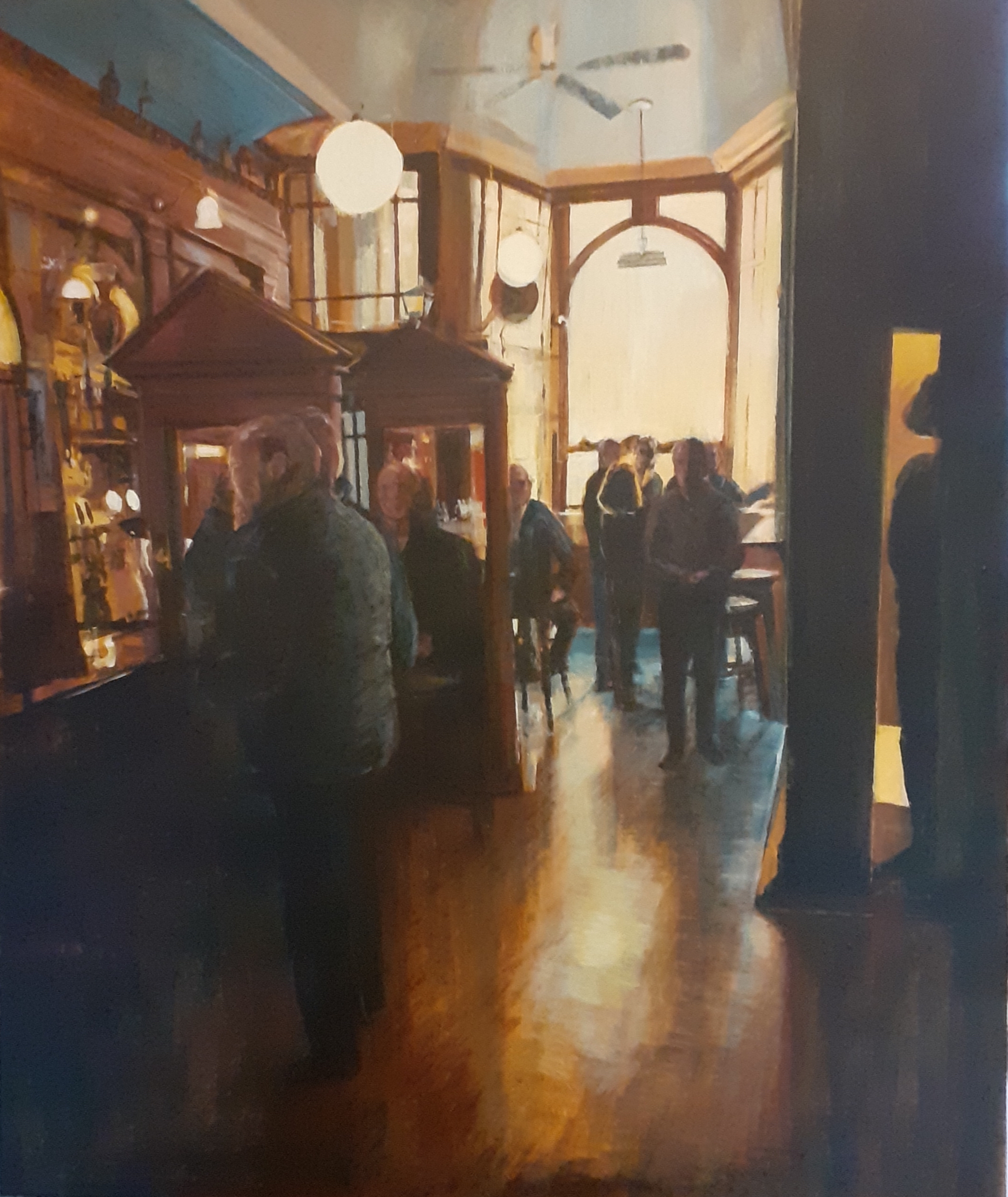
This acrylic is a snapshot of a sunny afternoon spent amongst friends. A brief lull in the conversation allows me to throw my eyes around the bar. I recognise a few of the faces, though things are getting a bit blurred around the edges; but pleasantly so. Perhaps I’ll have another.
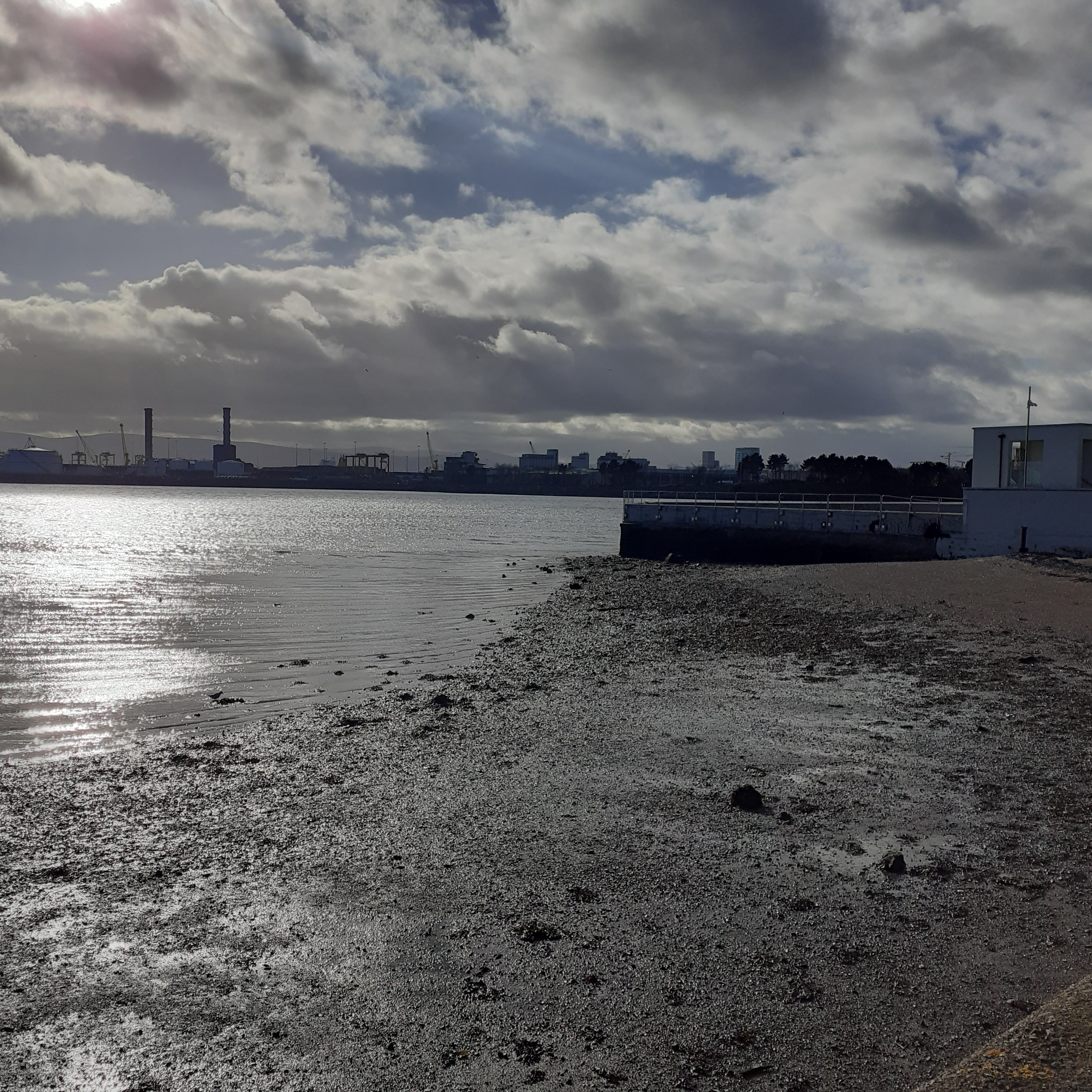
From the Sheds, we blink into the dazzling sun on water which vista extends past Clontarf to Dollymount. Clontarf pier is a little north of the village and it’s suburban housing along the shore from here on. A horse tram service was initiated in 1873 from the city to Clontarf, attracting more and more day trippers. Later catered to by the Howth Tram, this electrified service connected to Sutton and Howth stations via the Summit. On May 31st, 1959, the last tram took its final bow. The colourful, and most useful, tram era was gone, obliterated by conservative forces. Almost fifty years later, the powers that be were persuaded of the error of their ways, and the modern tram service, Luas, went on line in 2004. It doesn’t operate at this end of the city, but there is a frequent bus service all along the coast road.
In the distance, the straight line of the Bull Wall, and its wooden bridge, is apparent between our standpoint and the peninsula of Howth. The wide embrace of Dublin Bay looks the most natural and beautiful of havens for the ships of the ocean. More than a millennium of navigators have been welcomed. But there’s a darker side. The commodious bay is prone to silting and many’s the ship has been wrecked in these waters, or run aground on treacherous sandbars that form across the mouth of the Liffey, and the confluence of other tributaries of the bay such as the Dodder and the Tolka. In medieval and early modern times, the Liffey port was so treacherous that Dalkey to the South, and Howth to the North acted as port for the city. This couldn’t continue.
In 1715 work began on the Piles, a wooden construction built to provide a channel past the southern sand bank. Later this would be cast in stone to form the South Bull Wall. In 1760 Sir John Rogerson funded the extension of this westward to meet the Ballast Office and the South Quays. But the problem persisted and in 1801 the Admiralty commissioned William Bligh to survey Dublin bay. Just a dozen years earlier, Bligh had featured in that mother of all adventures at sea: the Mutiny on the Bounty. His four and a half thousand mile voyage with his eighteen loyalists in an open boat is truly the stuff of legend. The waters of Dublin Bay were rather calmer, though treacherous enough, and the Captian of the Bounty, and future Governor of New South Wales, brought his talents to bear on them. The result of Bligh’s survey was the recommendation to built the North Bull Wall, from the Clontarf Coast pointing southeastwards into the bay. This, he calculated, would build up the silt on the Northern side of the wall, which is now evident in the creation of the Bull Island.
Ultimately the design for the wall was made by George Halpin, Ballast Board engineer and designer of bridges and lighthouses. He was the uncle of Robert Halpin, the famed Wicklow mariner who captain Brunel’s SS Great Western in laying the first transatlantic telegraph cable in 1866. George is known as the father of the Irish lighthouse service. He was appointed inspector of lighthouses in 1810, responsible for over fifty lighthouses, including the Skelligs, and the Baily Lighthouse in Howth. He died in 1854 and was succeeded as Inspector of Lighthouses by his son, George.
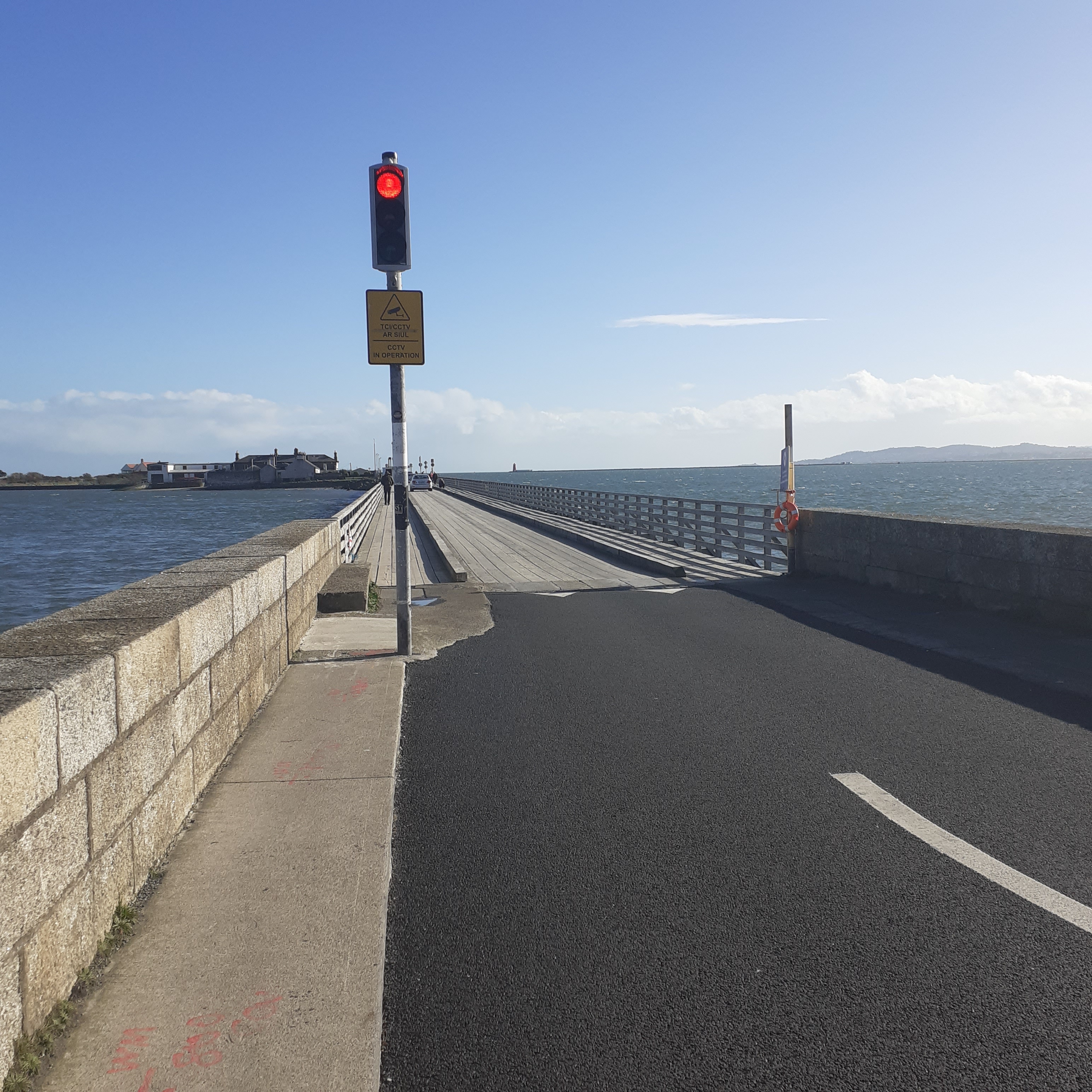
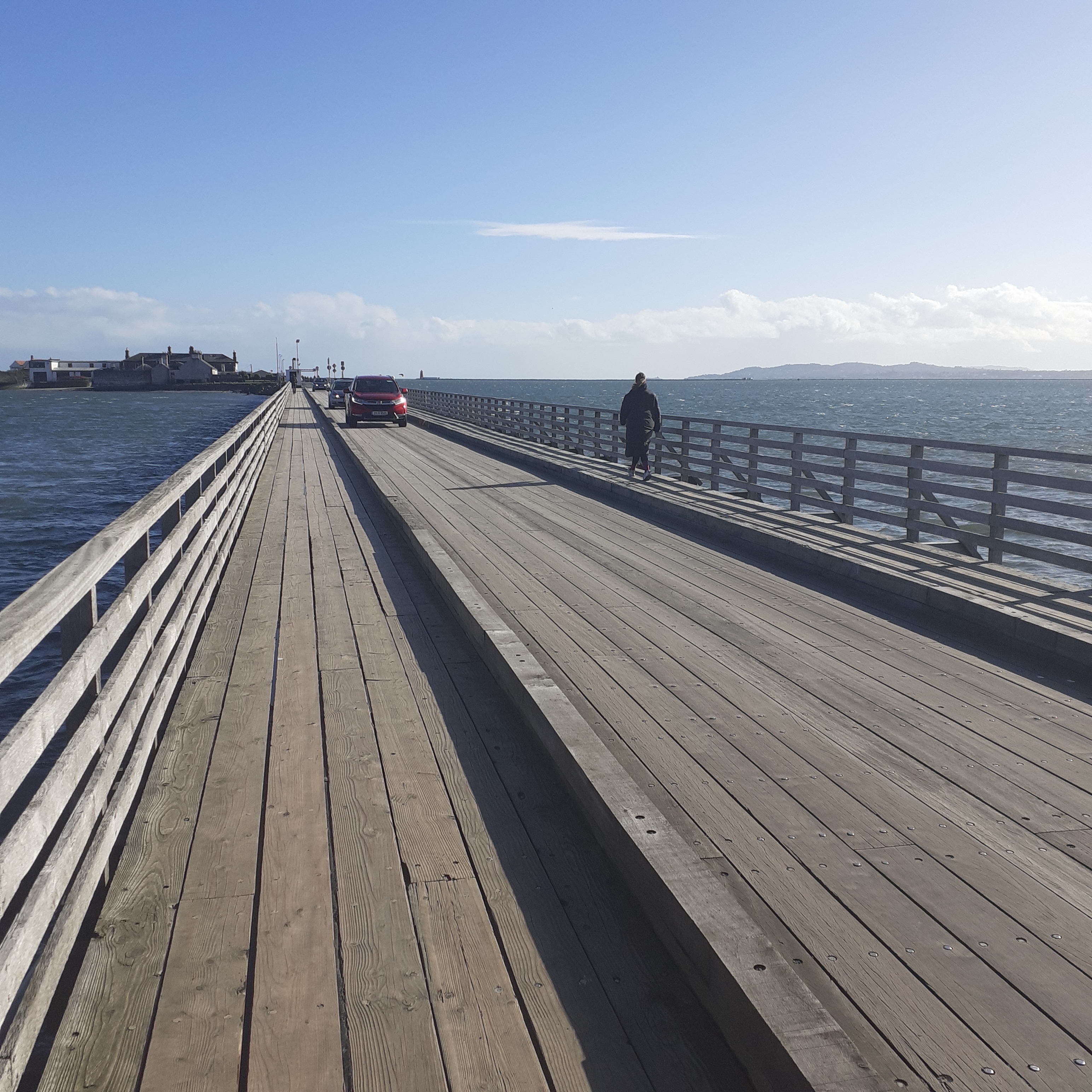
Work commenced on the North Bull in 1819 with the construction of the timber bridge. The crossing of this seems almost a rite of passage for a true blue Dub. Car traffic is one lane at a time, controlled by traffic lights. On one childhood trip, I recall our packed Morris Minor, stopped halfway out by a car coming in the opposite direction. An amber gambler, no doubt. My father got out to reason with the errant driver, who, on seeing him, reversed furiously back to the island. My father was a diminutive man, but imposing. He was a military man, Irish Army, but with something of a British accent. We had a good laugh at his quick resolution of the short impasse.
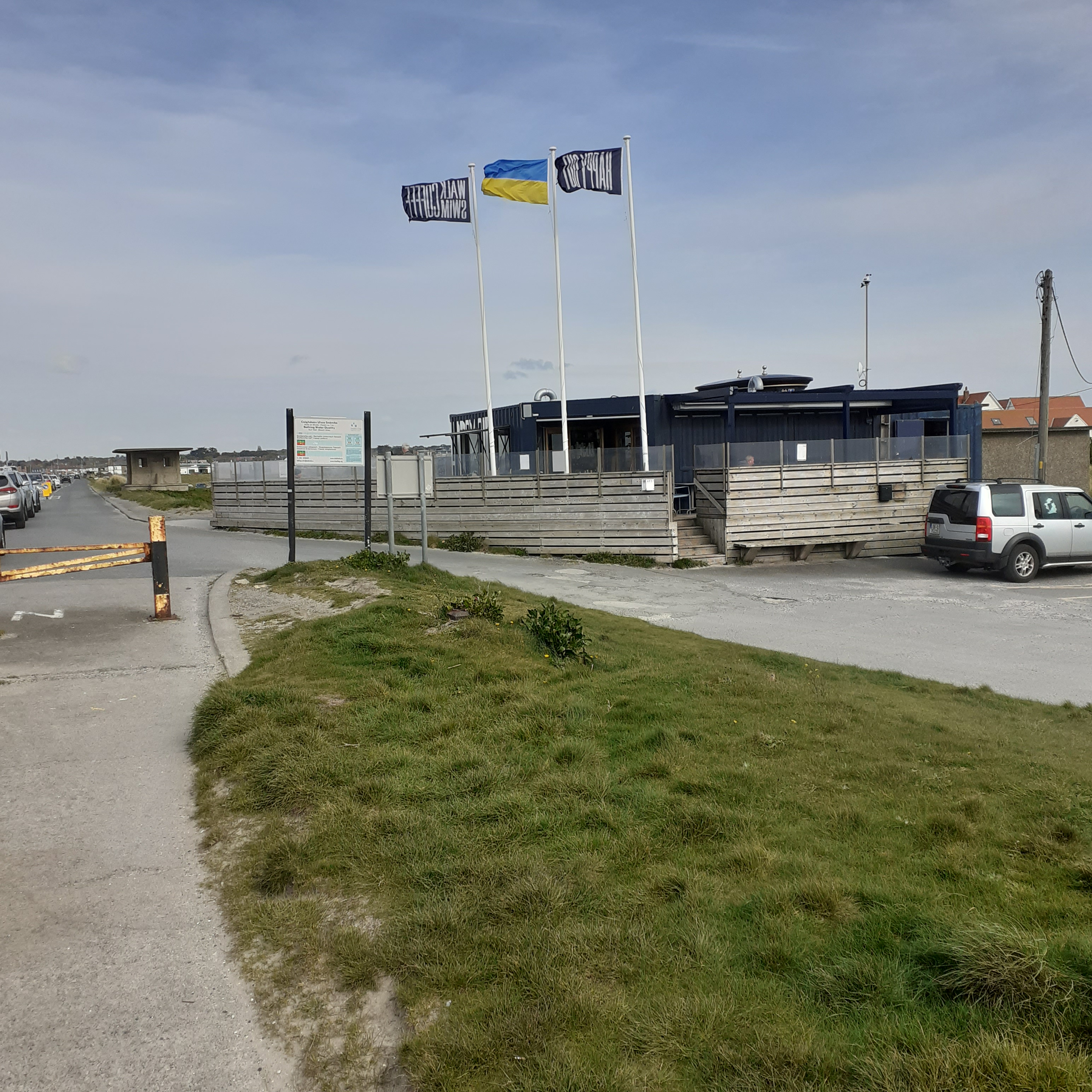
Over the bridge, there’s parking adjacent to a service area which includes pay toilets and picnic benches. There’s a windswept coffee and snack place called Happy Out. I throw out an anchor and lean into the gale, feeling the defrosting balm of americano seep through my veins. All the better to fortify myself on my walk out to the end of the wall.
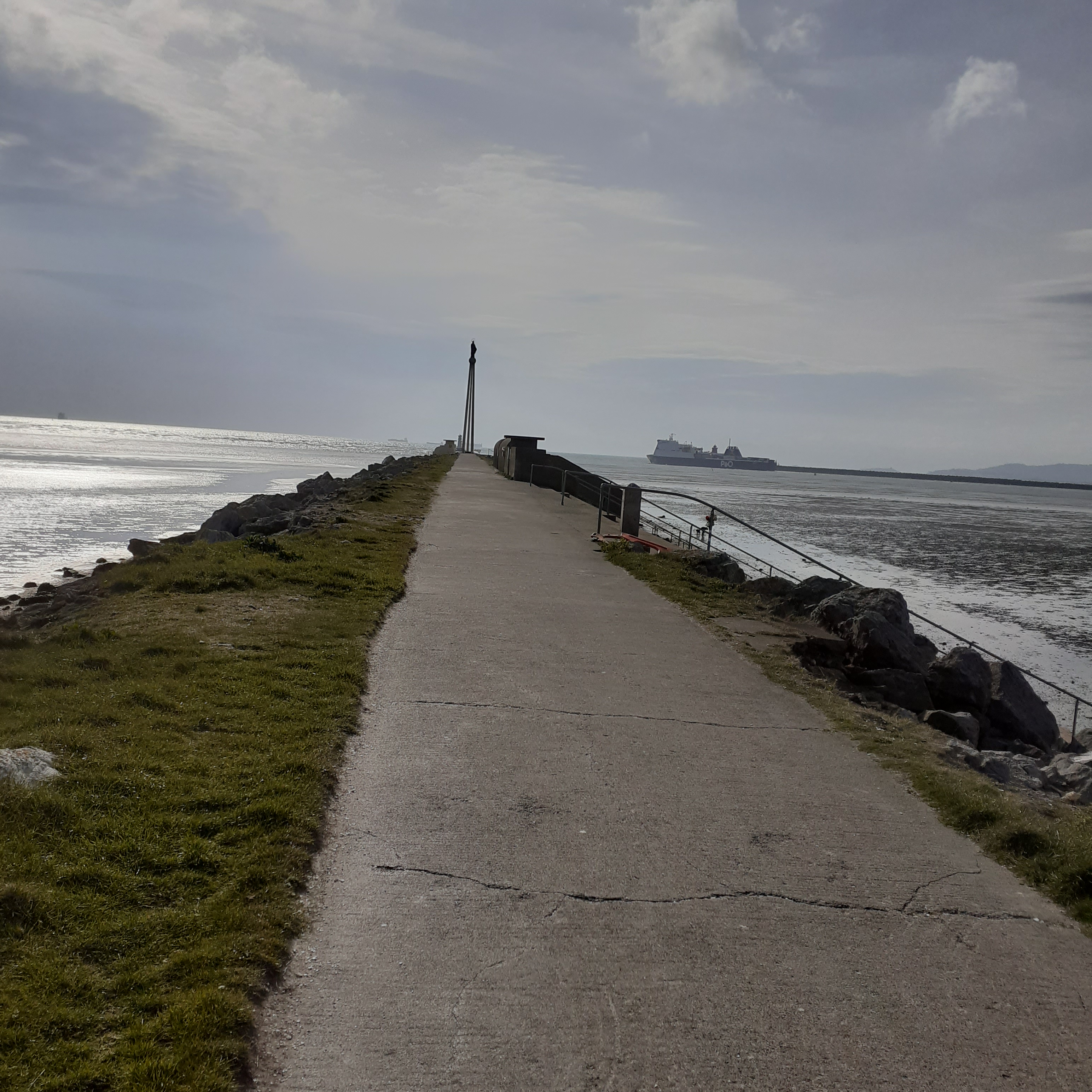
The wall itself was completed six years after the bridge and extended for more than three kilometres into the bay. The walkway is paved as far as Our Lady Star of the Sea, and the last stage is a rough breakwater, covered at high tide, with a green lighthouse at the end. As far as the statue, there are a number of public bathing shelters, designated male and female and designed by George Simms, Dublin Corporation housing architect. Star of the Sea was first mooted in the fifties and funded by subscription from Dublin dockers, sailors and port companies. The structure comprises three tall concrete pillars which merge to support a globe on which stands the statue sculpted by Cecil King. It was unveiled in 1972.
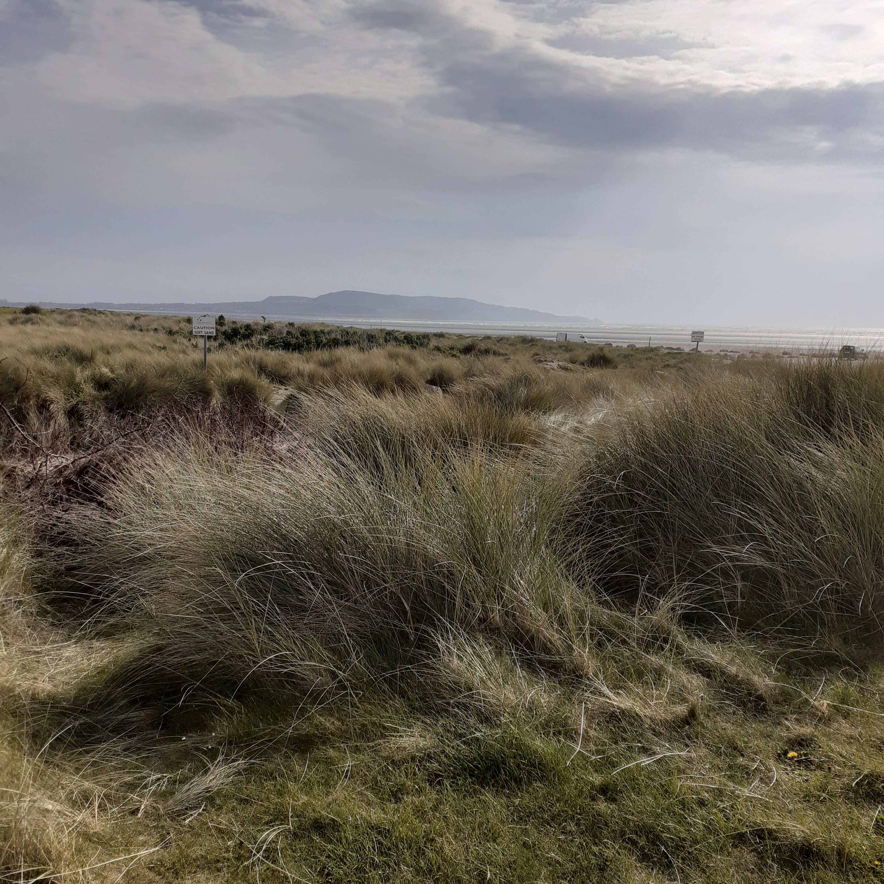
Dollymount strand is a good five kilometres long and is both a splendid public amenity for the huge city on its doorstep, and also an invaluable wildlife reserve. The Bull island on the landward side is occupied by two golf clubs, the Royal Dublin and St. Anne’s. The Royal Dublin was founded in 1855 and is Ireland’s second oldest golf club. It is a regular venue for the Irish Open Championship. A causeway links with the mainland further on at Raheny
And so to stroll the sands of the neverending beach that is Dollymount Strand. It can be all things at all times, a capsule of infinity, a panorama of the memory. Life is a beach. I recall another childhood trip to Dollymount. Taking the car without incident onto the beach, my father gave each of us three kids a turn at driving on the hard packed sand. This is also something of a Dublin tradition. Many’s the driver who cut their motoring teeth here. And returned for other pursuits. It was also a popular nighttime hangout. Motoring, music and romance; what more could a body ask for? There were cars, their drivers, and passengers, otherwise occupied, marooned by the incoming tide.
I want to take you to the island
And trace your footprints in the sand …
And in the evening when the sun goes down
We’ll make love to the sound of the ocean
The Island is a 1985 song by Paul Brady taken from his album Back to the Centre. Brady hails from the town of Strabane, not far from Dungannon, in County Tyrone. My father lived in Dungannon from when he was six, or maybe seven. He died in the late eighties. Near the end of his life he spent some time at a Convalescent Home near Sandymount Strand, across the bay. It was me that drove him home for the last time. We walked out along the corridor together, very slowly, and I recall the song playing was The Island. It refers to the greater island of Ireland, and caustically to the Troubles, but like any great song it applies across a range of human experience. Here, memory, belonging and isolation are evoked in the permanence, and transience of the tide across an expanse of beach. It seems apt now, on this sandy island, to let it flow, and ebb through the soul.
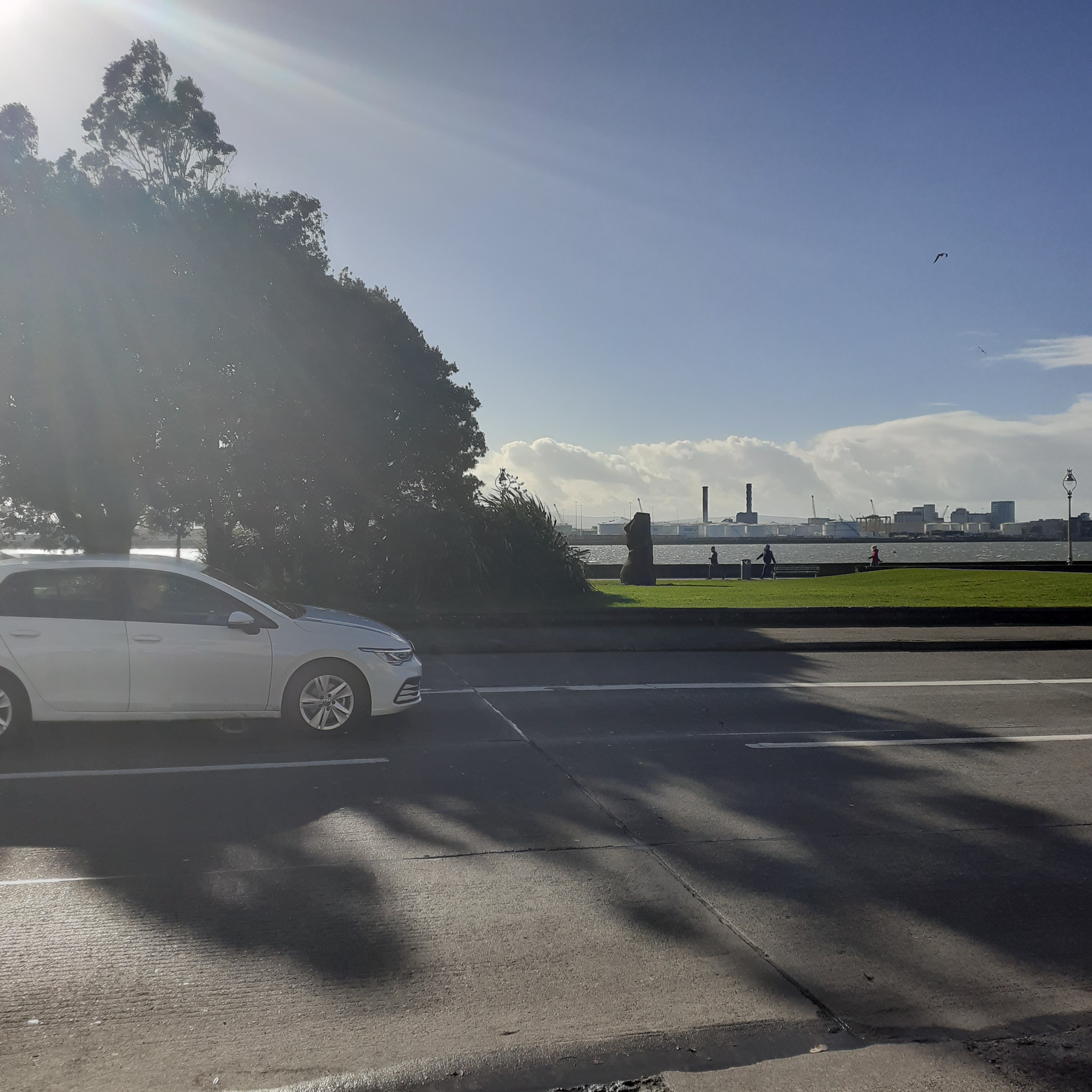
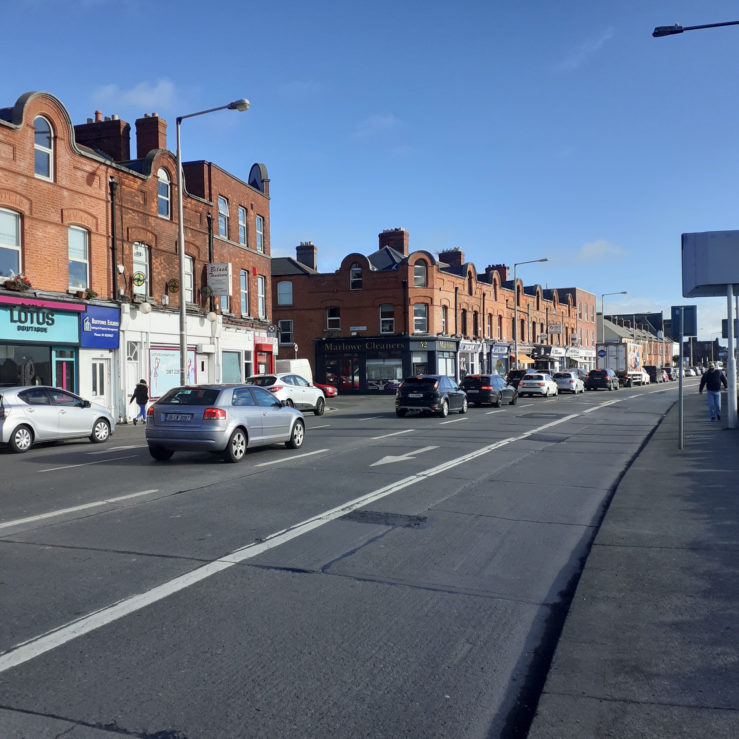
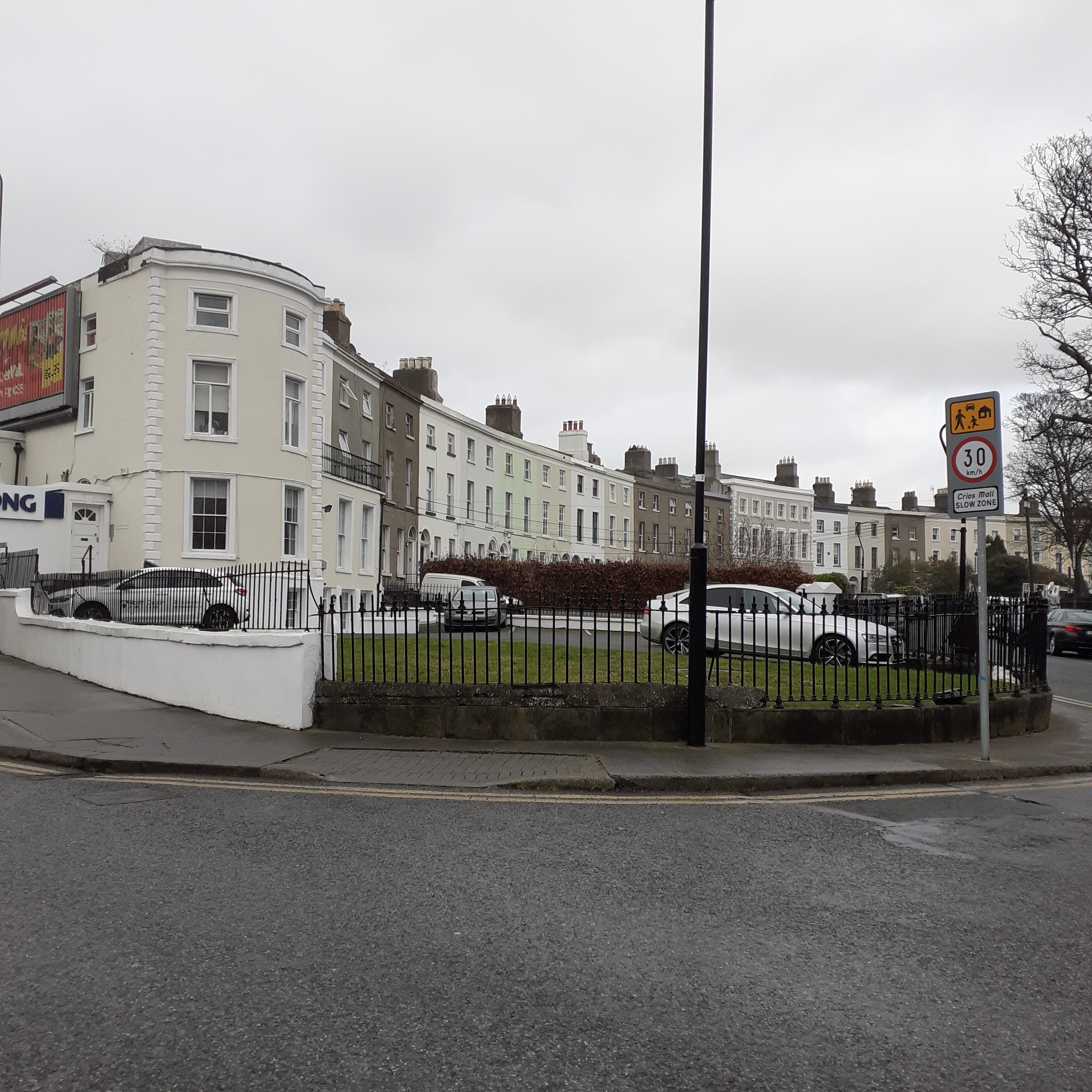
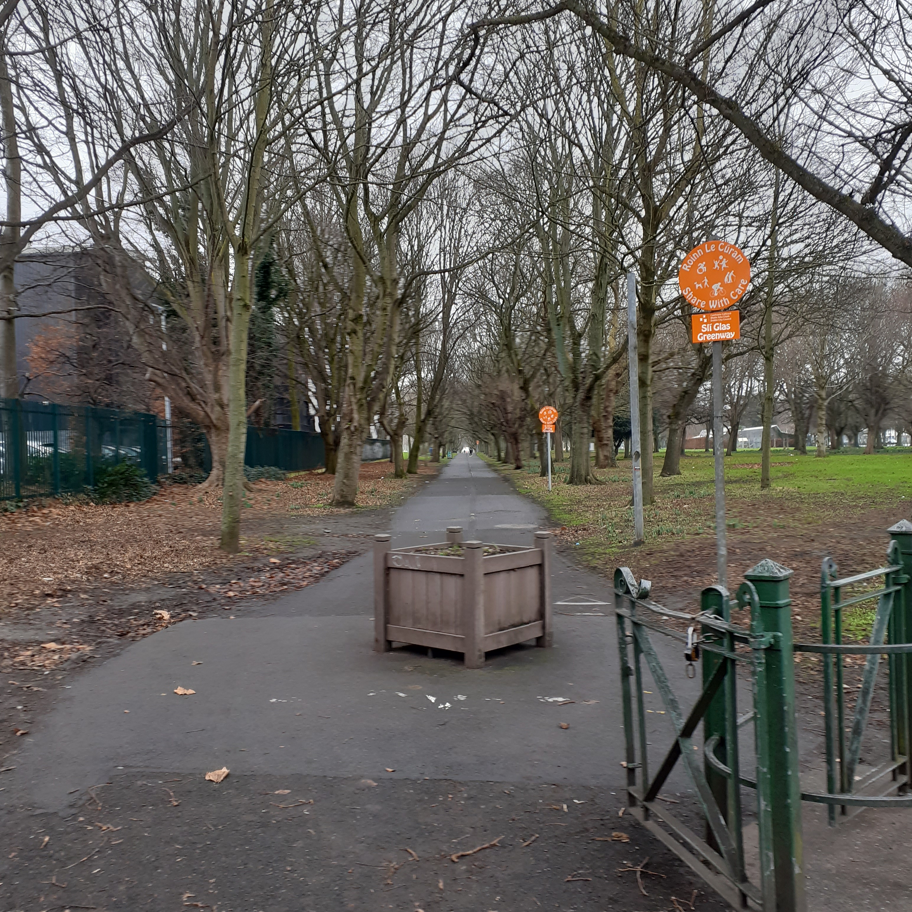
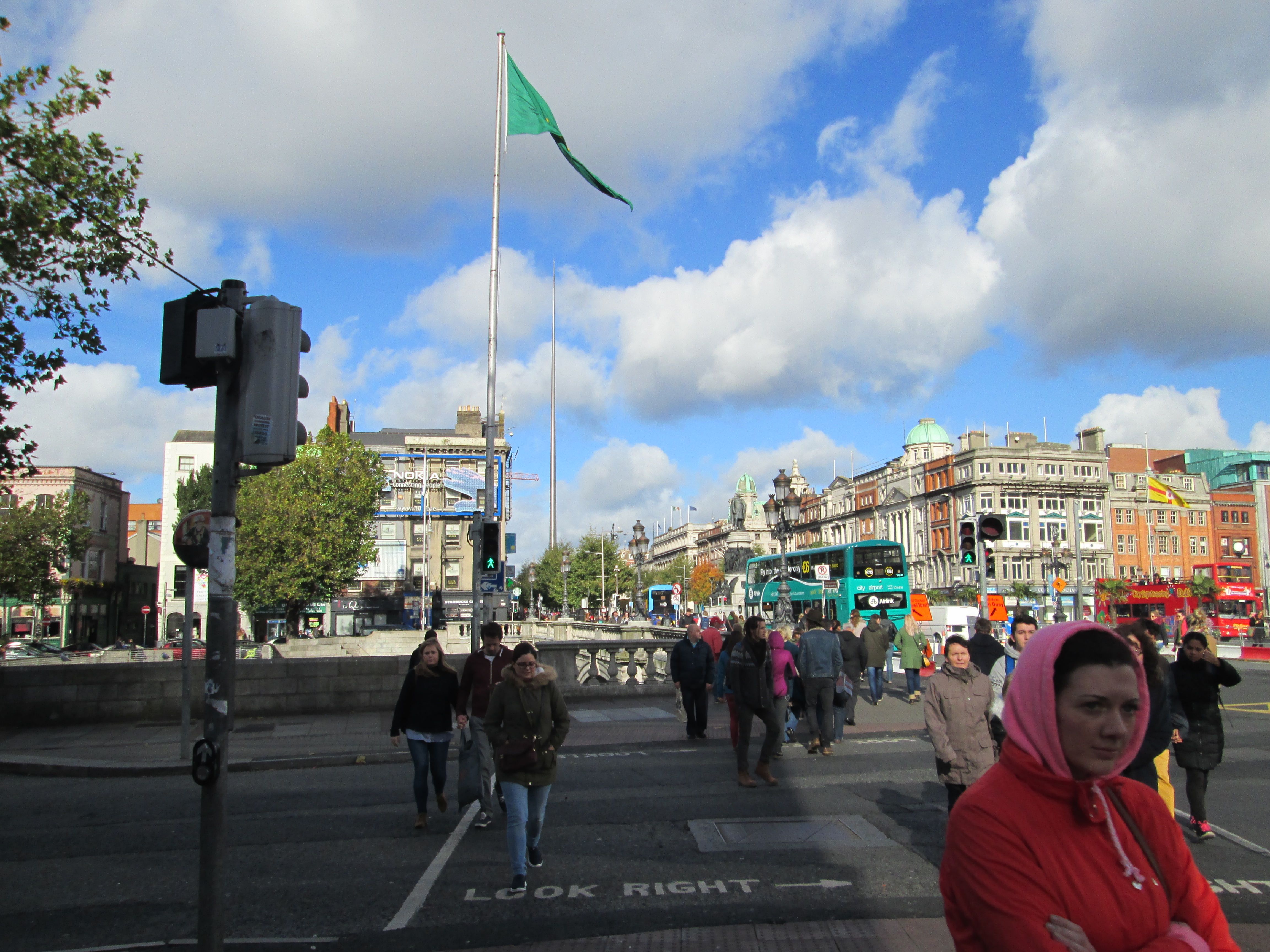
Stepping off the Yacht, I turn left and northwards along the coast. At least I will ultimately head North, way up north. Right now Clontarf Road is curving away east, south east. But there’s no way of getting lost. It hugs the coast, so eminently huggable, all the way onwards from its starting point in Fairview, through Clontarf and on to the timber bridge connecting to the Bull Island at Dollymount. There’s a long grassy promenade as far as the bridge, after which the coast road will continue alone past Saint Anne’s Park in Raheny until Sutton Strand at the isthmus of Howth.
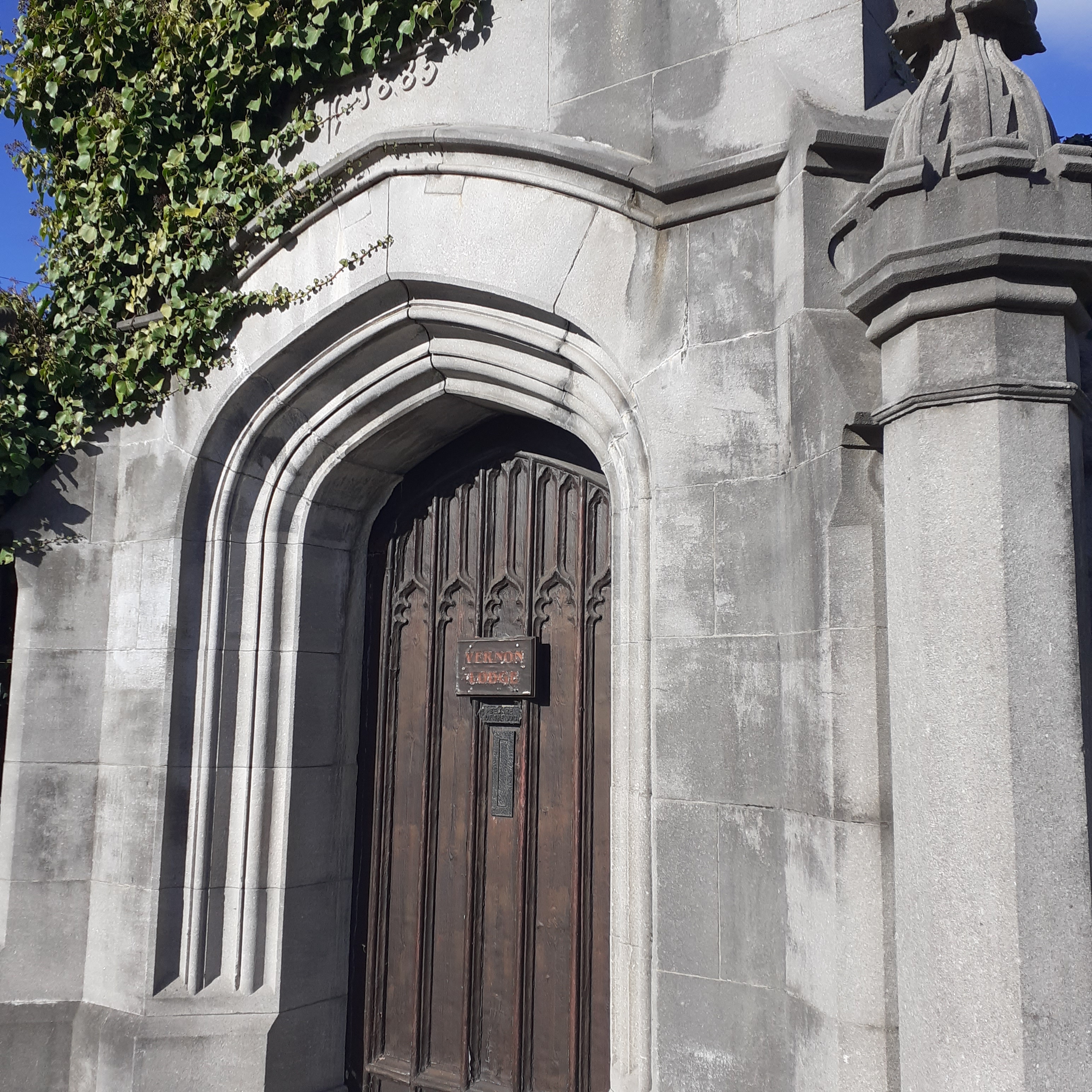
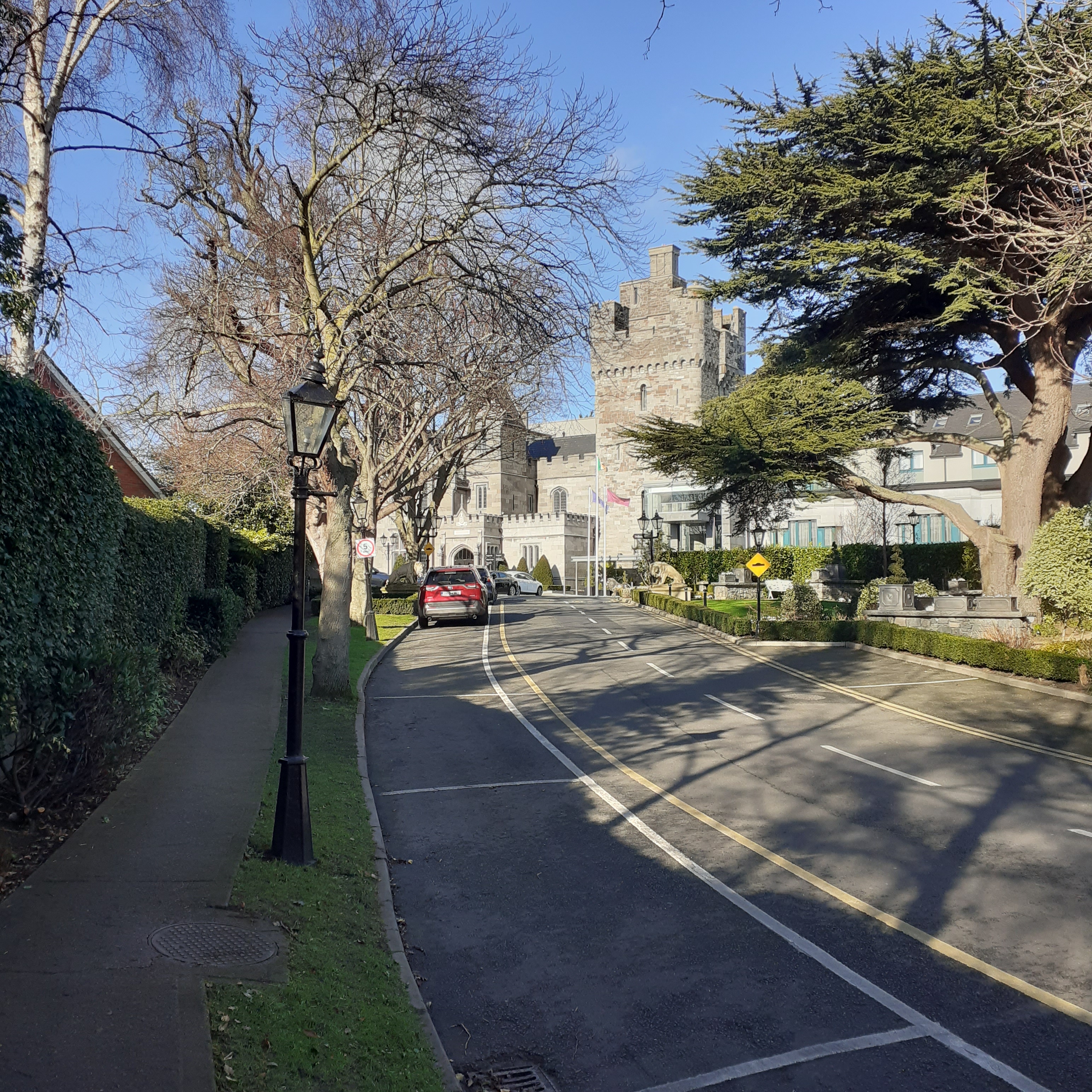
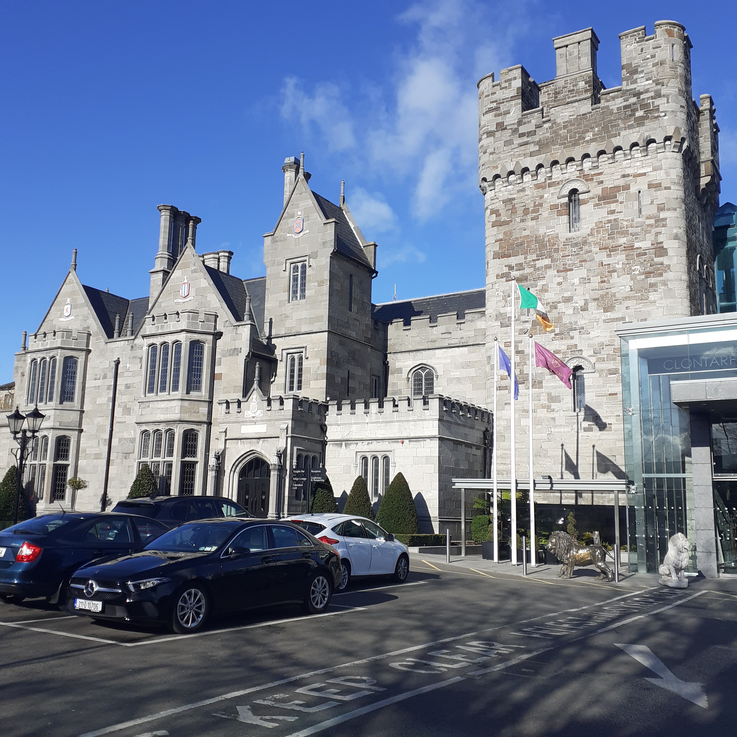
Dublins docklands form a spiky tableau along the horizon, the twin chimneys above all. The road curves away past salubrious suburbia. A few hundred yards on at Castle Avenue there’s time for a detour to Clontarf Castle. Castle Avenue is a sylvan boulevard, lined with attractive nineteenth century terraces and some more modern flats and houses. It takes a sharp right at the top where there’s a stone gateway inscribed for longtime owners of the Castle, the Vernons: Vernon Semper Virit, and dated 1885. This entrance is now dislocated from the Castle grounds, whose modern entrance is a hundred yards or so further on.
The original castle was built by Hugh De Lacy, Lord of Meath, following Strongbow’s conquest in 1172. His tenant, Adam de Pheypo, took up residence. Ownership passed to the Knights Templar and subsequently the Knights Hospitaller until Henry VIII’s dissolution of the monasteries.
By the mid seventeenth century, times were becoming ever more interesting. The War of the Three Kingdoms kicked off, with the Irish Confederacy of Gaelic and Old English (the Anglo Norman Lords) adding fuel to the fire with the Irish Rebellion of 1641. Avid Cromwellian, Sir Charles Coote, Governor of Dublin, burned the castle as part of a campaign to exterminate the Catholic rebels holed up there. The lands were subsequently granted to John Vernon, Quartermaster general of Cromwell’s army, and he set about rebuilding it and adding a parish church whose ruins endure.
George Handel is a noted visitor. In April 1742, the first performance of Handel’s Messiah took place in the Concert Hall in Fishamble St. The choirs of St Patrick’s and Christ Church Cathedrals were used, though the Dean of St Patrick’s, Jonathan Swift, was initially reluctant until informed it was to be a charity event. And hugely successful too. Such were the crowds clamouring to go, that gentlemen were required to leave their swords at the door, to facilitate more people. Handel stayed for a time at Clontarf Castle, where he formed a close relationship with the lady of the house Dorothy Vernon, whom he honoured in his music. She is also honoured by the Dolly in Dollymount further along the coast.
The Vernon’s owned the castle for three hundred years but the line extinguished in the 1930s and the castle and grounds fell into decay. In the late sixties the castle was reborn as a popular cabaret venue. It was completely renovated as an upmarket hotel in the 1990s. The current structure was designed by Irish Architect William Vitruvius Morrison in 1837, in a Gothic Tudor style. The Tower House being a replica of the original Templar structure.
Another probable visitor, in its derelict days, was Phil Lynott who left his home in Crumlin and moved into a flat at 28 Castle Avenue in the late sixties. The three storey Victorian house where Lynott lived was recently renovated as a private dwelling and worth an approximate four million. But it was the castle that caught the young musician’s imagination.
The friendly ranger paused
And scooping a bowl of beans
Spreading them like stars
Falling like justice on different scenes
Around that time, Lynott joined Skid Row, moving on to front Orphanage and forming Thin Lizzy at the end of 1969 with old pal, Brian Downey, and Belfast duo Eric Bell and Eric Wrixon of Them. Thin Lizzy’s eponymous first album opens with the song The Friendly Ranger at Clontarf Castle. The lyrics suggest the castle and grounds are deserted, a place where wild and ragged people go, which Lynott and friends may have used for a hangout. The friendly ranger is part tramp, part guru, and evening brings a rush of hope and wonder.
To feel the goodness glowing inside
To walk down a street with my arms about your hips, side by side
To play with a sad eyed child till he smiles
To look at a starry sky at night, realize the miles
Like Dublin’s other great musical bard, Thomas Moore, Lynott sings of love and landscape, of lost and living friendships.
Back down at the seafront, there’s a water outlet in the wall, which it is said, derives from the spring where Brian refreshed himself at the Battle of Clontarf. It is known as Brian Boru’s Well; although he wasn’t looking so good last time he left the place, dead.
Turning back onto the coast, we pass Clontarf baths, The bracing shoreline with its spectacular panorama of the bay saw Clontarf become a fashionable resort in the nineteenth century. Catering for the influx, the baths were constructed by a Mr Brierly with hot and cold seaweed baths. These closed in 1996, but are currently refurbished with bar and lounge, although access to bathing remains nebulous.
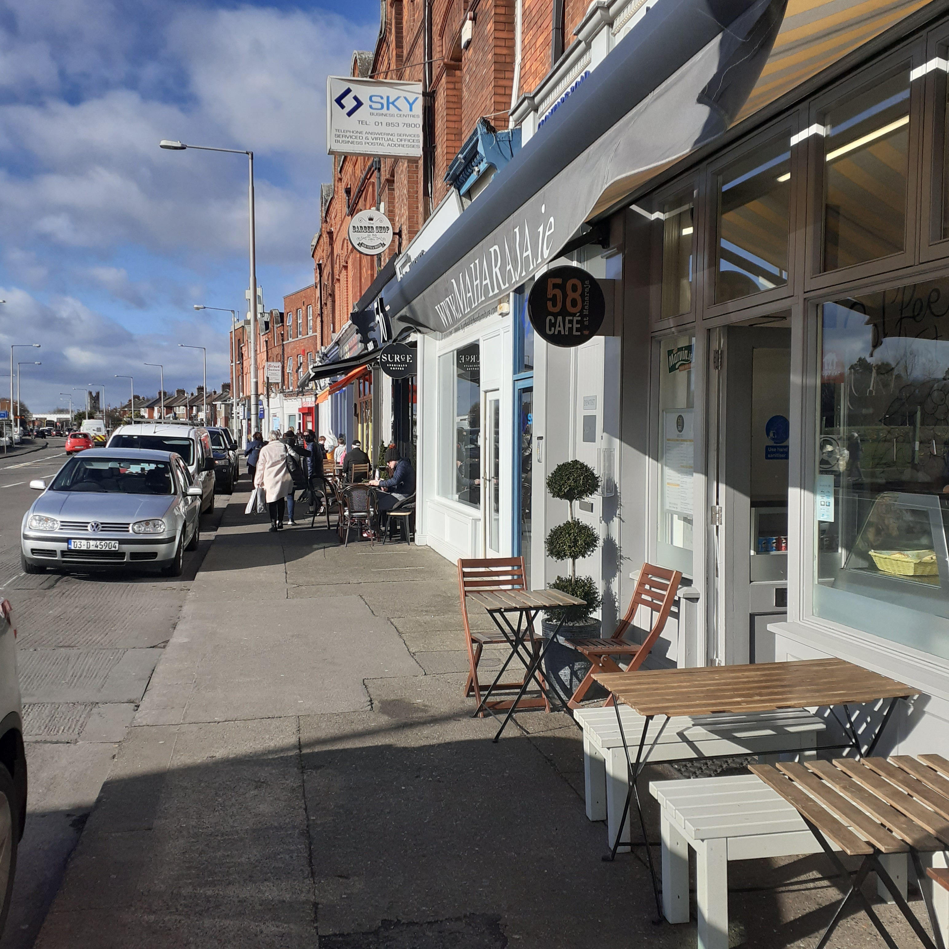
A little further on we reach the junction of Vernon Avenue where an urban village juts onto the coast road. The ancient manorial village of Clontarf grew originally in the vicinity of the Castle, but the population in the late seventeenth century was less than a hundred. An important fisheries industry developed on the coast further east. Processing the catch, including fish curing and oysters, was carried on in a group of buildings called the Sheds and the modern village grew around this. The fisheries are long gone, but the name, The Sheds, lives on at Connolly’s Pub on the seafront. The small village is an interesting enclave with cafes, eateries, shops and the pub.
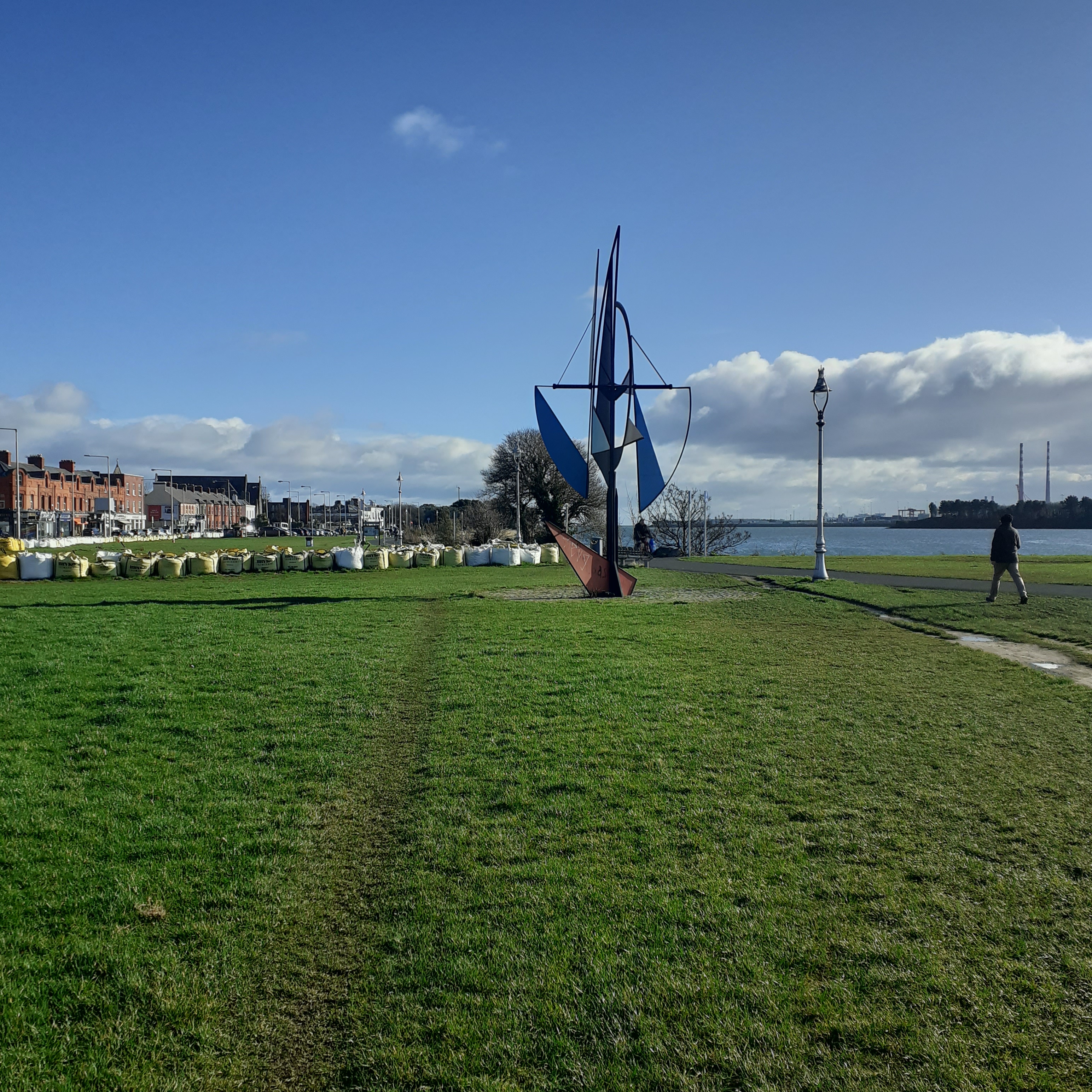
From here the road begins to curve northwards, towards Dollymount and the Bull Island. Guarding the route is an imposing head which resonates of a very distant culture. This is the Easter Island Maoi replica statue presented by the Chilean government to the city of Dublin in 2004. It was carved from the volcanic rock of Easter Island in the Pacific, and forms an eerie, though appropriate, connection between island cultures on different sides of the globe. Rock and roll!
To see the sun set behind the steeple
Clontarf castle, no king, queen or knightly people
A coal fire and it’s pouring rain
To wave goodbye to a very good friend, never meet again
Little thoughts bring little memories of you to me
The station at Clontarf Road was an addition to the Dartline in 1997. The old Clontarf Station was at the start of the Howth Road, a bit further inland, which operated for a century from the eighteen forties to its closure in the 1950s. Dart dates back to 1984, and provides fast, frequent and affordable transport along the Dublin and North Wicklow coast. Clontarf Road is the last coastal stop between the city and Howth Junction, as the line plunges inland to serve the suburbs of Killester, Harmonstown, Raheny and Kibarrack. Aesthetically, the stop’s a dump on stilts, but function and convenience save the day. Numerous bus connections can be made along Clontarf Road itself, and I found the station ideally sited for visiting the Casino and the start of a few good walks north along the coast as far as Dollymount.
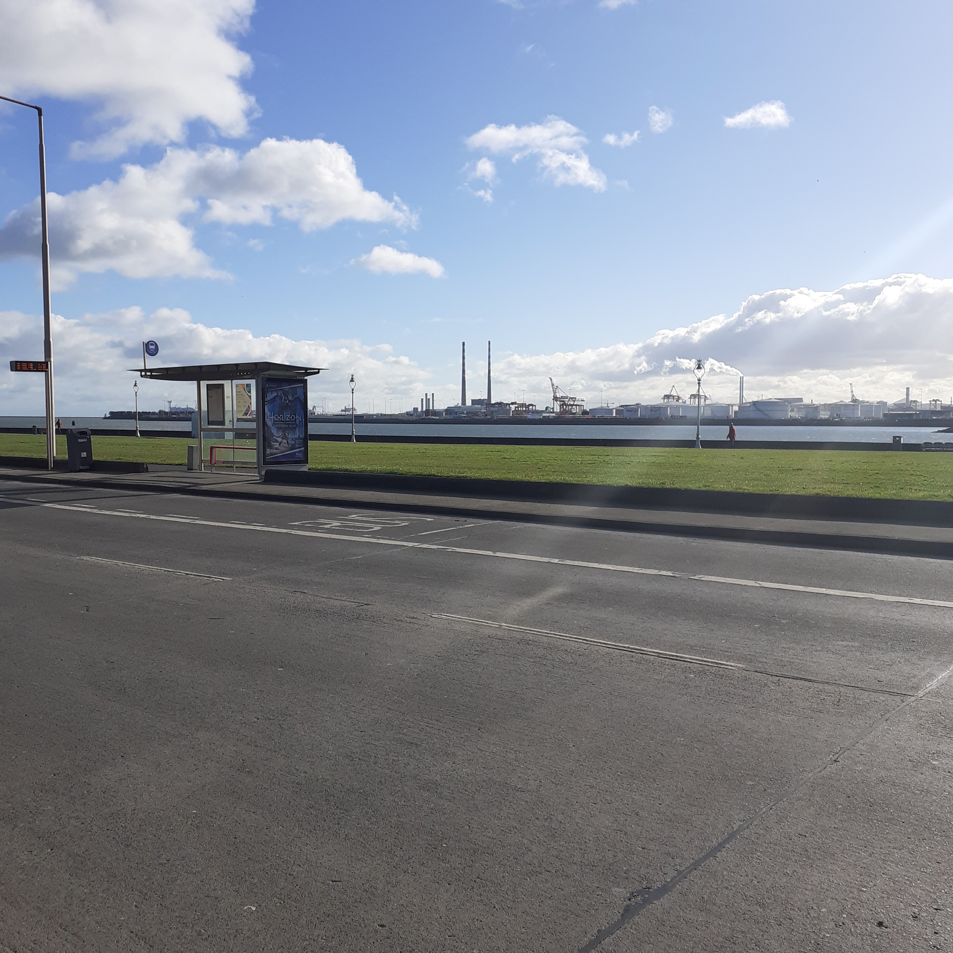
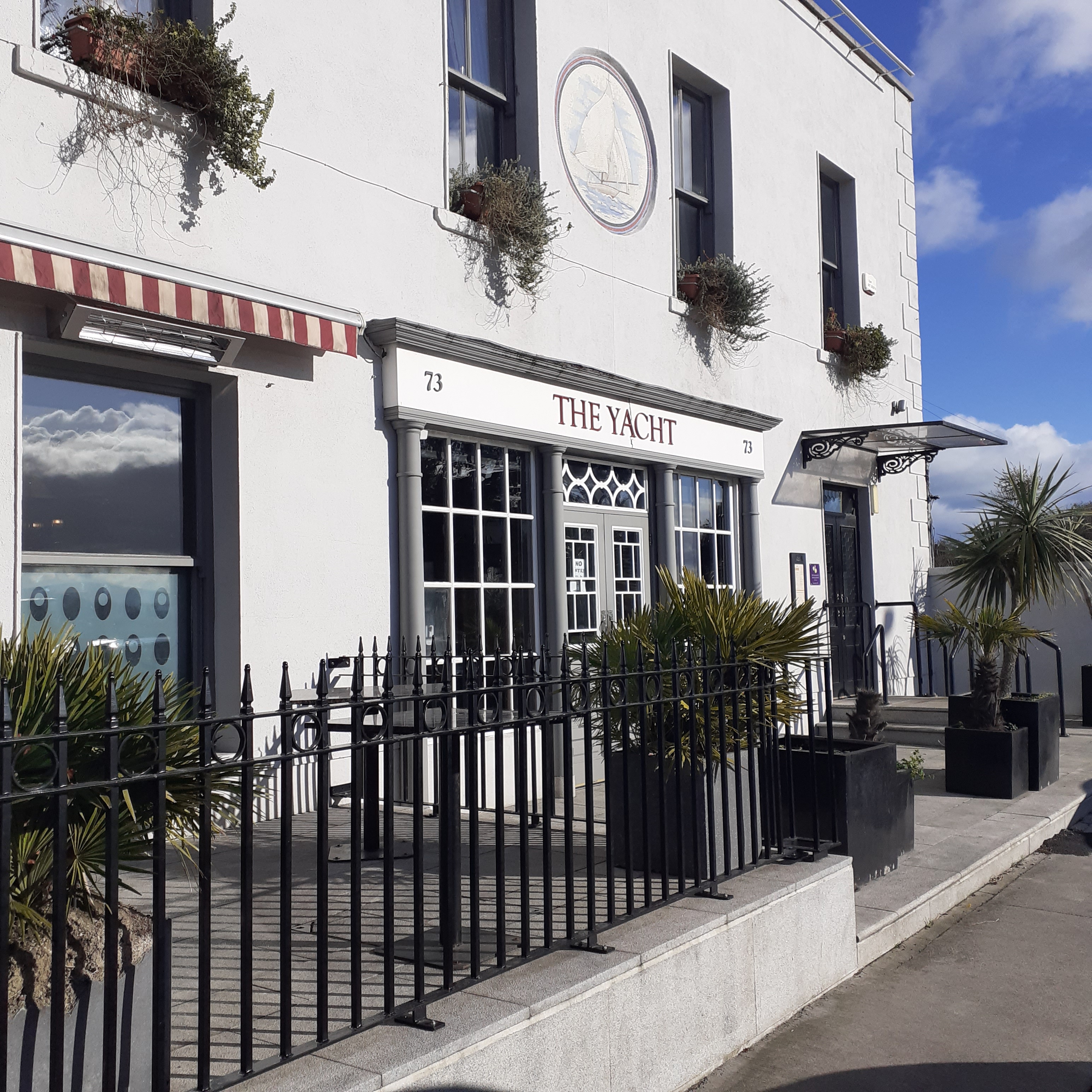
Escaping the station, one is rewarded with a nexus of parkland and seafront promenade. To our left lies Fairview Park and Marino which we’ve recently explored. To our right, the road curves along the coast with the well-to-do suburb of Clontarf inland, and a pleasant linear park laid out on the seaward side. It’s similar to the coastal stretch on the southside at Sandymount. Across the water we see industrial East Wall and Dublin Port and Docks, and a bit further, the dominant striped towers of the Pigeon House and the Incinerator on the South Bull. An urban streetfront of red brick two and three storey premises continues as far as St Lawrence Road and the Yacht bar and restaurant. Cafe society clings to the pavement, an uneasy but distinctive mix of environments; city street and seafront.
Clontarf means Meadow of the Bull, and is deeply resonant in Irish History and identity. This goes back a thousand years to the Battle of Clontarf, where, it is said, the Irish under Brian Boru, drove the invading Danes into the sea. There is an information sign for the Battle of Clontarf at the start of the esplanade.The battle took place in 1014 and was not the Ireland v Denmark match of our schoolbooks. Brian Boru, King of Munster and High King of Ireland, led a coalition of forces, mostly Gaelic, but including Munster Vikings whom he had subjugated. Ranged against him was the alliance of Danish Dublin and Gaelic Leinster, with a number of Danes from the Isle of Man and the Orkneys. Leader of this alliance was Sitric Silkenbeard. Sitric was born in Ireland around 970 and became King of Dublin in the late eighties.
At the end of the century he was obliged to submit to Brian Boru, becoming Brian’s ally in helpng him assert his rule over Ireland as High King. As part of the deal, Sitric married Brian’s daughter, Slaine, while Brian married Sitric’s mother Gormlaith. In marrying Brian, Gormlaith was on husband number three. She is cast as the femme fatale of her age, exercising a magnetic attraction at the apex of sex and power; a Celtic Cleopatra. But, hey, that’s the way the gals are in Dublin.
She was the daughter of Murchada King of Leinster and brother of his successor, Mael Morda. She first married Olaf Cuaran, King of Dublin and York, with whom she had Sitric. Olaf abdicated following defeat at Tara in 980, and died in exile. The victor Mael Seachnall, High King of Ireland, aka Malachy II became husband number two.
Gormlaith’s ardour waned with the arrival of a new force of nature. Brian Boru had by century’s end established himself as Ireland’s ruler and then captain of Gormlaith’s heart. Well, maybe. Things turned sour in a war between the sheets and Gormlaith left the ageing King. She also coaxed her brother and son away from their allegiance. The Gang of Three were now in open revolt. Sitric enlisted help from offshore Viking adventurers. Brodir and Ospak were Danish Manx brothers whom he hoped to persuade to join him at his day at the races. As it turned out they fought on different sides in the battle, Ospak finding Brian too good a king to oppose. Sigurd of Orkney supported Sitric.
The battle took place on Good Friday, 1014. A day, you will be aware, the pubs were all shut. It could have ranged all along the coast from the Tolka River as far as where the North Bull now stands. Slaughter was huge on both sides. As many as ten thousand died. Brian’s son, Murtagh, and grandson Turlough were slain. Mael Morda also fell.
By the end of the day, the numerical superiority of the Irish forces began to tell. Many Vikings were marooned by the high tide and were drowned or slain. Sitric led what few remained of his forces back to Dublin. Brian, seventy years old was in his tent where Brodir found him and killed him, before himself being killed by Brian’s bodyguard. Legend has it that Brian was on his knees in prayer, giving thanks to God for his victory. Although he could have been trying to get the cork out of a bottle. Either way he was dead, as was his son and heir, Murtagh. This was a pyrrhic victory for Brian’s kin.
Malachy resumed his High Kingship. He had brought his forces to Dublin, but they hung around the back smoking and playing cards, having forged a secret non aggression pact with the Dubs. He reigned until his death in 1022. Sitric, meanwhile, remained to rule the Fair City for a further two decades. Skilled in the not altogether disparate arts of piracy, pillage and politics, he is best known as patron of the church, establishing Christchurch Cathedral in a fit of piety after a pilgrimage to Rome in 1028. After almost fifty years in power, he was usurped in a palace coup in 1036, and exiled to York where he died in 1042. Gormlaith, the beautiful schemer, had died in 1030, in her seventieth year.
It’s thirsty work contemplating the legendary battles of yore. The wanderer, Dub or Dane, Gael or Gall, is welcome at the Yacht, a rare oasis in this seafront suburbia. They serve a good lunch, with battered fish and chunky chips the appropriate choice, either in the lounge of gleaming wood and glass flooded with seafront light or the windswept patio to the side. There, the cool wind blows, the seagulls call, and sometimes you’ll hear the echo of an ancient battle cry.
We come from the land of the ice and snow
From the midnight sun where the hot springs flow
How soft your fields so green
Can whisper tales of gore
Of how we calmed the tides of war
We are your overlords
Immigrant Song, was written on a visit to Reykjavik by Led Zeppelin, and opens their 1970 album Led Zeppelin III. Sitric would have loved it.
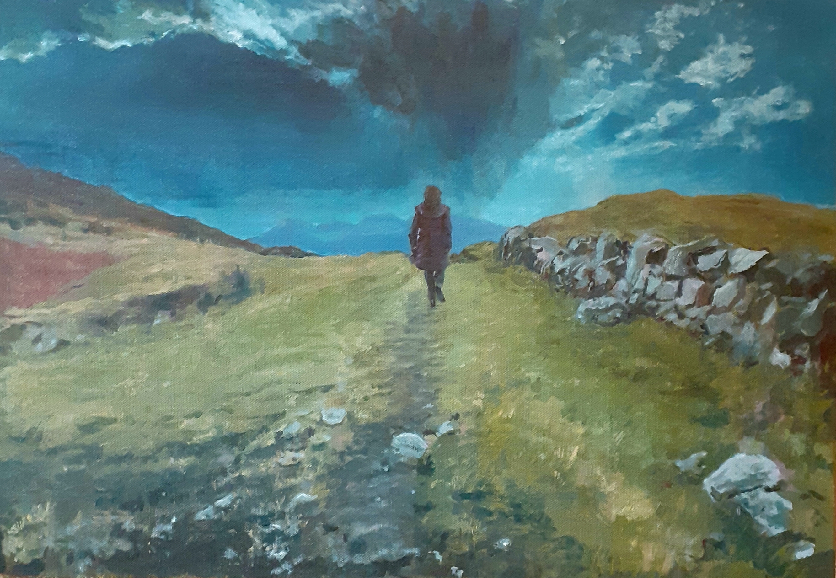
Last winter we visited Connemara, way out west. Yippee Yi O Ty Aye! We stayed in the Leenane Lodge on the shores of Killary Harbour. Killary, a rare fjord etched into the Connaught coast, is on the Wild Atlantic Way, a 2,600K road connecting Malin Head in Donegal with the Old Head of Kinsale in County Cork. Ireland’s Atlantic coast is truly spectacular and there are plenty of places to explore on foot with lakeland, dramatic cliffs and rugged mountains creating a paradise for the landscape lover.
Right past our hotel door winds the Western Way. The Western Way is a long distance walking trail through Mayo and Galway. It starts up past Ballina and shimmies on down through the mountains of Mayo, through Newport and Westport, past the Leenane Lodge and on down to Oughterard, by the shores of Lough Corrib in Galway.
We picked up a part of it just west of Leenane on a cool, bright morning after a hearty Irish breakfast. The full route of this particular section skirts the northern slopes of the Maumturk Mountains, rising above Killary Harbour, then turning south through Glen Inagh with Lough Inagh and the Twelve Bens away to the west. It is thirty kilometres long, about six hours in all, but we’re only planning two hours or so.
The walk is along an old coach road so the climb is relatively easy, and very rewarding. M precedes me up the hill. Cresting it, the majestic beauty of the twelve Bens are sketched along the horizon, sweeping down to where Killary fjord makes for the Atlantic. Mweelrea, mightiest mountain in Mayo, presides over the northern shore.
We are on the threshold of paradise, but it turns out we don’t we don’t get much further than this. The sky around here is prone to vertiginous mood swings and a storm has sprung up over the Twelve Bens. We turn and hurry downhill, reaching the road as the first sprinkles of rain hit. We are laughing in the lobby as the storm sweeps over, and just as quickly passes, leaving behind the cool and sunny landscape of the morning.
I finished off this piece in the bloom of early Summer, back East in Dublin 4, sitting in the sunshine on the veranda of a bar at the corner of Shelbourne Road and Bath Avenue. This song came on the radio and I felt the singer was looking over my shoulder.
My love, I’m in paradise whenever I’m with you
My time, we’ll be out whatever the weather
If it feels like paradise running through your bloody veins
You know it’s love heading your way!
The sung is Paradise by George Evra and taken from his 2018 album, Staying at Tamara’s. Coincidentally, again, I find he studied music at Bristol BIMM. I’m off to Bristol soon, and hope to revisit Bath. So, with connections abounding, what better lines to quote?
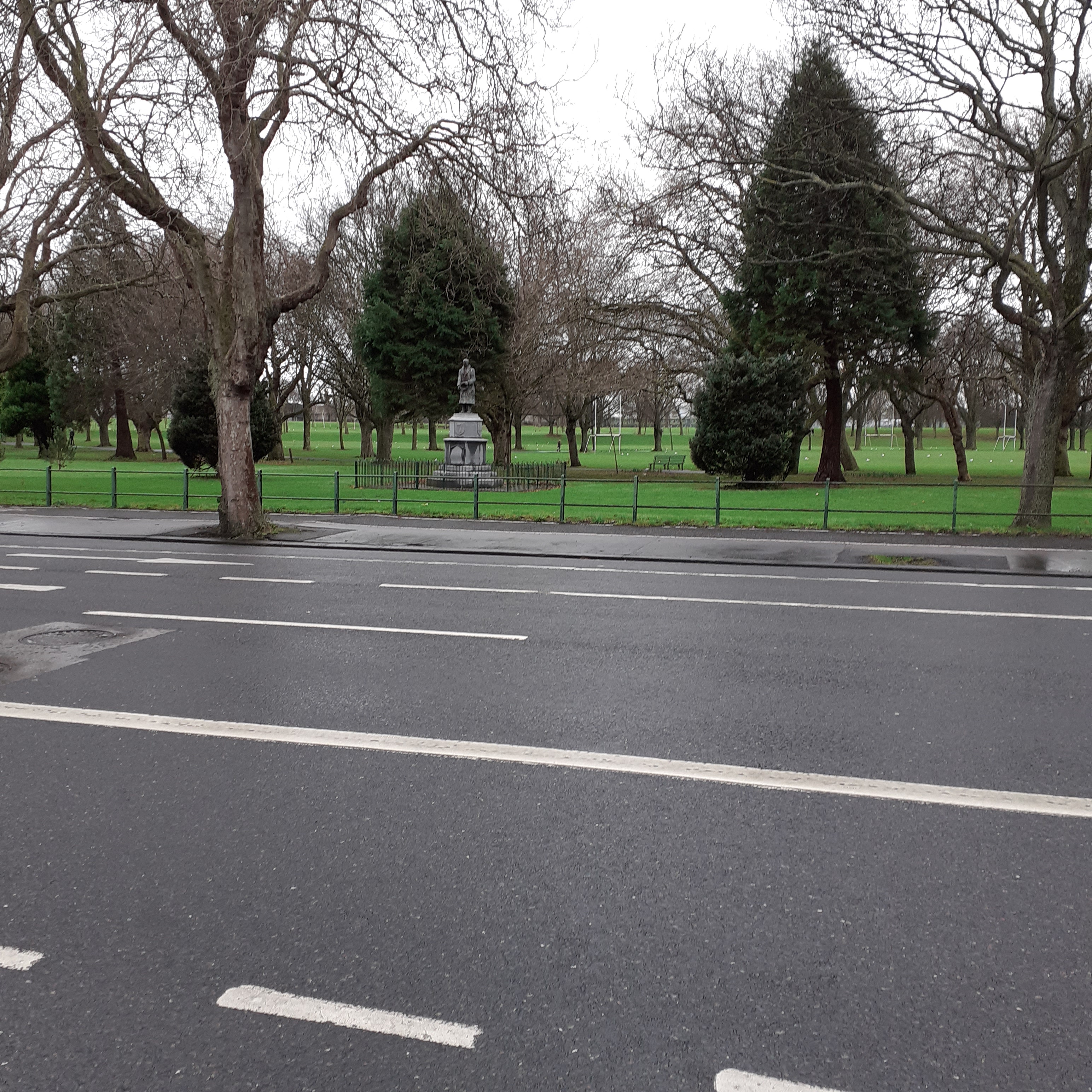
Leaving behind the Tolka River, the Main Road curves around Fairview Park. It’s a welcome stretch of greenery after the urban drear of North Strand. The park was reclaimed from tidal mudflats in the 1920s as the hinterland was being developed into suburbia. Tree lined walks are formally laid out, effectively masking off the railway line. Nearer the road, there’s a skatepark and a children’s playground. Beyond the tracks there are all weather pitches for Gaelic and Soccer.
Early on we pass a statue of Sean Russell. Russell was an IRA leader in the War of Independence, and fought against the Treaty in the Civil War. While the IRA diminished, Russell’s radicalism did not. He pursued the armed struggle until his death in 1940. He touted for arms and funding from the Soviet Union and subsequently Nazi Germany. From Germany he set out with Frank Ryan by U-boat, bound for Ireland as part of a sabotage mission. He died aboard and was buried at sea.
The memorial was erected in 1951 and has not proved popular with everyone. In 1954, the right arm, raised in unspecified salute was amputated by right, or left, wingers, depending. Next it was decapitated in 2004 by objectors citing Russell’s Nazi connections, condemning the latter’s systematic extermination of Jews, Gypsies and homosexuals. Apologists claim Russell was no Nazi, and that he leaned towards Communist Russia betimes. A man of many hats, so. The accident prone statue was replaced with a sturdier bronze version. Russell stands, right hand advisedly held close to his side, his left clutching a hat; though precisely which hat is unsure. This hasn’t repelled further indignities. The plinth was gaily painted, quite literally, with the LGBT flag in 2020.
Further on, the main road joins with Fairview Strand, coming from our left. The area known as Fairview formed in the early nineteenth century. Though originally considered part of Ballybough, Poor Town, it was in fact more of a middle class enclave and also held a sizeable Jewish community.
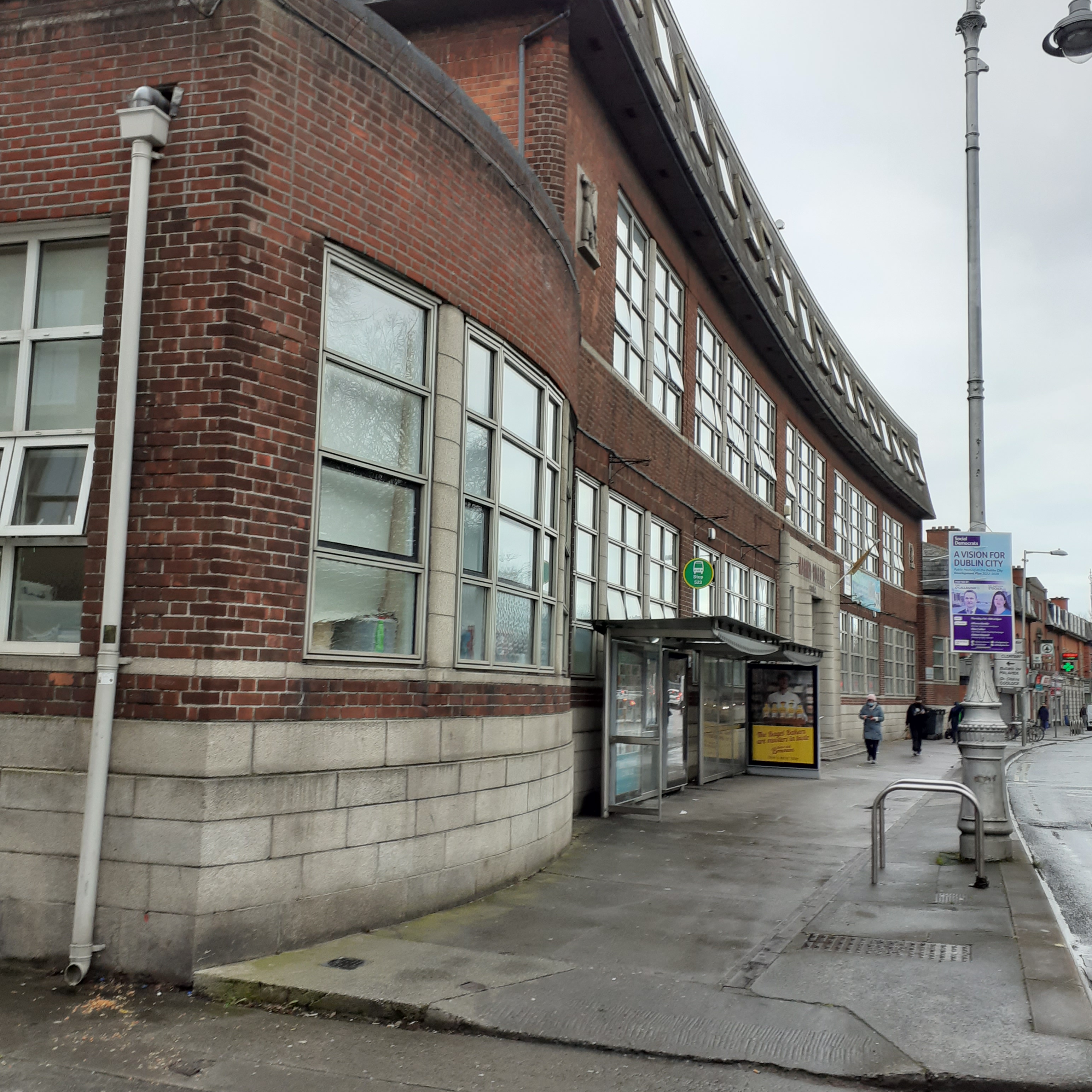
Marino College curves along with the roadway. This second level school, built in 1936 was designed by Robinson O’Keeffe, as a technical college. It is faced in granite and redbrick with metal framed windows. Its attractive, curved facade, recalls the style of the Art Deco period, when style and function rhymed. The complex includes a public library. The mansard roof is a later addition from the seventies, intended to harmonise with the more elegant mansards of the earlier buildings along the frontage.
The building of the church, Our Lady of Fairview, in mid century suggested a more pleasing name. In fact, the view over Dublin Bay from higher ground behind the foreshore had long been considered exceedingly fine. Presiding over it was the demesne of Lord Charlemont, and his grand Georgian residence, Marino House.
The fair view is perhaps less obvious now, the serrated scar of the docklands cutting across the serene complexion of the bay. A view still bracing to the modern, metropolitan soul, and beneath it, the palimpsest of heaven’s reflex endures. Marino House was built in 1753 for James Caulfield, the first Earl of Charlemont, and designed by Scottish architect, William Chambers. He also designed Charlemont House for the Earl in Parnell Square, the building which now houses Dublin’s Municipal Gallery, the Hugh Lane. A guiding impetus for the Marino project was the Grand Tour of Europe, a traditional rite of passage in the formation of the great and the good.The young Caulfield had been particularly engaged by the tour; nine years swanning around the Mediterranean, what’s not to like? On his return, the Bay of Naples, embedded in his memory, must have seemed magically projected on the horizon in the silhouette of the Dublin Mountains and Wicklow’s Sugarloaf Mountains. Milton’s Paradise Lost was another inspiration, suggesting a Garden of Eden for the aesthetically robust Earl back in his beloved home. Caulfield resolved to conjure up his own Xanadu from the higher ground of Marino.
The Casino (meaning small house) was also designed by William Chambers as a garden pavilion for the big house. Something of a Georgian Tardis, the building looks compact from without, but it comprises three stories and is on a grande scale within. Built in 1770, it was truly a wonder of its day, but fell into decline when the estate was sold in 1881. The Irish State took ownership in the thirties, and it has been lovingly restored by the OPW. Today only the pavilion survives, Marino House being demolished in the 1920s to make way for the housing estate.
This was the first large local authority housing estate built in independent Ireland. It followed the principles of the Garden City Movement, which aimed for the perfect synthesis of urban and rural living. One thousand, three hundred concrete houses were built, arranged in a symmetrical pattern encompassing circular greens and parks.
North of the junction of Malahide Road, stands an imposing Georgian crescent of twenty six houses, the only such crescent in Ireland. Built in 1792 by Charles Ffolliatt, a property developer from Aungier Street. It is said to have been built as a spite wall to block the view of the sea from Marino House. The nature of the dispute is lost in time, but whether the developer’s petty insult hastened the Earl’s end we can’t say. He had more important matters to observe, being president of the Royal Irish Academy and in the Irish Parliament a keen supporter of Henry Grattan and the assertion of Irish Independence. The Earl died in 1799 at seventy years of age, so at least he never got to see the hated Act of Union, that disaster being implemented two years later.
The Crescent was originally a redbrick terrace, but the facades were plastered in the Regency years as was then the fashion. The small park in front of the Crescent was originally for residents, though is now open to the public. It is named for Bram Stoker, the author of sensational novels in the Belle Epoque.
Abraham (Bram) Stoker was born in 1847 and lived at Number 15. Florence Balcombe, who lived at 1, became his wife. Oscar Wilde was a suitor, but she opted for Stoker and they married in 1878. Oscar wasn’t pleased, but he and Stoker remained friends, even after the Fall. The Stokers moved to London where Bram worked as manager for actor Henry Irving and the Lyceum Theatre until his death in 1912.
Stoker’s most enduring work is Dracula, published in 1897. A landmark of Gothic horror, it is an epistolary novel beginning with the account of Jonathan Harker, summoned to the Transylvanian Castle of Count Dracula. Dracula has become the archetypal Vampire, an ancient, nocturnal species that feeds on human blood. The legend is woven into European folklore from which Stoker drew his inspiration. There were also antecedents closer to home.
Sheridan Le Fanu’s Carmilla was published a quarter century earlier. Carmilla was a lesbian vampire, with the ability to morph into the form of a cat; Catwoman to Stoker’s Batman, who was himself wreathed in an aura of sexual ambiguity. With the heady mix of sex, death, horror and everlasting life, no surprise that Dracula became a staple of Hollywood horror. Nosferatu, a German expressionist silent film of the twenties, was the second film version of the book.
Florence, executor of her spouse’s estate, won a lawsuit against the filmmakers specifying that all copies be destroyed. The film, like the legend, endures, a creepy masterpiece in monochrome.
Both Fairview Park and Bram Stoker Park are closed off by the railway barrelling inland. At the end of Fairview is the Westwood Club, with a fifty metre swimming pool, indoor tennis courts, gyms and studios, a veritable mecca for health and fitness. Westwood were established across the bay in the Deep South at Leopardstown in 1988. I worked there for a time, but more in overalls than leotards. I painted murals for the studios, finding angels amidst the physical jerks.
We are all in the gutter
but some of us are looking at the stars
More metaphysical pleasures are celebrated at Bram Stoker’s Castle Dracula Experience housed in the Westwood Club. The experience is a two hour evening show, an interactive experience with characters from Dracula, and the life of Bram Stoker. Ironically, perhaps, it finds itself closed due to the pandemic.
The quote is a line written by Oscar Wilde in his comedy of infidelity, Lady Windermere’s Fan. It is echoed in the Pretenders 1981 song Message of Love, written by Chrissie Hind, something of an ode to fidelity, from their second album. The line is usually read as advocating the ability of art, or love, to lift us above the humdrum.
Cleary’s Pub lies in the shadow of the Loopline where it crosses Talbot Street. It is packed with the glinting brass and gloomy wood of the genuine, olde worlde Irish pub. With genuine passenger and freight trains hurtling overhead. I have stopped there on my way to concerts in Croke Park and in bygone days to slake my thirst after a hard day’s night in the Sheriff Street Sorting Office adjoining Connolly Station. Or even before the working night. The zombie shift could be tedious, but with hazardous interludes, so it was no harm to soften the sharper extremities of perception with a couple of pints before closing time. There were times too, in the wee small hours, when the Sorting Office would ring empty and hollow, the workers having repaired to some early opener to put in a round or two. I’d need to solve whatever task they’d set for me, some devious and booby trapped blockage, before sloping off into the dawn to herd them home from whatever watering hole they were hiding in. Grainger’s and the North Star being most likely.
Sheriff Street itself heads seaward before the Loopline, skirting the back end of the IFSC before crossing the Royal Canal to end off in the distance at East Wall Road. Our path continues northwards. A little further along Amiens Street we cross the line of the North Circular Road. Seville Place is on our right and Portland Row slopes up to our left towards Summerhill from where it continues on as the North Circular Road proper. At the five point intersection stands a notable Dublin landmark: the Five Lamps. This famous monument was erected in 1880 to fulfil the wishes of Lieutenant General Henry Hall who died five years earlier. Hall, from Athenry in County Galway, served with the British Army in Bengal and wanted his memorial to encourage sobriety. The cast iron fountain at its base provided clean drinking water, not available in the surrounding tenements.
The Five Lamps miraculously survived the North Strand Bombing of May 1941. WW2 was phrased the Emergency in neutral Ireland, but bits of war intruded. Three hundred houses were destroyed and twenty eight people died in this rare and brutal assault by German planes. Whether it was a mistake or a warning by the Luftwaffe we don’t know. Dublin had sent firefighters up to Belfast to deal with the aftermath of German bombings there, and Ireland’s neutrality was always slanted toward the Allies. Ireland remains neutral, though not passive, at time of going to press.
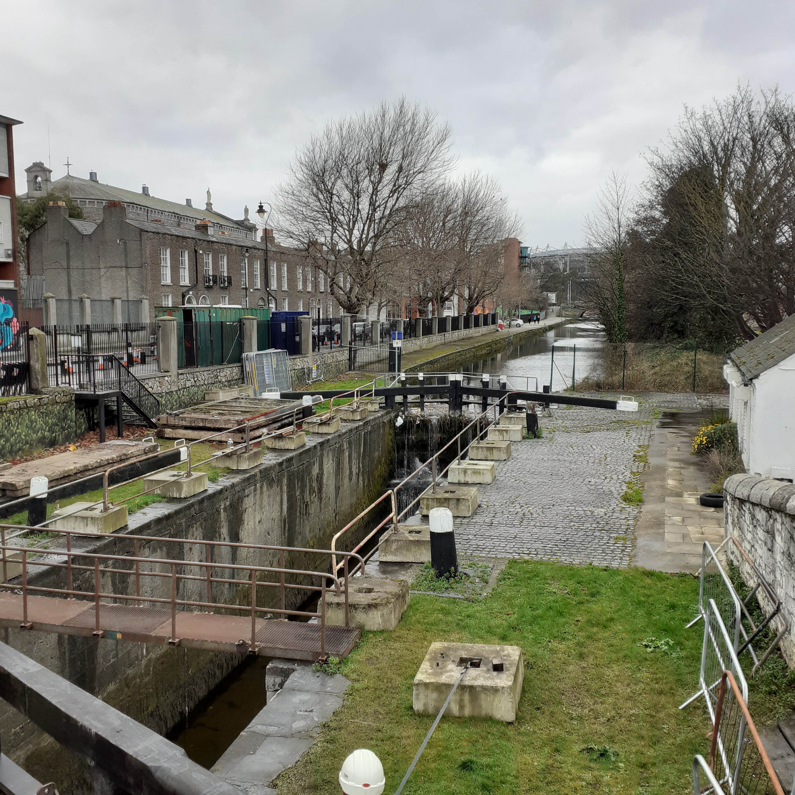
Continuing along North Strand Road, we cross the Royal Canal at Newcomen Bridge which is also the site of the first lock of the Royal Canal. The Royal Canal was the northside riposte to the Grand Canal on the southside. In 1790 construction began and soon the canal flowed westwards from Phibsborough to the Shannon River at Longford. The city extension of the Royal, as with the Grand, followed in the nineteenth century to link the Shannon with the Irish Sea. The Dublin Mullingar railway from the mid nineteenth century runs alongside the canal for much of its length.
Looking westward from the bridge, through the chaos of canal, railway and cityscape, Croke Park frames the horizon. The eighty thousand capacity stadium is the third largest in Europe. A feature of a stadium visit is the Skyline Tour. Way up in the eaves, it gives an elevated, dizzying, view over Dublin City. Croke Park has been the headquarters of the Gaelic Athletic Association (GAA) since its foundation in 1884. The major finals in hurling and football are played there. It is also, betimes, a concert venue. U2, Bruce Springsteen and the Red Hot Chilli Peppers are amongst those who have headlined, and whom I’ve seen.
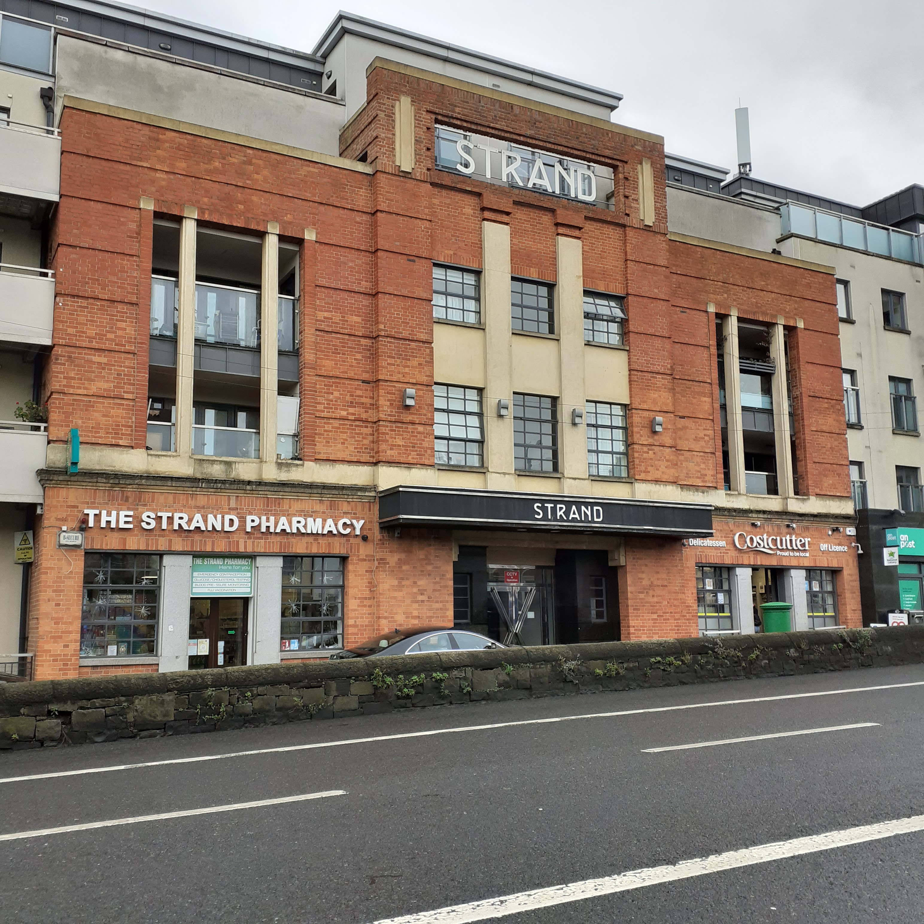
The Strand Cinema on the eastern side of the road was built in the mid thirties, becoming briefly a music venue and a bowling alley, before closing down along with so many suburban cinemas. The art deco facade was preserved and has been tastefully adapted as the frontage of an apartment complex.
Once more beneath the railway, this one also heading west, we continue through the dingy city outskirts to reach the Annesley Bridge crossing the Tolka River. Upstream, the river has enjoyed a pleasant suburban sojourn through The Botanic Gardens, Glasnevin and Drumcondra. But, off to our right, the murky Tolka seeps towards the docklands before taking a sharp left to join with the waters of the bay. East Wall Road continues straight into the docklands and eventually meets the Liffey at the East Link Bridge.
I worked in a factory down on East Wall approaching the Millennium. Planart made components for computers, bound for Finland mostly. It was a small operation, so I could follow through from darkroom to the final, messy business of etching. Urban spacemen in protective gear, the acid got everywhere. Not a place of love stories, so. Still, a young woman working production took a shine to the guy I worked with in the darkroom. I love a man with an accent, she said. Mac was from Arklow. I was appointed matchmaker, but such hints that I dropped, clanging from a height, went unheard by the Adonis of Arklow.
We argued regularly over music. There was wall to wall radio on the shop floor, strictly commercial, while one hip hop comrade was confined to the canteen for his aural hit. Rock music prevailed in the darkroom where I worked with Mac. The Cranberries were coming on strong just then. Their song, Zombie, stood out. Dolores Riordan wrote it in response to the death of two English boys in the IRA bombing of Warrington in 1993. Riordan’s enraged yodel fed directly into the zeitgeist. Mac quibbled with its political naivety, as he saw it. But it was a passionate vindication of light, and of leaving behind the dark, the heroic dead, and the persistent undead. No Need to Argue was the album, their second, released in 1994, and a global multi million seller.
It’s the same old theme Since nineteen-sixteen In your head, in your head, they’re still fighting With their tanks, and their bombs And their bombs, and their guns In your head, in your head, they are dying Zombie, zombie, zombie! What’s in your head?
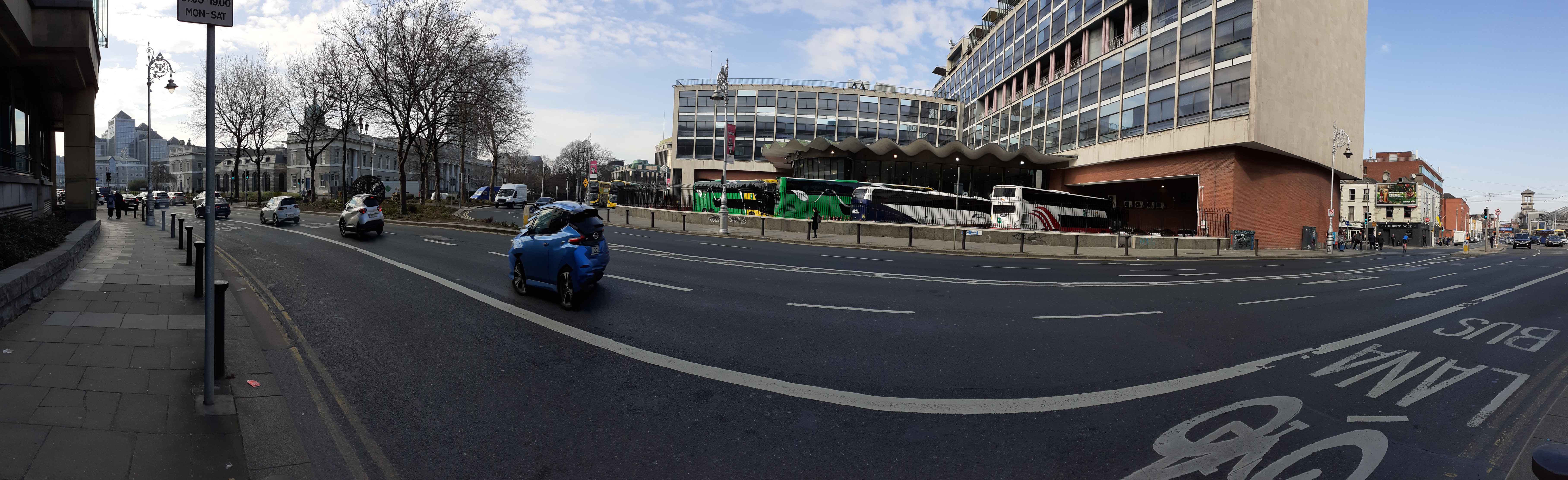
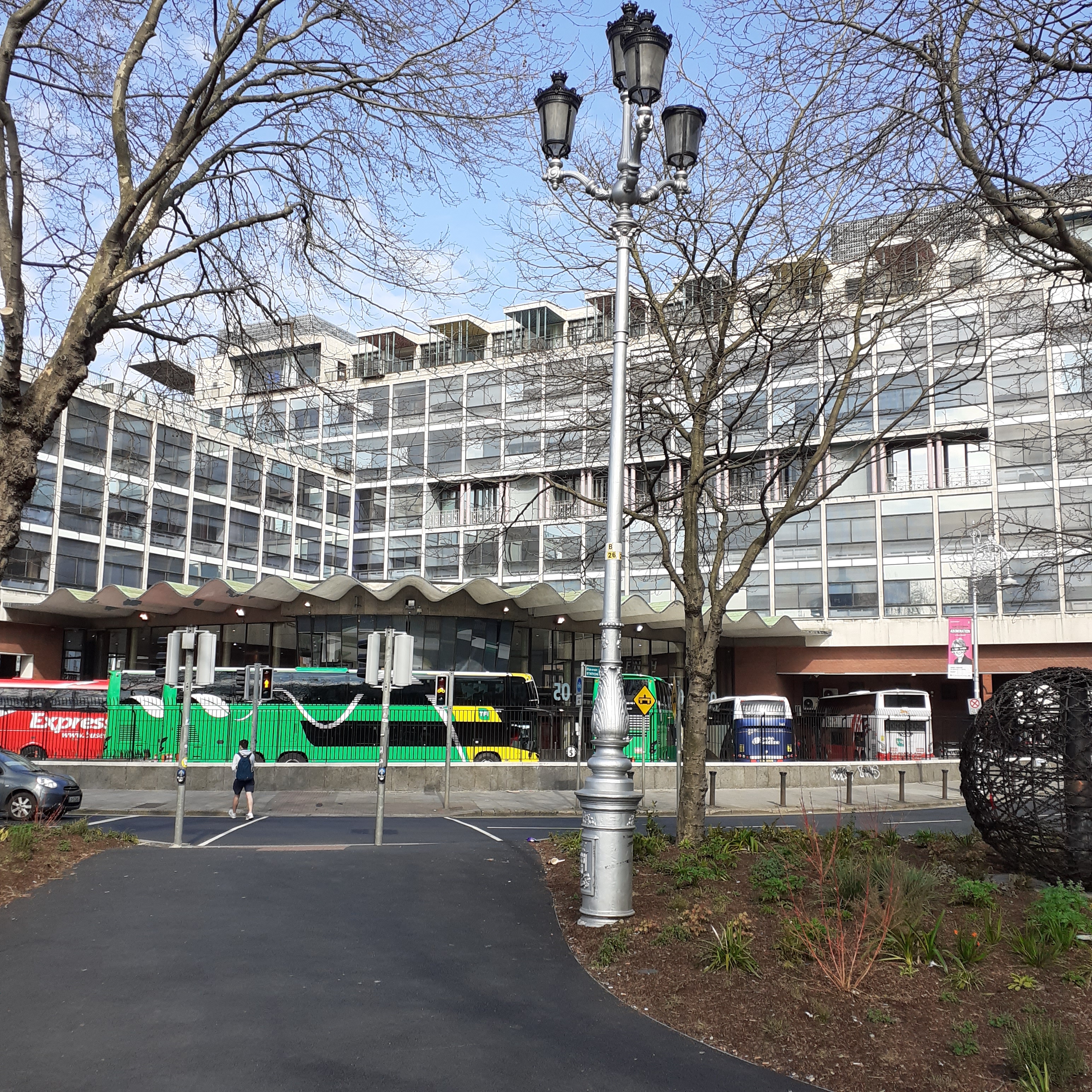
Memorial Road merges with Amiens Street as we head further north. This is transport city; seafaring ships on the river behind us, the railway curving along the Loopline to our left, while ahead Bus Aras forms a glass and steel embrace for the bus traveller.
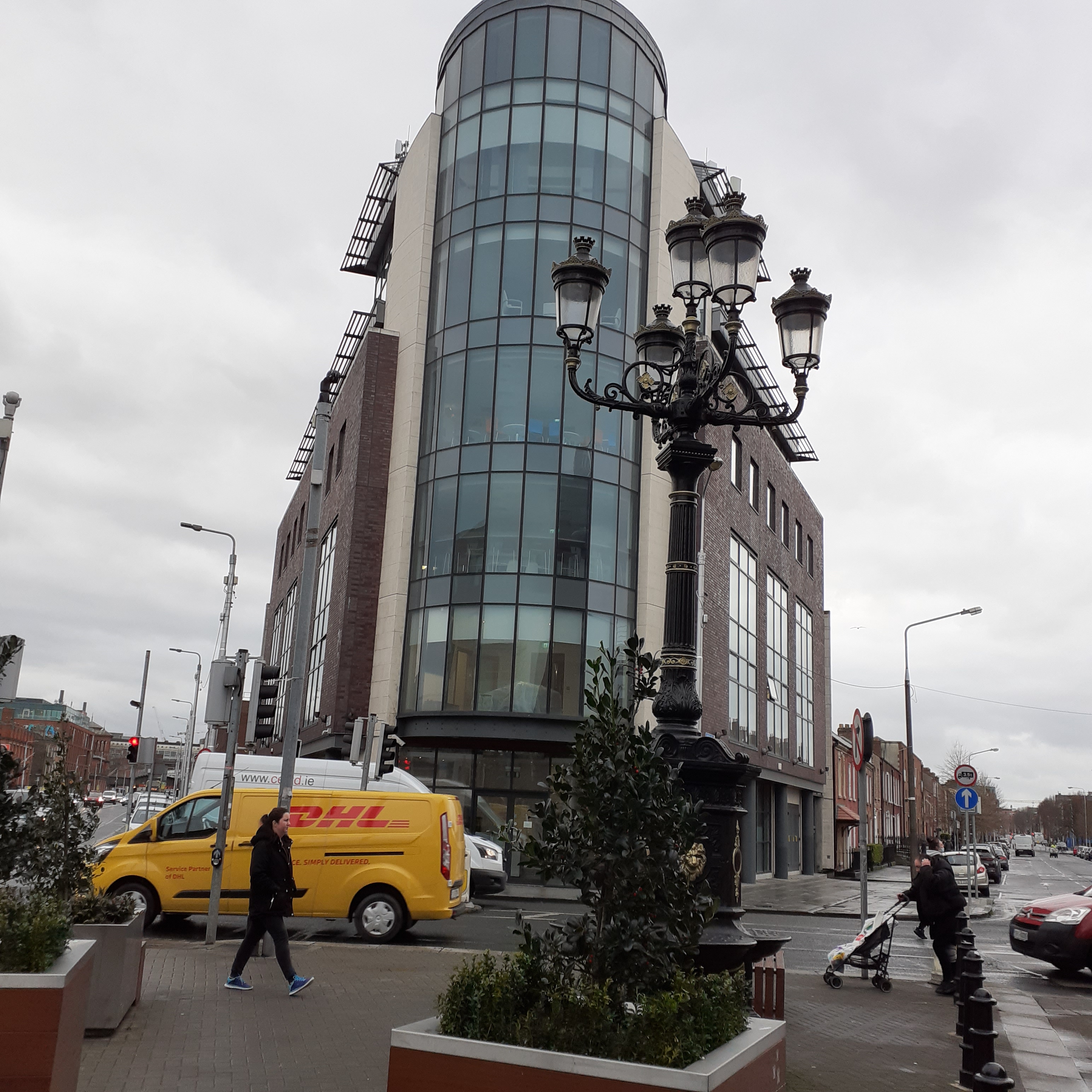
Bus Aras is about my vintage. Blinking into the world in the mid fifties, just as I was, not far away in the Rotunda Hospital on Parnell Square. First mooted in the immediate aftermath of World War Two, it took ten years for the project to be realised. Dublin’s first modernist building, it was also emblematic of the modernist rebuilding of Europe after the war.
This significance sat uneasily with conservative Ireland. Bus Aras had to be scaled back from eight storeys to seven, providing a foretaste for Ireland’s perplexing fear of tall buildings. Ultimately, the building features two rectangular blocks of differing heights at right angles, over a circular central foyer, and a semicircular glass frontage jutting onto the concourse. It was designed by Michael Scott and a team of architects including the young Kevin Roche and Robin Walker. LeCorbusier was a major influence, enlivened by more ornate features such as the top floor pavillion and the flowing canopy sweeping along the frontage. This was the work of Ove Arup, structural engineer who would subsequently work on Sydney Opera House in the late fifties.
Through a changing scenario of clients and governments, the project proved expensive. Plans extended past functionality, with restaurants, nightclubs and cinema all planned for a multi purpose complex. High quality materials and various texturings were used: copper, bronze, terrazzo and oak Irish, and a number of expensive meals at Jammet’s thrown in; architects have to eat too.
A small newsreel cinema for waiting passengers ran for a couple of years until replaced by the Eblana theatre. Its small size and situation in the basement, next to the Ladies, led to detractors calling it the only public toilets in Dublin with their own theatre. The Eblana and its company Gemini Productions was founded by Phyllis Ryan and despite its shortcomings, and goings, survived as a theatre until 1995, premiering works by such major playwrights as Brian Friel, Tom Murphy and John B Keane.
Eblana is a name dating back to Claudius Ptolemaeus, or Ptolemy, the Greek astronomer and cartographer whose map of Ireland appeared in his Geographia in the second century AD. It appears south of the Boyne and north of the Avoca of Arklow, and is reckoned to be the first mention of Dublin in historical records. The placing looks right and the name could be a corruption of Dubh Linn, the Black Pool, used centuries later by the Vikings. There is no actual evidence of significant trading settlement hereabouts, way back when. Some scholars think Eblana may refer to areas further north which boast some evidence of Roman trade, with Loughshiny and Portrane as possibilities.
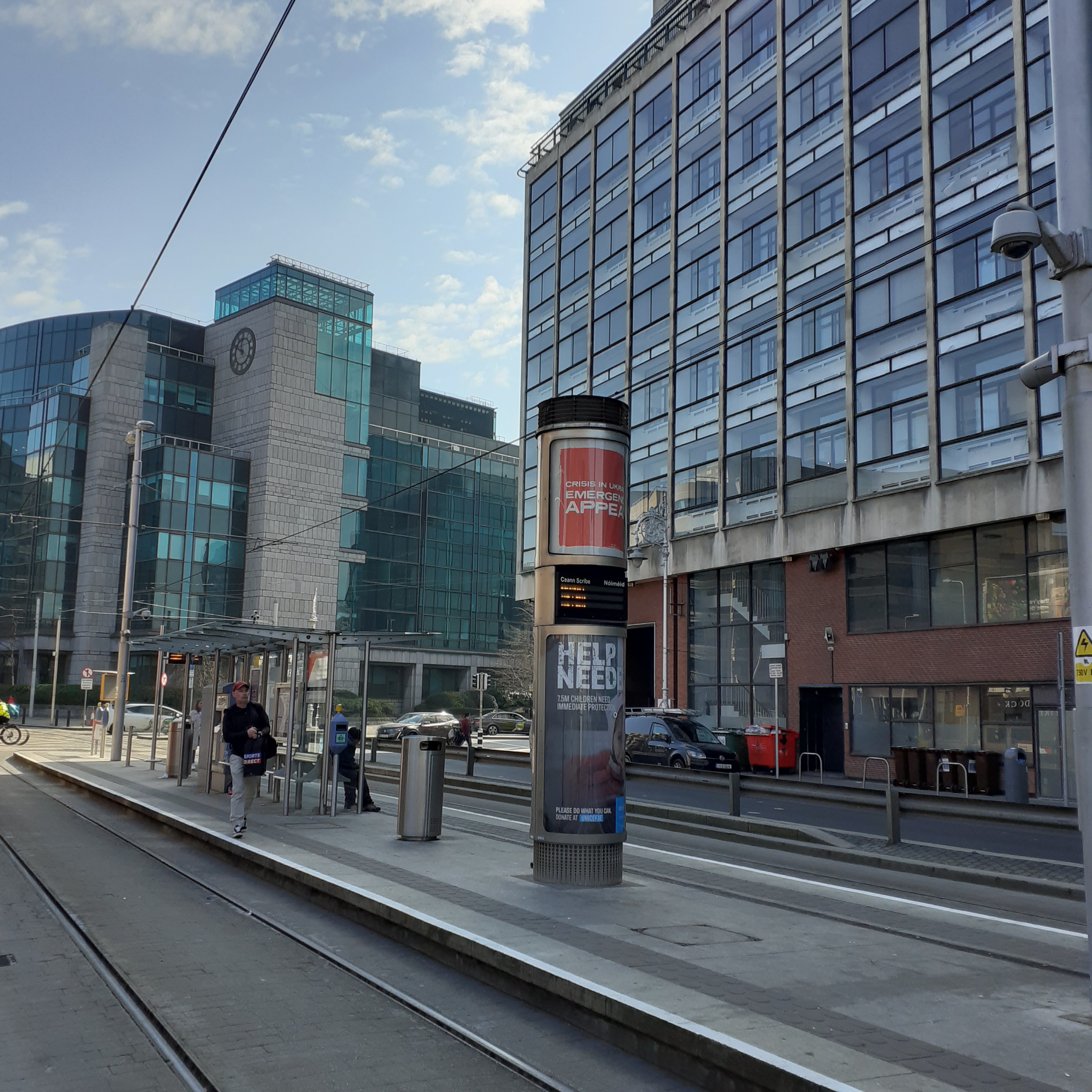
These days Busaras is central to a travel network throughout the city and country. You can even take the bus to London from here, via Holyhead. The Luas red line stops outside, connecting Connolly, next door, with Houston rail station away on the western end of the city. Eastwards, the Luas will continue past Connolly and on through the ultramodern development of the North Wall area as far as the point. There are bars, cafes and restaurants along the way, with Mayor Square providing a good oasis to stop and ponder the modern city.
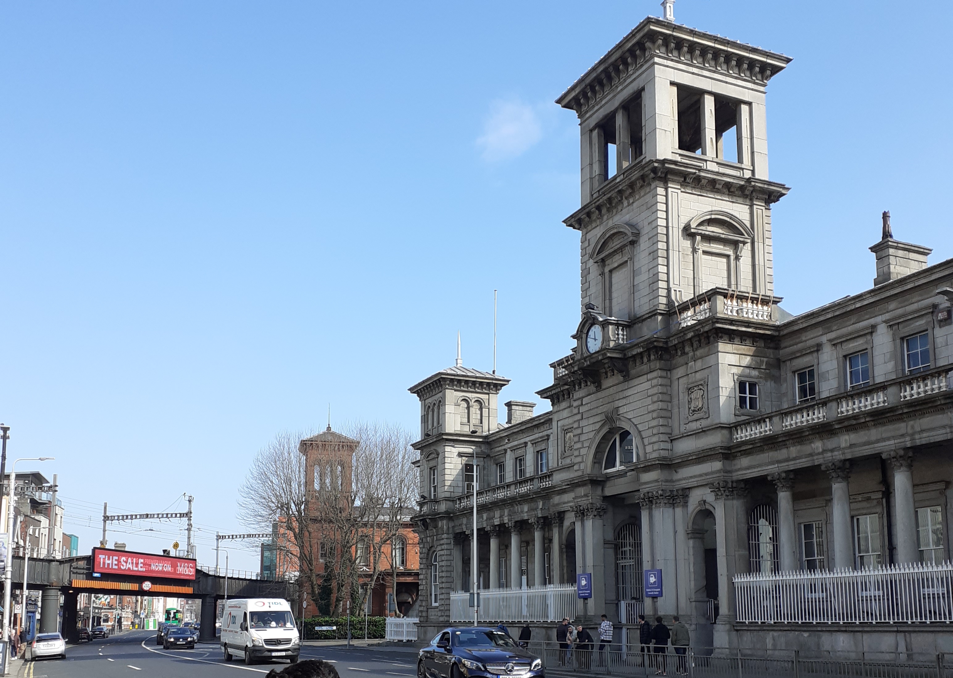
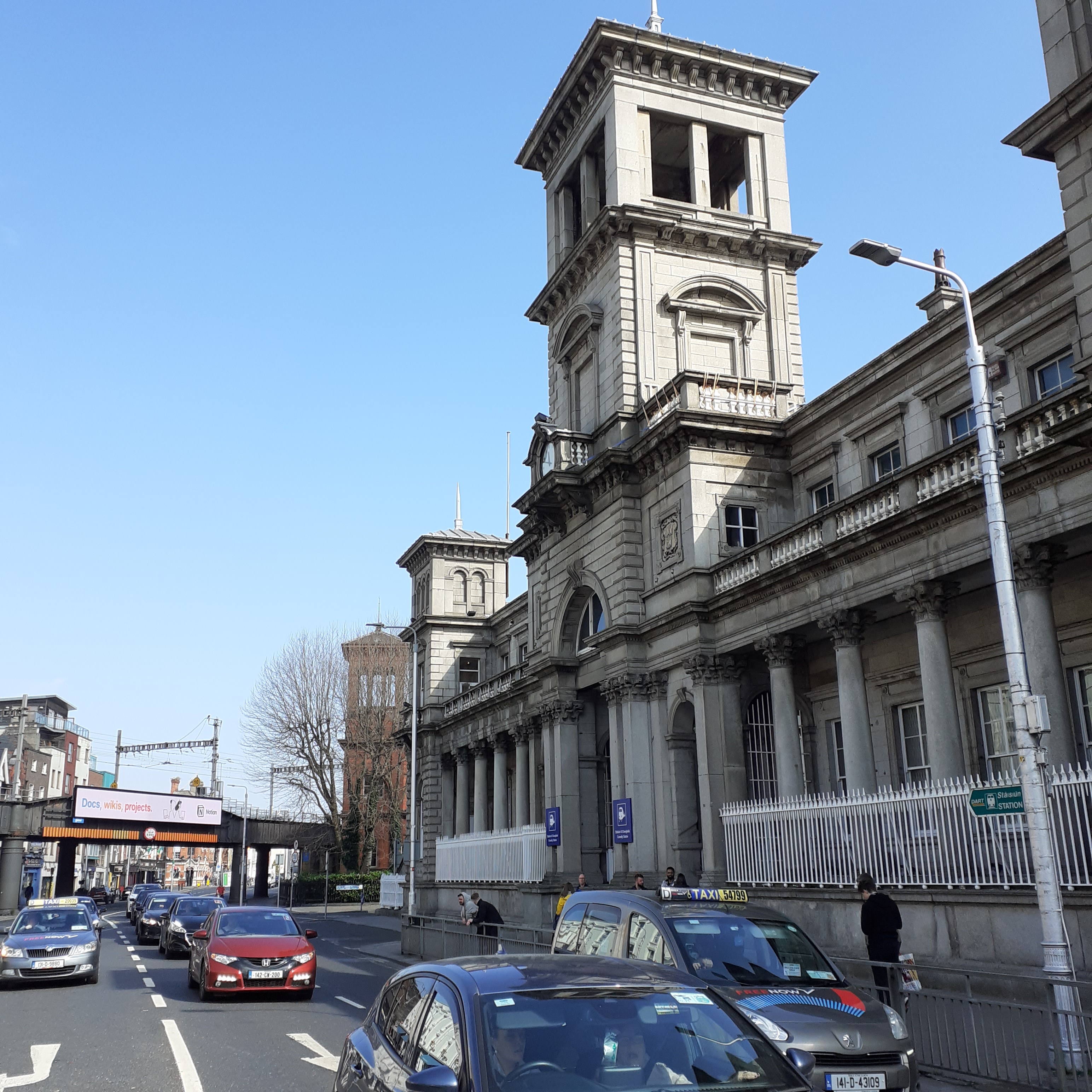
Meanwhile, back on the banks of Amiens Street, Connolly Station is more than a century older than Busaras. Long known as Amiens Street Station, it was the terminus for the railway connecting Dublin and Belfast. This came into operation in 1844 as the Dublin and Drogheda Line. There was for a while a brief portage at the Boyne while the viaduct awaited construction. This provided the last link in 1853 and made the trip to Belfast a reality. The Dublin terminus was designed by William Deane Butler. It was built of Wicklow Granite and is distinguished by its ornate colonnaded facade and Italianate tower.
Amongst its many virtues over the years was the fact that the station bar worked as a sole oasis for the weary wayfarer. Designated a bona fide premises, that meant it could serve alcohol on days of abstinence, for the bona fide traveller. Armed only with a valid rail ticket, you could claim your reward at the bar, while luckless pedestrians waited outside in the cold and dry. The long Good Friday is no more, only Christmas Day remains as a day of abstinence; well publicly, that is. Matt Talbot would be turning in his grave. Madigans continues to serve food and drink for all who hunger and thirst, day in day out.
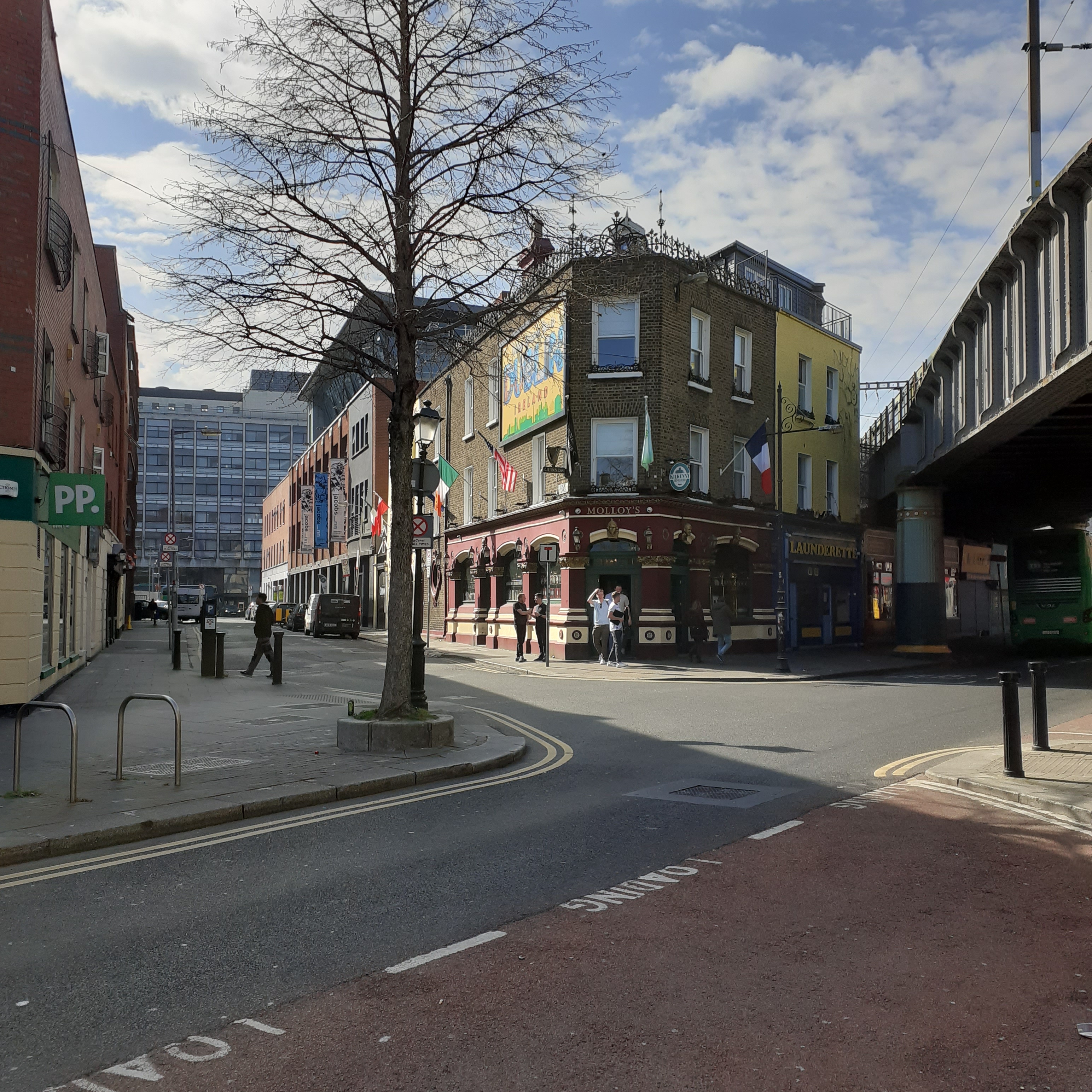
The Station faces down one of Dublin’s longest street vistas. The line of Talbot Street continues straight through O’Connell Street, becoming Henry Street, then Mary Street until it hits Capel Street. At 1.3km, it is almost a metric mile from the corner to Slattery’s of Capel Street. Talbot Street has nothing to do with the aforementioned Matt, it is named for Charles Cetwynd Talbot, Ireland’s Lord Lieutenant in 1820. The buildings were laid out in the 1840s at the start of the Victorian era. A certain pall of sleaze has hung in the air from early on. Monto, Dublin’s red light district in gaslight days, was just around the corner. The dreaded loopline came crashing through in 1890. Since then, such premises as the Cinerama, once the Electric Theatre, and Cleary’s pub on Amiens Street, functioned with the added sound effect of trains trundling overhead.
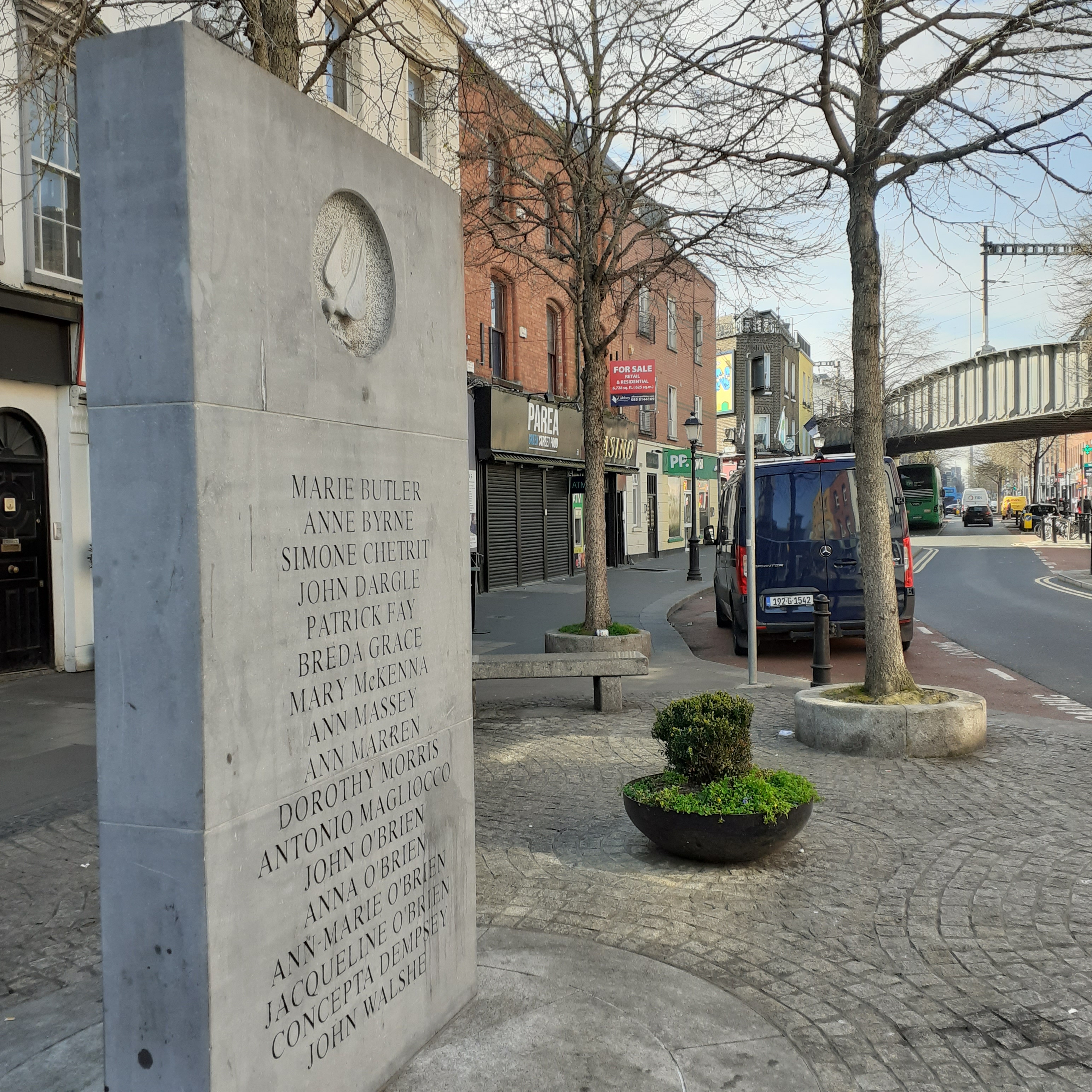
Talbot Street was one of three places in the capital hit by the Dublin and Monaghan bombings in1974. Fourteen of the thirty three victims died here, most of them women and including children and a full term, unborn child. The car bombs were planted by the UVF and exploded at Friday rush hour. The act was part of the Loyalist campaign against the Sunningdale Agreement which proposed a power sharing executive for Northern Ireland. Elements in British security forces, hostile to the British Labour Government, colluded. Peace would come however, twenty years later, with the Good Friday Agreement; Sunningdale for slow learners. A memorial to the victims was unveiled in 1997 and stands at the top of Talbot Street, across from Connolly.
The song Raised by Wolves from U2’s album Songs of Innocence references the event, describing the car and its registration. It features on their 2014 album, Songs of Innocence.
Boy sees his father crushed under the weight of a cross in a passion where the passion is hate Blue mink Ford, I’m gonna detonate and you’re dead Blood in the house, blood on the street The worst things in the world are justified by belief Registration 1385-WZ
In contrast to the hilly southside, Dublin’s north shore is quite flat, other than the hill of Howth jutting into the bay. The coast makes an opening for the central plain, extending past Drogheda and on to Dundalk where the Cooley Mountains rise above Carlingford Lough at the Border. It was an ancient power highway, connecting the Liffey to the Boyne and the centre of Irish power radiating from Tara. And it was a doorstep for invasion too. The Vikings established their first power bases along this coast in the ninth century, originally settling in Dundalk. The emergence of a strong high king, Niall Blacknee, forced them south to establish Dublin in around 845 AD. Originally the settlement was sporadic, but was secure by the end of the millennium, and remained so for two centuries until the Norman invasion.
Dublin was originally built on the higher ground south of the river. The north bank was farmland. The Ostmen were Danish speaking and their territory became known as Oxmantown. Further north the denizens were known as the Fingal, the fair foreigners. The fair foreigner is said to denote the Norwegian Vikings, while Baldoyle, further north, is the town of the dark foreigner, which is said to refer to the Danes. It seems unlikely that this signified distinct, contrasting complexion or even hair colour, the Vikings were generally fair in both. It may have been a note on character. In which case it was surely relative, Vikings were not usually renowned for peace, love and understanding. These days, beyond the city boundary, north county Dublin is called Fingal.
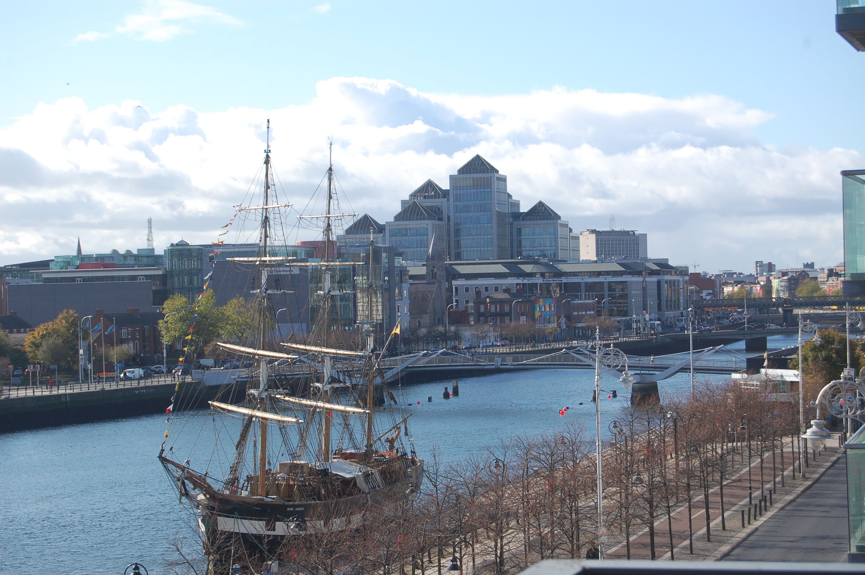
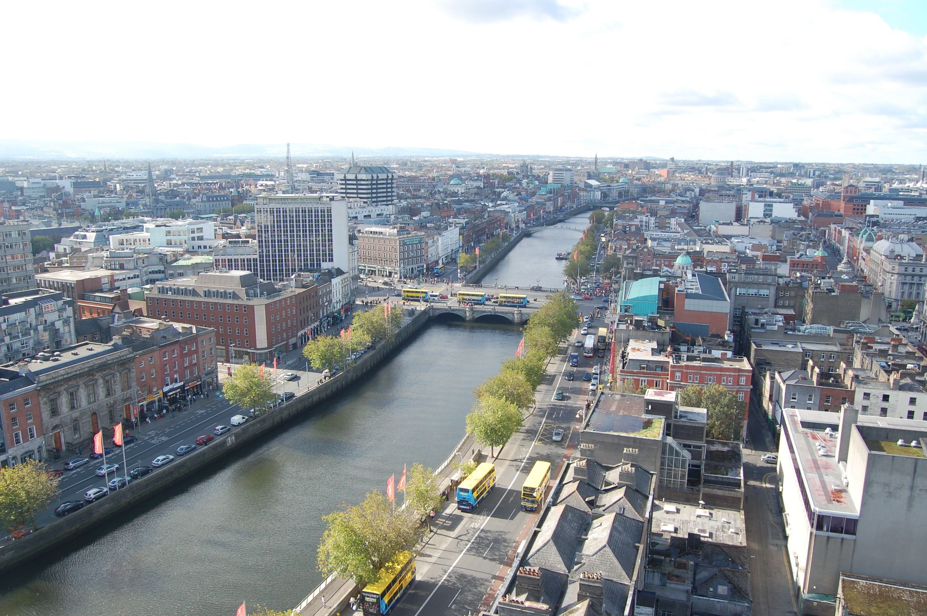
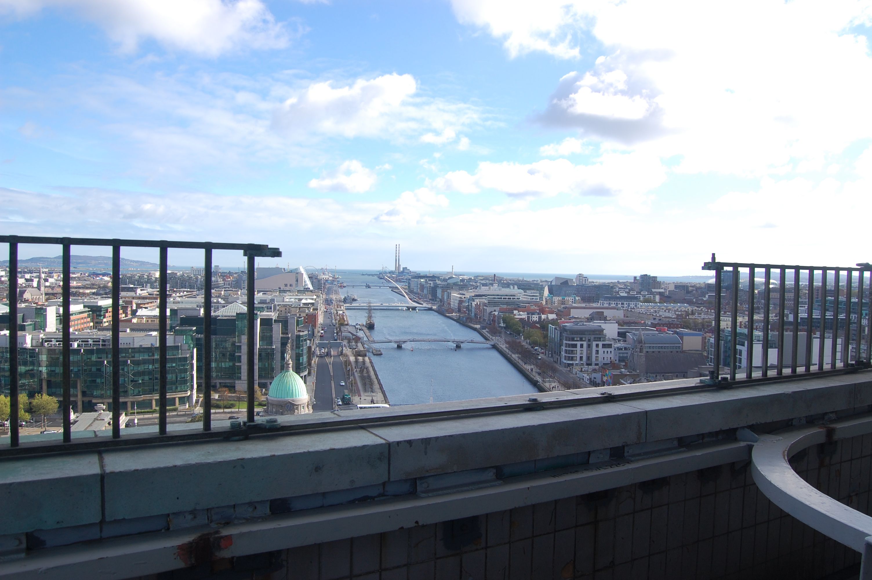
You’ll notice how the Liffey is already widening into its estuary east of O’Connell Bridge. The flow of water is tidal, with its inherent smell and rowdy host of seagulls. The land hereabouts has much been reclaimed from the shallow sea of Dublin Bay. Since the late eighteenth century, Dublin Port has developed along constructed quaysides with the silting estuary being cleared at last by the huge engineering feat of the North and South Bull Walls. While the South Bull is a direct extension of the south quays, the North Bull is farther away and out of sight, a finger extending into the bay from the distant suburb of Dollymount. The North Quays terminate at the Point and the East Link Bridge; Dublin’s modern port and docks extending further east for a bit.
As a starting point for our safari along North Dublin’s Sandy Shore, we can walk either bank down past Butt Bridge, under the Loop Line and on to the Talbot Memorial Bridge. The bridge was built in 1978 becoming then the easternmost crossing of the Liffey. It is named for Matt Talbot, poster boy of Irish temperance, with his statue standing on the southern end.
Matt Talbot was born in 1856 in North Strand and worked as an unskilled labourer. A fierce drinker from his early teens, he abandoned the demon drink at the age of twenty eight. His obsession with alcohol was replaced with an extreme, though benign, religious fervour. On his death in 1925, he was discovered to have practiced self mortification with several chains wrapped around his body beneath his clothing. He was renowned as an admirable worker and, while poor, was a dapper dresser. Some characterised him as a strike breaker in 1913, though there’s no evidence of this. Apparently he refused strike pay, donating it instead to comrades with families to support.
Photograph by Paula Nolan, a contemporary of mine at NCAD, George’s Quay. A fine photographer, she has exhibited at the RHA.
Also in 1978, George’s Quay became temporary home to the National College of Art and Design. I was one of the inbetweeners studying graphic design there as the college moved from its base in Kildare Street, between Leinster House National Library, to its current campus at Powers Distillery on Thomas Street. The surrounding area crumbled while awaiting the redemption of development. The theme song to the rubble and crumbling chimney stacks provided by U2 at Windmill Lane nearby. Today, the crystalline towers of the Ulster Bank form a significant landmark for the modern city. Begun in 1997 and completed five years later, the complex is distinguished by seven pyramid crowned glass towers and is now known as George’s Quay Plaza.
Another photograph by Paula Nolan, from the tv seat of a bus heading south on Memorial Road
Across the Bridge, the Custom House floats serenely above the waters of the Liffey. Initiated by Ireland’s first Revenue Commissioner John Beresford in 1780, it was designed by James Gandon and after completion in 1791 would be regarded as his masterpiece. The project had been much derided at the start, being built on a swamp and seen as remote from the city centre. The Corporation, enraged traders and the High Sheriff himself, sharked up mobs to disrupt construction, but Beresford prevailed. Now it’s a definitive symbol of Dublin, and stands away to the west of the extensive docklands.
Not that it hasn’t suffered its fair share of depredations in the meantime. It was burned by rebels during the War of Independence with the aim of destroying tax records. Unfortunately, the interior, the dome and irreplaceable historical records were also destroyed. The new government of independent Ireland moved quickly to restore the building. The renovation is apparent with the darker stone used for the reconstruction of the central tower. Meanwhile, Memorial Road was named in honour of those from the Dublin Brigade who died in this, and other engagements in the war.
Downriver, the International Financial Services Centre, is an undistinguished grouping of medium rise glass blocks from the late twentieth century. Beyond, lies the modern, geometric heart of the new commercial capital. Upriver, the Loop Line Bridge occludes the Fair City. This wrought iron bridge and carriageway of 1890 has attracted the ire of the aesthetically sensitive ever since. The Loop Line linked Ireland’s South Eastern railway system, affectionately known as the Slow and Easy, with the Great Northern Railway, linking the capital to Belfast. Pragmatic trumped aesthetic, with the project crashing through the facade of the South Eastern’s Westland Row HQ, before masking off the view of the Custom House and much else to each side.
However it was functionally a boon, completing the East Coast railway axis and crucially linking the Mailboat service from Kingstown. Even more so today, providing direct access for freight and commuters between Dublin and Belfast, and all around the bay and beyond to the towns and cities of the South and East. Besides, it is a visual delight to sit aboard a train twixt Tara and Connolly and finding yourself at the centre of the joyful panorama of Dublin and its sublime River Liffey. Better yet, it is a vista unmarked by the intrusion of the Loop Line itself.
I referred to the song What’s so funny ’bout peace, love and understanding earlier on. Written in 1974 by Nick Lowe, it became a hit for Elvis Costello in 1978 and was tacked on to the American release of the album Armed Forces. It forms a neat counterpoint to the theme of conflict implicit, if vaguely, in the songs and album title. Oliver’s Army directly references British military campaigns in Ireland right back to Oliver Cromwell. Costello was born Declan McManus in London and is of Irish descent. His songs are rich in wordplay, snappy phrases, and catchy too. He didn’t write this, but he could have. It’s a song of other times, one that fits with our times, and one for all time.
As I walk through this wicked world Searchin’ for light in the darkness of insanity I ask myself, is all hope lost? Is there only pain and hatred, and misery? And each time I feel like this inside There’s one thing I wanna know What’s so funny ’bout peace, love and understanding? Oh What’s so funny ’bout peace love and understanding?
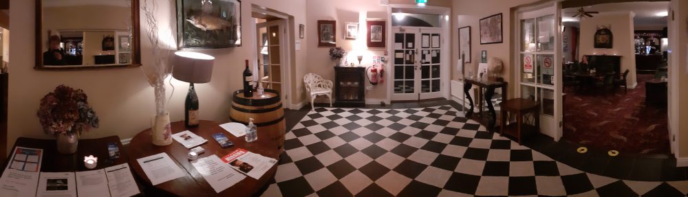
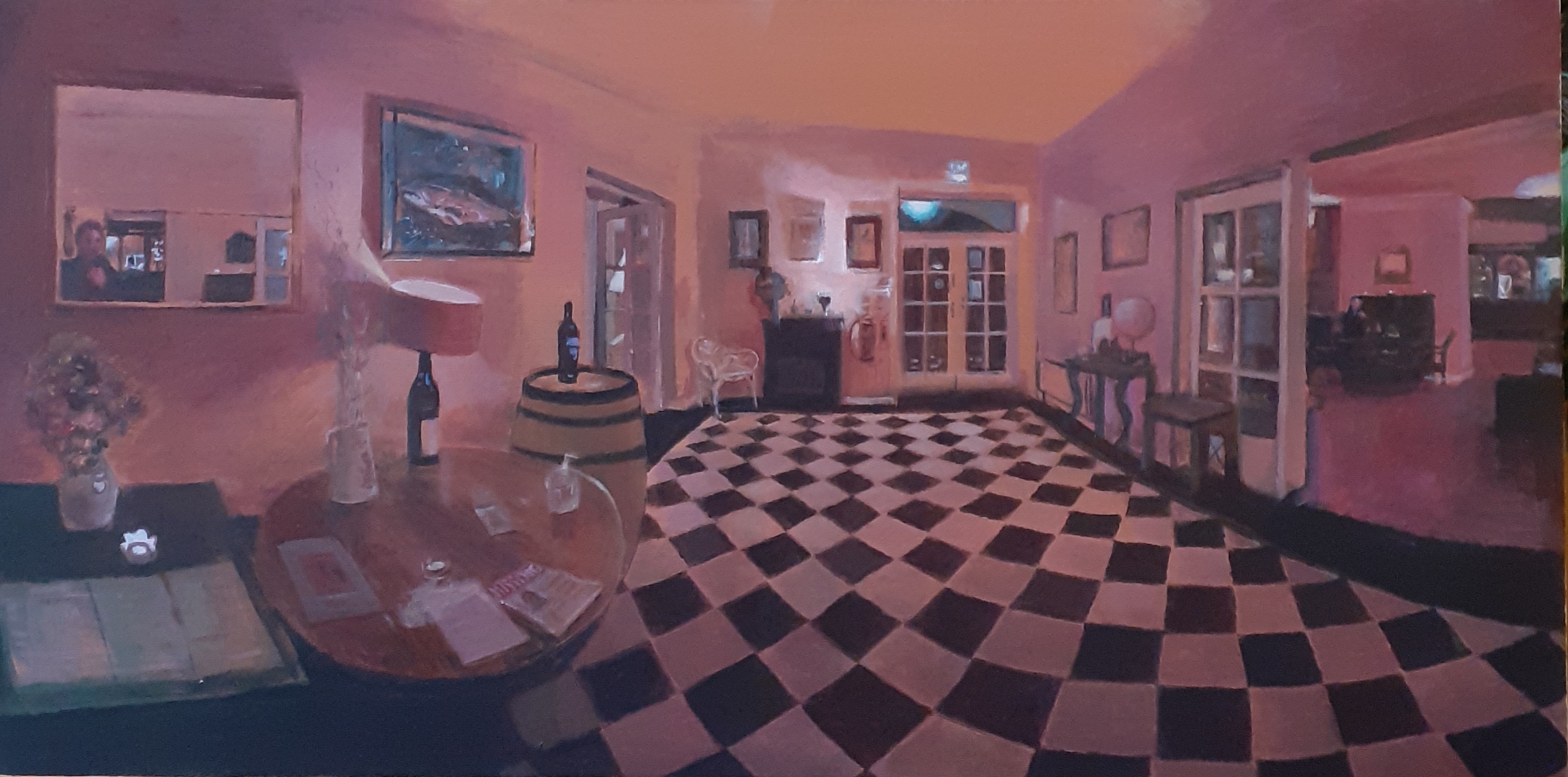
We went to Connemara for a short break, the winter just gone. Mind, with snow falling in February, the winter’s not exactly gone yet. Back in November, we stayed in the Leenane Hotel on Killary Harbour. It’s a late eighteenth century coach inn, modernised, but with its cosy atmosphere maintained. It made an excellent base for touring Connemara and there were excellent walks nearby, and the Ashleigh Falls just up the road. As night fell at four we would return to this haven for a pint of Guinness before the blazing turf fire. The time was opportune.
In this acrylic I am standing in the lobby slowly taking in the internal panorama. All is quiet, the place all but empty. But I am there and M awaits by the fireside. Beyond at the bar, our pints are being pulled. So, poised between the cold and heat, the inner and the outer worlds, time takes a second to pause as we await our aperitif.
I am inspired here by the wonderful Dutch painters of interiors, such as Jan Vermeer, chronicler of domestic scenes of the17th century. The checkerboard tiles floors are a regular feature of his paintings. They make a timeless surface, from ancient days to ultra modern. They even suggest, in certain illustrations, Einstein’s configuration of the space time continuum. Music Lesson, Art of Painting, The Astronomer, the Geographer, Lady Writing a Letter, the latter in the National Gallery in Dublin, are amongst Vermeer’s greatest hits. These paintings feature the major art forms: writing, painting and music, and the sciences of the world and the universe. Each caught for a perfect moment in the amber eye of the artist.
That is what I am looking for in my painting, and in life I suppose. Who doesn’t? In a moment of perfection, all stories await their writing. And then we’ll see.